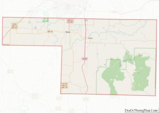
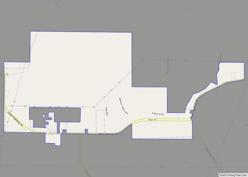
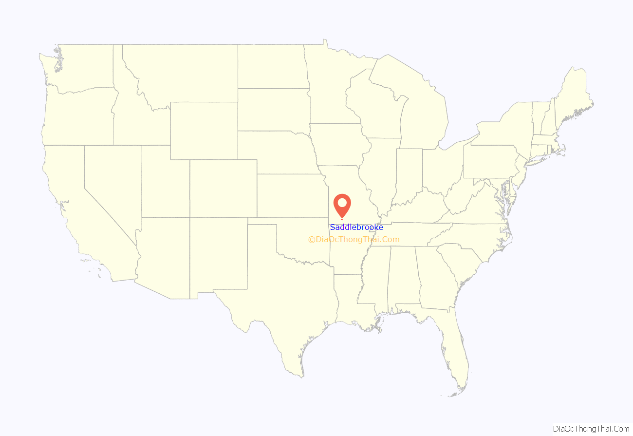
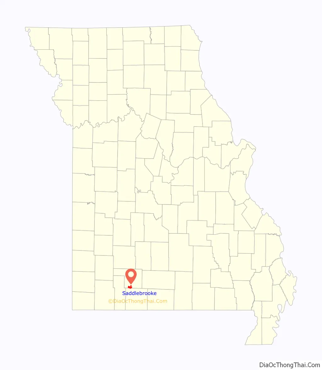
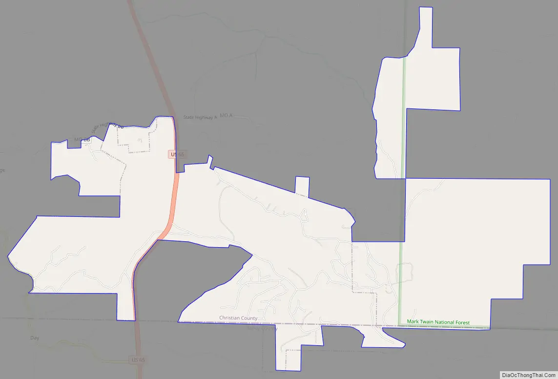
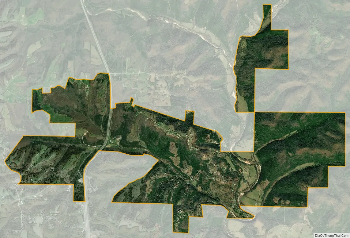
Saddlebrooke is a village located in southern Christian County, Missouri, on U.S. Route 65. A small portion of the village extends into Taney County. It is a master-planned community which incorporated in 2003. The population was 309 at the time of the 2020 census.
The Christian County portion of the village is part of the Springfield metropolitan area, while the Taney County portion is part of the Branson, Missouri micropolitan area.
| Name: | Saddlebrooke village |
|---|---|
| LSAD Code: | 47 |
| LSAD Description: | village (suffix) |
| State: | Missouri |
| County: | Christian County, Taney County |
| Elevation: | 955 ft (291 m) |
| Total Area: | 5.32 sq mi (13.79 km²) |
| Land Area: | 5.32 sq mi (13.79 km²) |
| Water Area: | 0.00 sq mi (0.00 km²) |
| Total Population: | 309 |
| Population Density: | 58.05/sq mi (22.41/km²) |
| ZIP code: | 65630 |
| Area code: | 417 |
| FIPS code: | 2963857 |
| GNISfeature ID: | 2339759 |
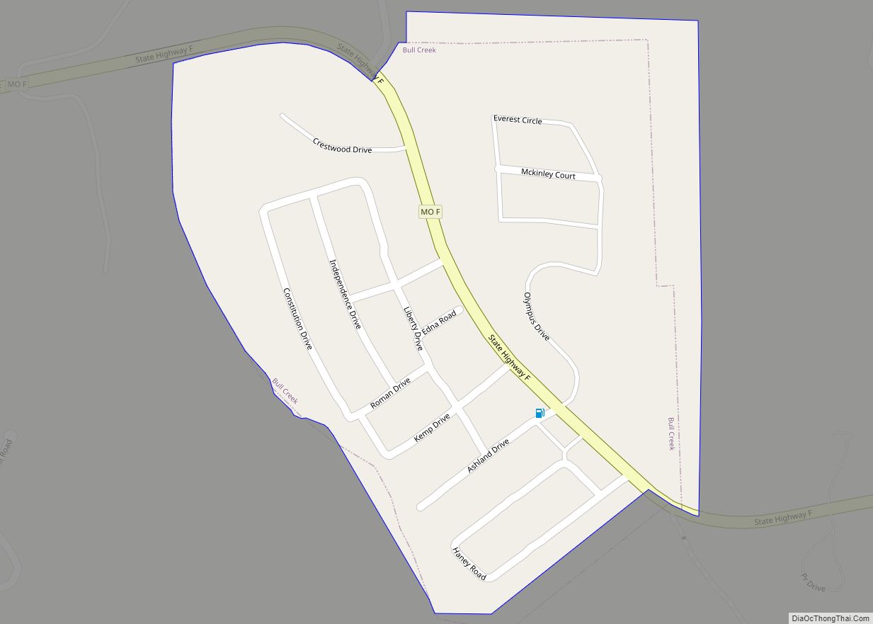
Online Interactive Map
Click on ![]() to view map in "full screen" mode.
to view map in "full screen" mode.
Saddlebrooke location map. Where is Saddlebrooke village?
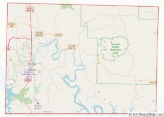
Saddlebrooke Road Map
Saddlebrooke city Satellite Map
Geography
Saddlebrooke is located at 36°49′41″N 93°13′05″W / 36.82806°N 93.21806°W / 36.82806; -93.21806 (36.828056, -93.218056).
According to the United States Census Bureau, the village has a total area of 7.01 square miles (18.16 km), all land.
See also
Map of Missouri State and its subdivision:- Adair
- Andrew
- Atchison
- Audrain
- Barry
- Barton
- Bates
- Benton
- Bollinger
- Boone
- Buchanan
- Butler
- Caldwell
- Callaway
- Camden
- Cape Girardeau
- Carroll
- Carter
- Cass
- Cedar
- Chariton
- Christian
- Clark
- Clay
- Clinton
- Cole
- Cooper
- Crawford
- Dade
- Dallas
- Daviess
- De Kalb
- Dent
- Douglas
- Dunklin
- Franklin
- Gasconade
- Gentry
- Greene
- Grundy
- Harrison
- Henry
- Hickory
- Holt
- Howard
- Howell
- Iron
- Jackson
- Jasper
- Jefferson
- Johnson
- Knox
- Laclede
- Lafayette
- Lawrence
- Lewis
- Lincoln
- Linn
- Livingston
- Macon
- Madison
- Maries
- Marion
- McDonald
- Mercer
- Miller
- Mississippi
- Moniteau
- Monroe
- Montgomery
- Morgan
- New Madrid
- Newton
- Nodaway
- Oregon
- Osage
- Ozark
- Pemiscot
- Perry
- Pettis
- Phelps
- Pike
- Platte
- Polk
- Pulaski
- Putnam
- Ralls
- Randolph
- Ray
- Reynolds
- Ripley
- Saint Charles
- Saint Clair
- Saint Francois
- Saint Louis
- Sainte Genevieve
- Saline
- Schuyler
- Scotland
- Scott
- Shannon
- Shelby
- Stoddard
- Stone
- Sullivan
- Taney
- Texas
- Vernon
- Warren
- Washington
- Wayne
- Webster
- Worth
- Wright
- Alabama
- Alaska
- Arizona
- Arkansas
- California
- Colorado
- Connecticut
- Delaware
- District of Columbia
- Florida
- Georgia
- Hawaii
- Idaho
- Illinois
- Indiana
- Iowa
- Kansas
- Kentucky
- Louisiana
- Maine
- Maryland
- Massachusetts
- Michigan
- Minnesota
- Mississippi
- Missouri
- Montana
- Nebraska
- Nevada
- New Hampshire
- New Jersey
- New Mexico
- New York
- North Carolina
- North Dakota
- Ohio
- Oklahoma
- Oregon
- Pennsylvania
- Rhode Island
- South Carolina
- South Dakota
- Tennessee
- Texas
- Utah
- Vermont
- Virginia
- Washington
- West Virginia
- Wisconsin
- Wyoming