Savannah is a city and county seat of Andrew County, Missouri, United States. The population was 5,069 at the 2020 census.
| Name: | Savannah city |
|---|---|
| LSAD Code: | 25 |
| LSAD Description: | city (suffix) |
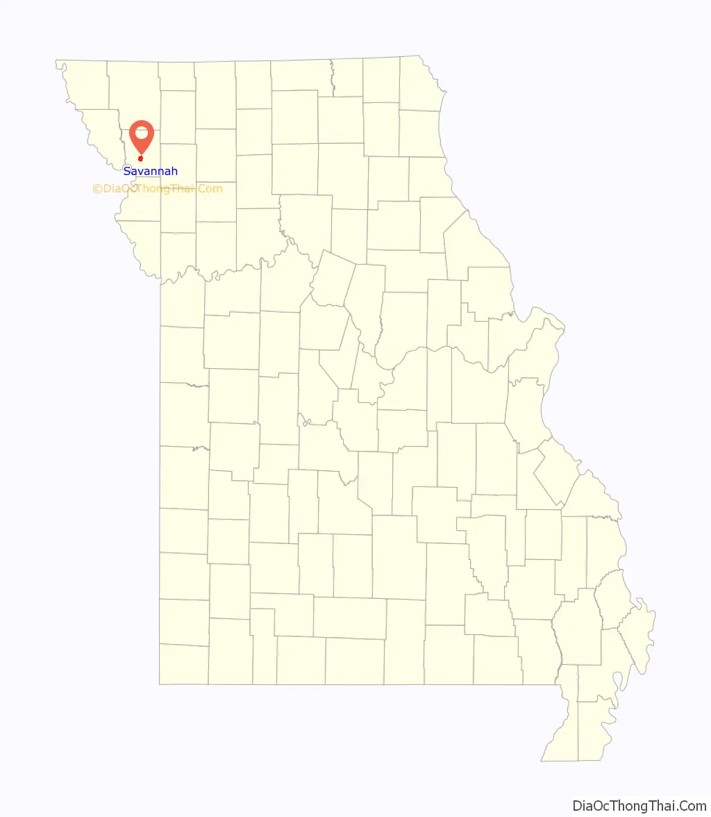
| State: | Missouri |
| County: | Andrew County |
| Elevation: | 1,076 ft (328 m) |
| Total Area: | 3.26 sq mi (8.45 km²) |
| Land Area: | 3.25 sq mi (8.42 km²) |
| Water Area: | 0.01 sq mi (0.04 km²) |
| Total Population: | 5,069 |
| Population Density: | 1,559.69/sq mi (602.21/km²) |
| ZIP code: | 64485 |
| Area code: | 816 |
| FIPS code: | 2966044 |
| GNISfeature ID: | 2396545 |
| Website: | savannahmo.net |
Online Interactive Map
Click on ![]() to view map in "full screen" mode.
to view map in "full screen" mode.
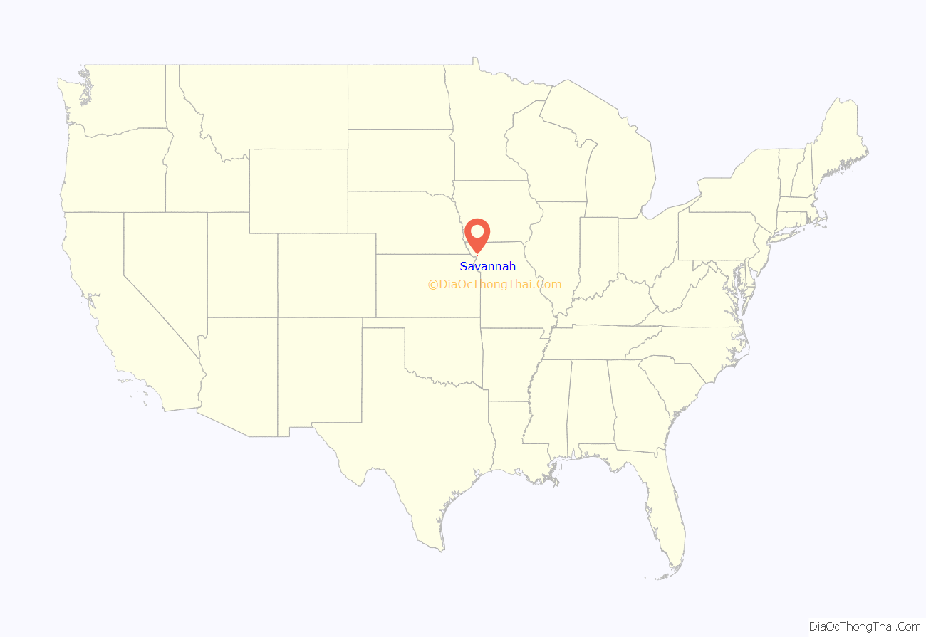
Savannah location map. Where is Savannah city?
History
Savannah was founded in 1841. The city was named after Savannah Woods, the child of a first settler. A post office called Savannah has been in operation since 1841.
The Andrew County Courthouse was listed on the National Register of Historic Places in 1980.
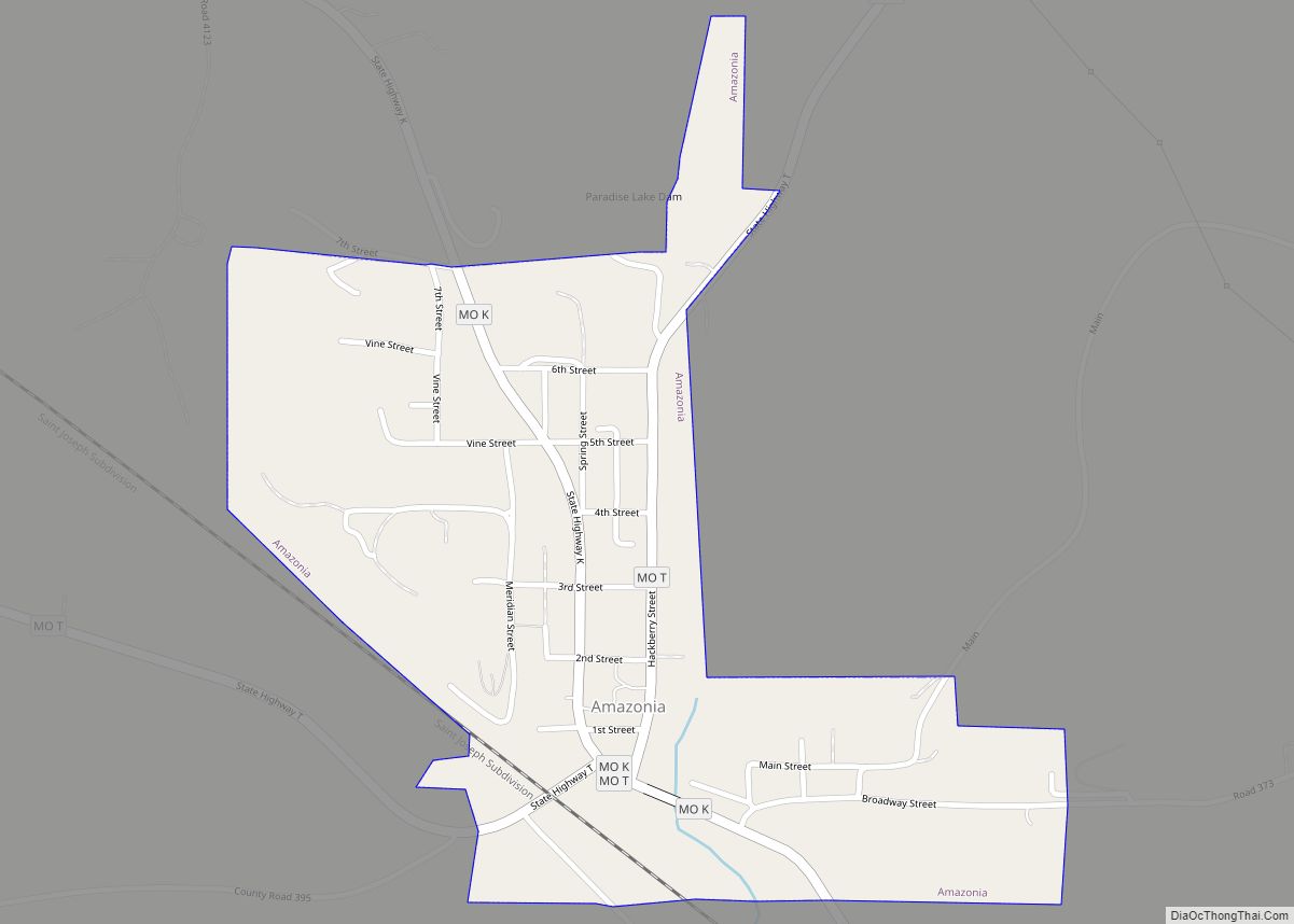
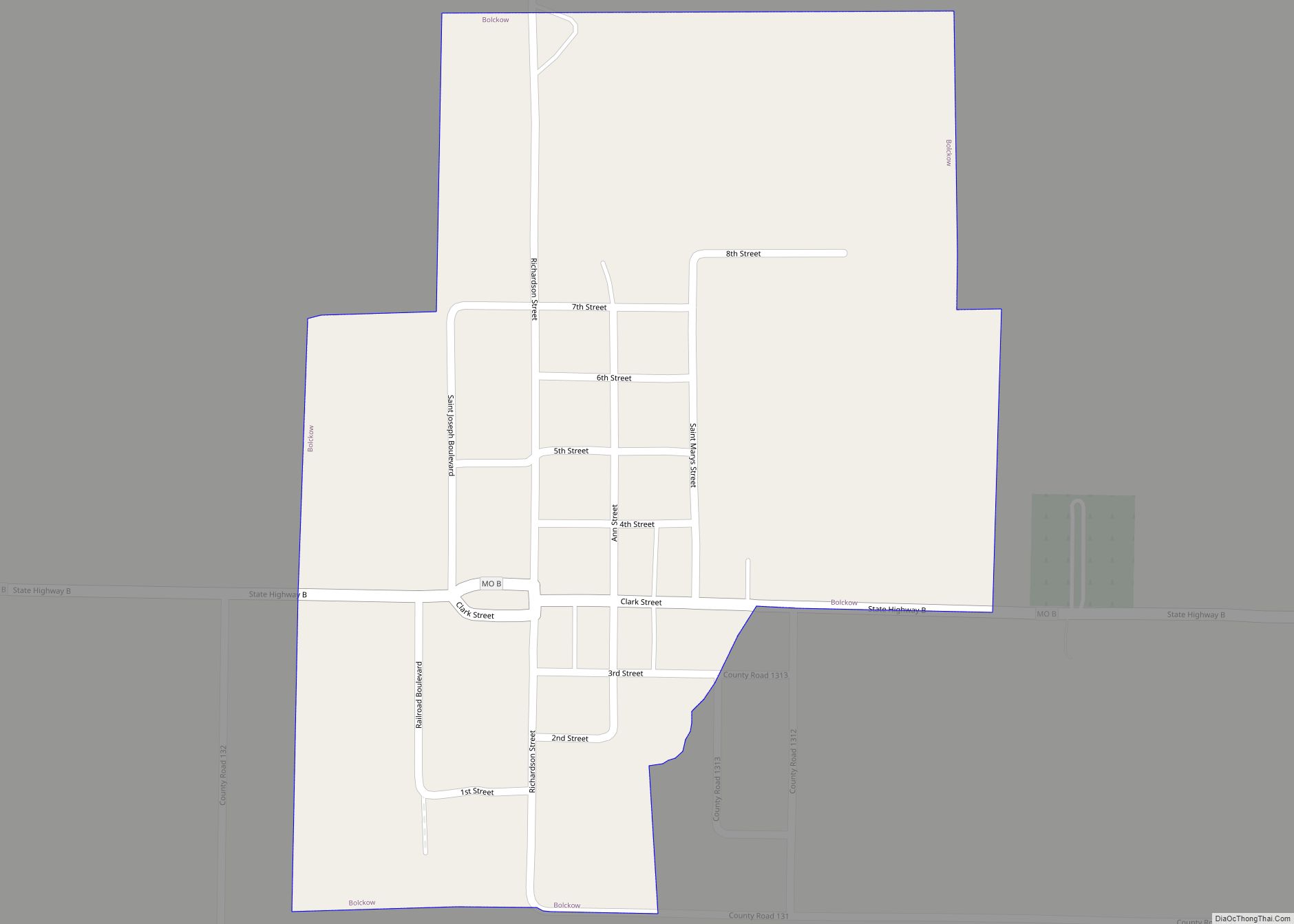
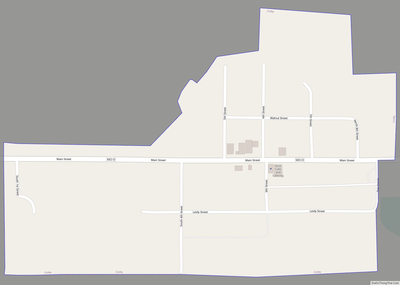
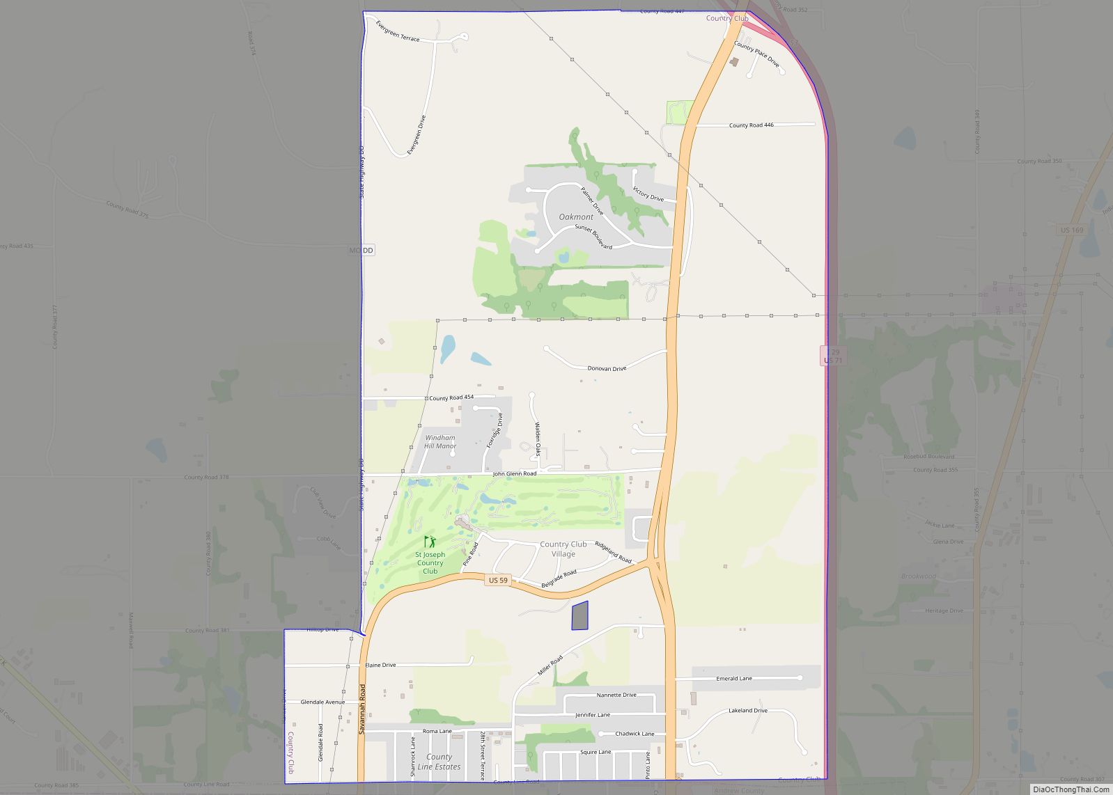
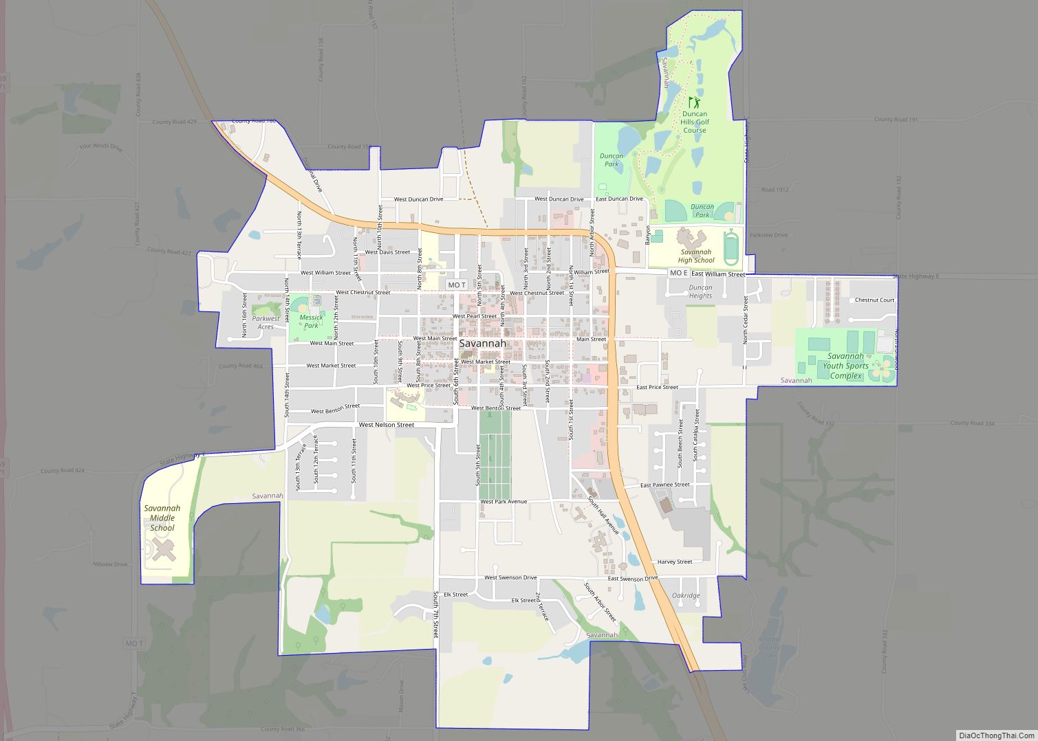
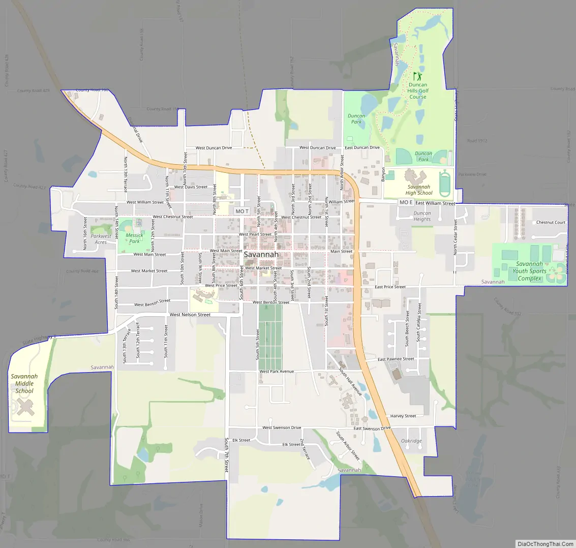
Savannah Road Map
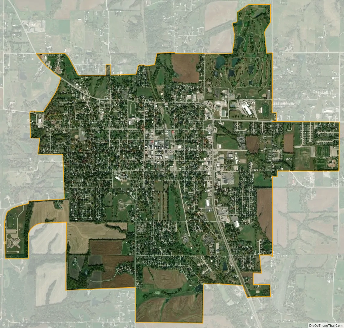
Savannah city Satellite Map
Geography
Savannah is located on Business 71 ten miles north of St Joseph. The One Hundred and Two River flows past two miles east of the city and the Happy Hollar Lake Conservation Area is three miles to the northeast.
According to the United States Census Bureau, the city has a total area of 3.15 square miles (8.16 km), of which 3.14 square miles (8.13 km) is land and 0.01 square miles (0.03 km) is water.
See also
Map of Missouri State and its subdivision:- Adair
- Andrew
- Atchison
- Audrain
- Barry
- Barton
- Bates
- Benton
- Bollinger
- Boone
- Buchanan
- Butler
- Caldwell
- Callaway
- Camden
- Cape Girardeau
- Carroll
- Carter
- Cass
- Cedar
- Chariton
- Christian
- Clark
- Clay
- Clinton
- Cole
- Cooper
- Crawford
- Dade
- Dallas
- Daviess
- De Kalb
- Dent
- Douglas
- Dunklin
- Franklin
- Gasconade
- Gentry
- Greene
- Grundy
- Harrison
- Henry
- Hickory
- Holt
- Howard
- Howell
- Iron
- Jackson
- Jasper
- Jefferson
- Johnson
- Knox
- Laclede
- Lafayette
- Lawrence
- Lewis
- Lincoln
- Linn
- Livingston
- Macon
- Madison
- Maries
- Marion
- McDonald
- Mercer
- Miller
- Mississippi
- Moniteau
- Monroe
- Montgomery
- Morgan
- New Madrid
- Newton
- Nodaway
- Oregon
- Osage
- Ozark
- Pemiscot
- Perry
- Pettis
- Phelps
- Pike
- Platte
- Polk
- Pulaski
- Putnam
- Ralls
- Randolph
- Ray
- Reynolds
- Ripley
- Saint Charles
- Saint Clair
- Saint Francois
- Saint Louis
- Sainte Genevieve
- Saline
- Schuyler
- Scotland
- Scott
- Shannon
- Shelby
- Stoddard
- Stone
- Sullivan
- Taney
- Texas
- Vernon
- Warren
- Washington
- Wayne
- Webster
- Worth
- Wright
- Alabama
- Alaska
- Arizona
- Arkansas
- California
- Colorado
- Connecticut
- Delaware
- District of Columbia
- Florida
- Georgia
- Hawaii
- Idaho
- Illinois
- Indiana
- Iowa
- Kansas
- Kentucky
- Louisiana
- Maine
- Maryland
- Massachusetts
- Michigan
- Minnesota
- Mississippi
- Missouri
- Montana
- Nebraska
- Nevada
- New Hampshire
- New Jersey
- New Mexico
- New York
- North Carolina
- North Dakota
- Ohio
- Oklahoma
- Oregon
- Pennsylvania
- Rhode Island
- South Carolina
- South Dakota
- Tennessee
- Texas
- Utah
- Vermont
- Virginia
- Washington
- West Virginia
- Wisconsin
- Wyoming