Seymour is a city in southeastern Webster County, Missouri, United States. The population was 1,921 at the 2010 census. It is part of the Springfield, Missouri Metropolitan Statistical Area.
| Name: | Seymour city |
|---|---|
| LSAD Code: | 25 |
| LSAD Description: | city (suffix) |
| State: | Missouri |
| County: | Webster County |
| Elevation: | 1,644 ft (501 m) |
| Total Area: | 3.48 sq mi (9.03 km²) |
| Land Area: | 3.48 sq mi (9.02 km²) |
| Water Area: | 0.00 sq mi (0.00 km²) |
| Total Population: | 1,841 |
| Population Density: | 528.42/sq mi (204.01/km²) |
| FIPS code: | 2966800 |
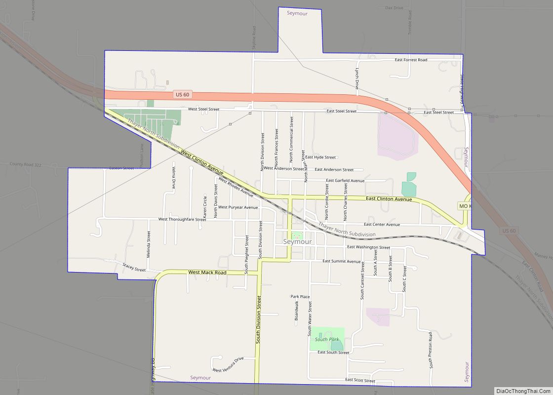
Online Interactive Map
Click on ![]() to view map in "full screen" mode.
to view map in "full screen" mode.
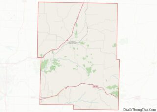
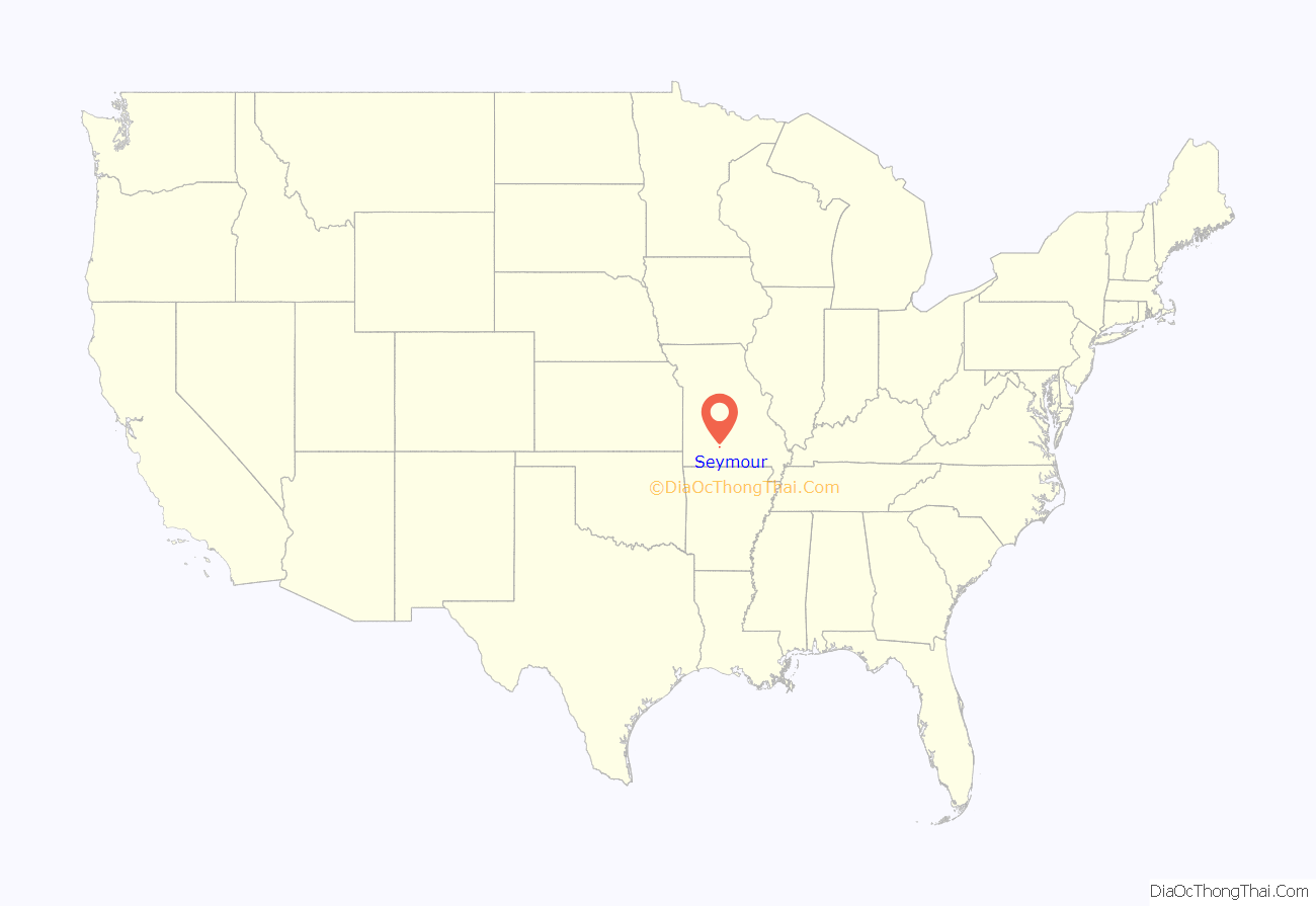
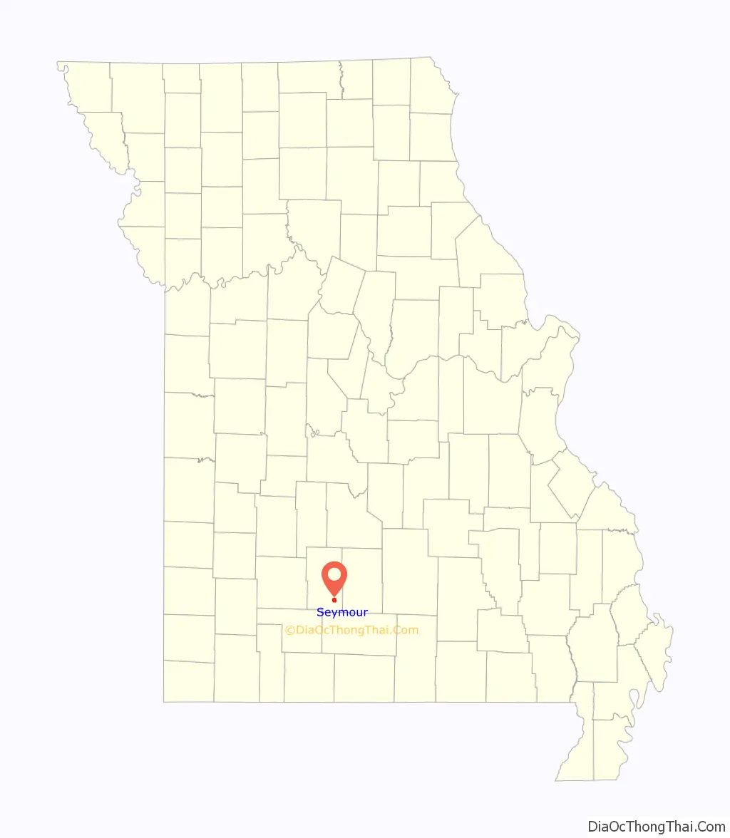
Seymour location map. Where is Seymour city?
History
Seymour was laid out in 1882. The town was named by Mr. T.P. Crabbe after Seymour, Indiana. A post office called Seymour has been in operation since 1881.
The Col. Thomas C. Love House was listed on the National Register of Historic Places in 1985.
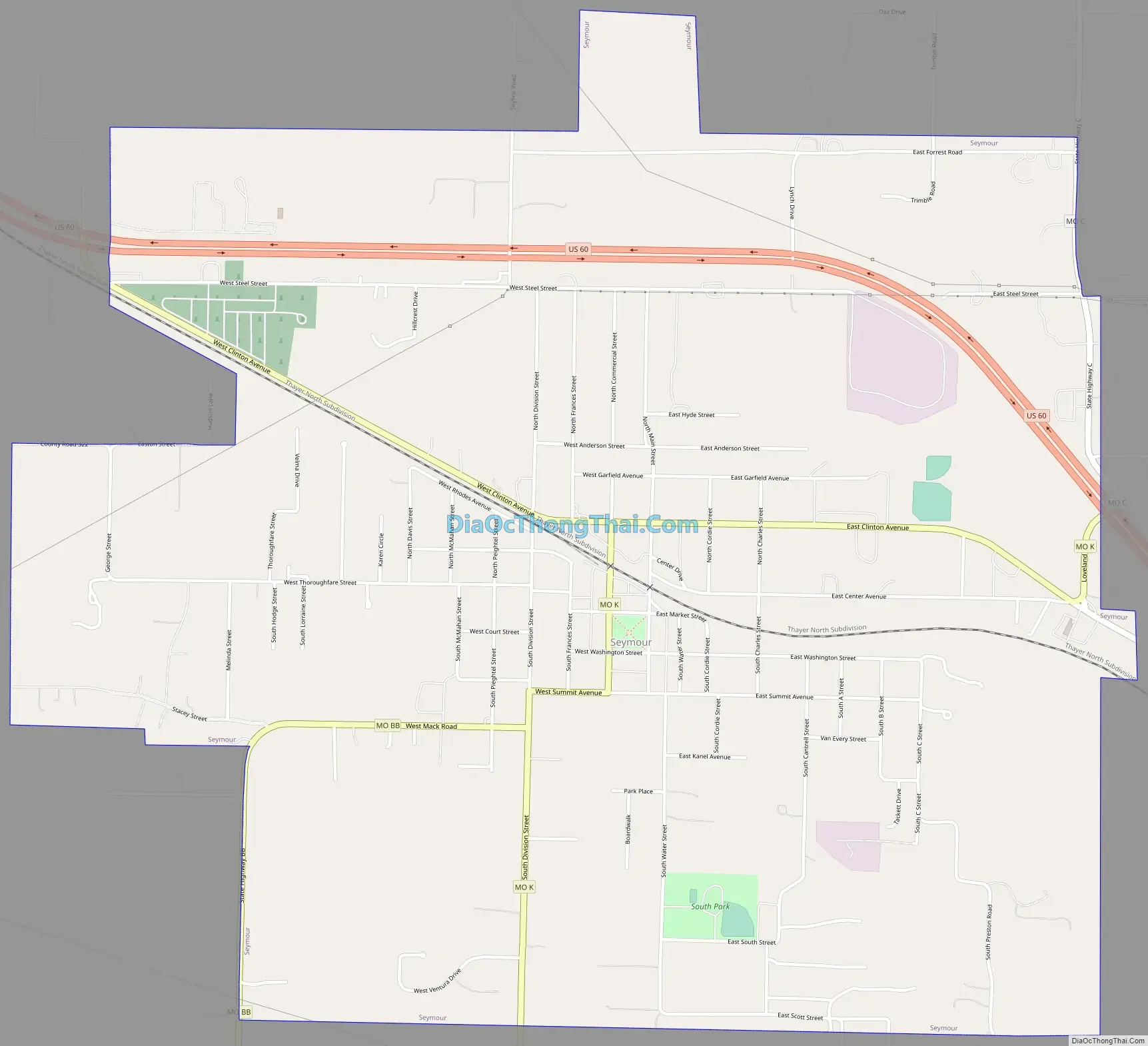
Seymour Road Map
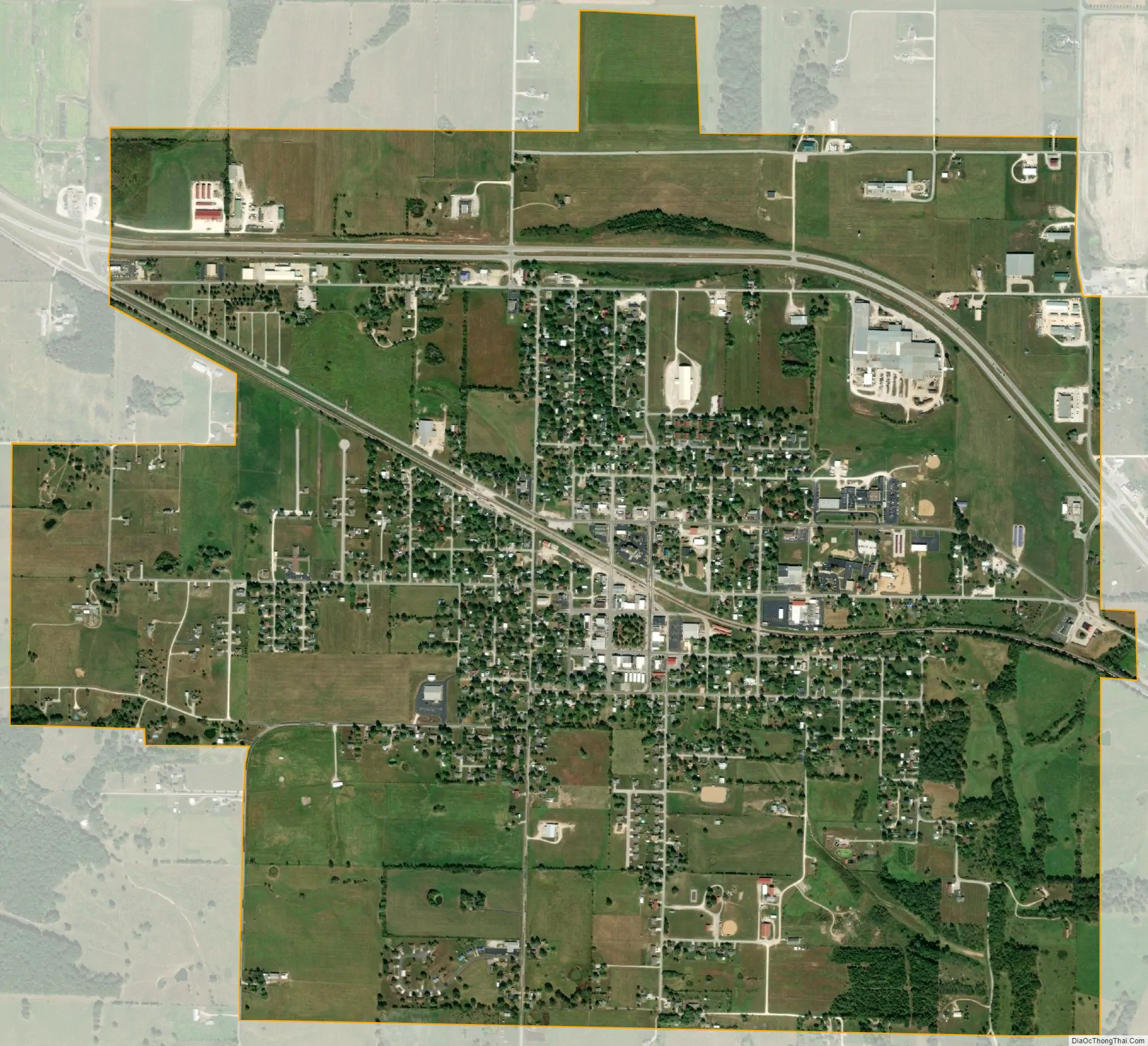
Seymour city Satellite Map
Geography
Seymour is located on the southeastern edge of the Springfield Plateau in the Ozarks. Streams to the east flow into the Gasconade River, the headwaters of the James River lie to the north and Finley Creek drains the south side of the town. US 60 passes the north side of the town and Missouri routes K, C and BB serve the town. The community of Diggins is 4.5 miles to the west and Mansfield is 10 miles to the east along Route 60. The Burlington Northern Santa Fe railroad’s single-tracked Springfield–Memphis line runs through the town just north of the town square.
According to the United States Census Bureau, the city has a total area of 2.76 square miles (7.15 km), all land.
See also
Map of Missouri State and its subdivision:- Adair
- Andrew
- Atchison
- Audrain
- Barry
- Barton
- Bates
- Benton
- Bollinger
- Boone
- Buchanan
- Butler
- Caldwell
- Callaway
- Camden
- Cape Girardeau
- Carroll
- Carter
- Cass
- Cedar
- Chariton
- Christian
- Clark
- Clay
- Clinton
- Cole
- Cooper
- Crawford
- Dade
- Dallas
- Daviess
- De Kalb
- Dent
- Douglas
- Dunklin
- Franklin
- Gasconade
- Gentry
- Greene
- Grundy
- Harrison
- Henry
- Hickory
- Holt
- Howard
- Howell
- Iron
- Jackson
- Jasper
- Jefferson
- Johnson
- Knox
- Laclede
- Lafayette
- Lawrence
- Lewis
- Lincoln
- Linn
- Livingston
- Macon
- Madison
- Maries
- Marion
- McDonald
- Mercer
- Miller
- Mississippi
- Moniteau
- Monroe
- Montgomery
- Morgan
- New Madrid
- Newton
- Nodaway
- Oregon
- Osage
- Ozark
- Pemiscot
- Perry
- Pettis
- Phelps
- Pike
- Platte
- Polk
- Pulaski
- Putnam
- Ralls
- Randolph
- Ray
- Reynolds
- Ripley
- Saint Charles
- Saint Clair
- Saint Francois
- Saint Louis
- Sainte Genevieve
- Saline
- Schuyler
- Scotland
- Scott
- Shannon
- Shelby
- Stoddard
- Stone
- Sullivan
- Taney
- Texas
- Vernon
- Warren
- Washington
- Wayne
- Webster
- Worth
- Wright
- Alabama
- Alaska
- Arizona
- Arkansas
- California
- Colorado
- Connecticut
- Delaware
- District of Columbia
- Florida
- Georgia
- Hawaii
- Idaho
- Illinois
- Indiana
- Iowa
- Kansas
- Kentucky
- Louisiana
- Maine
- Maryland
- Massachusetts
- Michigan
- Minnesota
- Mississippi
- Missouri
- Montana
- Nebraska
- Nevada
- New Hampshire
- New Jersey
- New Mexico
- New York
- North Carolina
- North Dakota
- Ohio
- Oklahoma
- Oregon
- Pennsylvania
- Rhode Island
- South Carolina
- South Dakota
- Tennessee
- Texas
- Utah
- Vermont
- Virginia
- Washington
- West Virginia
- Wisconsin
- Wyoming