Tightwad is a village in Henry County, Missouri, United States. Its population was 64 at the 2010 United States Census. Tightwad is located along Missouri Route 7.
| Name: | Tightwad village |
|---|---|
| LSAD Code: | 47 |
| LSAD Description: | village (suffix) |
| State: | Missouri |
| County: | Henry County |
| Elevation: | 876 ft (267 m) |
| Total Area: | 1.01 sq mi (2.61 km²) |
| Land Area: | 1.00 sq mi (2.58 km²) |
| Water Area: | 0.01 sq mi (0.03 km²) |
| Total Population: | 58 |
| Population Density: | 58.12/sq mi (22.45/km²) |
| ZIP code: | 64735 |
| Area code: | 660 |
| FIPS code: | 2973240 |
| GNISfeature ID: | 2399980 |
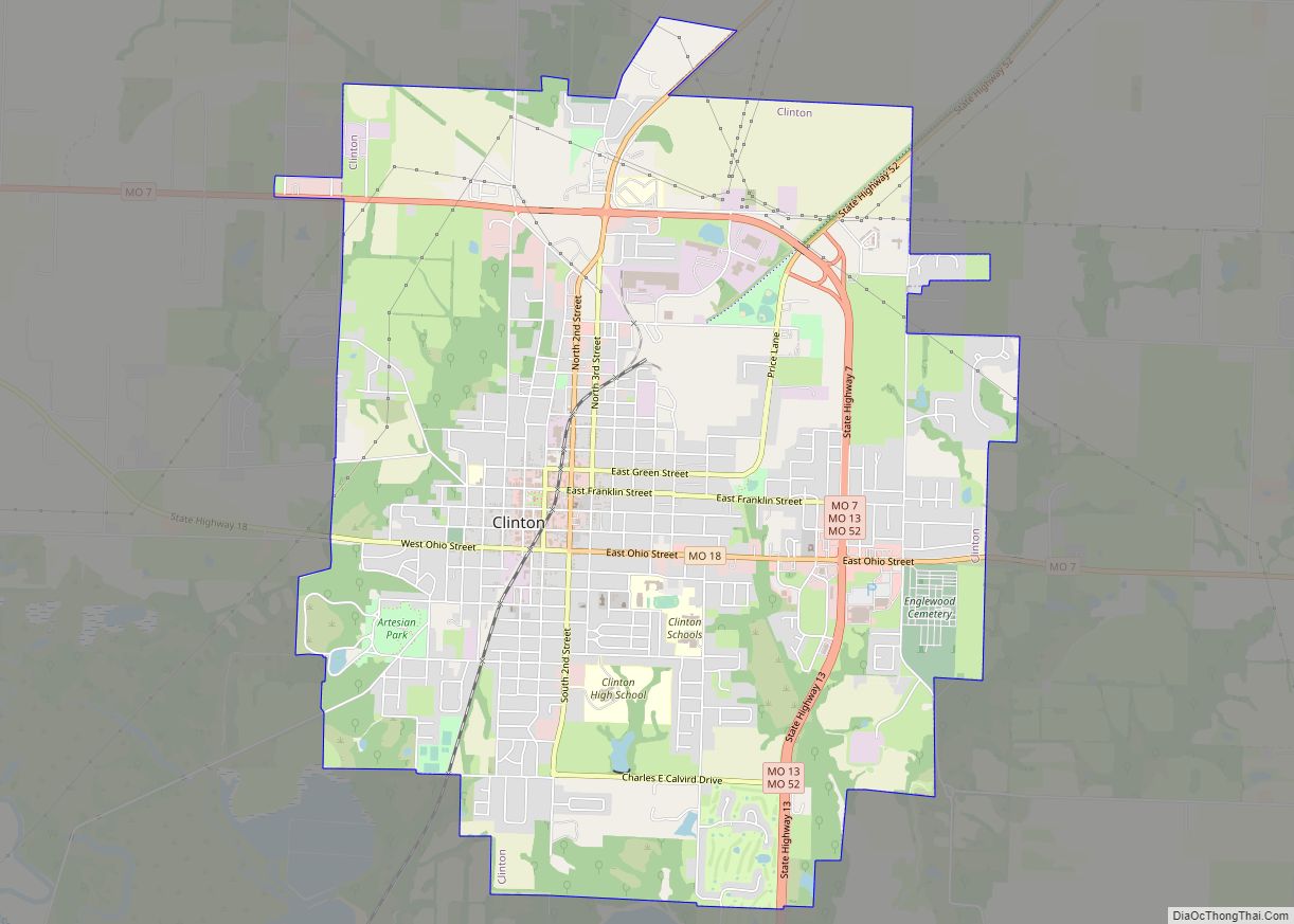
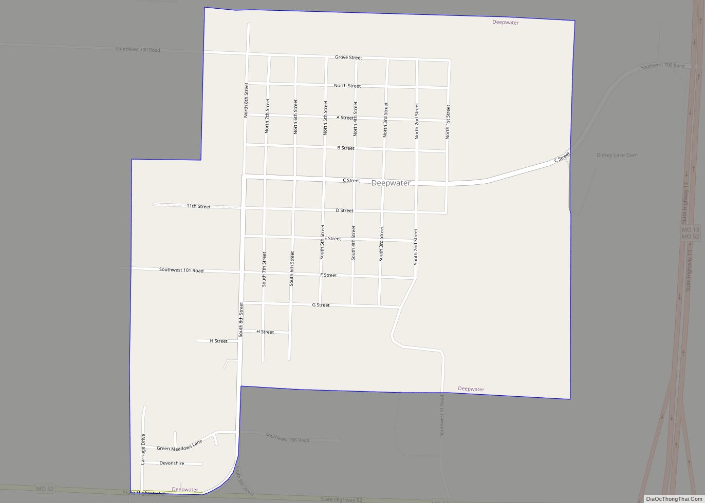
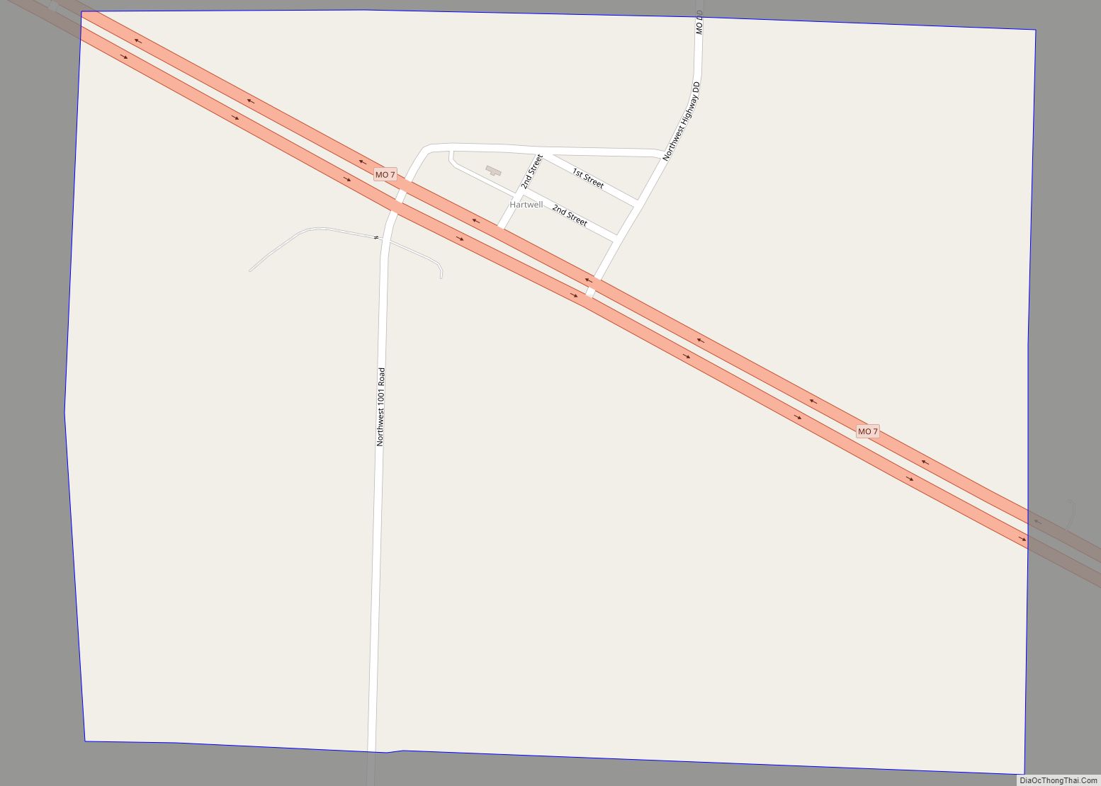
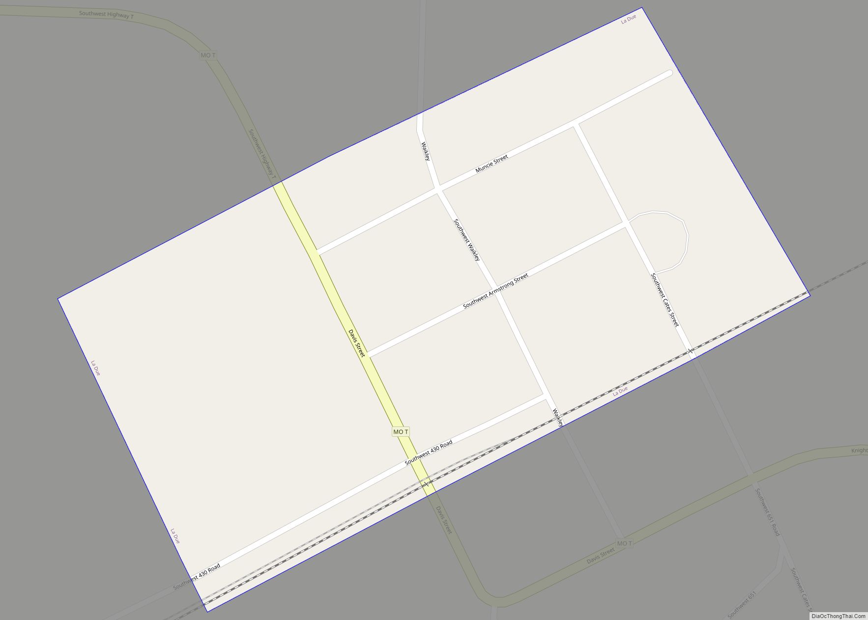
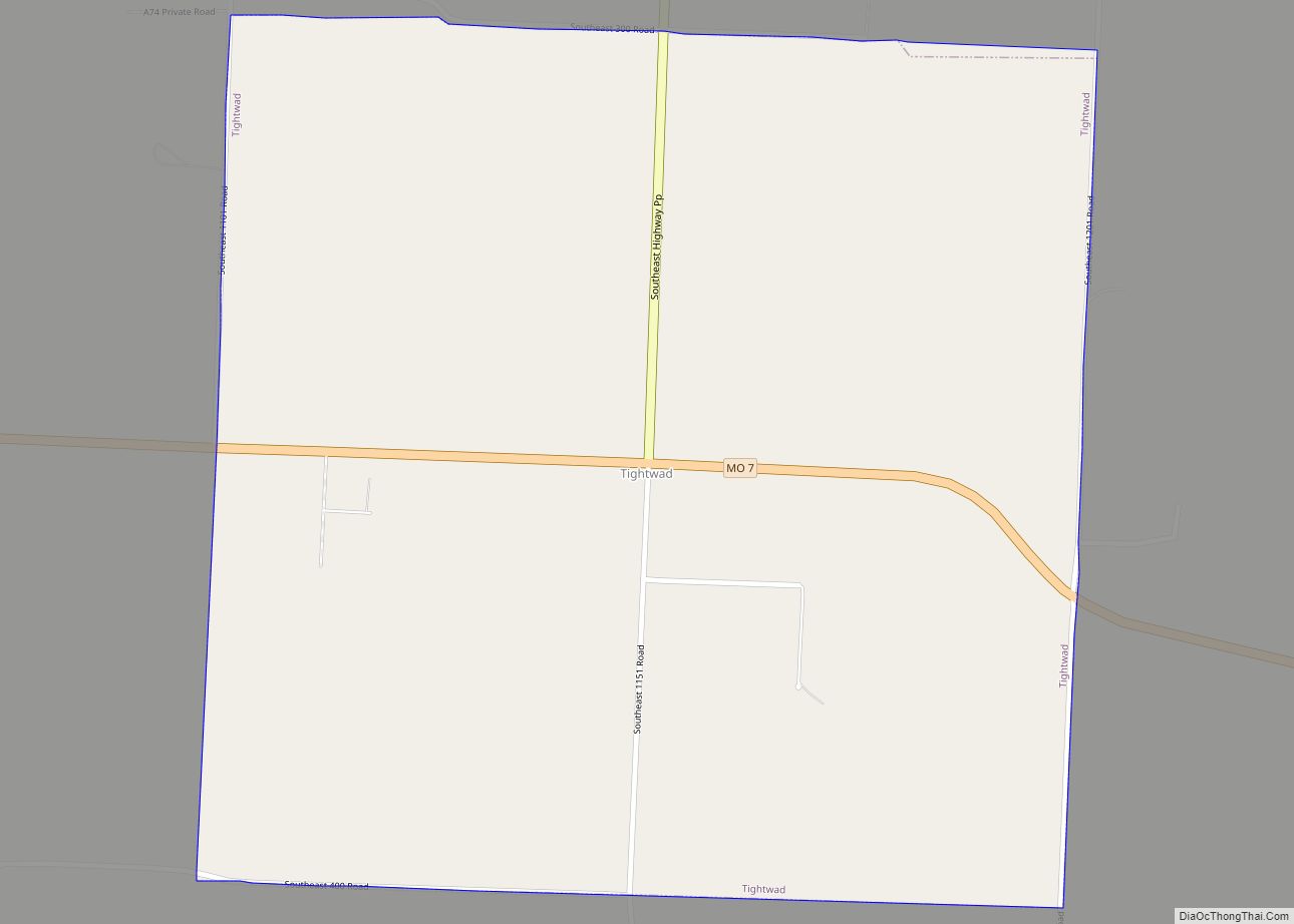
Online Interactive Map
Click on ![]() to view map in "full screen" mode.
to view map in "full screen" mode.
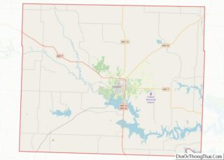
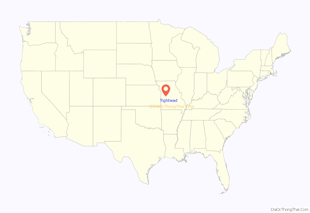
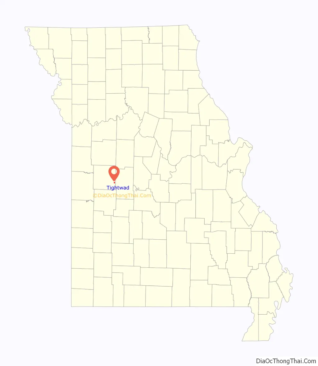
Tightwad location map. Where is Tightwad village?
History
Tightwad was originally called Edgewood, for the woods near the original town site.
The village’s unusual name is said to stem from an episode in which a store owner cheated a customer, who was a postman, by charging him an extra 50 cents for a better watermelon. Some sources claim the transaction involved a rooster rather than a watermelon. Due to its proximity to Truman Reservoir, Tightwad saw some limited growth starting in the mid-1980s. As of 2010, the village’s business district included a bank (see below), café, tavern, and convenience store. As of April 2019, the bank is now closed and is being used for personal use. The café was bought after sitting vacant for many years and is now being used as an antique store called the “Nook and Cranny” and most recent with the addition of a Dollar General within the business district, the local convenience store was forced to close their doors, and is in the process of being turned into apartments. Tightwad also had an additional business added off of Highway 7, down Highway PP called Hickory Hollow Resort, which rents cabins and Rv spots. They now have a bait store and a diner called Donnas Drive Inn.
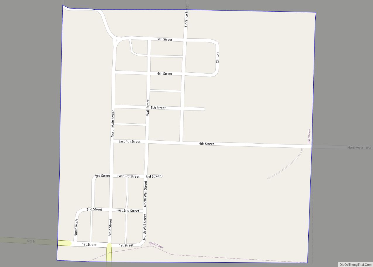
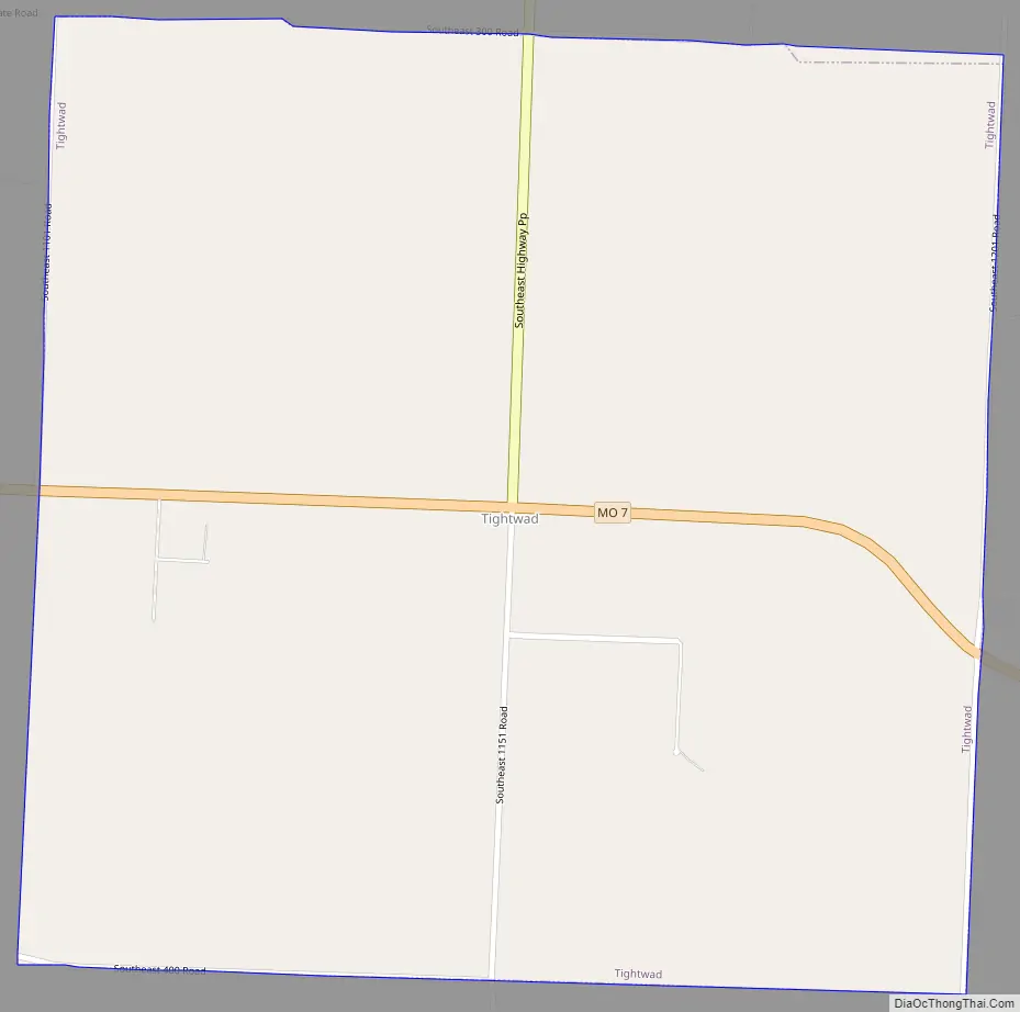
Tightwad Road Map
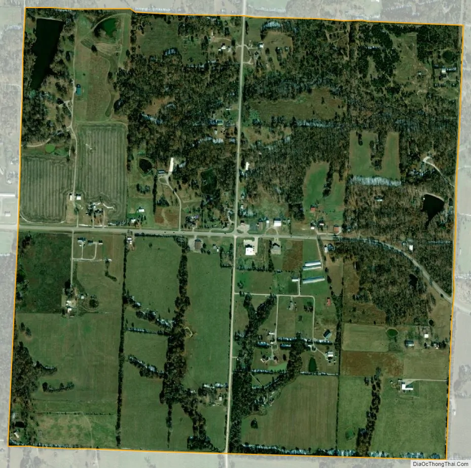
Tightwad city Satellite Map
Geography
According to the United States Census Bureau, the village has a total area of 1.01 square miles (2.62 km), of which 1.00 square mile (2.59 km) is land and 0.01 square miles (0.03 km) is water.
See also
Map of Missouri State and its subdivision:- Adair
- Andrew
- Atchison
- Audrain
- Barry
- Barton
- Bates
- Benton
- Bollinger
- Boone
- Buchanan
- Butler
- Caldwell
- Callaway
- Camden
- Cape Girardeau
- Carroll
- Carter
- Cass
- Cedar
- Chariton
- Christian
- Clark
- Clay
- Clinton
- Cole
- Cooper
- Crawford
- Dade
- Dallas
- Daviess
- De Kalb
- Dent
- Douglas
- Dunklin
- Franklin
- Gasconade
- Gentry
- Greene
- Grundy
- Harrison
- Henry
- Hickory
- Holt
- Howard
- Howell
- Iron
- Jackson
- Jasper
- Jefferson
- Johnson
- Knox
- Laclede
- Lafayette
- Lawrence
- Lewis
- Lincoln
- Linn
- Livingston
- Macon
- Madison
- Maries
- Marion
- McDonald
- Mercer
- Miller
- Mississippi
- Moniteau
- Monroe
- Montgomery
- Morgan
- New Madrid
- Newton
- Nodaway
- Oregon
- Osage
- Ozark
- Pemiscot
- Perry
- Pettis
- Phelps
- Pike
- Platte
- Polk
- Pulaski
- Putnam
- Ralls
- Randolph
- Ray
- Reynolds
- Ripley
- Saint Charles
- Saint Clair
- Saint Francois
- Saint Louis
- Sainte Genevieve
- Saline
- Schuyler
- Scotland
- Scott
- Shannon
- Shelby
- Stoddard
- Stone
- Sullivan
- Taney
- Texas
- Vernon
- Warren
- Washington
- Wayne
- Webster
- Worth
- Wright
- Alabama
- Alaska
- Arizona
- Arkansas
- California
- Colorado
- Connecticut
- Delaware
- District of Columbia
- Florida
- Georgia
- Hawaii
- Idaho
- Illinois
- Indiana
- Iowa
- Kansas
- Kentucky
- Louisiana
- Maine
- Maryland
- Massachusetts
- Michigan
- Minnesota
- Mississippi
- Missouri
- Montana
- Nebraska
- Nevada
- New Hampshire
- New Jersey
- New Mexico
- New York
- North Carolina
- North Dakota
- Ohio
- Oklahoma
- Oregon
- Pennsylvania
- Rhode Island
- South Carolina
- South Dakota
- Tennessee
- Texas
- Utah
- Vermont
- Virginia
- Washington
- West Virginia
- Wisconsin
- Wyoming