Wellston is a city in St. Louis County, Missouri, United States, along the northwest border of the city of St. Louis. The population was 2,313 at the 2010 census.
| Name: | Wellston city |
|---|---|
| LSAD Code: | 25 |
| LSAD Description: | city (suffix) |
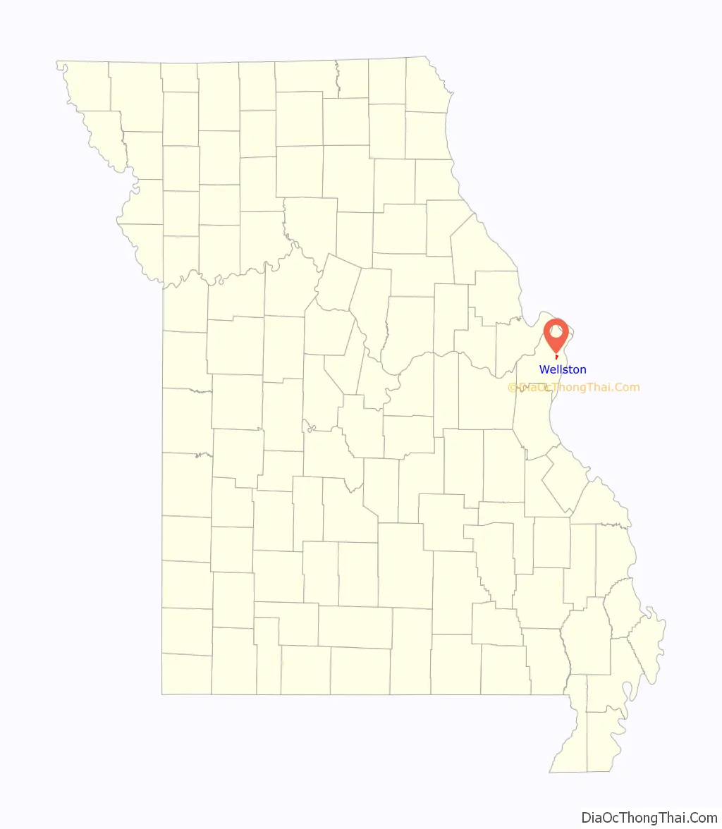
| State: | Missouri |
| County: | St. Louis County |
| Incorporated: | 1909 |
| Elevation: | 548 ft (167 m) |
| Total Area: | 0.93 sq mi (2.41 km²) |
| Land Area: | 0.93 sq mi (2.41 km²) |
| Water Area: | 0.00 sq mi (0.00 km²) |
| Total Population: | 1,537 |
| Population Density: | 1,649.14/sq mi (636.54/km²) |
| FIPS code: | 2978370 |
| GNISfeature ID: | 2397251 |
Online Interactive Map
Click on ![]() to view map in "full screen" mode.
to view map in "full screen" mode.
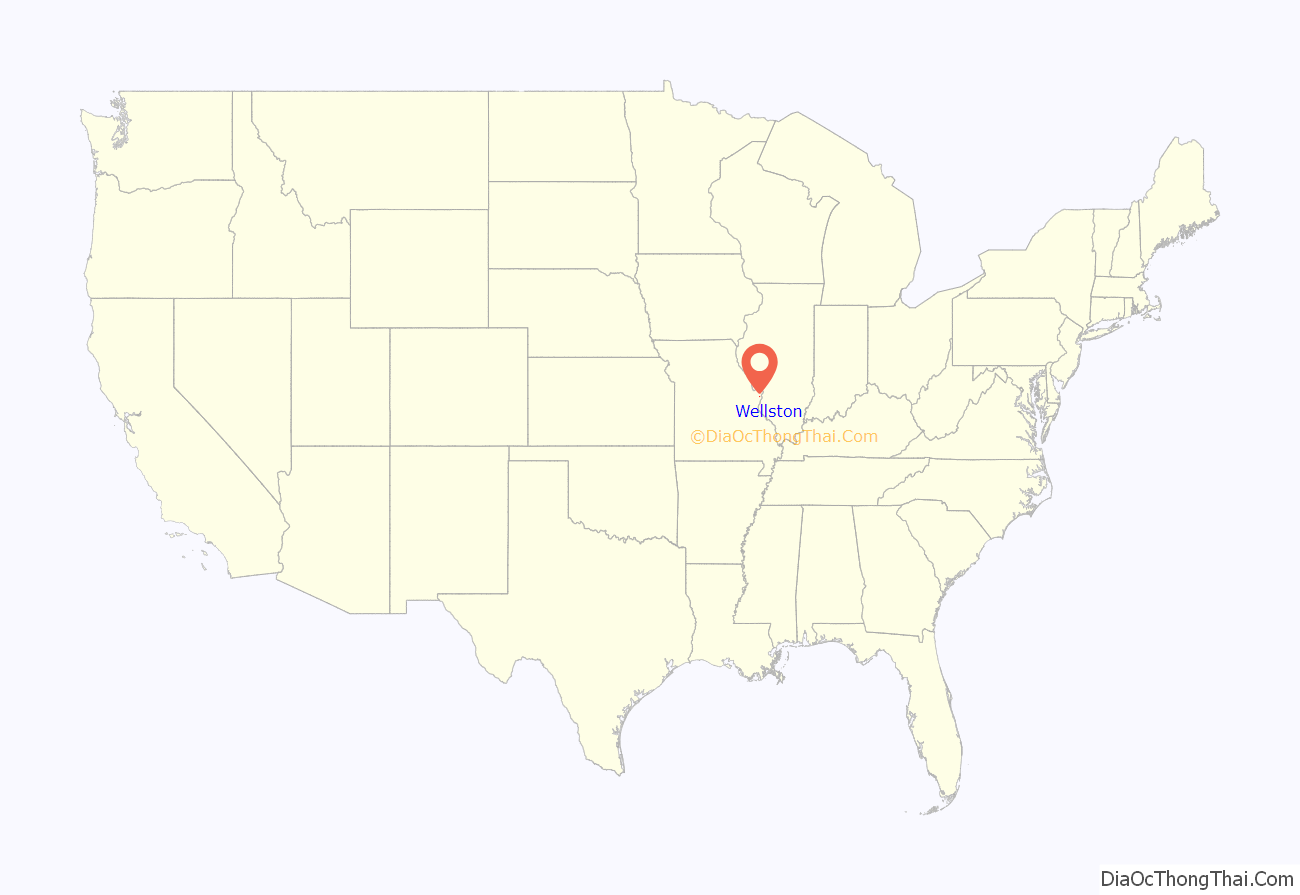
Wellston location map. Where is Wellston city?
History
Wellston was incorporated as a city in 1909; due to “government difficulties” the city was dissolved three years later, only to be reestablished in 1949. The city was named for Erastus Wells.
During the early 1900s, the Wagner Electric Company, a manufacturer of small motors for appliances and transformers, began development along Plymouth Avenue in Wellston, growing to occupy the entire block and providing 4,500 jobs during World War I. North of the Wagner site, ABEX Corporation built a steel foundry that began operation in 1923.
In 1982 ABEX moved out of its Wellston location; the next year, the Wagner Electric Company closed its doors. After closure, it took 22 years, and millions of dollars in tax credits and development grants, for the St. Louis County Economic Council to demolish five buildings and clean up 15 acres (6.1 ha) of the Wagner brownfield land along the MetroLink so that it could be made marketable as the Plymouth Industrial Park.
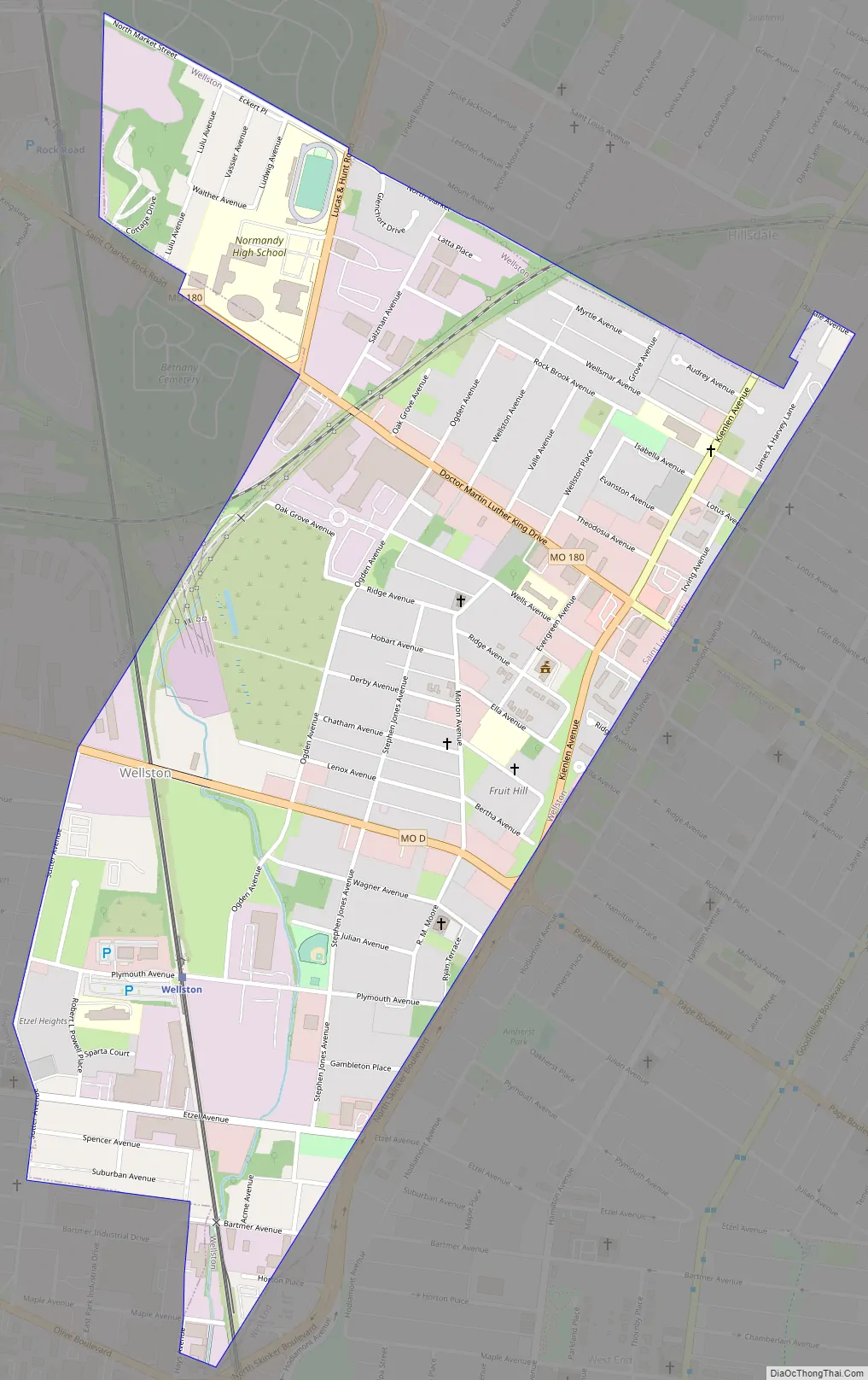
Wellston Road Map
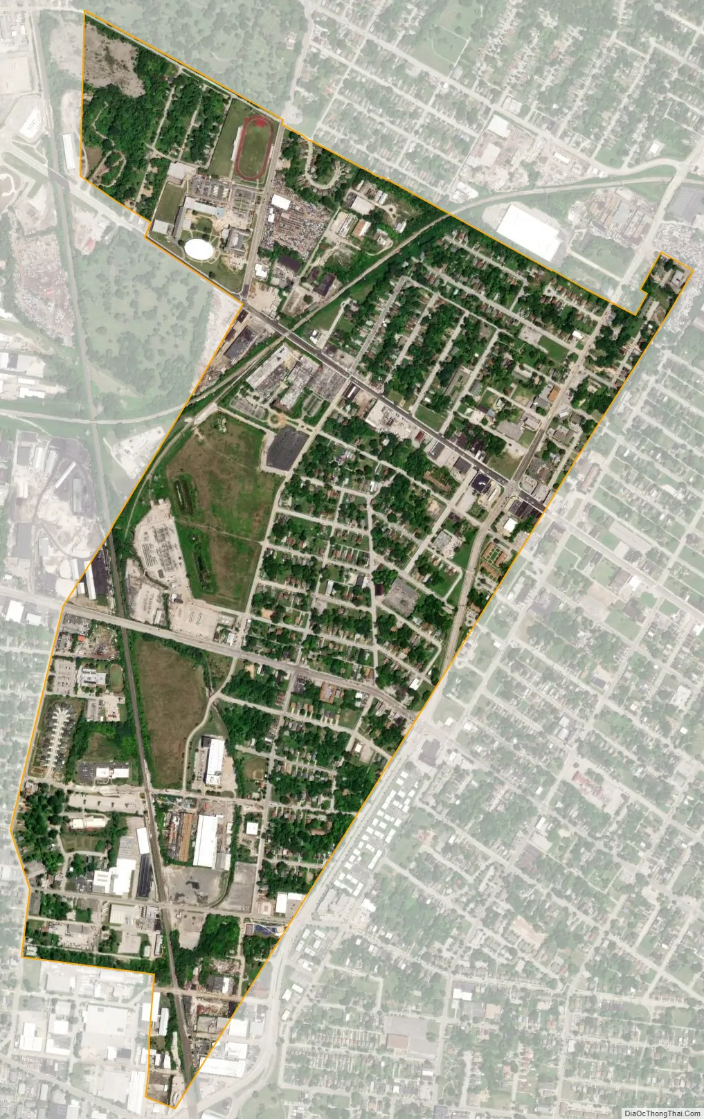
Wellston city Satellite Map
Geography
According to the United States Census Bureau, the city has a total area of 0.93 square miles (2.41 km), all land.
See also
Map of Missouri State and its subdivision:- Adair
- Andrew
- Atchison
- Audrain
- Barry
- Barton
- Bates
- Benton
- Bollinger
- Boone
- Buchanan
- Butler
- Caldwell
- Callaway
- Camden
- Cape Girardeau
- Carroll
- Carter
- Cass
- Cedar
- Chariton
- Christian
- Clark
- Clay
- Clinton
- Cole
- Cooper
- Crawford
- Dade
- Dallas
- Daviess
- De Kalb
- Dent
- Douglas
- Dunklin
- Franklin
- Gasconade
- Gentry
- Greene
- Grundy
- Harrison
- Henry
- Hickory
- Holt
- Howard
- Howell
- Iron
- Jackson
- Jasper
- Jefferson
- Johnson
- Knox
- Laclede
- Lafayette
- Lawrence
- Lewis
- Lincoln
- Linn
- Livingston
- Macon
- Madison
- Maries
- Marion
- McDonald
- Mercer
- Miller
- Mississippi
- Moniteau
- Monroe
- Montgomery
- Morgan
- New Madrid
- Newton
- Nodaway
- Oregon
- Osage
- Ozark
- Pemiscot
- Perry
- Pettis
- Phelps
- Pike
- Platte
- Polk
- Pulaski
- Putnam
- Ralls
- Randolph
- Ray
- Reynolds
- Ripley
- Saint Charles
- Saint Clair
- Saint Francois
- Saint Louis
- Sainte Genevieve
- Saline
- Schuyler
- Scotland
- Scott
- Shannon
- Shelby
- Stoddard
- Stone
- Sullivan
- Taney
- Texas
- Vernon
- Warren
- Washington
- Wayne
- Webster
- Worth
- Wright
- Alabama
- Alaska
- Arizona
- Arkansas
- California
- Colorado
- Connecticut
- Delaware
- District of Columbia
- Florida
- Georgia
- Hawaii
- Idaho
- Illinois
- Indiana
- Iowa
- Kansas
- Kentucky
- Louisiana
- Maine
- Maryland
- Massachusetts
- Michigan
- Minnesota
- Mississippi
- Missouri
- Montana
- Nebraska
- Nevada
- New Hampshire
- New Jersey
- New Mexico
- New York
- North Carolina
- North Dakota
- Ohio
- Oklahoma
- Oregon
- Pennsylvania
- Rhode Island
- South Carolina
- South Dakota
- Tennessee
- Texas
- Utah
- Vermont
- Virginia
- Washington
- West Virginia
- Wisconsin
- Wyoming


