Westphalia is a city in Osage County, Missouri, United States. The population was 378 at the 2020 census. It is part of the Jefferson City, Missouri Metropolitan Statistical Area.
Westphalia is heavily influenced by the German heritage of the majority of its inhabitants. Many of the early settlers of the area came from the Westphalia region of Germany, hence the name. Many buildings are influenced by nineteenth-century German architecture, and streets are labeled in both English and German. The center of population of Missouri is located in Westphalia.
| Name: | Westphalia city |
|---|---|
| LSAD Code: | 25 |
| LSAD Description: | city (suffix) |
| State: | Missouri |
| County: | Osage County |
| Founded: | 1835 |
| Incorporated: | 1848 |
| Elevation: | 620 ft (190 m) |
| Total Area: | 0.37 sq mi (0.97 km²) |
| Land Area: | 0.37 sq mi (0.97 km²) |
| Water Area: | 0.00 sq mi (0.00 km²) |
| Total Population: | 378 |
| Population Density: | 1,013.40/sq mi (391.46/km²) |
| ZIP code: | 65085 |
| Area code: | 573 |
| FIPS code: | 2978910 |
| GNISfeature ID: | 2397284 |
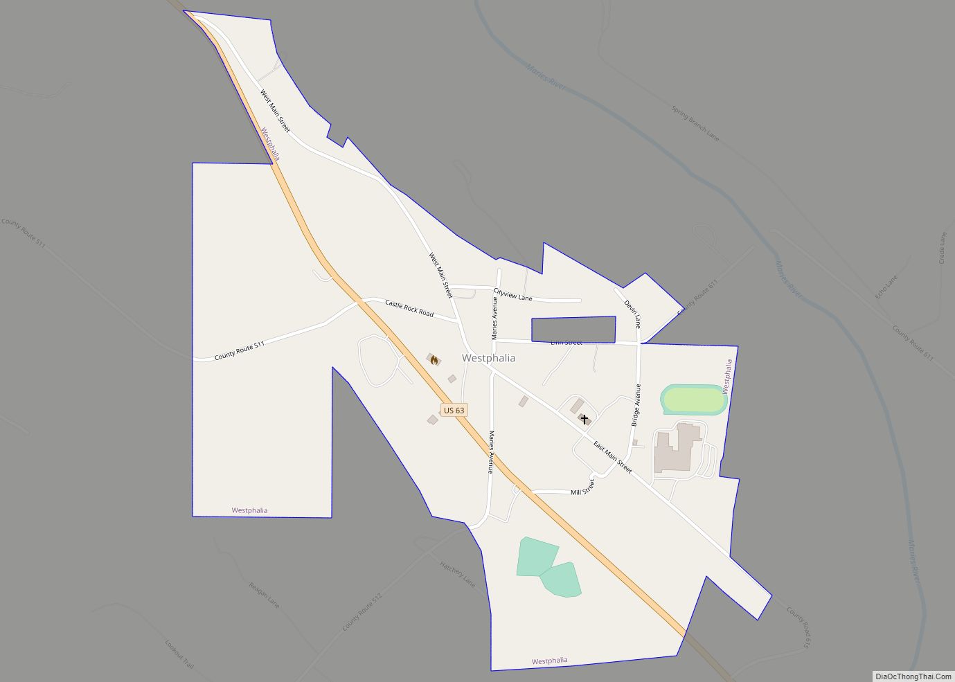
Online Interactive Map
Click on ![]() to view map in "full screen" mode.
to view map in "full screen" mode.
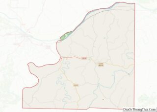
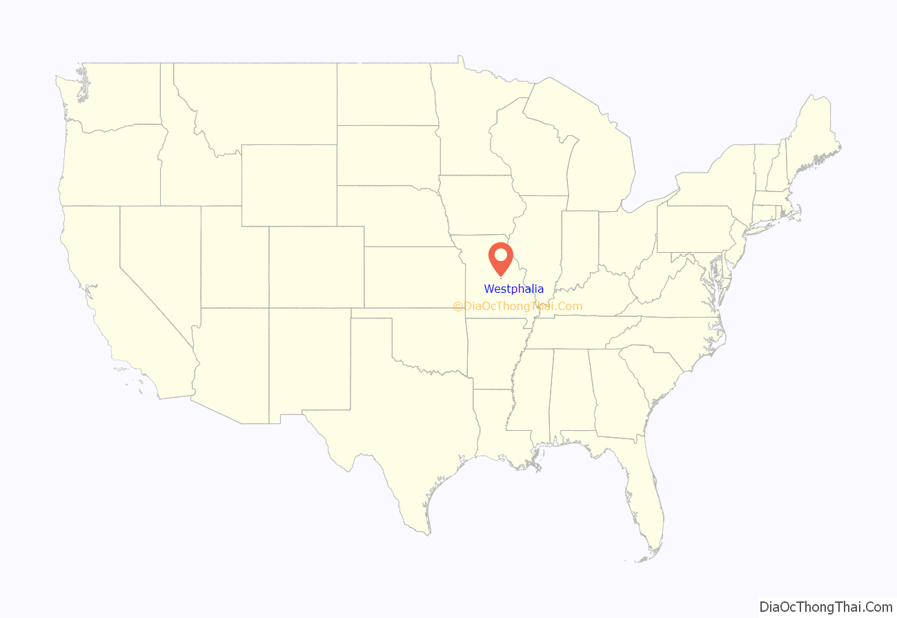
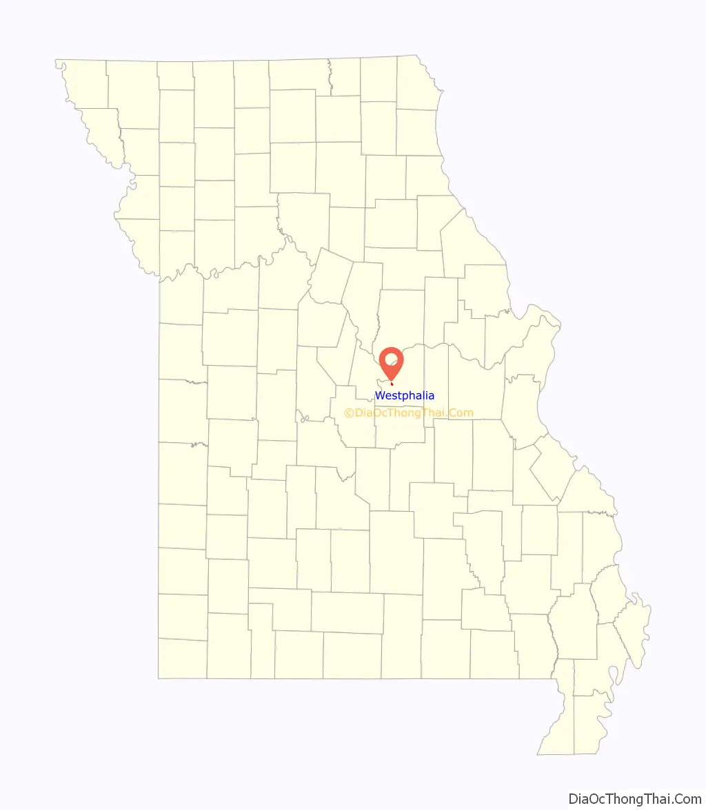
Westphalia location map. Where is Westphalia city?
History
Westphalia was platted in 1835, and named after Westphalia, in Germany, the native home of a large share of the first settlers. A post office called Westphalia has been in operation since 1848.
St. Joseph Church was listed on the National Register of Historic Places in 1972.
Westphalia Road Map
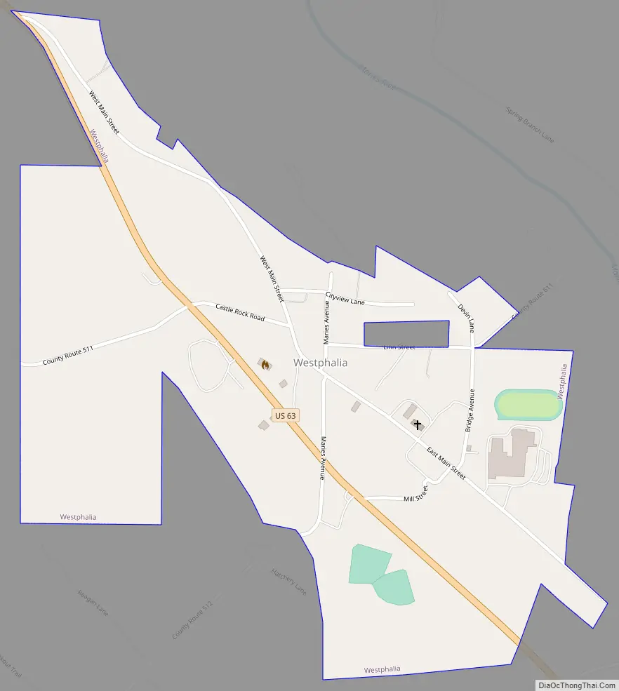
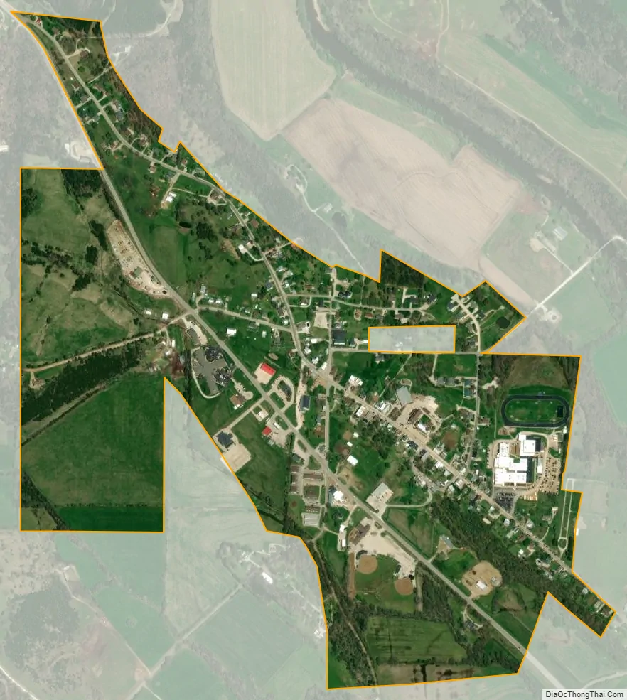
Westphalia city Satellite Map
Geography
Westphalia is located on US Route 63 approximately 12 miles southeast of Jefferson City. The Maries River flows past the south and east sides of the site and the Gasconade River is two miles to the northwest.
According to the United States Census Bureau, the city has a total area of 0.53 square miles (1.37 km), all land.
See also
Map of Missouri State and its subdivision:- Adair
- Andrew
- Atchison
- Audrain
- Barry
- Barton
- Bates
- Benton
- Bollinger
- Boone
- Buchanan
- Butler
- Caldwell
- Callaway
- Camden
- Cape Girardeau
- Carroll
- Carter
- Cass
- Cedar
- Chariton
- Christian
- Clark
- Clay
- Clinton
- Cole
- Cooper
- Crawford
- Dade
- Dallas
- Daviess
- De Kalb
- Dent
- Douglas
- Dunklin
- Franklin
- Gasconade
- Gentry
- Greene
- Grundy
- Harrison
- Henry
- Hickory
- Holt
- Howard
- Howell
- Iron
- Jackson
- Jasper
- Jefferson
- Johnson
- Knox
- Laclede
- Lafayette
- Lawrence
- Lewis
- Lincoln
- Linn
- Livingston
- Macon
- Madison
- Maries
- Marion
- McDonald
- Mercer
- Miller
- Mississippi
- Moniteau
- Monroe
- Montgomery
- Morgan
- New Madrid
- Newton
- Nodaway
- Oregon
- Osage
- Ozark
- Pemiscot
- Perry
- Pettis
- Phelps
- Pike
- Platte
- Polk
- Pulaski
- Putnam
- Ralls
- Randolph
- Ray
- Reynolds
- Ripley
- Saint Charles
- Saint Clair
- Saint Francois
- Saint Louis
- Sainte Genevieve
- Saline
- Schuyler
- Scotland
- Scott
- Shannon
- Shelby
- Stoddard
- Stone
- Sullivan
- Taney
- Texas
- Vernon
- Warren
- Washington
- Wayne
- Webster
- Worth
- Wright
- Alabama
- Alaska
- Arizona
- Arkansas
- California
- Colorado
- Connecticut
- Delaware
- District of Columbia
- Florida
- Georgia
- Hawaii
- Idaho
- Illinois
- Indiana
- Iowa
- Kansas
- Kentucky
- Louisiana
- Maine
- Maryland
- Massachusetts
- Michigan
- Minnesota
- Mississippi
- Missouri
- Montana
- Nebraska
- Nevada
- New Hampshire
- New Jersey
- New Mexico
- New York
- North Carolina
- North Dakota
- Ohio
- Oklahoma
- Oregon
- Pennsylvania
- Rhode Island
- South Carolina
- South Dakota
- Tennessee
- Texas
- Utah
- Vermont
- Virginia
- Washington
- West Virginia
- Wisconsin
- Wyoming