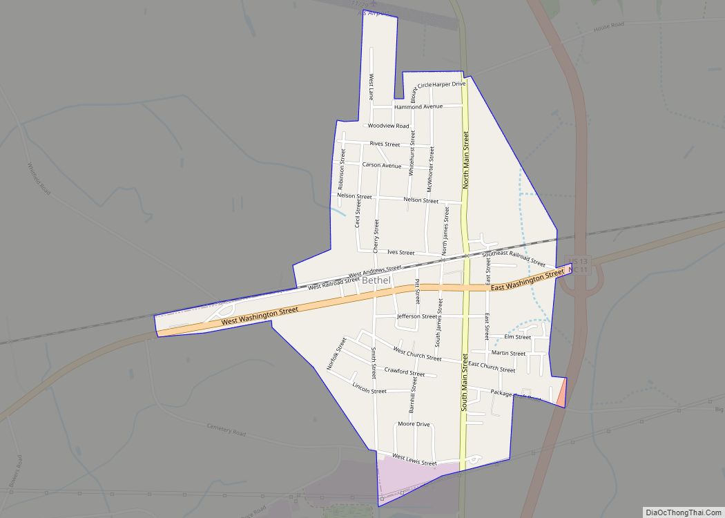
Bethel is a town in Pitt County, North Carolina, United States. The population was 1,577 at the 2010 Census. The town is a part of the Greenville Metropolitan Area located in North Carolina’s Inner Banks region. Confusingly, there are three other towns in the state named “Bethel.” One is between Edenton and Hertford in the “Finger Counties” region in the northeastern corner of the state, another is in the north-central part, in Caswell County and the third is located in the Mountain Region of North Carolina, in Haywood County. There is also a community named Bethel located in Watauga County.
| Name: | Bethel town |
|---|---|
| LSAD Code: | 43 |
| LSAD Description: | town (suffix) |
| State: | North Carolina |
| County: | Pitt County |
| Elevation: | 69 ft (21 m) |
| Total Area: | 1.05 sq mi (2.73 km²) |
| Land Area: | 1.05 sq mi (2.73 km²) |
| Water Area: | 0.00 sq mi (0.00 km²) |
| Total Population: | 1,373 |
| Population Density: | 1,305.13/sq mi (503.74/km²) |
| ZIP code: | 27812 |
| Area code: | 252 |
| FIPS code: | 3705460 |
| GNISfeature ID: | 0981099 |
| Website: | http://www.bethelnc.org/ |
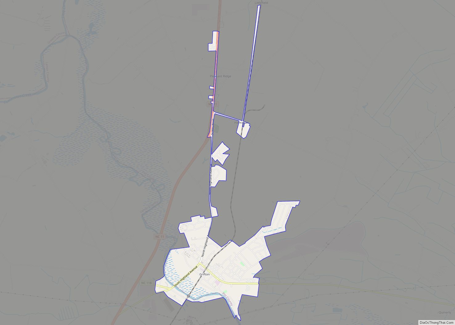
Online Interactive Map
Click on ![]() to view map in "full screen" mode.
to view map in "full screen" mode.
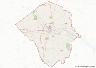
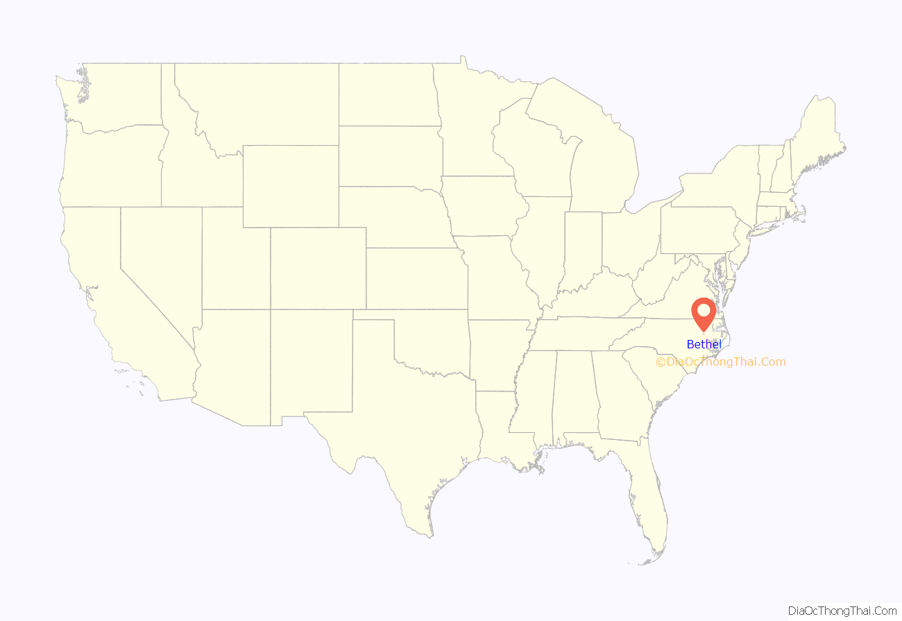
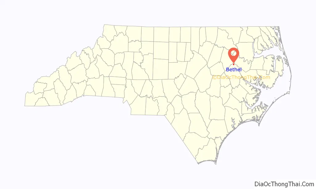
Bethel location map. Where is Bethel town?
History
The area was settled before the American Civil War. The town of Bethel was incorporated in 1873, taking its name from Bethel Methodist Church.
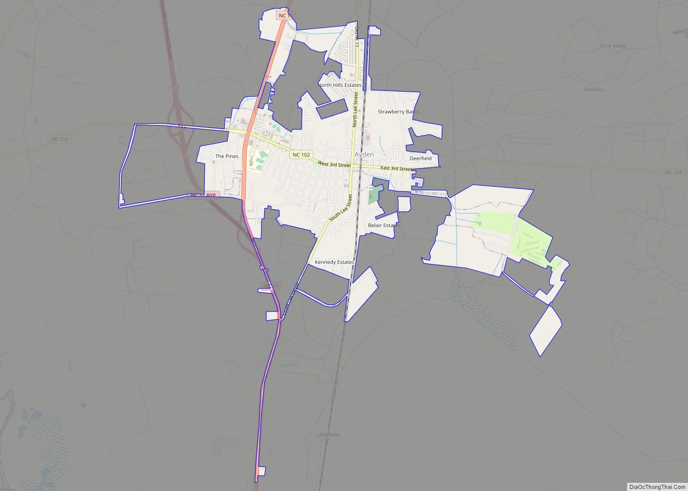
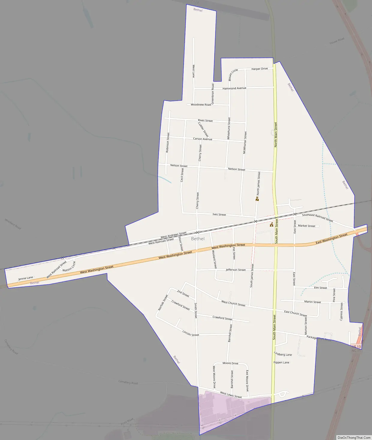
Bethel Road Map
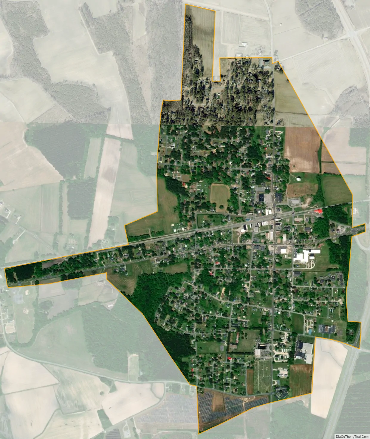
Bethel city Satellite Map
Geography
Bethel is located at 35°48′25″N 77°22′37″W / 35.80694°N 77.37694°W / 35.80694; -77.37694 (35.806916, -77.376889).
See also
Map of North Carolina State and its subdivision:- Alamance
- Alexander
- Alleghany
- Anson
- Ashe
- Avery
- Beaufort
- Bertie
- Bladen
- Brunswick
- Buncombe
- Burke
- Cabarrus
- Caldwell
- Camden
- Carteret
- Caswell
- Catawba
- Chatham
- Cherokee
- Chowan
- Clay
- Cleveland
- Columbus
- Craven
- Cumberland
- Currituck
- Dare
- Davidson
- Davie
- Duplin
- Durham
- Edgecombe
- Forsyth
- Franklin
- Gaston
- Gates
- Graham
- Granville
- Greene
- Guilford
- Halifax
- Harnett
- Haywood
- Henderson
- Hertford
- Hoke
- Hyde
- Iredell
- Jackson
- Johnston
- Jones
- Lee
- Lenoir
- Lincoln
- Macon
- Madison
- Martin
- McDowell
- Mecklenburg
- Mitchell
- Montgomery
- Moore
- Nash
- New Hanover
- Northampton
- Onslow
- Orange
- Pamlico
- Pasquotank
- Pender
- Perquimans
- Person
- Pitt
- Polk
- Randolph
- Richmond
- Robeson
- Rockingham
- Rowan
- Rutherford
- Sampson
- Scotland
- Stanly
- Stokes
- Surry
- Swain
- Transylvania
- Tyrrell
- Union
- Vance
- Wake
- Warren
- Washington
- Watauga
- Wayne
- Wilkes
- Wilson
- Yadkin
- Yancey
- Alabama
- Alaska
- Arizona
- Arkansas
- California
- Colorado
- Connecticut
- Delaware
- District of Columbia
- Florida
- Georgia
- Hawaii
- Idaho
- Illinois
- Indiana
- Iowa
- Kansas
- Kentucky
- Louisiana
- Maine
- Maryland
- Massachusetts
- Michigan
- Minnesota
- Mississippi
- Missouri
- Montana
- Nebraska
- Nevada
- New Hampshire
- New Jersey
- New Mexico
- New York
- North Carolina
- North Dakota
- Ohio
- Oklahoma
- Oregon
- Pennsylvania
- Rhode Island
- South Carolina
- South Dakota
- Tennessee
- Texas
- Utah
- Vermont
- Virginia
- Washington
- West Virginia
- Wisconsin
- Wyoming