Greenville is the county seat of and the most populous city in Pitt County, North Carolina, United States; the principal city of the Greenville metropolitan area; and the 12th-most populous city in North Carolina. Greenville is the health, entertainment, and educational hub of North Carolina’s Tidewater and Coastal Plain. As of the 2020 census, there were 87,521 people in the city. The Greenville, NC Metropolitan Statistical Area has also seen a population boom since the 1990s, as major companies have moved their regional and national headquarters to Greenville. Companies include Grady-White Boats, Hyster-Yale Group, Thermo Fisher Scientific, and Denso, among others. Minges Bottling Group, a large Pepsi facility is also located just outside Greenville.
Greenville is the home of East Carolina University, the fourth-largest university in the University of North Carolina system, and ECU Health Medical Center, the flagship hospital for ECU Health and the teaching hospital for the Brody School of Medicine.
| Name: | Greenville city |
|---|---|
| LSAD Code: | 25 |
| LSAD Description: | city (suffix) |
| State: | North Carolina |
| County: | Pitt County |
| Founded: | 1774 (Martinsborough) |
| Elevation: | 56 ft (17 m) |
| Land Area: | 37.44 sq mi (96.97 km²) |
| Water Area: | 0.76 sq mi (1.98 km²) 2.59% |
| Population Density: | 2,337.63/sq mi (902.55/km²) |
| ZIP code: | 27833, 27834, 27835, 27836, 27858 |
| Area code: | 252 |
| FIPS code: | 3728080 |
| GNISfeature ID: | 1023721 |
| Website: | greenvillenc.gov |
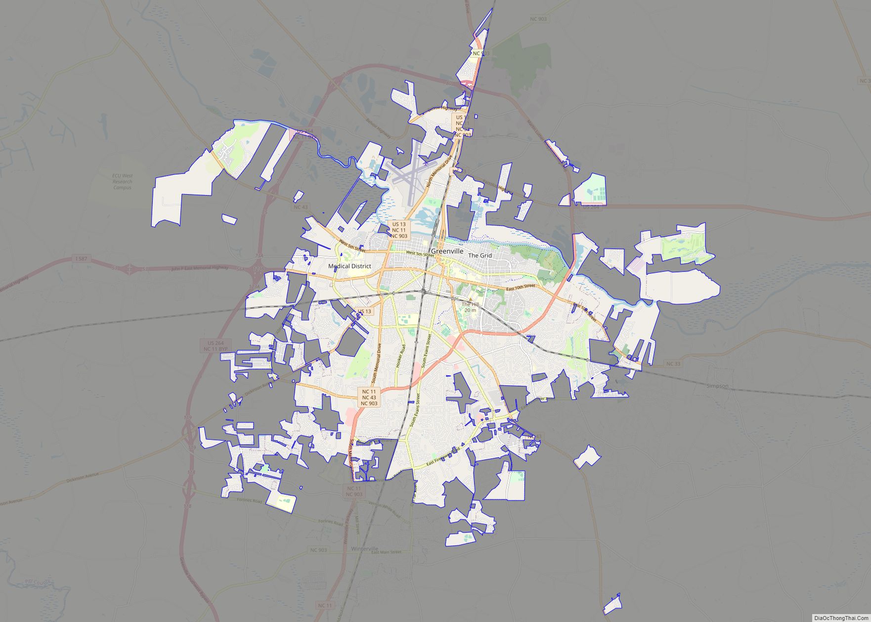
Online Interactive Map
Click on ![]() to view map in "full screen" mode.
to view map in "full screen" mode.
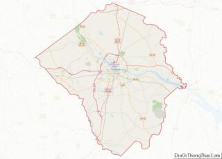
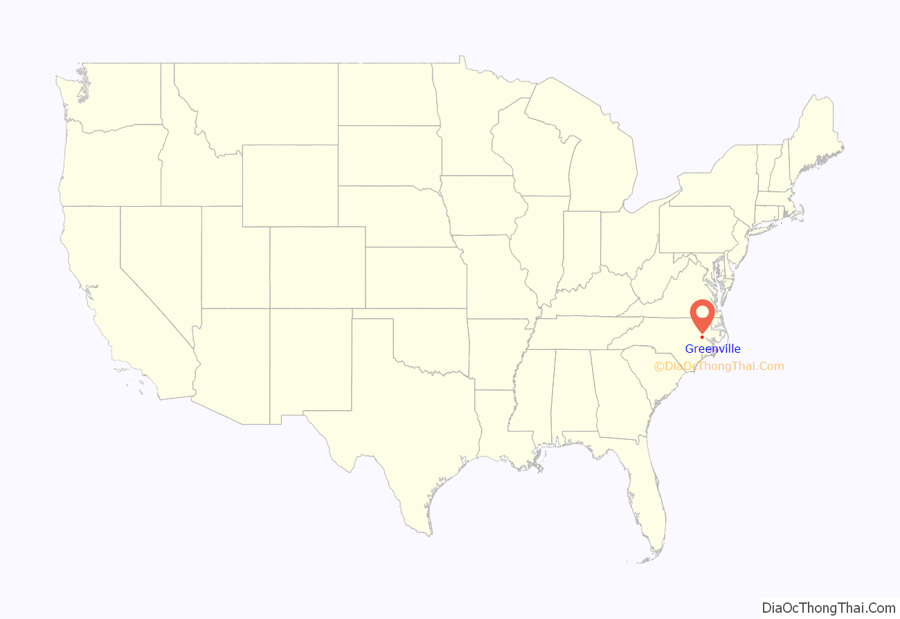
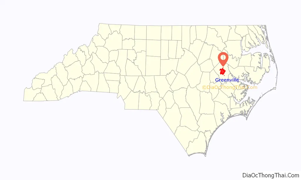
Greenville location map. Where is Greenville city?
History
Founding
Greenville was founded in 1771 as “Martinsborough”, named after the Royal Governor Josiah Martin. In 1774 the town was moved to its present location on the south bank of the Tar River, three miles (4.8 km) west of its original site. In 1786, the name was changed to Greenesville in honor of General Nathanael Greene, the American Revolutionary War hero. It was later shortened to Greenville.
19th century
During Greenville’s early years, the Tar River was a navigable waterway; and by the 1860s there were several established steamboat lines transporting passengers and goods on the river. Cotton was the leading agricultural crop, and Greenville became a major cotton export center. Before the turn of the century, however, tobacco surpassed cotton and became the leading money crop. Greenville became one of the state’s leading tobacco marketing and warehouse centers.
20th century
For over a century, Greenville was recognized only as an important tobacco market and the home of a small state-supported college, chartered by the Legislature in March 1907 and named East Carolina Teacher’s Training School, a co-ed institution. By the mid 1960s, East Carolina College had become the third-largest state-supported college, and enrollment approached 8,000 students — twice the 1960 enrollment figure. In 1967, it became East Carolina University. ECU Medical School admitted its first four-year class in 1977. At the turn of the century, enrollment at ECU topped the 18,000 mark, and now exceeds 29,000 students.
Greenville’s current economic development began in 1963 when Empire Brush was recruited to the new Greenville Industrial Park established by Greenville Industries, Inc. (a for-profit land holding company) in partnership with the Pitt County Development Commission (established by a voter referendum in 1957) and Greenville Utilities Commission. One of the community’s greatest successes came in 1968 when Burroughs Wellcome, a major pharmaceutical research and manufacturing firm, located a pharmaceutical development/manufacturing facility near the city. The site is now owned by Patheon, a Thermo Fisher Scientific company, which employs approximately 1,200 people. The city and Pitt County have also become home to many other major industries and businesses including Hyster-Yale Group, Grady-White Boats, Domtar Personal Care, Mayne Pharma, and DENSO (formerly ASMO). Greenville is also home to The HammockSource, the world’s largest hammock manufacturer.
Hurricane Floyd
In September 1999, Hurricane Floyd made landfall in eastern North Carolina, dropping nearly 17 inches (430 mm) of rain during the hours of its passage. Many residents were not aware of the flooding until the water came into their homes. Most localized flooding happened overnight, and the Tar River suffered the worst flooding, exceeding 500-year flood levels along its lower stretches. An additional 20+ inches of rain had fallen prior in the month from the two passes of Hurricane Dennis.
Damages in Pitt County alone were estimated at $1.6 billion (1999 USD, $1.87 billion 2006 USD). Some residents in Greenville had to swim six feet underwater to reach the front doors of their homes and apartments. Due to the heavy flooding in downtown Greenville, the East Carolina Pirates were forced to relocate their football game against #9 Miami to N.C. State’s Carter–Finley Stadium in Raleigh, where they beat the Hurricanes, 27–23.
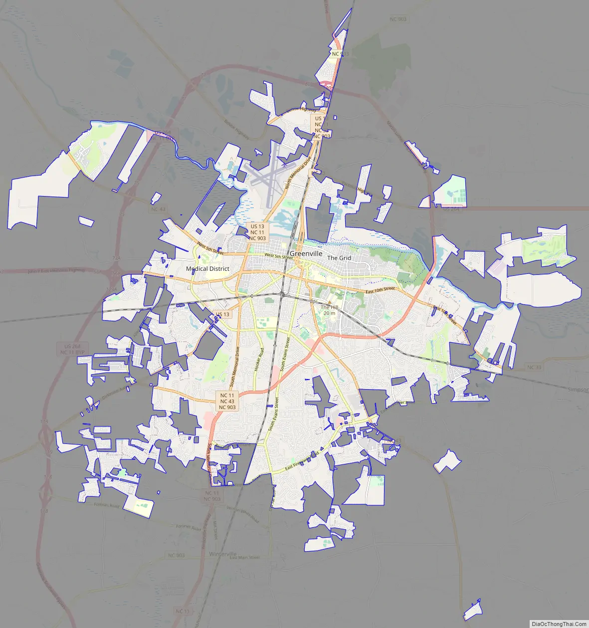
Greenville Road Map
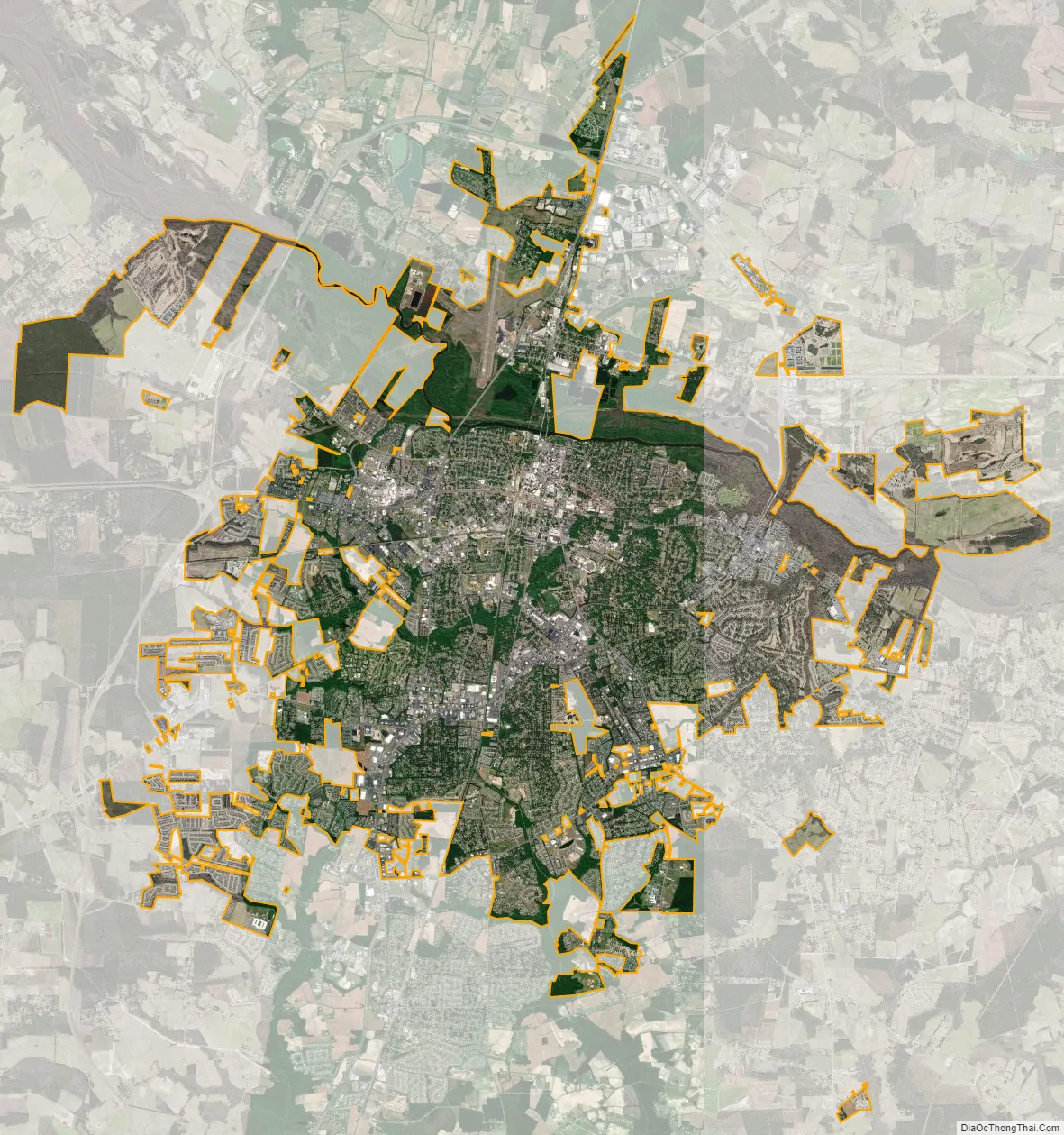
Greenville city Satellite Map
Geography
Greenville is located at 35°36′6″N 77°22′21″W / 35.60167°N 77.37250°W / 35.60167; -77.37250 (35.601613, −77.372366).
According to the United States Census Bureau, the city has a total area of 26.3 square miles (68 km), of which 25.6 square miles (66 km) is land and 0.7 square miles (1.8 km) (2.59%) is water. It is located in the inner Coastal Plain.
Climate
Like most of the state and all of its lower areas, Greenville has a humid subtropical climate.
Greenville is within the Middle Atlantic Coastal Forests ecoregion of the much larger Eastern Temperate Broadleaf Mixed Forests biome.
See also
Map of North Carolina State and its subdivision:- Alamance
- Alexander
- Alleghany
- Anson
- Ashe
- Avery
- Beaufort
- Bertie
- Bladen
- Brunswick
- Buncombe
- Burke
- Cabarrus
- Caldwell
- Camden
- Carteret
- Caswell
- Catawba
- Chatham
- Cherokee
- Chowan
- Clay
- Cleveland
- Columbus
- Craven
- Cumberland
- Currituck
- Dare
- Davidson
- Davie
- Duplin
- Durham
- Edgecombe
- Forsyth
- Franklin
- Gaston
- Gates
- Graham
- Granville
- Greene
- Guilford
- Halifax
- Harnett
- Haywood
- Henderson
- Hertford
- Hoke
- Hyde
- Iredell
- Jackson
- Johnston
- Jones
- Lee
- Lenoir
- Lincoln
- Macon
- Madison
- Martin
- McDowell
- Mecklenburg
- Mitchell
- Montgomery
- Moore
- Nash
- New Hanover
- Northampton
- Onslow
- Orange
- Pamlico
- Pasquotank
- Pender
- Perquimans
- Person
- Pitt
- Polk
- Randolph
- Richmond
- Robeson
- Rockingham
- Rowan
- Rutherford
- Sampson
- Scotland
- Stanly
- Stokes
- Surry
- Swain
- Transylvania
- Tyrrell
- Union
- Vance
- Wake
- Warren
- Washington
- Watauga
- Wayne
- Wilkes
- Wilson
- Yadkin
- Yancey
- Alabama
- Alaska
- Arizona
- Arkansas
- California
- Colorado
- Connecticut
- Delaware
- District of Columbia
- Florida
- Georgia
- Hawaii
- Idaho
- Illinois
- Indiana
- Iowa
- Kansas
- Kentucky
- Louisiana
- Maine
- Maryland
- Massachusetts
- Michigan
- Minnesota
- Mississippi
- Missouri
- Montana
- Nebraska
- Nevada
- New Hampshire
- New Jersey
- New Mexico
- New York
- North Carolina
- North Dakota
- Ohio
- Oklahoma
- Oregon
- Pennsylvania
- Rhode Island
- South Carolina
- South Dakota
- Tennessee
- Texas
- Utah
- Vermont
- Virginia
- Washington
- West Virginia
- Wisconsin
- Wyoming