Gorman is a census-designated place (CDP) in Durham County, North Carolina, United States. The population was 1,011 at the 2010 census.
| Name: | Gorman CDP |
|---|---|
| LSAD Code: | 57 |
| LSAD Description: | CDP (suffix) |
| State: | North Carolina |
| County: | Durham County |
| Elevation: | 361 ft (110 m) |
| Total Area: | 2.96 sq mi (7.66 km²) |
| Land Area: | 2.90 sq mi (7.51 km²) |
| Water Area: | 0.06 sq mi (0.14 km²) |
| Total Population: | 1,104 |
| Population Density: | 380.56/sq mi (146.92/km²) |
| ZIP code: | 27704 |
| Area code: | 919 and 984 |
| FIPS code: | 3727120 |
| GNISfeature ID: | 1020478 |
Online Interactive Map
Click on ![]() to view map in "full screen" mode.
to view map in "full screen" mode.
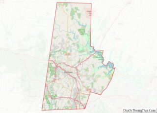
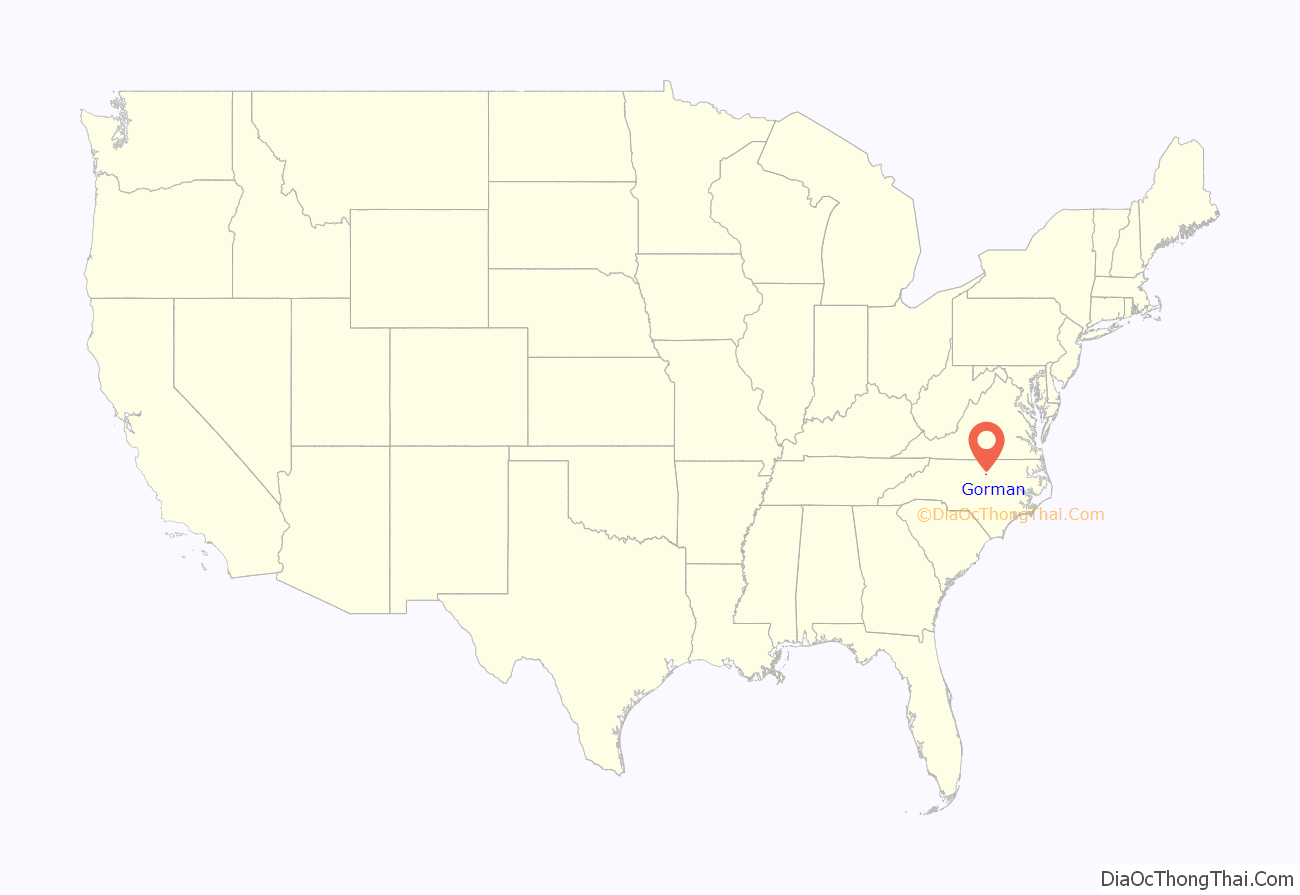
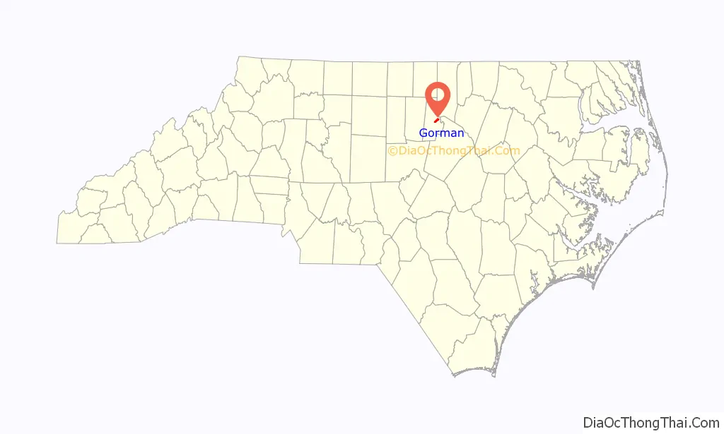
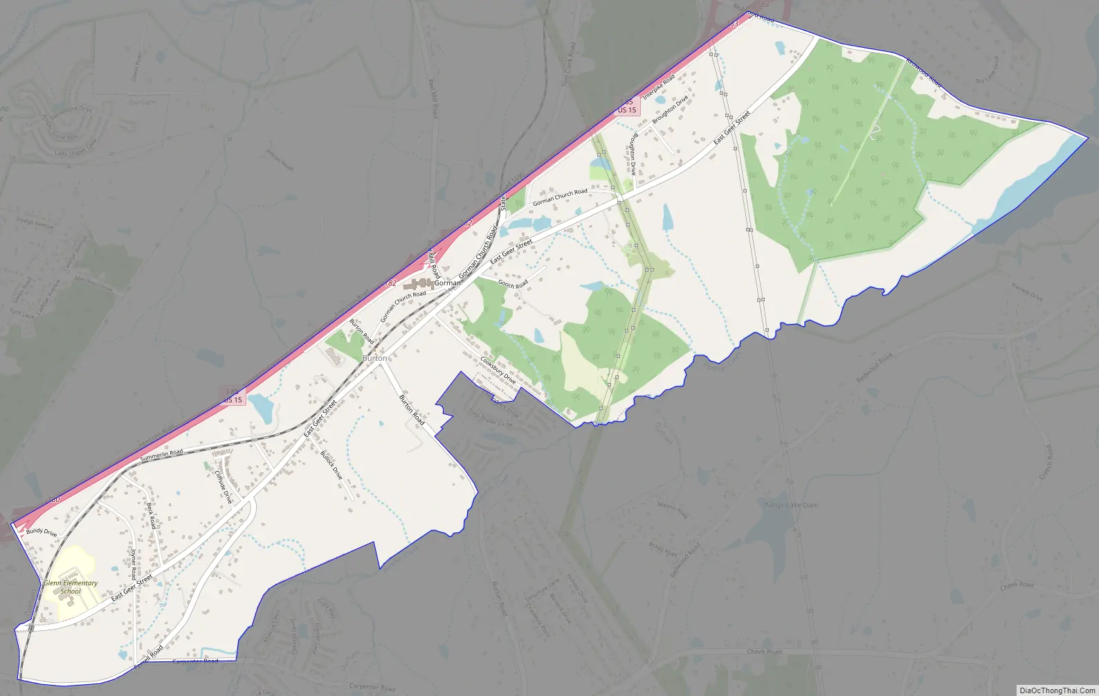
Gorman location map. Where is Gorman CDP?
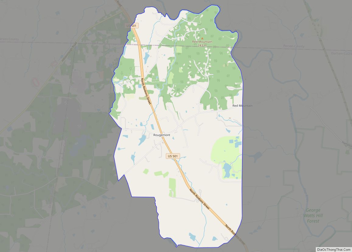
Gorman Road Map
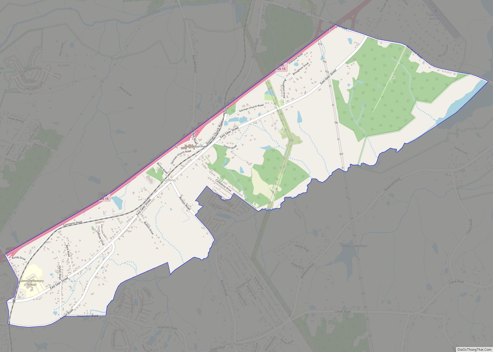
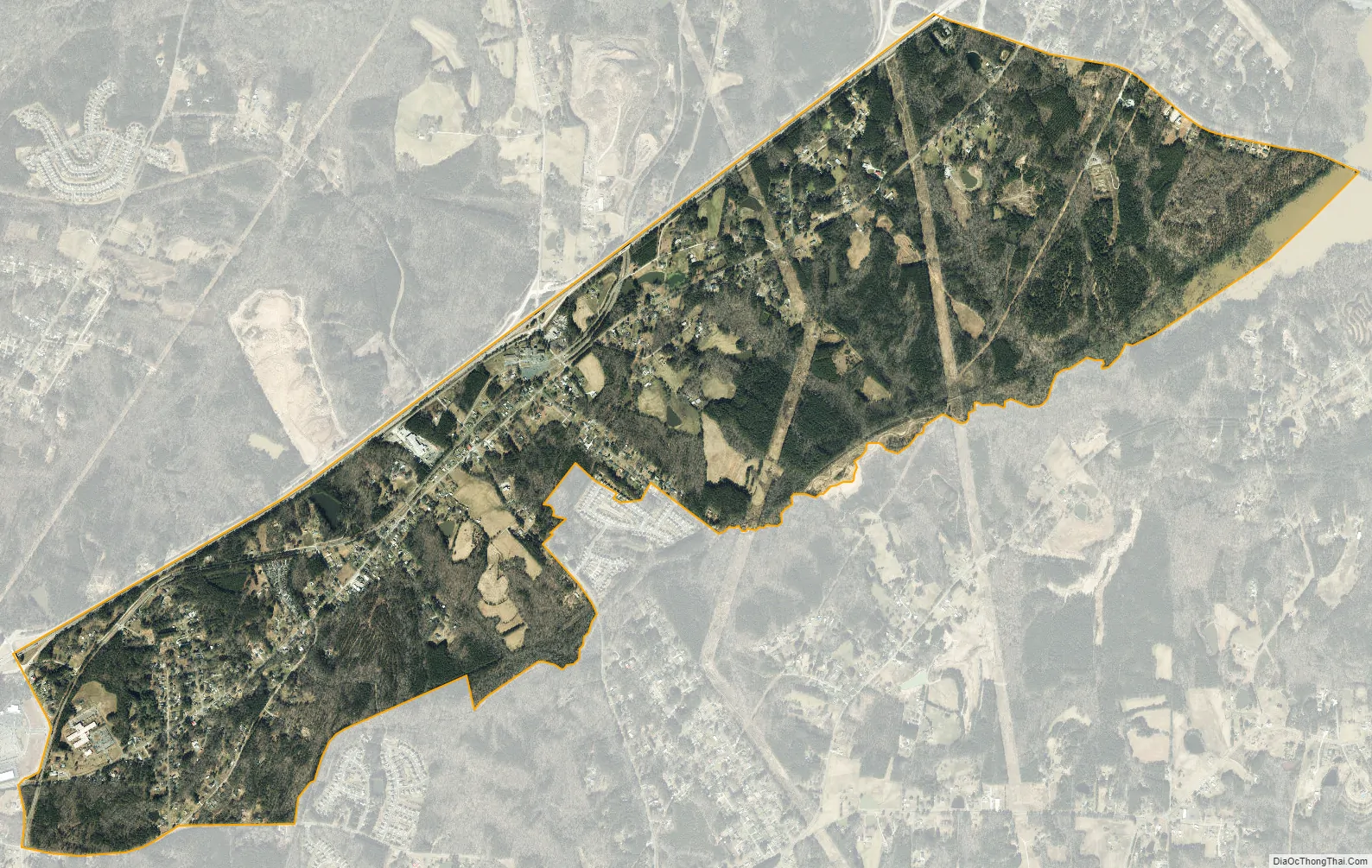
Gorman city Satellite Map
Geography
Gorman is located in east-central Durham County at 36°2′22″N 78°49′11″W / 36.03944°N 78.81972°W / 36.03944; -78.81972 (36.039342, -78.819783), between the city of Durham to the southwest and Falls Lake on the Neuse River to the northeast. Interstate 85 forms the northwestern border of the community, with access from exits 180, 182, and 183. The main road through the community is East Geer Street, running roughly parallel to I-85.
According to the United States Census Bureau, the Gorman CDP has a total area of 2.93 square miles (7.60 km), of which 2.88 square miles (7.45 km) is land and 0.054 square miles (0.14 km), or 1.89%, is water.
See also
Map of North Carolina State and its subdivision:- Alamance
- Alexander
- Alleghany
- Anson
- Ashe
- Avery
- Beaufort
- Bertie
- Bladen
- Brunswick
- Buncombe
- Burke
- Cabarrus
- Caldwell
- Camden
- Carteret
- Caswell
- Catawba
- Chatham
- Cherokee
- Chowan
- Clay
- Cleveland
- Columbus
- Craven
- Cumberland
- Currituck
- Dare
- Davidson
- Davie
- Duplin
- Durham
- Edgecombe
- Forsyth
- Franklin
- Gaston
- Gates
- Graham
- Granville
- Greene
- Guilford
- Halifax
- Harnett
- Haywood
- Henderson
- Hertford
- Hoke
- Hyde
- Iredell
- Jackson
- Johnston
- Jones
- Lee
- Lenoir
- Lincoln
- Macon
- Madison
- Martin
- McDowell
- Mecklenburg
- Mitchell
- Montgomery
- Moore
- Nash
- New Hanover
- Northampton
- Onslow
- Orange
- Pamlico
- Pasquotank
- Pender
- Perquimans
- Person
- Pitt
- Polk
- Randolph
- Richmond
- Robeson
- Rockingham
- Rowan
- Rutherford
- Sampson
- Scotland
- Stanly
- Stokes
- Surry
- Swain
- Transylvania
- Tyrrell
- Union
- Vance
- Wake
- Warren
- Washington
- Watauga
- Wayne
- Wilkes
- Wilson
- Yadkin
- Yancey
- Alabama
- Alaska
- Arizona
- Arkansas
- California
- Colorado
- Connecticut
- Delaware
- District of Columbia
- Florida
- Georgia
- Hawaii
- Idaho
- Illinois
- Indiana
- Iowa
- Kansas
- Kentucky
- Louisiana
- Maine
- Maryland
- Massachusetts
- Michigan
- Minnesota
- Mississippi
- Missouri
- Montana
- Nebraska
- Nevada
- New Hampshire
- New Jersey
- New Mexico
- New York
- North Carolina
- North Dakota
- Ohio
- Oklahoma
- Oregon
- Pennsylvania
- Rhode Island
- South Carolina
- South Dakota
- Tennessee
- Texas
- Utah
- Vermont
- Virginia
- Washington
- West Virginia
- Wisconsin
- Wyoming