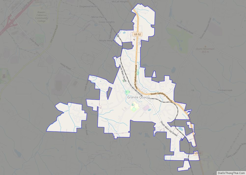
Granite Quarry is a town in Rowan County, North Carolina, United States. The population was 2,930 at the 2010 census.
| Name: | Granite Quarry town |
|---|---|
| LSAD Code: | 43 |
| LSAD Description: | town (suffix) |
| State: | North Carolina |
| County: | Rowan County |
| Elevation: | 820 ft (250 m) |
| Total Area: | 2.92 sq mi (7.56 km²) |
| Land Area: | 2.92 sq mi (7.56 km²) |
| Water Area: | 0.00 sq mi (0.00 km²) |
| Total Population: | 2,984 |
| Population Density: | 1,022.27/sq mi (394.76/km²) |
| ZIP code: | 28072, 28146 |
| Area code: | 704, 980 |
| FIPS code: | 3727440 |
| GNISfeature ID: | 0985922 |
| Website: | http://www.granitequarrync.gov/ |
Online Interactive Map
Click on ![]() to view map in "full screen" mode.
to view map in "full screen" mode.
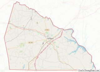
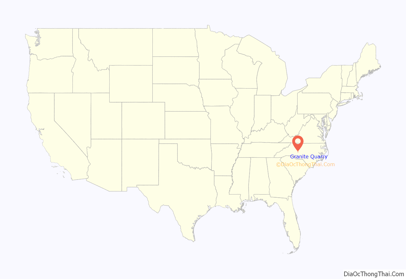
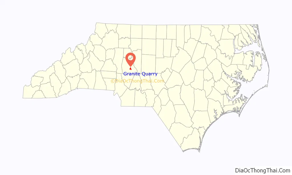
Granite Quarry location map. Where is Granite Quarry town?
History
Granite Quarry was originally named Woodville when it was founded in the late 1800s. However, the first post office in the town was established under the name of Woodsides in 1891, after a prominent family in the area named Woodsides. The name was officially changed to Woodsides when the town was incorporated on March 7, 1901, by the North Carolina General Assembly. Jerry L. Shuping was the first mayor. The first town meetings were held in an upstairs room in the W. S. Brown store building. What is now the Town Hall Municipal Building was originally built in 1963 by Gemgas, and purchased later by the town.
Soon after the town’s incorporation, however, problems arose with mail delivery, since there was already another town in North Carolina named Woodsides. Because of this, in 1902, the post office changed its name to Granite Quarry, after the stone quarried in the area. The town’s name was not officially changed until February 5, 1905.
The Michael Braun House and Granite Quarry School are listed on the National Register of Historic Places.
Though town officials have been working to change this since 1990, residents and businesses who get their mail delivered have a Salisbury address because the Granite Quarry post office only has boxes, not delivery. A proposal rejected by the Postal Service would have allowed a Granite Quarry address but a Salisbury zip code. In early November 2015, with the help of U.S. Rep. Richard Hudson, the town persuaded the Postal Service make the change.
Granite Quarry Road Map
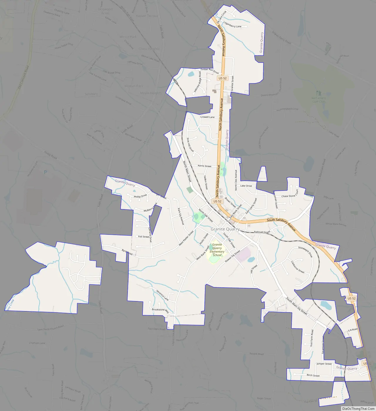
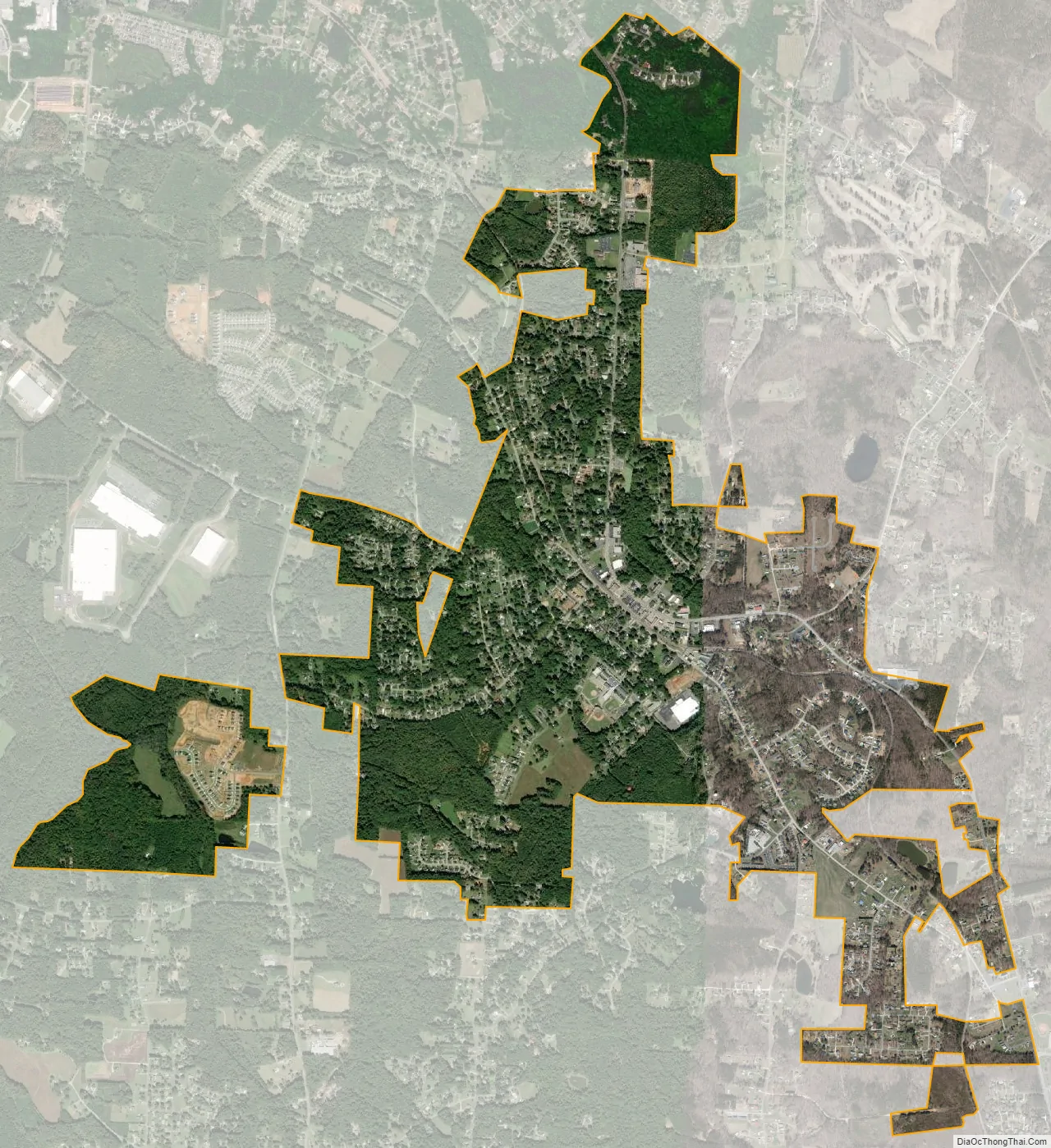
Granite Quarry city Satellite Map
Geography
Granite Quarry is located at 35°36′46″N 80°26′40″W / 35.61278°N 80.44444°W / 35.61278; -80.44444 (35.612902, -80.444350).
According to the United States Census Bureau, the town has a total area of 2.3 square miles (6.0 km), all land.
See also
Map of North Carolina State and its subdivision:- Alamance
- Alexander
- Alleghany
- Anson
- Ashe
- Avery
- Beaufort
- Bertie
- Bladen
- Brunswick
- Buncombe
- Burke
- Cabarrus
- Caldwell
- Camden
- Carteret
- Caswell
- Catawba
- Chatham
- Cherokee
- Chowan
- Clay
- Cleveland
- Columbus
- Craven
- Cumberland
- Currituck
- Dare
- Davidson
- Davie
- Duplin
- Durham
- Edgecombe
- Forsyth
- Franklin
- Gaston
- Gates
- Graham
- Granville
- Greene
- Guilford
- Halifax
- Harnett
- Haywood
- Henderson
- Hertford
- Hoke
- Hyde
- Iredell
- Jackson
- Johnston
- Jones
- Lee
- Lenoir
- Lincoln
- Macon
- Madison
- Martin
- McDowell
- Mecklenburg
- Mitchell
- Montgomery
- Moore
- Nash
- New Hanover
- Northampton
- Onslow
- Orange
- Pamlico
- Pasquotank
- Pender
- Perquimans
- Person
- Pitt
- Polk
- Randolph
- Richmond
- Robeson
- Rockingham
- Rowan
- Rutherford
- Sampson
- Scotland
- Stanly
- Stokes
- Surry
- Swain
- Transylvania
- Tyrrell
- Union
- Vance
- Wake
- Warren
- Washington
- Watauga
- Wayne
- Wilkes
- Wilson
- Yadkin
- Yancey
- Alabama
- Alaska
- Arizona
- Arkansas
- California
- Colorado
- Connecticut
- Delaware
- District of Columbia
- Florida
- Georgia
- Hawaii
- Idaho
- Illinois
- Indiana
- Iowa
- Kansas
- Kentucky
- Louisiana
- Maine
- Maryland
- Massachusetts
- Michigan
- Minnesota
- Mississippi
- Missouri
- Montana
- Nebraska
- Nevada
- New Hampshire
- New Jersey
- New Mexico
- New York
- North Carolina
- North Dakota
- Ohio
- Oklahoma
- Oregon
- Pennsylvania
- Rhode Island
- South Carolina
- South Dakota
- Tennessee
- Texas
- Utah
- Vermont
- Virginia
- Washington
- West Virginia
- Wisconsin
- Wyoming