Hallsboro is an unincorporated community and census-designated place (CDP) in Columbus County, in southeastern North Carolina, United States. As of the 2010 census it had a population of 465.
| Name: | Hallsboro CDP |
|---|---|
| LSAD Code: | 57 |
| LSAD Description: | CDP (suffix) |
| State: | North Carolina |
| County: | Columbus County |
| Elevation: | 66 ft (20 m) |
| Total Area: | 3.28 sq mi (8.49 km²) |
| Land Area: | 3.28 sq mi (8.49 km²) |
| Water Area: | 0.00 sq mi (0.00 km²) |
| Total Population: | 382 |
| Population Density: | 116.57/sq mi (45.01/km²) |
| ZIP code: | 28442 |
| FIPS code: | 3729000 |
| GNISfeature ID: | 986326 |
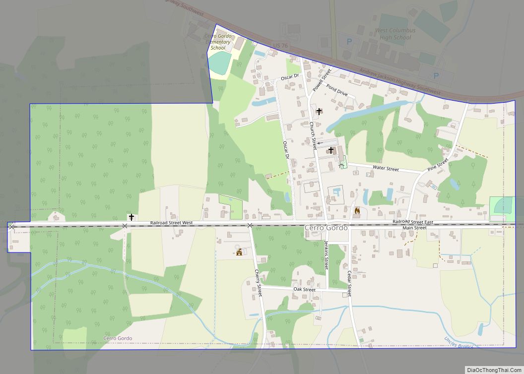
Online Interactive Map
Click on ![]() to view map in "full screen" mode.
to view map in "full screen" mode.
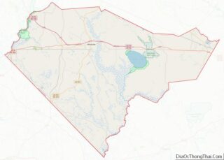
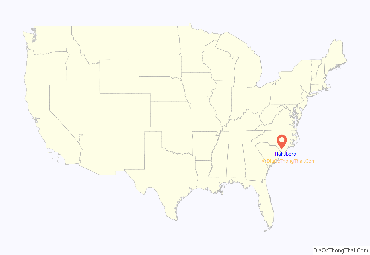
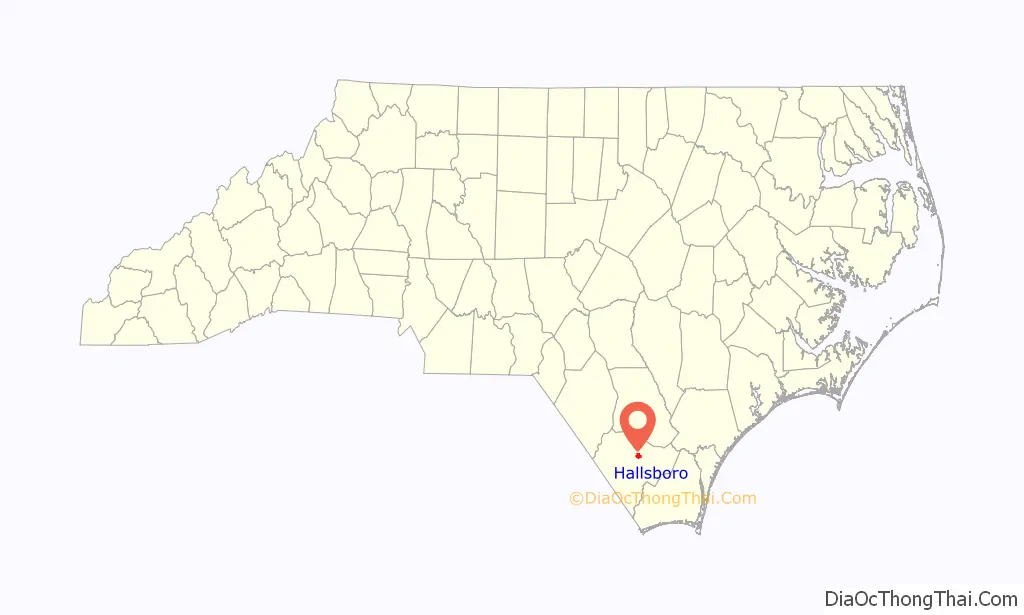
Hallsboro location map. Where is Hallsboro CDP?
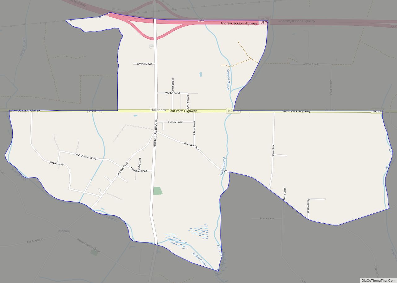
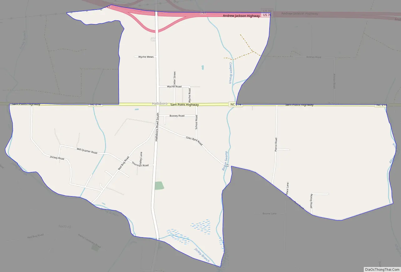
Hallsboro Road Map
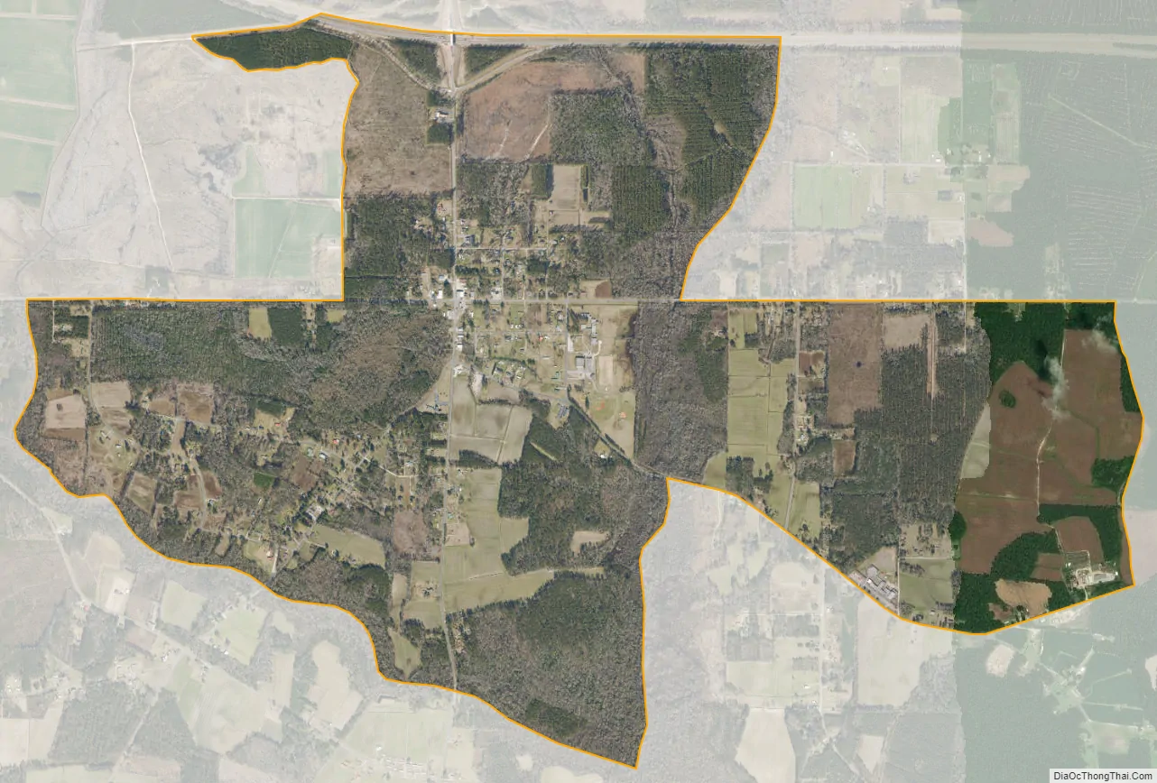
Hallsboro city Satellite Map
Geography
Hallsboro is located in east-central Columbus County at 34°19′21″N 78°35′56″W / 34.322391°N 78.598902°W / 34.322391; -78.598902 (34.322391, -78.598902). It lies 66 feet (20 m) above sea level. The town is in the Eastern Time Zone (EST/EDT) and observes daylight saving time.
According to the U.S. Census Bureau, the Hallsboro CDP has an area of 3.3 square miles (8.5 km), all land.
Surrounding communities include Lake Waccamaw 5 miles (8 km) to the east, Whiteville, the Columbus County seat, 6 miles (10 km) to the west, Bolton 11 miles (18 km) to the east, and Clarkton 13 miles (21 km) to the north.
See also
Map of North Carolina State and its subdivision:- Alamance
- Alexander
- Alleghany
- Anson
- Ashe
- Avery
- Beaufort
- Bertie
- Bladen
- Brunswick
- Buncombe
- Burke
- Cabarrus
- Caldwell
- Camden
- Carteret
- Caswell
- Catawba
- Chatham
- Cherokee
- Chowan
- Clay
- Cleveland
- Columbus
- Craven
- Cumberland
- Currituck
- Dare
- Davidson
- Davie
- Duplin
- Durham
- Edgecombe
- Forsyth
- Franklin
- Gaston
- Gates
- Graham
- Granville
- Greene
- Guilford
- Halifax
- Harnett
- Haywood
- Henderson
- Hertford
- Hoke
- Hyde
- Iredell
- Jackson
- Johnston
- Jones
- Lee
- Lenoir
- Lincoln
- Macon
- Madison
- Martin
- McDowell
- Mecklenburg
- Mitchell
- Montgomery
- Moore
- Nash
- New Hanover
- Northampton
- Onslow
- Orange
- Pamlico
- Pasquotank
- Pender
- Perquimans
- Person
- Pitt
- Polk
- Randolph
- Richmond
- Robeson
- Rockingham
- Rowan
- Rutherford
- Sampson
- Scotland
- Stanly
- Stokes
- Surry
- Swain
- Transylvania
- Tyrrell
- Union
- Vance
- Wake
- Warren
- Washington
- Watauga
- Wayne
- Wilkes
- Wilson
- Yadkin
- Yancey
- Alabama
- Alaska
- Arizona
- Arkansas
- California
- Colorado
- Connecticut
- Delaware
- District of Columbia
- Florida
- Georgia
- Hawaii
- Idaho
- Illinois
- Indiana
- Iowa
- Kansas
- Kentucky
- Louisiana
- Maine
- Maryland
- Massachusetts
- Michigan
- Minnesota
- Mississippi
- Missouri
- Montana
- Nebraska
- Nevada
- New Hampshire
- New Jersey
- New Mexico
- New York
- North Carolina
- North Dakota
- Ohio
- Oklahoma
- Oregon
- Pennsylvania
- Rhode Island
- South Carolina
- South Dakota
- Tennessee
- Texas
- Utah
- Vermont
- Virginia
- Washington
- West Virginia
- Wisconsin
- Wyoming