Kenly is a town in Johnston and Wilson counties in the U.S. state of North Carolina. It was named for John R. Kenly, Northern Division Superintendent of the Atlantic Coast Line Railroad, who later became president of the railroad in 1913. The population was 1,339 at the 2010 census, down from 1,569 in 2000.
| Name: | Kenly town |
|---|---|
| LSAD Code: | 43 |
| LSAD Description: | town (suffix) |
| State: | North Carolina |
| County: | Johnston County, Wilson County |
| Elevation: | 194 ft (59 m) |
| Total Area: | 1.82 sq mi (4.71 km²) |
| Land Area: | 1.81 sq mi (4.70 km²) |
| Water Area: | 0.00 sq mi (0.01 km²) |
| Total Population: | 1,491 |
| Population Density: | 821.49/sq mi (317.10/km²) |
| ZIP code: | 27542 |
| Area code: | 919 |
| FIPS code: | 3735540 |
| GNISfeature ID: | 1021028 |
| Website: | www.townofkenly.com |
Online Interactive Map
Click on ![]() to view map in "full screen" mode.
to view map in "full screen" mode.
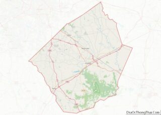
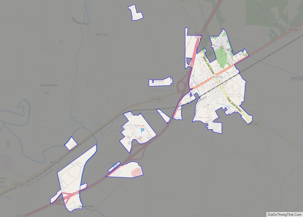
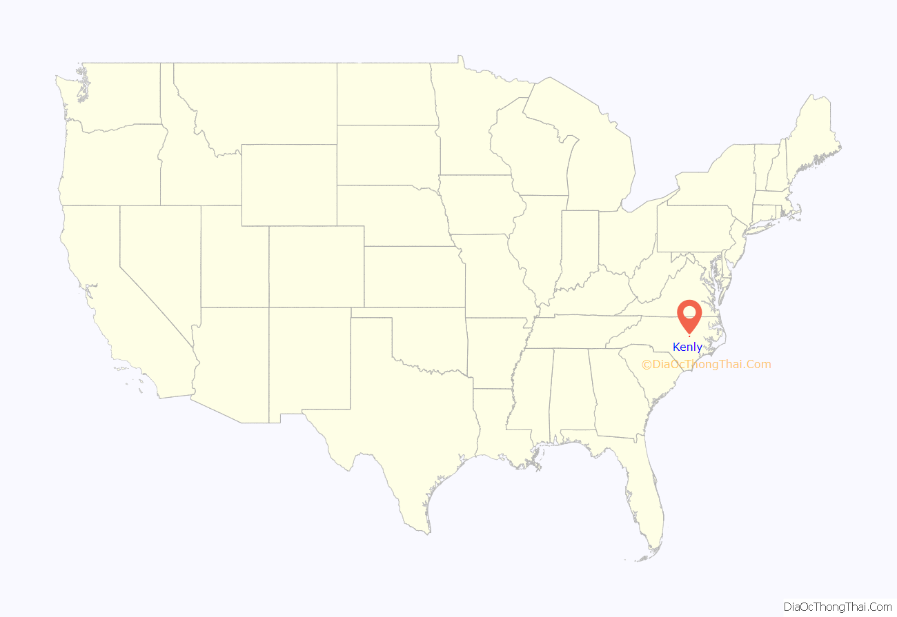
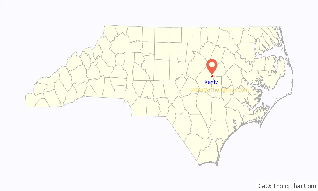
Kenly location map. Where is Kenly town?
History
The community was settled in about 1875, developing along the “Short-Cut” rail line of the Wilmington and Weldon Railroad. It was incorporated in 1887 as Kenly, being named for railroad official J. R. Kenly. In 1897, the community’s first school, Kenly Academy, a private boarding institution, was established. Kenly High School, a public institution, was opened in 1914. That year the town received its first electric service.
In July 2022, all five members of Kenly’s police force resigned, citing a “hostile work environment”, allegedly created by the newly-appointed town manager.
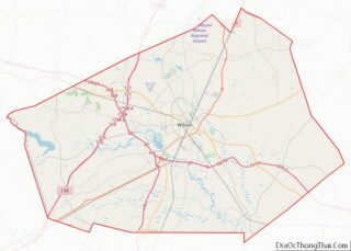
Kenly Road Map
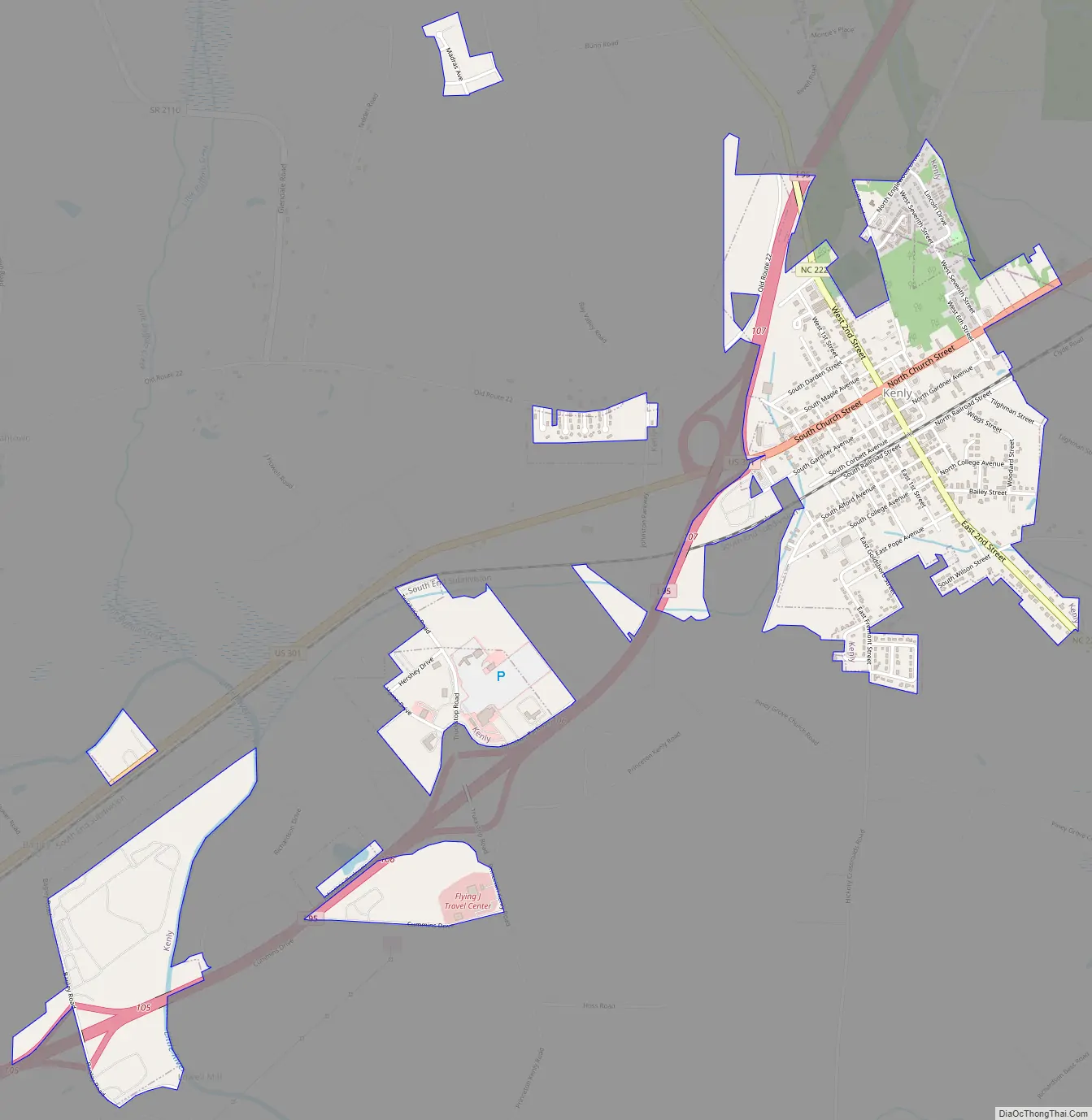
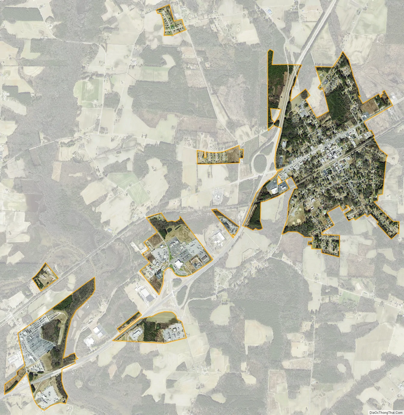
Kenly city Satellite Map
Geography
Kenly is located in eastern Johnston County. A small portion of the town extends into the southwest corner of Wilson County. U.S. Route 301 (Church Street) is the main road through the center of town. North Carolina Highway 222 (Second Street) crosses US 301 in the center of Kenly. Interstate 95 runs along the northwest edge of Kenly, with access from Exit 107 (US 301).
According to the United States Census Bureau, Kenly has a total area of 1.6 square miles (4.2 km), of which 1.609 acres (6,513 m), or 0.16%, are water.
See also
Map of North Carolina State and its subdivision:- Alamance
- Alexander
- Alleghany
- Anson
- Ashe
- Avery
- Beaufort
- Bertie
- Bladen
- Brunswick
- Buncombe
- Burke
- Cabarrus
- Caldwell
- Camden
- Carteret
- Caswell
- Catawba
- Chatham
- Cherokee
- Chowan
- Clay
- Cleveland
- Columbus
- Craven
- Cumberland
- Currituck
- Dare
- Davidson
- Davie
- Duplin
- Durham
- Edgecombe
- Forsyth
- Franklin
- Gaston
- Gates
- Graham
- Granville
- Greene
- Guilford
- Halifax
- Harnett
- Haywood
- Henderson
- Hertford
- Hoke
- Hyde
- Iredell
- Jackson
- Johnston
- Jones
- Lee
- Lenoir
- Lincoln
- Macon
- Madison
- Martin
- McDowell
- Mecklenburg
- Mitchell
- Montgomery
- Moore
- Nash
- New Hanover
- Northampton
- Onslow
- Orange
- Pamlico
- Pasquotank
- Pender
- Perquimans
- Person
- Pitt
- Polk
- Randolph
- Richmond
- Robeson
- Rockingham
- Rowan
- Rutherford
- Sampson
- Scotland
- Stanly
- Stokes
- Surry
- Swain
- Transylvania
- Tyrrell
- Union
- Vance
- Wake
- Warren
- Washington
- Watauga
- Wayne
- Wilkes
- Wilson
- Yadkin
- Yancey
- Alabama
- Alaska
- Arizona
- Arkansas
- California
- Colorado
- Connecticut
- Delaware
- District of Columbia
- Florida
- Georgia
- Hawaii
- Idaho
- Illinois
- Indiana
- Iowa
- Kansas
- Kentucky
- Louisiana
- Maine
- Maryland
- Massachusetts
- Michigan
- Minnesota
- Mississippi
- Missouri
- Montana
- Nebraska
- Nevada
- New Hampshire
- New Jersey
- New Mexico
- New York
- North Carolina
- North Dakota
- Ohio
- Oklahoma
- Oregon
- Pennsylvania
- Rhode Island
- South Carolina
- South Dakota
- Tennessee
- Texas
- Utah
- Vermont
- Virginia
- Washington
- West Virginia
- Wisconsin
- Wyoming