Kinston is a city in Lenoir County, North Carolina, United States, with a population of 19,900 as of the 2020 census. It has been the county seat of Lenoir County since its formation in 1791. Kinston is located in the coastal plains region of eastern North Carolina.
In 2009, Kinston won the All-America City Award. This marks the second time in 21 years the city has won the title.
| Name: | Kinston city |
|---|---|
| LSAD Code: | 25 |
| LSAD Description: | city (suffix) |
| State: | North Carolina |
| County: | Lenoir County |
| Elevation: | 43 ft (13 m) |
| Total Area: | 18.43 sq mi (47.73 km²) |
| Land Area: | 18.28 sq mi (47.34 km²) |
| Water Area: | 0.15 sq mi (0.40 km²) |
| Total Population: | 19,900 |
| Population Density: | 1,088.86/sq mi (420.41/km²) |
| ZIP code: | 28501-28504 |
| Area code: | 252 |
| FIPS code: | 3735920 |
| GNISfeature ID: | 0988015 |
| Website: | www.ci.kinston.nc.us |
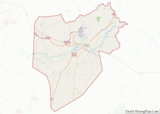
Online Interactive Map
Click on ![]() to view map in "full screen" mode.
to view map in "full screen" mode.
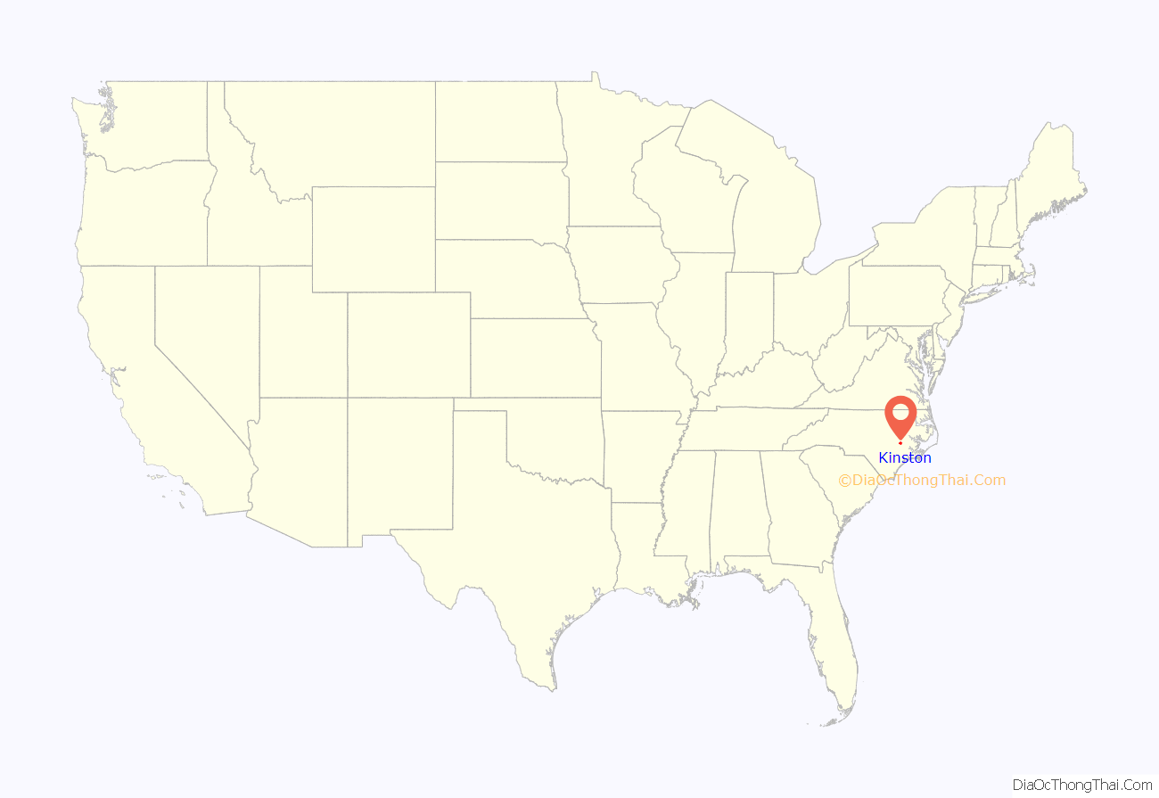
Kinston location map. Where is Kinston city?
History
Early history
At the time of English settlement, the area was inhabited by the Neusiok people. Preceding the historic tribe, indigenous peoples of a variety of cultures had lived in the area for thousands of years. Before the English colonists established the city, they called the area “Atkins Bank”, referring to a bluff once owned by Robert Atkins just above the Neuse River. Atkins Bank was the site of farms, a tobacco warehouse, and a Church of England mission.
Kinston was created by an act of the North Carolina General Assembly in December 1762 as “Kingston”, in honor of King George III, who had just recently ascended to the throne. The bill to incorporate it was introduced by Richard Caswell, who made his home there and later served as the first governor of the state of North Carolina from 1776 to 1780. After victory in the American Revolution, the citizens renamed the city “Kinston” in 1784 to show the population’s disavowal of royalty. In 1833, Kinston briefly became “Caswell”, in honor of Governor Caswell, but the name Kinston was restored the following year.
Commissioners appointed to design the town began to accept “subscriptions” for numbered lots. To keep a lot, subscribers were required to build brick homes of specific dimensions within three years or lose their rights to the property. The town was laid out with border streets named East, North, and South, with the western border the Neuse River. The two principal roads within these borders were named for King George and Queen Charlotte. They remain King and Queen Street to this day. Other streets were named in honor of Governor Arthur Dobbs (later renamed Independent Street) and the commissioners.
In December 1791, an act was passed in the General Assembly to abolish Dobbs County and form Lenoir and Glasgow Counties. At that time, Kinston was designated the county seat for Lenoir County.
Kinston was an unincorporated town until it was incorporated through an act of the legislature in January 1849. Following incorporation, the population grew rapidly. In 1850, the population was estimated at 455 people, and just 10 years later, it had more than doubled to over 1000.
Civil War
During the onset of the Civil War, Camp Campbell and Camp Johnston were established near the city as training camps, and a bakery on Queen Street was converted to produce hardtack in large quantities. Also, a factory for the production of shoes for the military was located in Kinston. The Battle of Kinston took place in and around the city on December 14, 1862.
From February 5 to February 22, 1864, 22 deserters were executed by hanging in the city. The court martial and subsequent hangings were carried out by the 54th Regiment, North Carolina Troops, Confederate States Army. Fifteen of these men were from Jones County and had all started their service in the 8th Battalion North Carolina Partisan Rangers.
The Battle of Wyse Fork, also known as the Battle of Southwest Creek (March 7–10, 1865) took place very near the city. At this later battle, the Confederate ram Neuse was scuttled to avoid capture by Union troops. Remnants of the ship have been salvaged, and were on display at Richard Caswell Park on West Vernon Avenue. A climate-controlled museum has been built on downtown Queen Street, and has moved the hulk there to prevent further deterioration of the original ship’s remains. A full-scale replica vessel (Ram Neuse II) has been constructed near the original’s resting place (known as the “Cat’s Hole”) beside the bank of the Neuse River on Heritage Street in Kinston. Union Army forces occupied the city following the battle. United States troops were assigned to the area through the Reconstruction era.
Post-Reconstruction
Despite the hardships of war and Reconstruction, the population of the city continued to grow. By 1870, the population had increased to 1,100 people and grew to more than 1,700 within a decade.
During the late 19th century, an expansion into new areas of industry occurred, most notably the production of horse-drawn carriages. Kinston also became a major tobacco and cotton trading center. By the start of the 20th century, more than 5 million lb of tobacco were being sold annually in Kinston’s warehouses. Along with the growth in population and industry came a growth in property values. Some parcels increased in value more than fivefold within a 20-year period.
On April 6, 1916, Joseph Black was taken from the Lenoir County Jail and lynched by a mob of armed men. He was accused of assisting his son in an escape attempt.
20th century
New industries were founded, including lumber and cotton mills, as North Carolina businessmen invested in processing their own crops. Professional sports were introduced in the form of a minor league baseball team. Later growth came from a DuPont plant for the manufacture of polyester fibers, and manufacturing plants for pharmaceuticals. Growth finally slowed following the 1960s, with the shift in textile production overseas. Efforts to reinvigorate the economy through various means have had limited success.
Kinston was heavily impacted by flooding in 1996 and 1999. Hurricane Fran struck the North Carolina coast on September 5, 1996, and brought 16 inches (410 mm) of rain to the area, causing the Neuse River to flood portions of the city. On September 16, 1999, Hurricane Floyd struck the area, bringing 17 inches (430 mm) of rain. It caused what locals have called the “Flood of the Century”.
The National Register of Historic Places lists these Kinston sites: American Tobacco Company Prizery, Atlantic and North Carolina Railroad Freight Depot, Baptist Parsonage, Robert L. Blalock House, B. W. Canady House, CSS Neuse, Hill-Grainger Historic District, Hotel Kinston, Jesse Jackson House, Kennedy Memorial Home Historic District, Kinston Apartments, Kinston Baptist-White Rock Presbyterian Church, Kinston Battlefield, Kinston Commercial Historic District, Kinston Fire Station-City Hall, Lenoir County Courthouse, Mitchelltown Historic District, Peebles House, Peoples Bank Building, Queen-Gordon Streets Historic District, Standard Drug No. 2, Sumrell and McCoy Building, Trianon Historic District, Tull-Worth-Holland Farm, and Dempsey Wood House.
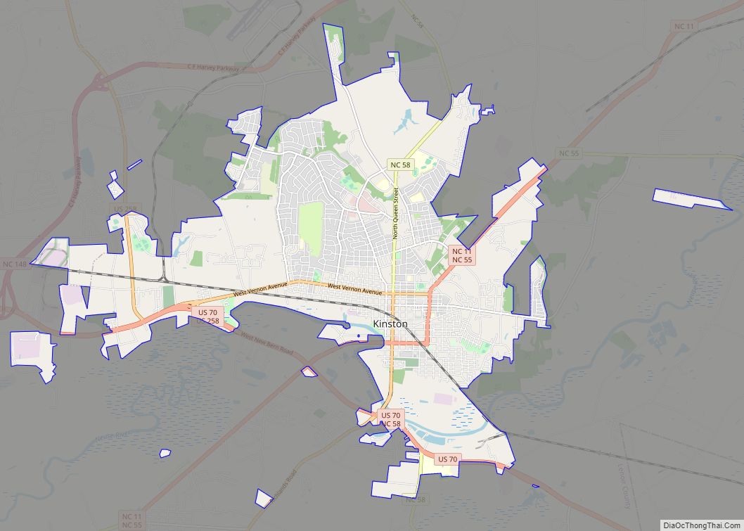
Kinston Road Map
Kinston city Satellite Map
Geography
Kinston is in the Atlantic coastal plain region of North Carolina. It is mainly on the northeast side of the Neuse River, and is northeast of the center of Lenoir County. It is 26 miles (42 km) east of Goldsboro, 30 miles (48 km) south of Greenville, and 35 miles (56 km) west of New Bern. The Atlantic Ocean at Emerald Isle is 57 miles (92 km) to the southeast, and Raleigh, the state capital, is 80 miles (130 km) to the northwest.
According to the U.S. Census Bureau, the city of Kinston has a total area of 18.6 sq mi (48.1 km), of which 0.2 sq mi (0.5 km), or 0.95%, is covered by water.
Climate
According to the Köppen Climate Classification system, Kinston has a humid subtropical climate, abbreviated “Cfa” on climate maps. The hottest temperature recorded in Kinston was 103 °F (39.4 °C) on July 20, 1977 and August 20–22, 1983, while the coldest temperature recorded was −2 °F (−18.9 °C) on January 21, 1985.
See also
Map of North Carolina State and its subdivision:- Alamance
- Alexander
- Alleghany
- Anson
- Ashe
- Avery
- Beaufort
- Bertie
- Bladen
- Brunswick
- Buncombe
- Burke
- Cabarrus
- Caldwell
- Camden
- Carteret
- Caswell
- Catawba
- Chatham
- Cherokee
- Chowan
- Clay
- Cleveland
- Columbus
- Craven
- Cumberland
- Currituck
- Dare
- Davidson
- Davie
- Duplin
- Durham
- Edgecombe
- Forsyth
- Franklin
- Gaston
- Gates
- Graham
- Granville
- Greene
- Guilford
- Halifax
- Harnett
- Haywood
- Henderson
- Hertford
- Hoke
- Hyde
- Iredell
- Jackson
- Johnston
- Jones
- Lee
- Lenoir
- Lincoln
- Macon
- Madison
- Martin
- McDowell
- Mecklenburg
- Mitchell
- Montgomery
- Moore
- Nash
- New Hanover
- Northampton
- Onslow
- Orange
- Pamlico
- Pasquotank
- Pender
- Perquimans
- Person
- Pitt
- Polk
- Randolph
- Richmond
- Robeson
- Rockingham
- Rowan
- Rutherford
- Sampson
- Scotland
- Stanly
- Stokes
- Surry
- Swain
- Transylvania
- Tyrrell
- Union
- Vance
- Wake
- Warren
- Washington
- Watauga
- Wayne
- Wilkes
- Wilson
- Yadkin
- Yancey
- Alabama
- Alaska
- Arizona
- Arkansas
- California
- Colorado
- Connecticut
- Delaware
- District of Columbia
- Florida
- Georgia
- Hawaii
- Idaho
- Illinois
- Indiana
- Iowa
- Kansas
- Kentucky
- Louisiana
- Maine
- Maryland
- Massachusetts
- Michigan
- Minnesota
- Mississippi
- Missouri
- Montana
- Nebraska
- Nevada
- New Hampshire
- New Jersey
- New Mexico
- New York
- North Carolina
- North Dakota
- Ohio
- Oklahoma
- Oregon
- Pennsylvania
- Rhode Island
- South Carolina
- South Dakota
- Tennessee
- Texas
- Utah
- Vermont
- Virginia
- Washington
- West Virginia
- Wisconsin
- Wyoming
