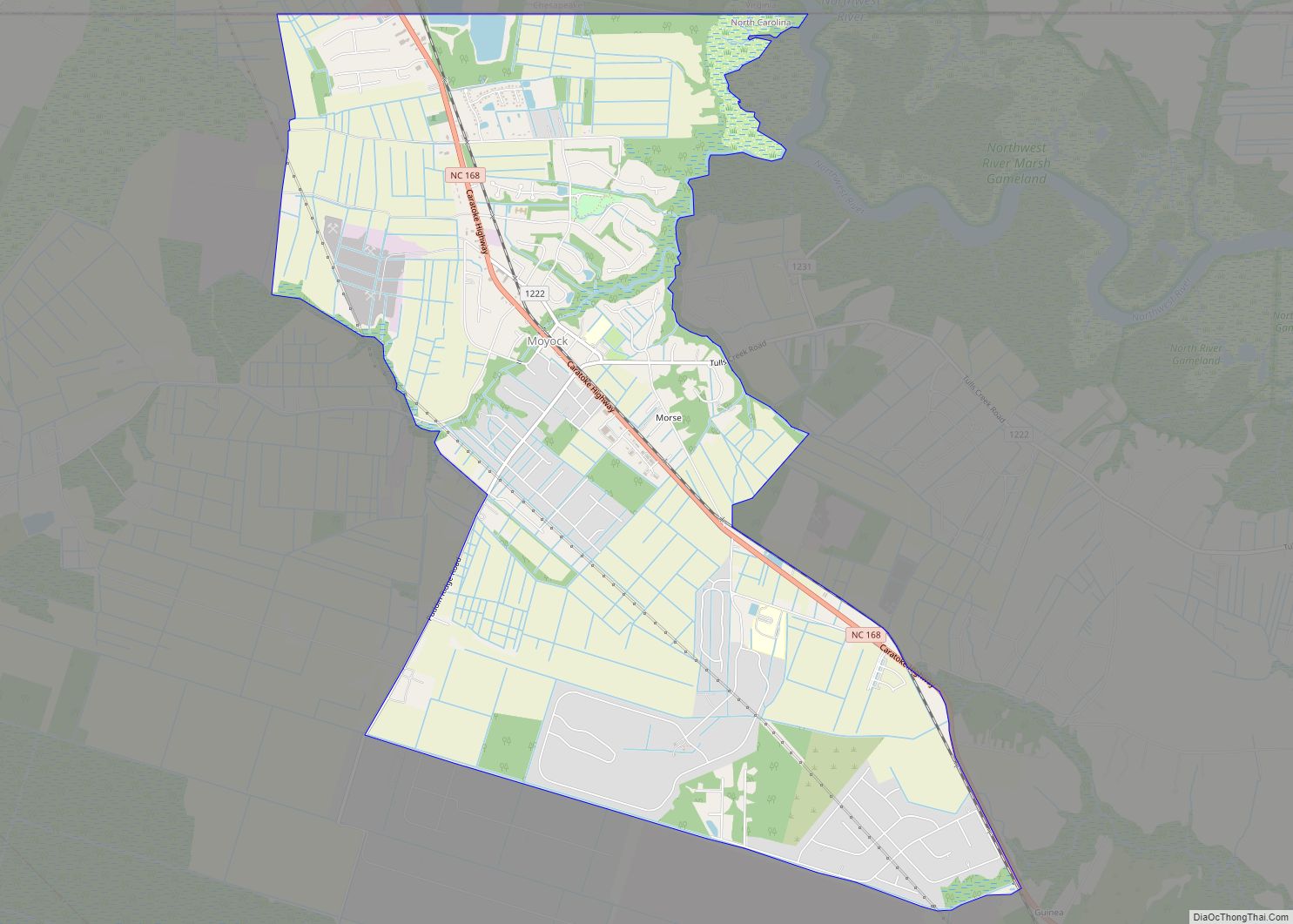
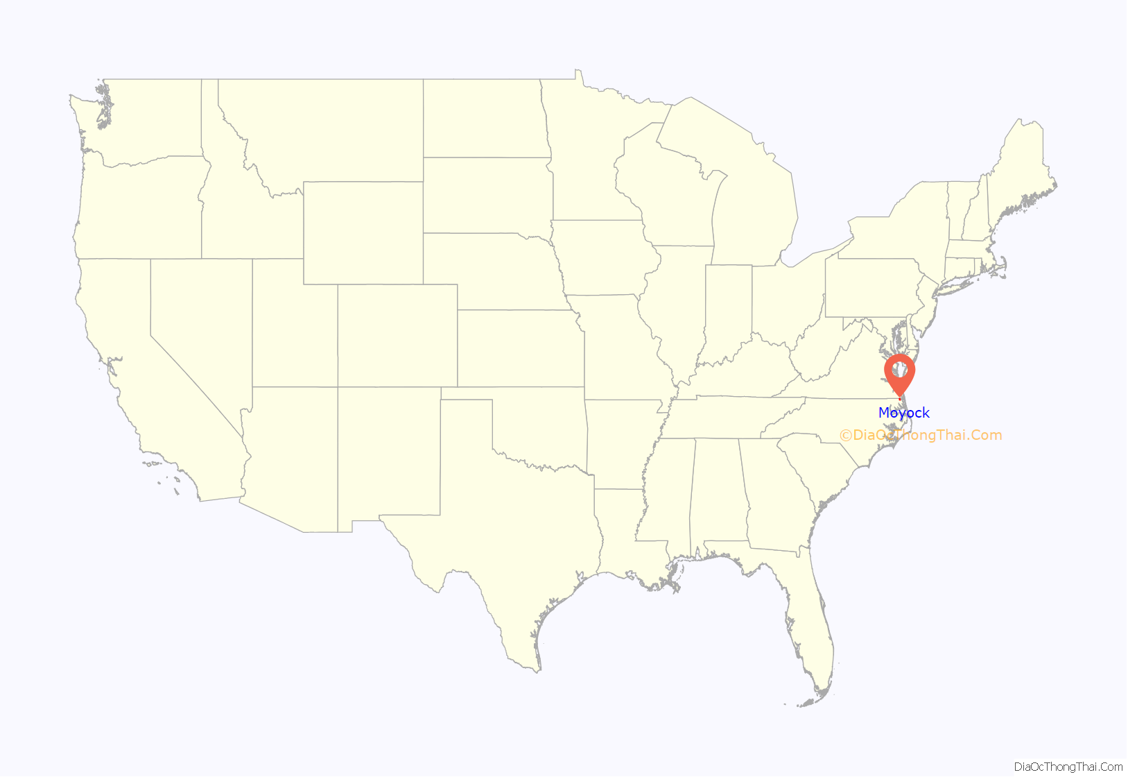
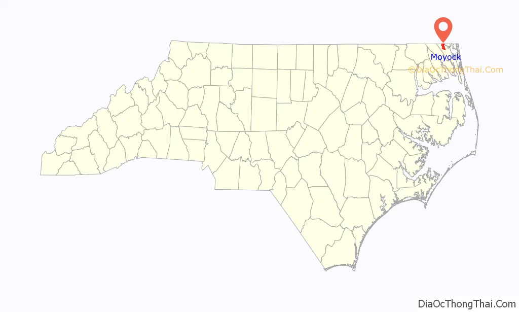
Moyock /ˈmoʊjɒk/ is an unincorporated community and census-designated place (CDP) in Currituck County, North Carolina, United States. As of the 2010 census it had a population of 3,759.
| Name: | Moyock CDP |
|---|---|
| LSAD Code: | 57 |
| LSAD Description: | CDP (suffix) |
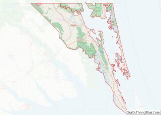
| State: | North Carolina |
| County: | Currituck County |
| Elevation: | 5 ft (2 m) |
| Total Area: | 10.52 sq mi (27.26 km²) |
| Land Area: | 10.43 sq mi (27.02 km²) |
| Water Area: | 0.09 sq mi (0.24 km²) |
| Total Population: | 5,154 |
| Population Density: | 493.96/sq mi (190.72/km²) |
| ZIP code: | 27958 |
| Area code: | 252 |
| FIPS code: | 3745460 |
| GNISfeature ID: | 0990736 |
Online Interactive Map
Click on ![]() to view map in "full screen" mode.
to view map in "full screen" mode.
Moyock location map. Where is Moyock CDP?
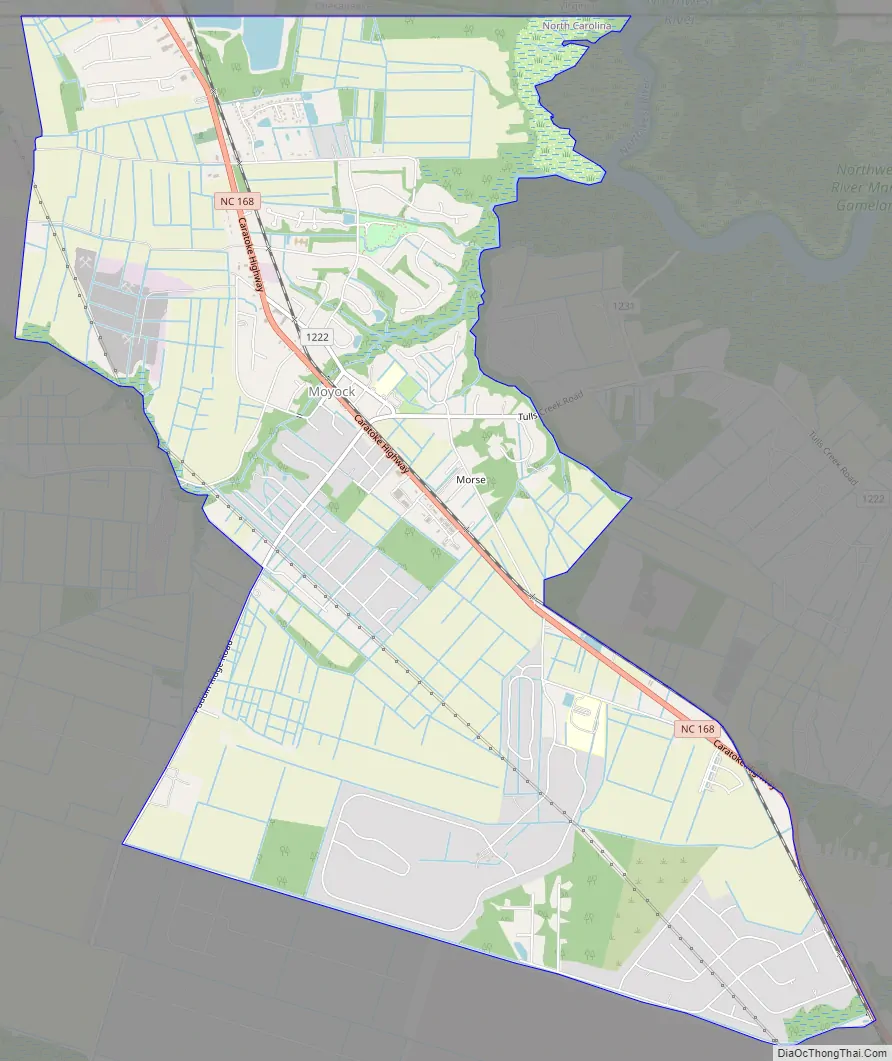
Moyock Road Map
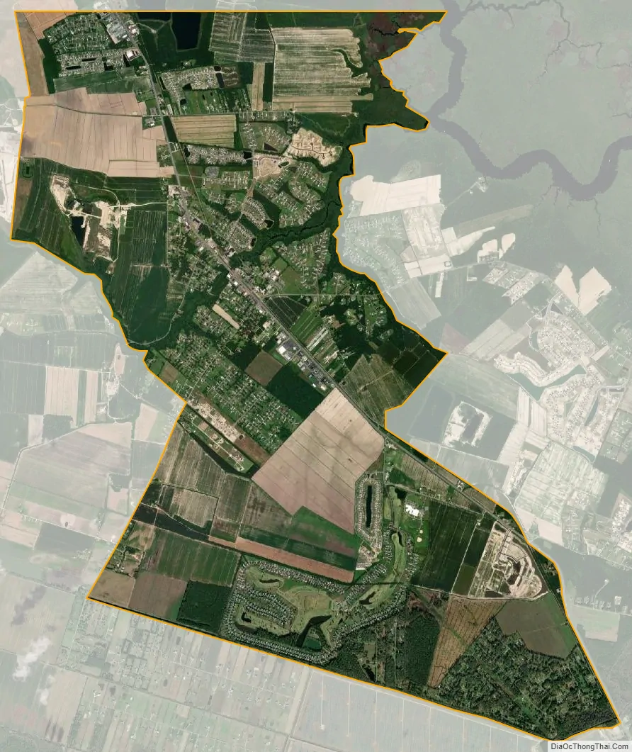
Moyock city Satellite Map
Geography
Moyock is located on North Carolina Highway 168 just south of the Virginia state line. The community sits at the end of the Chesapeake Expressway toll road, and is only 25 miles (40 km) south of downtown Norfolk, Virginia. Because of this, Moyock has begun to witness an increase in residential development as an emerging commuter town for the Hampton Roads region. NC 168 leads southeast 11 miles (18 km) to Currituck, the county seat.
Driving distances
Areas north of the N.C. state line are a short to medium distance away. Moyock is the closest of all North Carolina locales to the following places:
- The Delmarva Peninsula at Fisherman Island before the Chesapeake Bay Bridge-Tunnel toll booth is 49 miles (79 km) to the north.
- The Mason–Dixon line at Selbyville, Delaware, is 162 miles (261 km) to the north.
- The New Jersey state line where crossed by the Cape May-Lewes Ferry in the middle of Delaware Bay is 198 miles (319 km) to the north (8 miles (13 km) into the bay after leaving Lewes, Delaware). This is the closest distance that North Carolina is to the Northeastern United States.
See also
Map of North Carolina State and its subdivision:- Alamance
- Alexander
- Alleghany
- Anson
- Ashe
- Avery
- Beaufort
- Bertie
- Bladen
- Brunswick
- Buncombe
- Burke
- Cabarrus
- Caldwell
- Camden
- Carteret
- Caswell
- Catawba
- Chatham
- Cherokee
- Chowan
- Clay
- Cleveland
- Columbus
- Craven
- Cumberland
- Currituck
- Dare
- Davidson
- Davie
- Duplin
- Durham
- Edgecombe
- Forsyth
- Franklin
- Gaston
- Gates
- Graham
- Granville
- Greene
- Guilford
- Halifax
- Harnett
- Haywood
- Henderson
- Hertford
- Hoke
- Hyde
- Iredell
- Jackson
- Johnston
- Jones
- Lee
- Lenoir
- Lincoln
- Macon
- Madison
- Martin
- McDowell
- Mecklenburg
- Mitchell
- Montgomery
- Moore
- Nash
- New Hanover
- Northampton
- Onslow
- Orange
- Pamlico
- Pasquotank
- Pender
- Perquimans
- Person
- Pitt
- Polk
- Randolph
- Richmond
- Robeson
- Rockingham
- Rowan
- Rutherford
- Sampson
- Scotland
- Stanly
- Stokes
- Surry
- Swain
- Transylvania
- Tyrrell
- Union
- Vance
- Wake
- Warren
- Washington
- Watauga
- Wayne
- Wilkes
- Wilson
- Yadkin
- Yancey
- Alabama
- Alaska
- Arizona
- Arkansas
- California
- Colorado
- Connecticut
- Delaware
- District of Columbia
- Florida
- Georgia
- Hawaii
- Idaho
- Illinois
- Indiana
- Iowa
- Kansas
- Kentucky
- Louisiana
- Maine
- Maryland
- Massachusetts
- Michigan
- Minnesota
- Mississippi
- Missouri
- Montana
- Nebraska
- Nevada
- New Hampshire
- New Jersey
- New Mexico
- New York
- North Carolina
- North Dakota
- Ohio
- Oklahoma
- Oregon
- Pennsylvania
- Rhode Island
- South Carolina
- South Dakota
- Tennessee
- Texas
- Utah
- Vermont
- Virginia
- Washington
- West Virginia
- Wisconsin
- Wyoming