Sanford is a city in Lee County, North Carolina, United States. The population was 30,261 at the 2020 census. It is the county seat of Lee County.
| Name: | Sanford city |
|---|---|
| LSAD Code: | 25 |
| LSAD Description: | city (suffix) |
| State: | North Carolina |
| County: | Lee County |
| Elevation: | 365 ft (108 m) |
| Total Area: | 29.83 sq mi (77.26 km²) |
| Land Area: | 29.57 sq mi (76.59 km²) |
| Water Area: | 0.26 sq mi (0.67 km²) |
| Total Population: | 30,261 |
| Population Density: | 1,023.33/sq mi (395.11/km²) |
| Area code: | 919 |
| FIPS code: | 3759280 |
| GNISfeature ID: | 1022497 |
| Website: | www.sanfordnc.net |
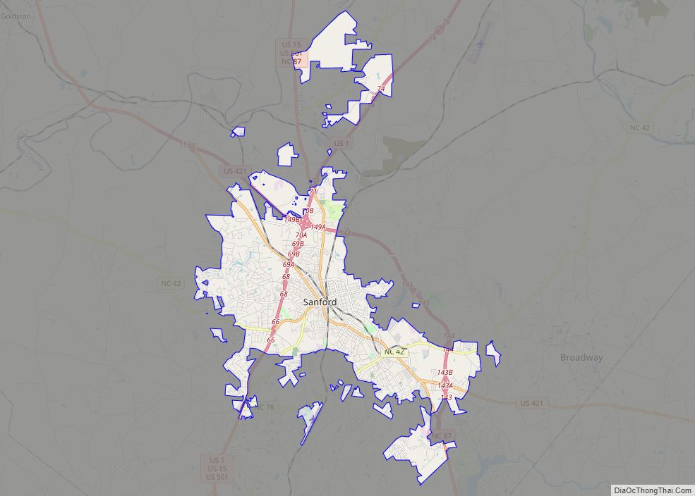
Online Interactive Map
Click on ![]() to view map in "full screen" mode.
to view map in "full screen" mode.
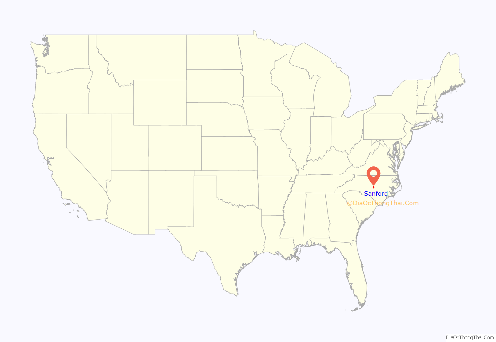
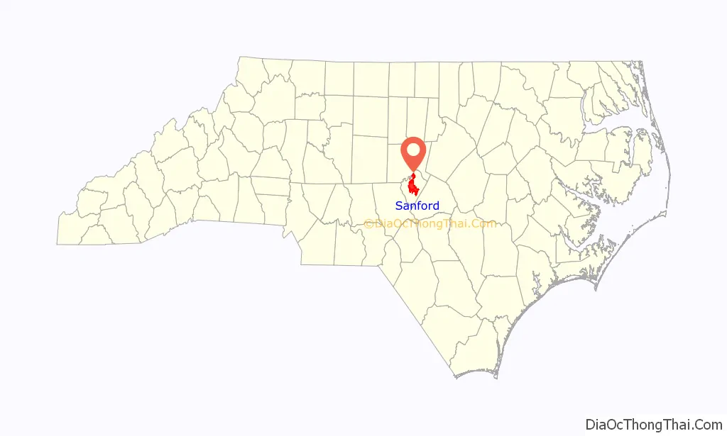
Sanford location map. Where is Sanford city?
History
Sanford was named for C.O. Sanford, a railroad civil engineer instrumental in the building of the rail lines through the area that formed the foundation of what became the city of Sanford.
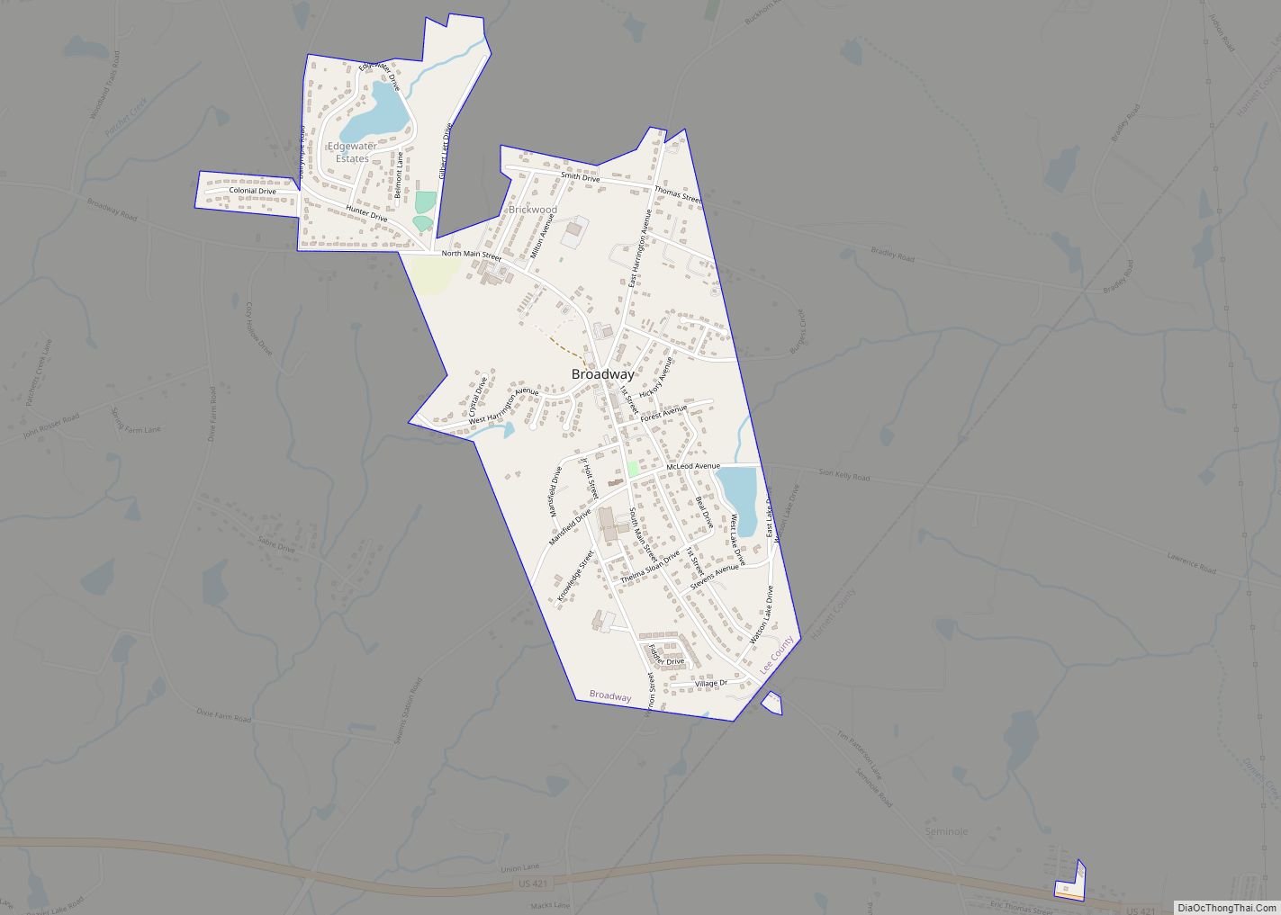
Sanford is located in Lee County, North Carolina, which was formed from parts of the surrounding three counties in 1907. On creation of the new county, Sanford and Jonesboro were the major towns in the area. Rather than decide which would be the county seat, the decision was to place the county’s new courthouse directly between the two towns. For decades, Lee County was the only county in the United States to have a courthouse with an RFD address. In the late 20th century Sanford had grown to such an extent that it eventually merged with Jonesboro. The town of Jonesboro became Jonesboro Heights, and the name of Sanford was kept for the town.
The general Sanford area played key roles in the Revolutionary and Civil Wars, specifically regarding sites like the House in the Horseshoe and Endor Iron Furnace. Over the following decades, the Sanford area became an important source of coal, brownstone, and brick. In particular brownstone and subsequent brick production made Sanford a key provider of these building materials for areas throughout the United States.
For seven seasons, 1941-42 and 1946-50, Sanford fielded a professional minor league baseball team. In 1941-42, the Sanford Spinners played in the Class D level Bi-State League. After the war, a new Spinners team was a member of the Class D level Tobacco State League from 1946 to 1950. Home games were played at Temple Park. Led by manager Zeb Harrington, the Spinners won the regular season pennant three times.
On April 16, 2011, a large tornado ripped through Sanford, demolishing a Lowe’s hardware store and a warehouse, and destroying multiple homes and buildings before moving into Wake County.
On October 21, 2014, Sanford established a formal sister city relationship with Yixing, China. On October 5, 2019, Sanford established a formal sister city relationship with Atizapan de Zaragoza, Mexico.
The Buffalo Presbyterian Church and Cemeteries, Downtown Sanford Historic District, East Sanford Historic District, Euphronia Presbyterian Church, Farish-Lambeth House, Hawkins Avenue Historic District, Lee Avenue Historic District, Lee County Courthouse, Lee County Training School, John D. McIver Farm, Railroad House, Rosemount-McIver Park Historic District, Sanford High School, Former, Seaboard Milling Company, and Temple Theatre are listed on the National Register of Historic Places.
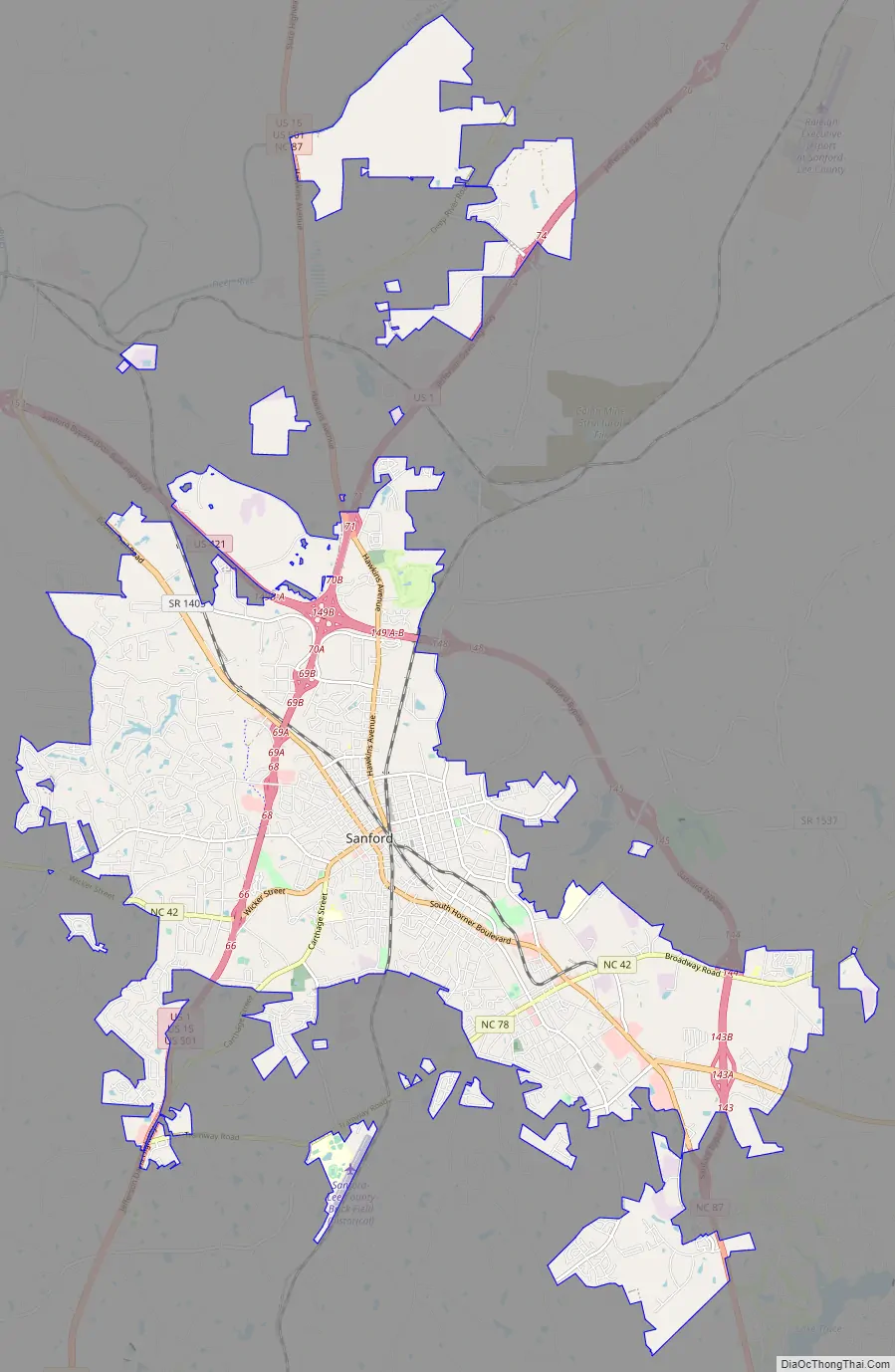
Sanford Road Map
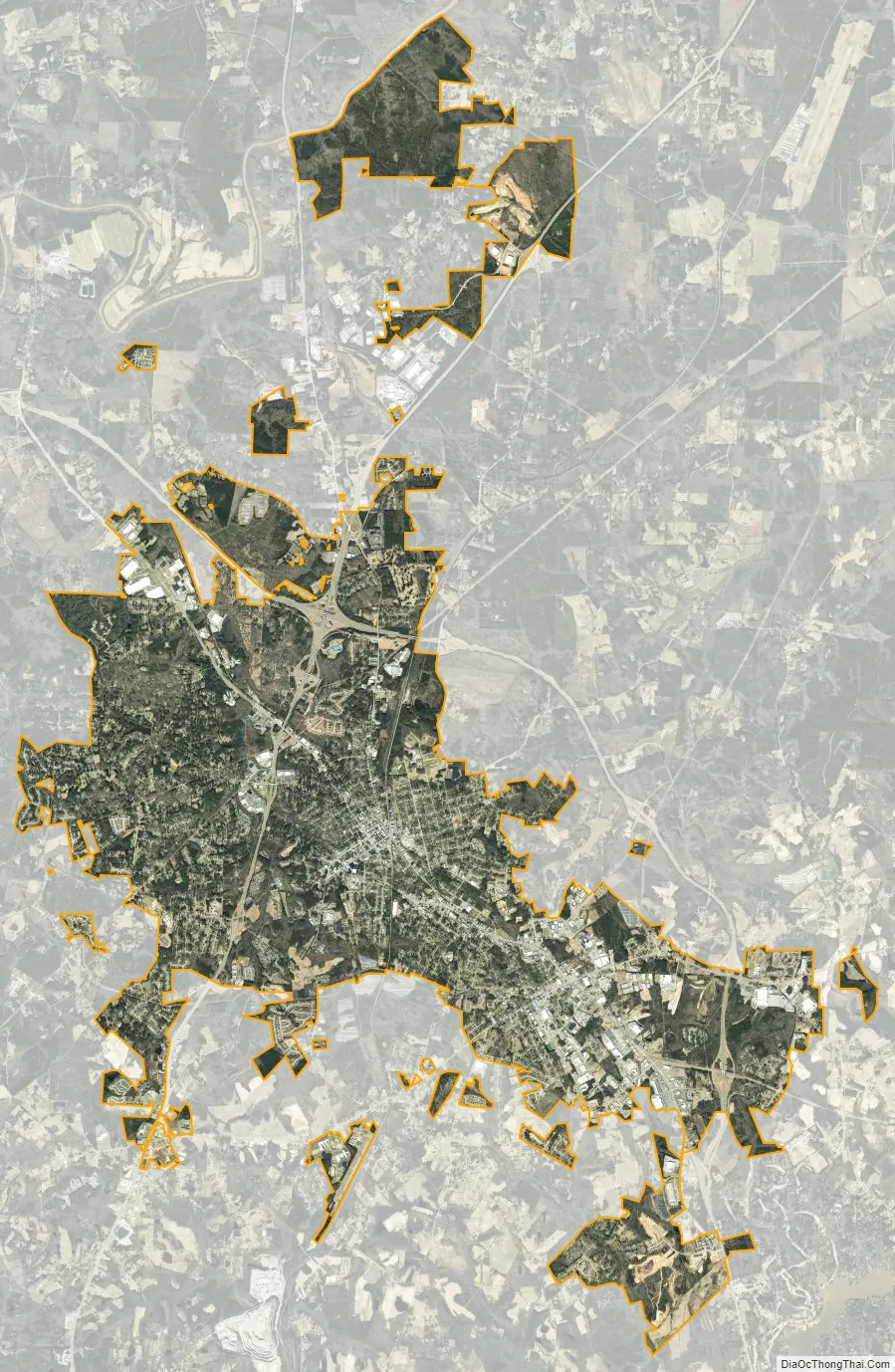
Sanford city Satellite Map
Geography
Sanford is 42 miles (68 km) southwest of Raleigh, the state capital, 57 miles (92 km) southeast of Greensboro, and 36 miles (58 km) northwest of Fayetteville.
According to the United States Census Bureau, the city has a total area of 29.3 square miles (75.9 km), of which 29.1 square miles (75.3 km) are land and 0.3 square miles (0.7 km), or 0.88%, are water. Little Buffalo Creek, a tributary of the Deep River, flows northward through the center of the city. Big Buffalo Creek flows through the west side of the city, and the entire city is part of the Cape Fear River watershed. Lick Creek and its tributaries drain the east side of the city.
See also
Map of North Carolina State and its subdivision:- Alamance
- Alexander
- Alleghany
- Anson
- Ashe
- Avery
- Beaufort
- Bertie
- Bladen
- Brunswick
- Buncombe
- Burke
- Cabarrus
- Caldwell
- Camden
- Carteret
- Caswell
- Catawba
- Chatham
- Cherokee
- Chowan
- Clay
- Cleveland
- Columbus
- Craven
- Cumberland
- Currituck
- Dare
- Davidson
- Davie
- Duplin
- Durham
- Edgecombe
- Forsyth
- Franklin
- Gaston
- Gates
- Graham
- Granville
- Greene
- Guilford
- Halifax
- Harnett
- Haywood
- Henderson
- Hertford
- Hoke
- Hyde
- Iredell
- Jackson
- Johnston
- Jones
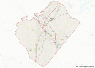
- Lee
- Lenoir
- Lincoln
- Macon
- Madison
- Martin
- McDowell
- Mecklenburg
- Mitchell
- Montgomery
- Moore
- Nash
- New Hanover
- Northampton
- Onslow
- Orange
- Pamlico
- Pasquotank
- Pender
- Perquimans
- Person
- Pitt
- Polk
- Randolph
- Richmond
- Robeson
- Rockingham
- Rowan
- Rutherford
- Sampson
- Scotland
- Stanly
- Stokes
- Surry
- Swain
- Transylvania
- Tyrrell
- Union
- Vance
- Wake
- Warren
- Washington
- Watauga
- Wayne
- Wilkes
- Wilson
- Yadkin
- Yancey
- Alabama
- Alaska
- Arizona
- Arkansas
- California
- Colorado
- Connecticut
- Delaware
- District of Columbia
- Florida
- Georgia
- Hawaii
- Idaho
- Illinois
- Indiana
- Iowa
- Kansas
- Kentucky
- Louisiana
- Maine
- Maryland
- Massachusetts
- Michigan
- Minnesota
- Mississippi
- Missouri
- Montana
- Nebraska
- Nevada
- New Hampshire
- New Jersey
- New Mexico
- New York
- North Carolina
- North Dakota
- Ohio
- Oklahoma
- Oregon
- Pennsylvania
- Rhode Island
- South Carolina
- South Dakota
- Tennessee
- Texas
- Utah
- Vermont
- Virginia
- Washington
- West Virginia
- Wisconsin
- Wyoming