Spencer is a town in Rowan County, North Carolina, United States, incorporated in 1905. As of the 2010 census, the town population was 3,267.
| Name: | Spencer town |
|---|---|
| LSAD Code: | 43 |
| LSAD Description: | town (suffix) |
| State: | North Carolina |
| County: | Rowan County |
| Elevation: | 715 ft (218 m) |
| Total Area: | 3.07 sq mi (7.95 km²) |
| Land Area: | 3.07 sq mi (7.95 km²) |
| Water Area: | 0.00 sq mi (0.00 km²) |
| Total Population: | 3,308 |
| Population Density: | 1,077.88/sq mi (416.14/km²) |
| ZIP code: | 28159 |
| Area code: | 704 |
| FIPS code: | 3763760 |
| GNISfeature ID: | 0995290 |
| Website: | spencernc.gov |
Online Interactive Map
Click on ![]() to view map in "full screen" mode.
to view map in "full screen" mode.
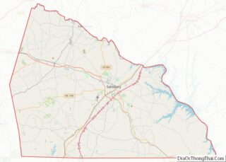
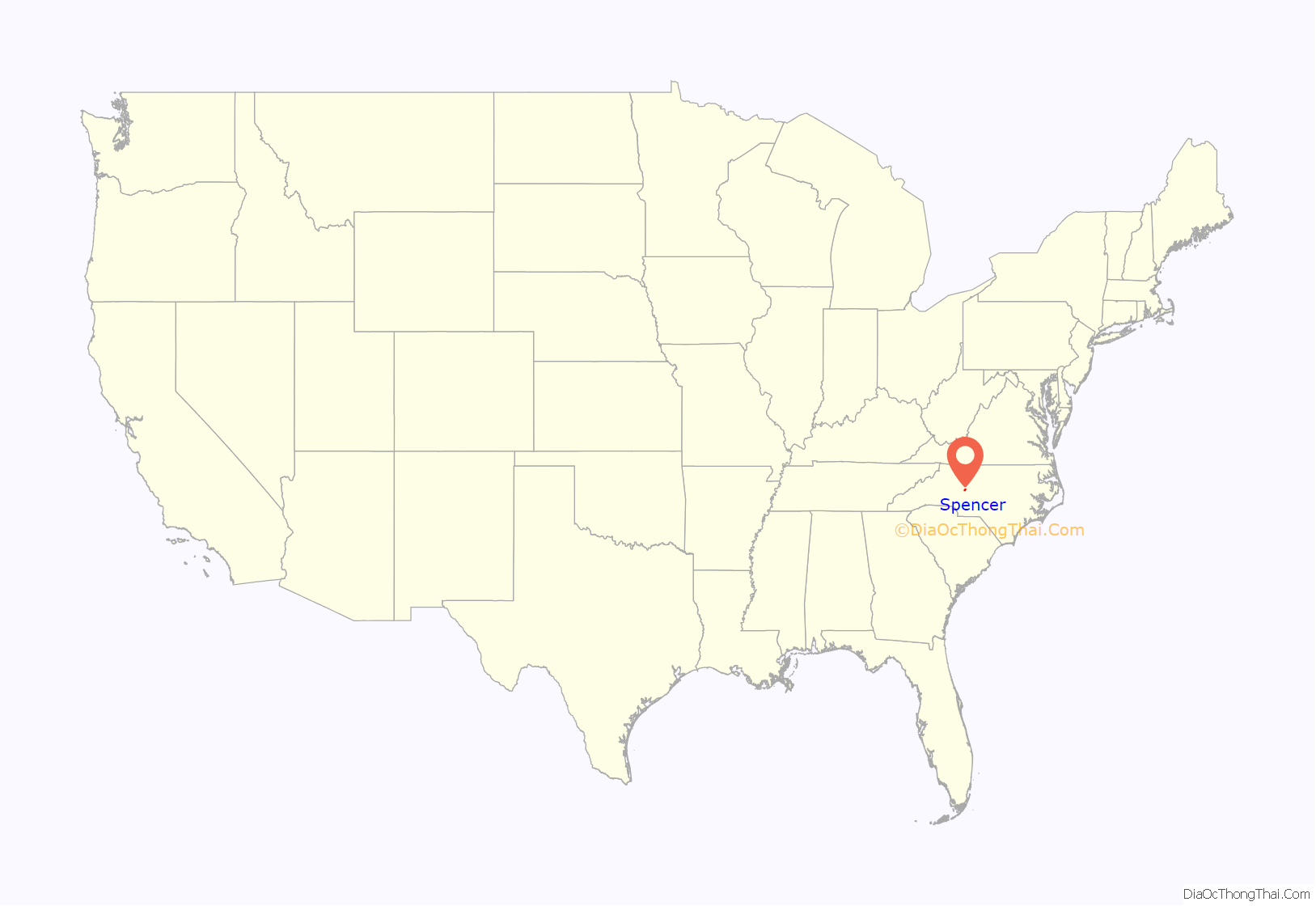
Spencer location map. Where is Spencer town?

History
The town was named for Samuel Spencer, first president of the Southern Railway, who is credited with establishment of the railroad’s mechanical shops at the site in 1896. The site was approximately the midpoint of the railroad’s mainline between Atlanta, GA and Washington, D.C. As the shops were being built the Southern Railway developed a town, also named Spencer, alongside the shops for worker housing. Initially, the Southern partitioned 85 acres into 500 lots. Instead of creating a traditional “company” town in which the workers rented houses Southern sold the lots to workers or businesses for $100 apiece. The deeds did contain restrictive covenants which maintained that a dwelling costing in excess of $400 and approved by a Southern appointed architect be built within a year. The Southern donated lots for religious institutions. Southern also helped establish a YMCA in the town. The community grew quickly and by 1901 had 625 residents. By the 1920s it had 4,000 residents.
The former Spencer Shops were phased out during the 1950s through 1970s and have now become the location of the North Carolina Transportation Museum.
The Alexander Long House, Southern Railway’s Spencer Shops, and Spencer Historic District are listed on the National Register of Historic Places.
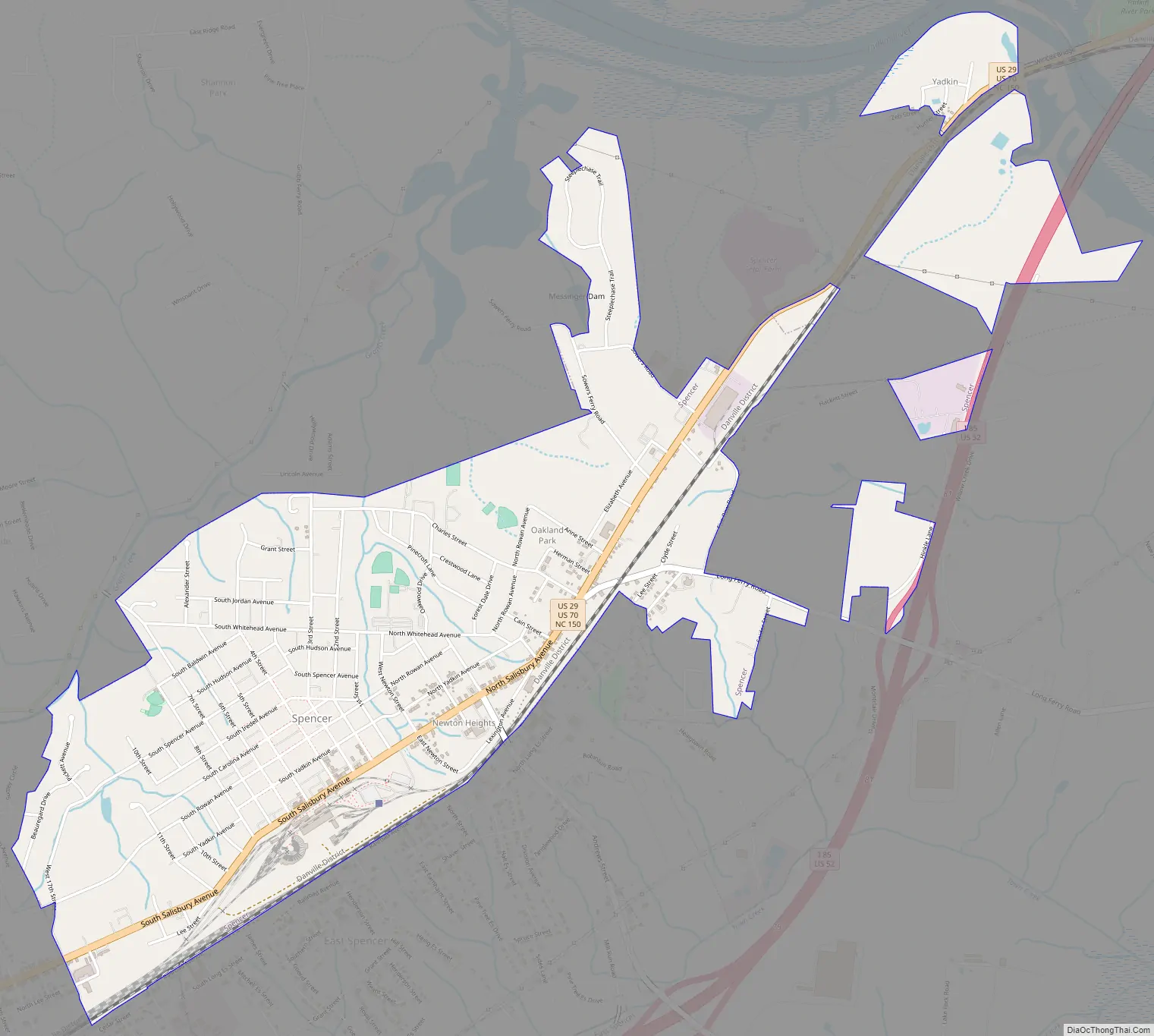
Spencer Road Map
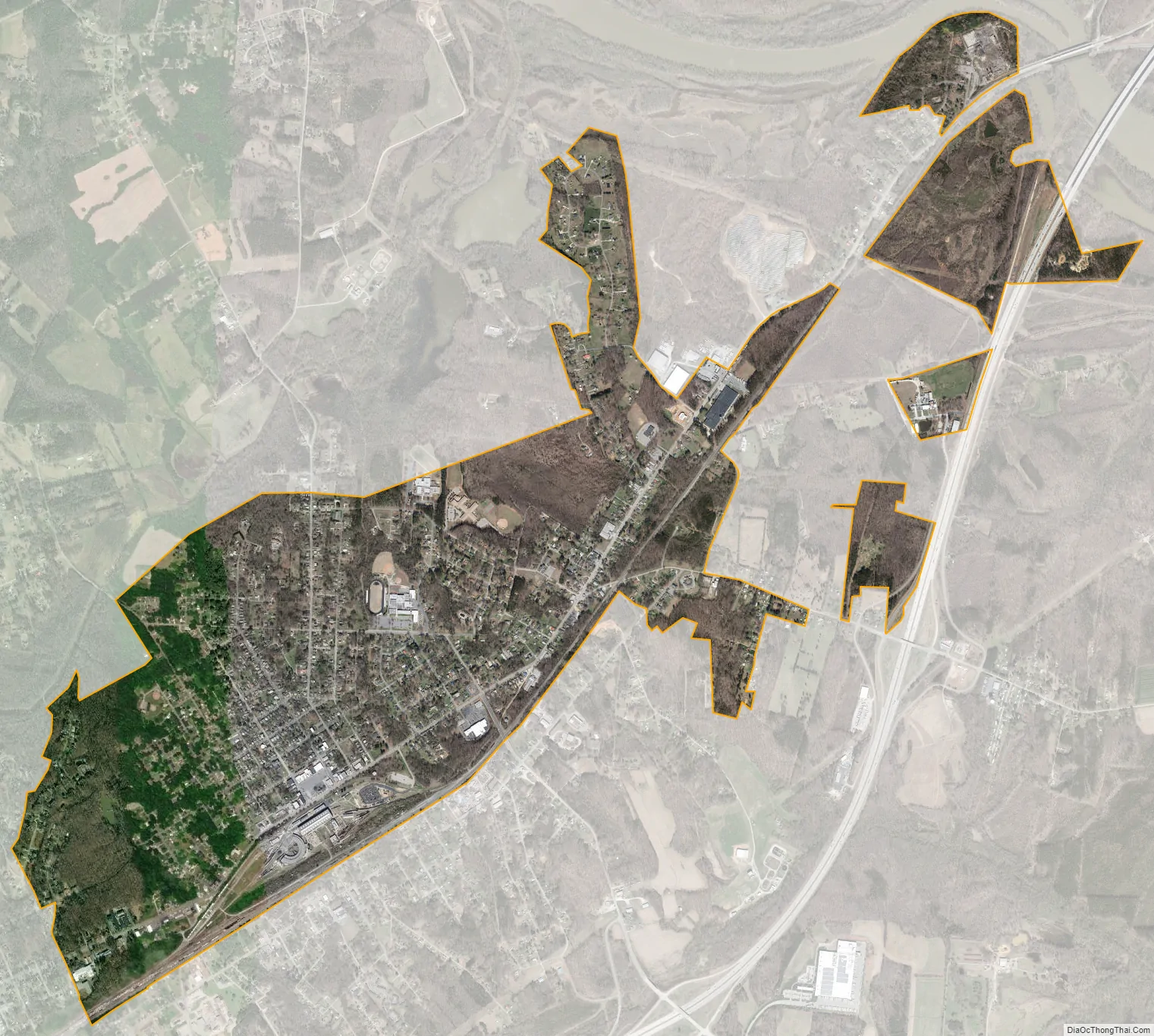
Spencer city Satellite Map
Geography
Spencer is located at 35°41′37″N 80°25′55″W / 35.693672°N 80.431906°W / 35.693672; -80.431906.
According to the United States Census Bureau, the town has a total area of 2.7 square miles (7.0 km), all land.
See also
Map of North Carolina State and its subdivision:- Alamance
- Alexander
- Alleghany
- Anson
- Ashe
- Avery
- Beaufort
- Bertie
- Bladen
- Brunswick
- Buncombe
- Burke
- Cabarrus
- Caldwell
- Camden
- Carteret
- Caswell
- Catawba
- Chatham
- Cherokee
- Chowan
- Clay
- Cleveland
- Columbus
- Craven
- Cumberland
- Currituck
- Dare
- Davidson
- Davie
- Duplin
- Durham
- Edgecombe
- Forsyth
- Franklin
- Gaston
- Gates
- Graham
- Granville
- Greene
- Guilford
- Halifax
- Harnett
- Haywood
- Henderson
- Hertford
- Hoke
- Hyde
- Iredell
- Jackson
- Johnston
- Jones
- Lee
- Lenoir
- Lincoln
- Macon
- Madison
- Martin
- McDowell
- Mecklenburg
- Mitchell
- Montgomery
- Moore
- Nash
- New Hanover
- Northampton
- Onslow
- Orange
- Pamlico
- Pasquotank
- Pender
- Perquimans
- Person
- Pitt
- Polk
- Randolph
- Richmond
- Robeson
- Rockingham
- Rowan
- Rutherford
- Sampson
- Scotland
- Stanly
- Stokes
- Surry
- Swain
- Transylvania
- Tyrrell
- Union
- Vance
- Wake
- Warren
- Washington
- Watauga
- Wayne
- Wilkes
- Wilson
- Yadkin
- Yancey
- Alabama
- Alaska
- Arizona
- Arkansas
- California
- Colorado
- Connecticut
- Delaware
- District of Columbia
- Florida
- Georgia
- Hawaii
- Idaho
- Illinois
- Indiana
- Iowa
- Kansas
- Kentucky
- Louisiana
- Maine
- Maryland
- Massachusetts
- Michigan
- Minnesota
- Mississippi
- Missouri
- Montana
- Nebraska
- Nevada
- New Hampshire
- New Jersey
- New Mexico
- New York
- North Carolina
- North Dakota
- Ohio
- Oklahoma
- Oregon
- Pennsylvania
- Rhode Island
- South Carolina
- South Dakota
- Tennessee
- Texas
- Utah
- Vermont
- Virginia
- Washington
- West Virginia
- Wisconsin
- Wyoming