Walnut Cove is a town in Stokes County, North Carolina, United States. The population was 1,536 at the 2020 census.
It is the home of Family Pharmacy and the Walnut Cove Springfest, which draws many visitors to the area. Festival-organizers marked 1889, the town’s incorporation date, but the town’s roots date to the mid-18th century when it was known as Town Fork. Town Fork settlers formed a bond with Moravians in Bethania and Bethabara. Eventually, William Lash, a Moravian settler at Bethania, bought land along the Town Fork Creek, which later developed into a large plantation named Walnut Cove. The Town was a railroad center in its former years, and today remnants of the old Train Depot still stand on Depot Street.
It is also home to historic Covington House (built in 1821), Fulp-Marshall Home (built in 1836), Culler Roller Mill now known as Monitor Roller Mill (built in 1900).
Walnut Cove is also home to South Stokes High School. Belews Lake and Hanging Rock State Park are located nearby. It is also the hometown of rising sports announcer Matthew Owens who has served as the PA Announcer for South Stokes Football since 2017. Popular spots in and around Walnut Cove include Just Plain Country Store, Sam’s Pizza, El Cabo Mexican Restaurant, and nearby Belews Lake and Hanging Rock State Park. Winston-Salem is 23 miles to the southeast via Route 311, Route 158 and Salem Parkway (US-421). Danbury is 10 miles to the north via Highway 89. Germanton is 6.6 miles to the west-southwest via Highway 65. Madison and Mayodan are 14 miles to the northeast via US 311. Other nearby cities include Kernersville, Walkertown, Rural Hall, and the small community of Pine Hall.
| Name: | Walnut Cove town |
|---|---|
| LSAD Code: | 43 |
| LSAD Description: | town (suffix) |
| State: | North Carolina |
| County: | Stokes County |
| Elevation: | 676 ft (206 m) |
| Total Area: | 2.56 sq mi (6.62 km²) |
| Land Area: | 2.52 sq mi (6.53 km²) |
| Water Area: | 0.03 sq mi (0.09 km²) |
| Total Population: | 1,586 |
| Population Density: | 628.87/sq mi (242.78/km²) |
| ZIP code: | 27052 |
| Area code: | 336 |
| FIPS code: | 3770780 |
| GNISfeature ID: | 0996735 |
| Website: | www.townofwalnutcove.org |
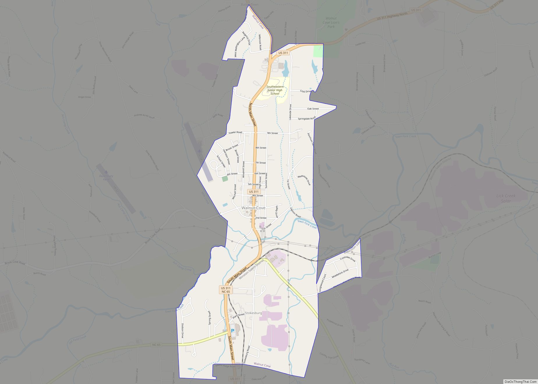
Online Interactive Map
Click on ![]() to view map in "full screen" mode.
to view map in "full screen" mode.
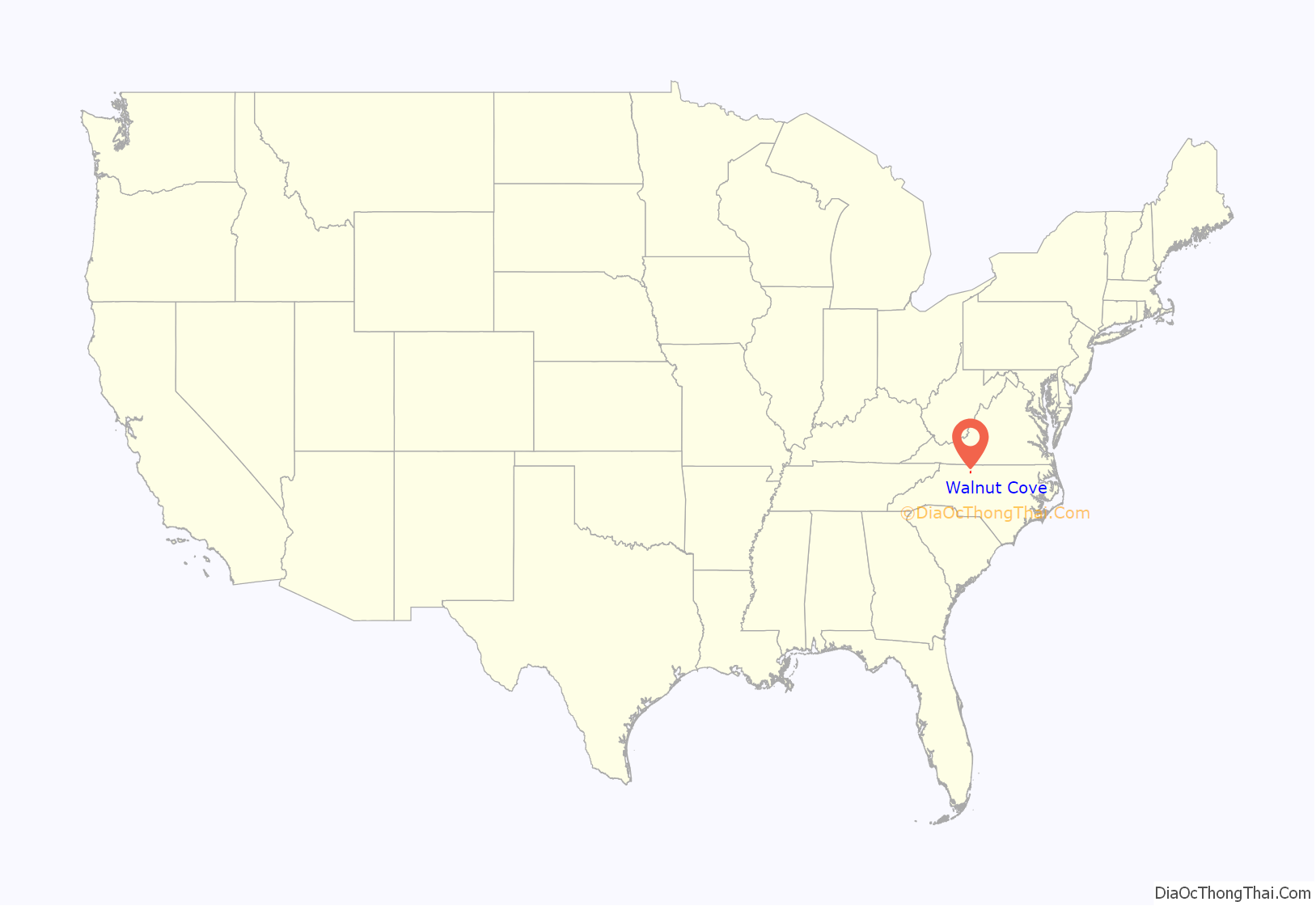
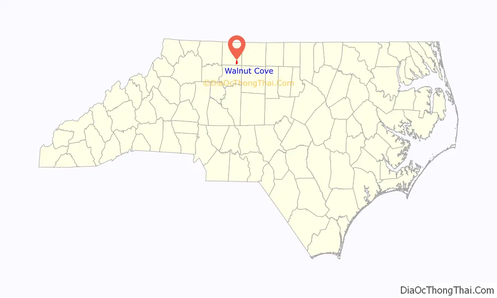
Walnut Cove location map. Where is Walnut Cove town?
History
The Christ Episcopal Church and Walnut Cove Colored School are listed on the National Register of Historic Places.
Burt Myers, a race car driver for NASCAR Whelen Southern Modified Tour, is from Walnut Cove.
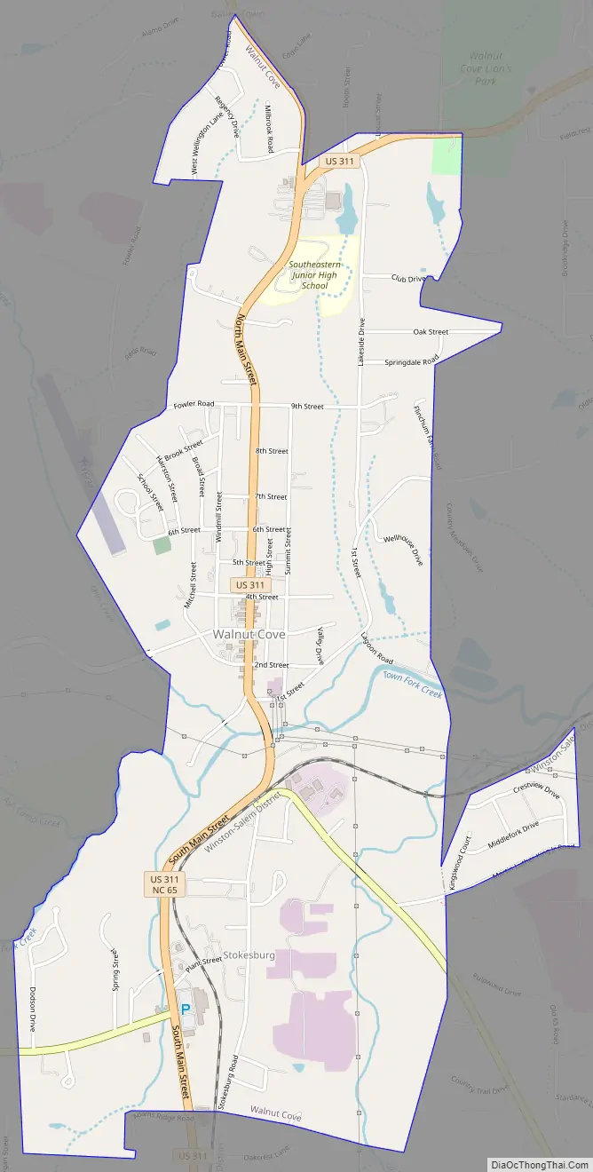
Walnut Cove Road Map
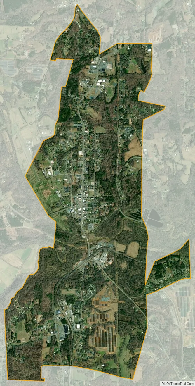
Walnut Cove city Satellite Map
Geography
Walnut Cove is located at 36°17′46″N 80°8′28″W / 36.29611°N 80.14111°W / 36.29611; -80.14111 (36.296225, -80.141150).
According to the United States Census Bureau, the town has a total area of 2.4 square miles (6.2 km), all of it land.
See also
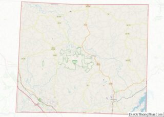
Map of North Carolina State and its subdivision:- Alamance
- Alexander
- Alleghany
- Anson
- Ashe
- Avery
- Beaufort
- Bertie
- Bladen
- Brunswick
- Buncombe
- Burke
- Cabarrus
- Caldwell
- Camden
- Carteret
- Caswell
- Catawba
- Chatham
- Cherokee
- Chowan
- Clay
- Cleveland
- Columbus
- Craven
- Cumberland
- Currituck
- Dare
- Davidson
- Davie
- Duplin
- Durham
- Edgecombe
- Forsyth
- Franklin
- Gaston
- Gates
- Graham
- Granville
- Greene
- Guilford
- Halifax
- Harnett
- Haywood
- Henderson
- Hertford
- Hoke
- Hyde
- Iredell
- Jackson
- Johnston
- Jones
- Lee
- Lenoir
- Lincoln
- Macon
- Madison
- Martin
- McDowell
- Mecklenburg
- Mitchell
- Montgomery
- Moore
- Nash
- New Hanover
- Northampton
- Onslow
- Orange
- Pamlico
- Pasquotank
- Pender
- Perquimans
- Person
- Pitt
- Polk
- Randolph
- Richmond
- Robeson
- Rockingham
- Rowan
- Rutherford
- Sampson
- Scotland
- Stanly
- Stokes
- Surry
- Swain
- Transylvania
- Tyrrell
- Union
- Vance
- Wake
- Warren
- Washington
- Watauga
- Wayne
- Wilkes
- Wilson
- Yadkin
- Yancey
- Alabama
- Alaska
- Arizona
- Arkansas
- California
- Colorado
- Connecticut
- Delaware
- District of Columbia
- Florida
- Georgia
- Hawaii
- Idaho
- Illinois
- Indiana
- Iowa
- Kansas
- Kentucky
- Louisiana
- Maine
- Maryland
- Massachusetts
- Michigan
- Minnesota
- Mississippi
- Missouri
- Montana
- Nebraska
- Nevada
- New Hampshire
- New Jersey
- New Mexico
- New York
- North Carolina
- North Dakota
- Ohio
- Oklahoma
- Oregon
- Pennsylvania
- Rhode Island
- South Carolina
- South Dakota
- Tennessee
- Texas
- Utah
- Vermont
- Virginia
- Washington
- West Virginia
- Wisconsin
- Wyoming