Winfall is a town in Perquimans County, North Carolina, United States. The population was 554 at the 2020 census. It is part of the Elizabeth City, North Carolina Micropolitan Statistical Area.
| Name: | Winfall town |
|---|---|
| LSAD Code: | 43 |
| LSAD Description: | town (suffix) |
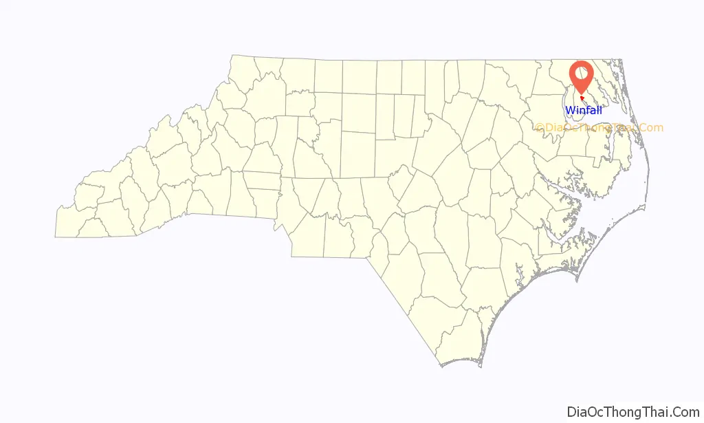
| State: | North Carolina |
| County: | Perquimans County |
| Incorporated: | 1887 |
| Elevation: | 13 ft (4 m) |
| Total Area: | 2.32 sq mi (6.01 km²) |
| Land Area: | 2.31 sq mi (5.98 km²) |
| Water Area: | 0.01 sq mi (0.03 km²) |
| Total Population: | 555 |
| Population Density: | 240.47/sq mi (92.86/km²) |
| ZIP code: | 27985 |
| Area code: | 252 |
| FIPS code: | 3774720 |
| GNISfeature ID: | 1023283 |
| Website: | www.townofwinfall.com |
Online Interactive Map
Click on ![]() to view map in "full screen" mode.
to view map in "full screen" mode.
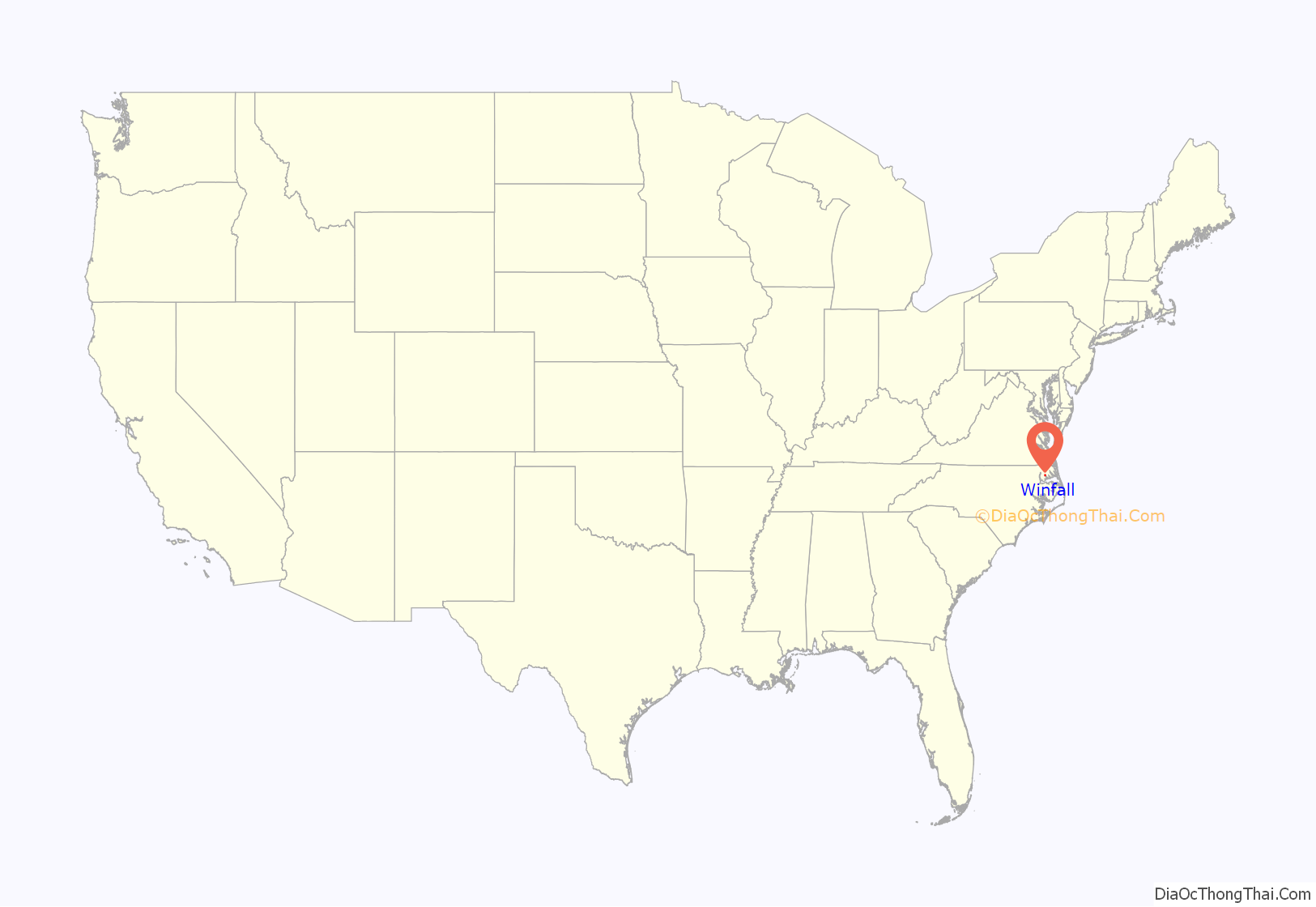
Winfall location map. Where is Winfall town?
History
The Winfall Historic District was listed on the National Register of Historic Places in 2003.
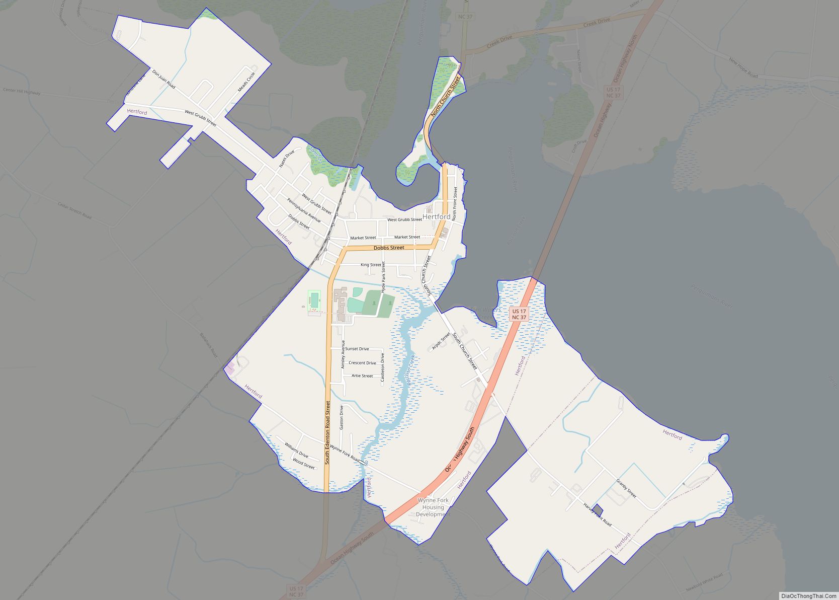
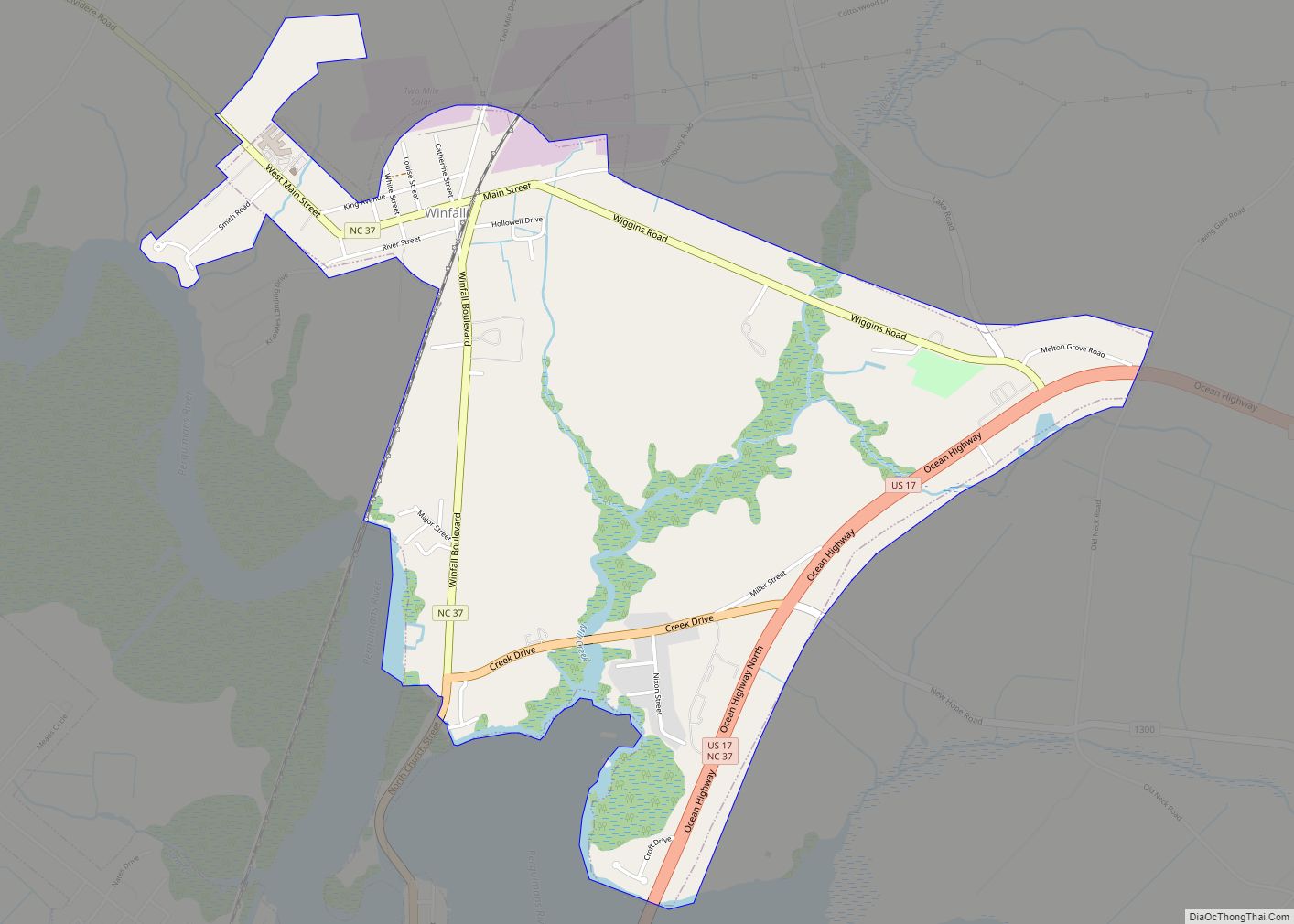
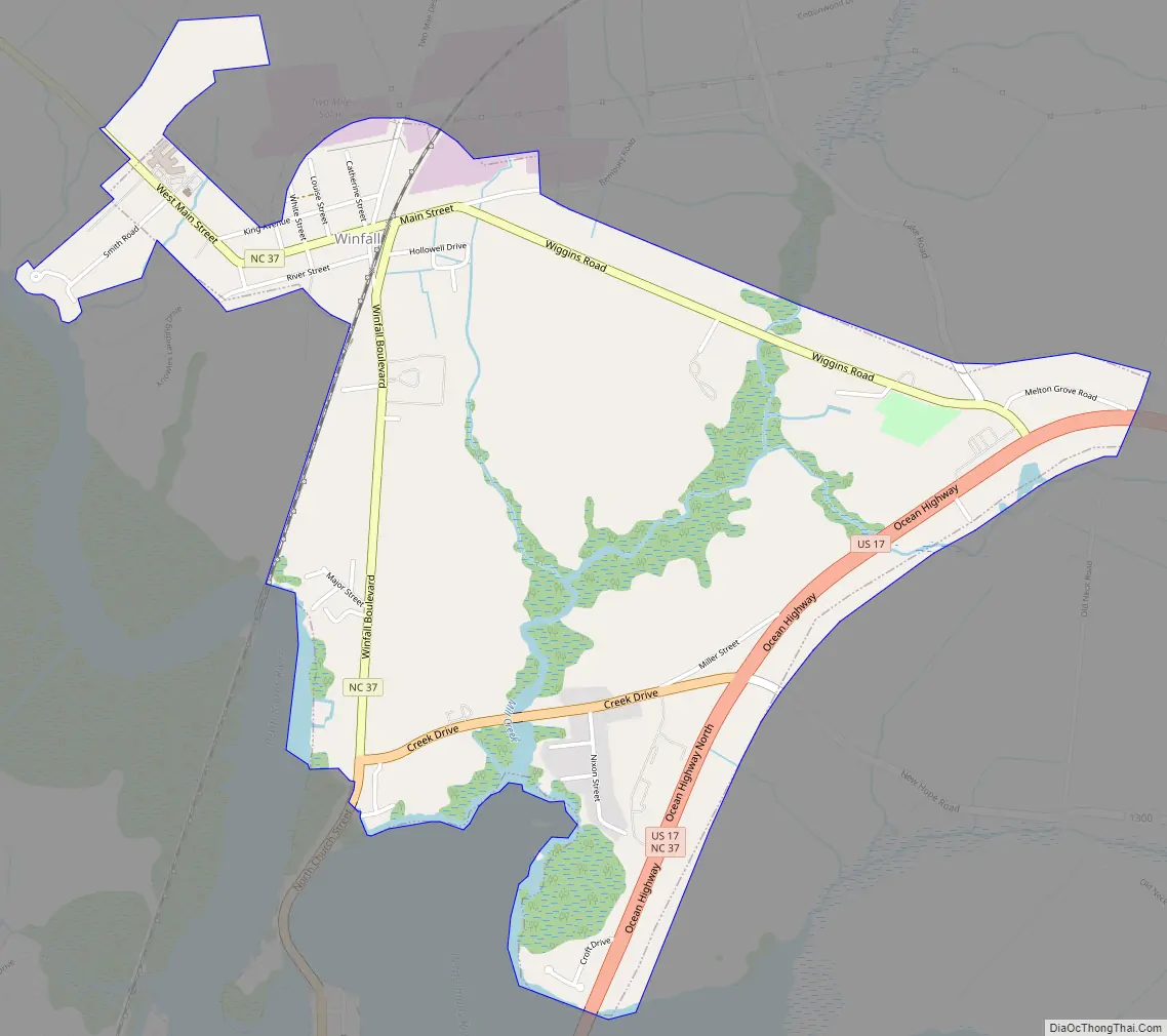
Winfall Road Map
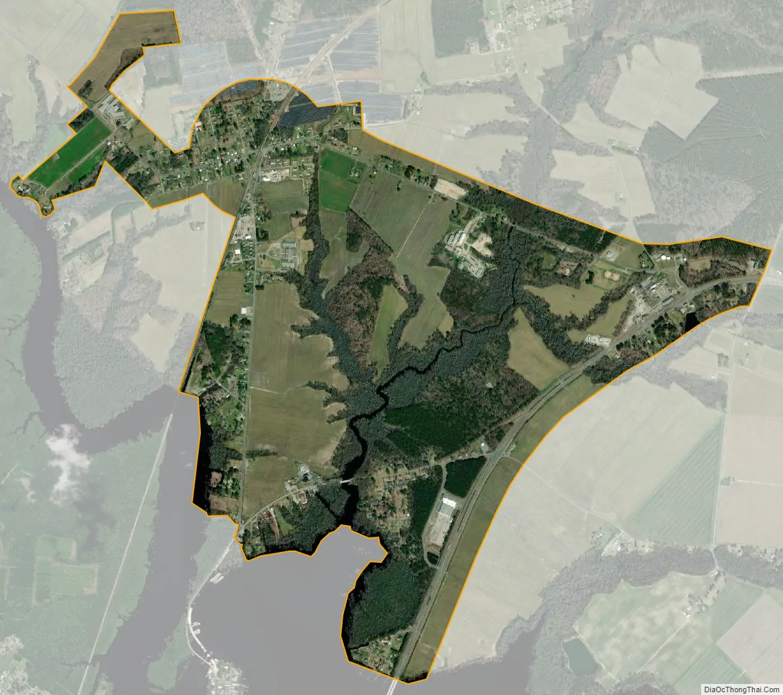
Winfall city Satellite Map
Geography
Winfall is located at 36°12′52″N 76°27′24″W / 36.21444°N 76.45667°W / 36.21444; -76.45667 (36.214551, -76.456758).
Winfall (along with Hertford) is considered to be on the southwesternmost fringe of the Hampton Roads Metropolitan Area, and many local residents commute frequently to and from the Seven Cities region for work, shopping, and leisure.
According to the United States Census Bureau, the town has a total area of 2.2 square miles (5.7 km), of which 2.1 square miles (5.4 km) is land and 0.47% is water. It is located strategically upon the Perquimans River.
See also
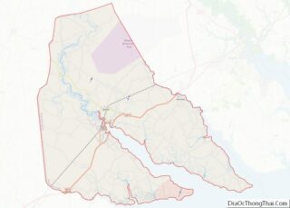
Map of North Carolina State and its subdivision:- Alamance
- Alexander
- Alleghany
- Anson
- Ashe
- Avery
- Beaufort
- Bertie
- Bladen
- Brunswick
- Buncombe
- Burke
- Cabarrus
- Caldwell
- Camden
- Carteret
- Caswell
- Catawba
- Chatham
- Cherokee
- Chowan
- Clay
- Cleveland
- Columbus
- Craven
- Cumberland
- Currituck
- Dare
- Davidson
- Davie
- Duplin
- Durham
- Edgecombe
- Forsyth
- Franklin
- Gaston
- Gates
- Graham
- Granville
- Greene
- Guilford
- Halifax
- Harnett
- Haywood
- Henderson
- Hertford
- Hoke
- Hyde
- Iredell
- Jackson
- Johnston
- Jones
- Lee
- Lenoir
- Lincoln
- Macon
- Madison
- Martin
- McDowell
- Mecklenburg
- Mitchell
- Montgomery
- Moore
- Nash
- New Hanover
- Northampton
- Onslow
- Orange
- Pamlico
- Pasquotank
- Pender
- Perquimans
- Person
- Pitt
- Polk
- Randolph
- Richmond
- Robeson
- Rockingham
- Rowan
- Rutherford
- Sampson
- Scotland
- Stanly
- Stokes
- Surry
- Swain
- Transylvania
- Tyrrell
- Union
- Vance
- Wake
- Warren
- Washington
- Watauga
- Wayne
- Wilkes
- Wilson
- Yadkin
- Yancey
- Alabama
- Alaska
- Arizona
- Arkansas
- California
- Colorado
- Connecticut
- Delaware
- District of Columbia
- Florida
- Georgia
- Hawaii
- Idaho
- Illinois
- Indiana
- Iowa
- Kansas
- Kentucky
- Louisiana
- Maine
- Maryland
- Massachusetts
- Michigan
- Minnesota
- Mississippi
- Missouri
- Montana
- Nebraska
- Nevada
- New Hampshire
- New Jersey
- New Mexico
- New York
- North Carolina
- North Dakota
- Ohio
- Oklahoma
- Oregon
- Pennsylvania
- Rhode Island
- South Carolina
- South Dakota
- Tennessee
- Texas
- Utah
- Vermont
- Virginia
- Washington
- West Virginia
- Wisconsin
- Wyoming