Yadkinville is a town in Yadkin County, North Carolina, United States. The population was 2,995 at the 2020 census. Located in the Piedmont Triad, it is the county seat and largest city of Yadkin County.
| Name: | Yadkinville town |
|---|---|
| LSAD Code: | 43 |
| LSAD Description: | town (suffix) |
| State: | North Carolina |
| County: | Yadkin County |
| Elevation: | 974 ft (297 m) |
| Total Area: | 2.94 sq mi (7.61 km²) |
| Land Area: | 2.93 sq mi (7.59 km²) |
| Water Area: | 0.01 sq mi (0.02 km²) |
| Total Population: | 2,995 |
| Population Density: | 1,021.84/sq mi (394.60/km²) |
| ZIP code: | 27055 |
| Area code: | 336 |
| FIPS code: | 3775960 |
| GNISfeature ID: | 0997683 |
| Website: | www.yadkinville.org |
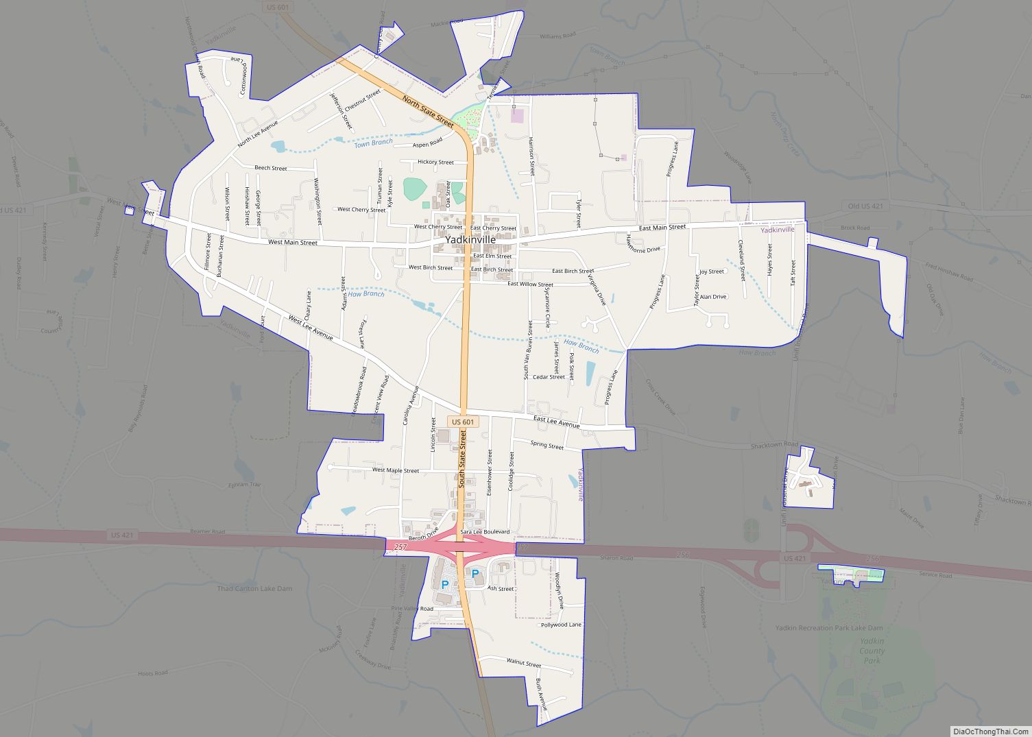
Online Interactive Map
Click on ![]() to view map in "full screen" mode.
to view map in "full screen" mode.
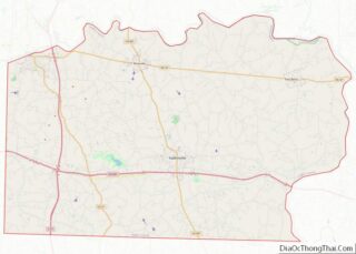
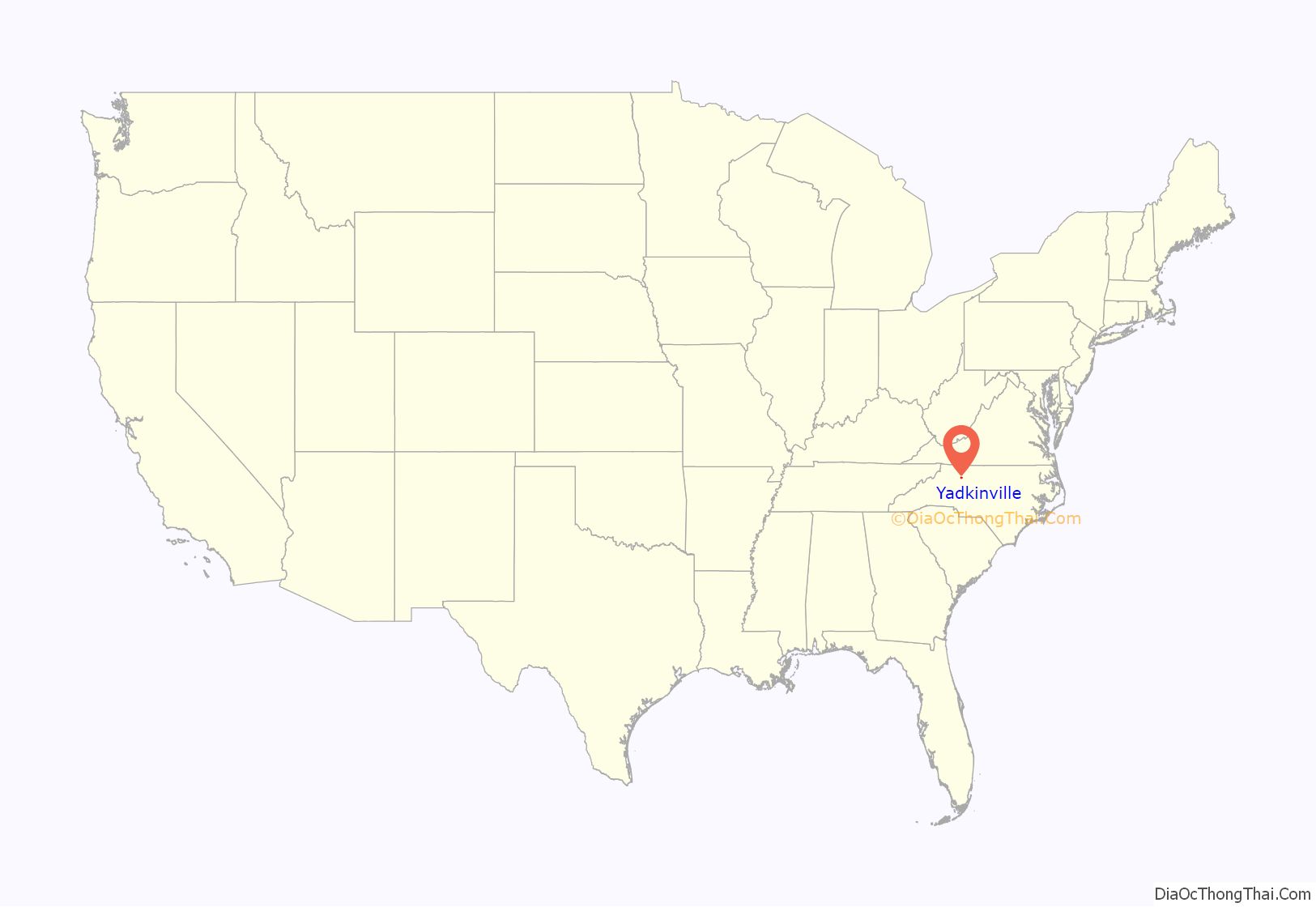
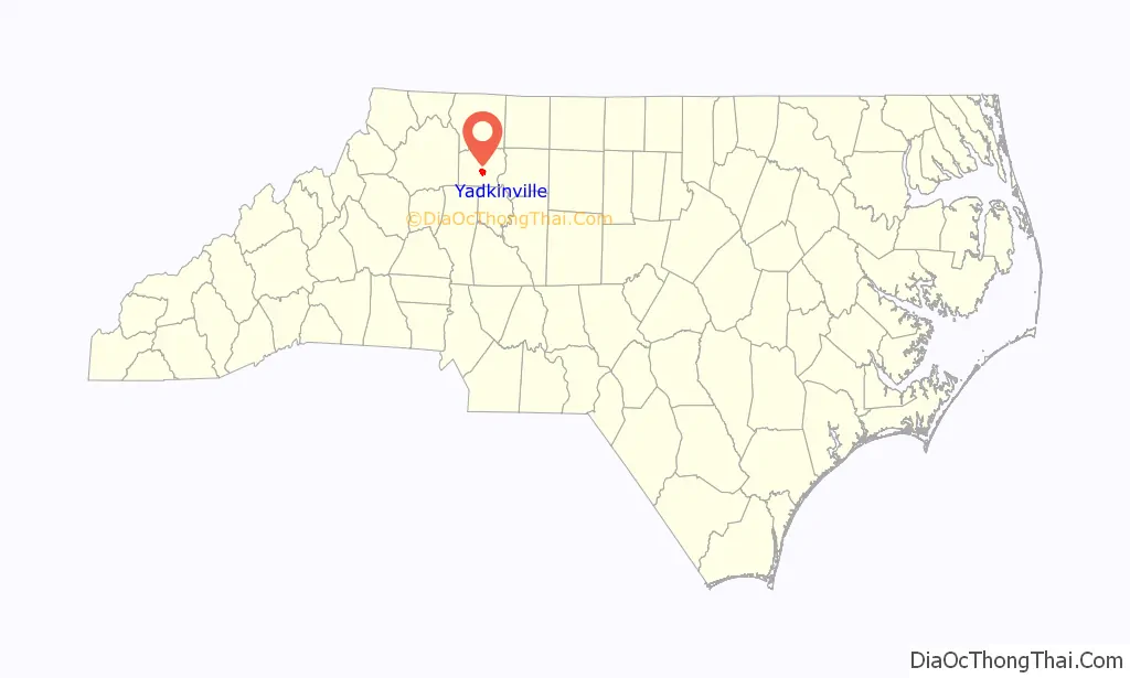
Yadkinville location map. Where is Yadkinville town?
History
The area was chosen as the county seat with the founding of Yadkin County in 1850. It was first known as Wilson, in honor of Louis D. Wilson, a legislator who died in the Mexican War. However, the name was changed to Yadkinville in 1852 after it was discovered that another area, Wilson, North Carolina, already had the name. At the time the county seat was established, there was only one house in town. Yadkinville was incorporated in 1857.
The first courthouse, a two-story brick building, was built in 1853 by William White of Hamptonville, North Carolina. The bricks were handmade on a farm north of town. The courthouse was torn down in 1958 and a new building was constructed.
The Second Yadkin County Jail was listed on the National Register of Historic Places in 1988.
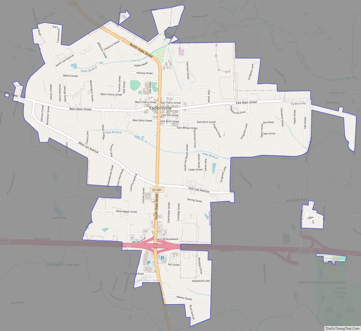
Yadkinville Road Map
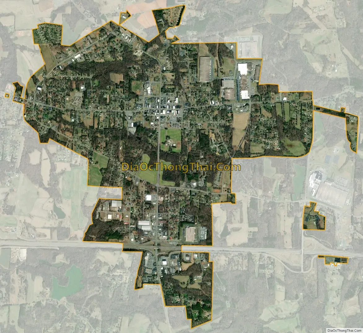
Yadkinville city Satellite Map
Geography
According to the United States Census Bureau, the town has a total area of 2.7 square miles (7.0 km), all land.
See also
Map of North Carolina State and its subdivision:- Alamance
- Alexander
- Alleghany
- Anson
- Ashe
- Avery
- Beaufort
- Bertie
- Bladen
- Brunswick
- Buncombe
- Burke
- Cabarrus
- Caldwell
- Camden
- Carteret
- Caswell
- Catawba
- Chatham
- Cherokee
- Chowan
- Clay
- Cleveland
- Columbus
- Craven
- Cumberland
- Currituck
- Dare
- Davidson
- Davie
- Duplin
- Durham
- Edgecombe
- Forsyth
- Franklin
- Gaston
- Gates
- Graham
- Granville
- Greene
- Guilford
- Halifax
- Harnett
- Haywood
- Henderson
- Hertford
- Hoke
- Hyde
- Iredell
- Jackson
- Johnston
- Jones
- Lee
- Lenoir
- Lincoln
- Macon
- Madison
- Martin
- McDowell
- Mecklenburg
- Mitchell
- Montgomery
- Moore
- Nash
- New Hanover
- Northampton
- Onslow
- Orange
- Pamlico
- Pasquotank
- Pender
- Perquimans
- Person
- Pitt
- Polk
- Randolph
- Richmond
- Robeson
- Rockingham
- Rowan
- Rutherford
- Sampson
- Scotland
- Stanly
- Stokes
- Surry
- Swain
- Transylvania
- Tyrrell
- Union
- Vance
- Wake
- Warren
- Washington
- Watauga
- Wayne
- Wilkes
- Wilson
- Yadkin
- Yancey
- Alabama
- Alaska
- Arizona
- Arkansas
- California
- Colorado
- Connecticut
- Delaware
- District of Columbia
- Florida
- Georgia
- Hawaii
- Idaho
- Illinois
- Indiana
- Iowa
- Kansas
- Kentucky
- Louisiana
- Maine
- Maryland
- Massachusetts
- Michigan
- Minnesota
- Mississippi
- Missouri
- Montana
- Nebraska
- Nevada
- New Hampshire
- New Jersey
- New Mexico
- New York
- North Carolina
- North Dakota
- Ohio
- Oklahoma
- Oregon
- Pennsylvania
- Rhode Island
- South Carolina
- South Dakota
- Tennessee
- Texas
- Utah
- Vermont
- Virginia
- Washington
- West Virginia
- Wisconsin
- Wyoming