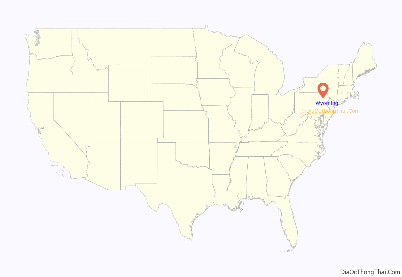
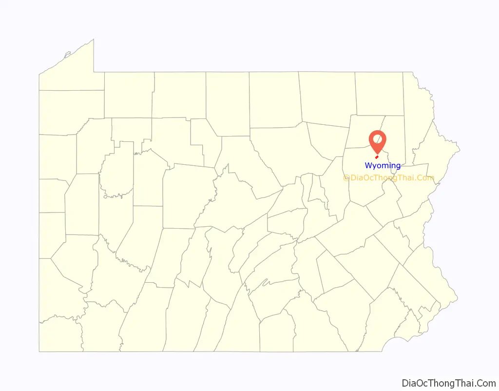
Wyoming is a borough in the Greater Pittston area of Luzerne County, Pennsylvania, United States. It is located 5 miles (8 km) north of Wilkes-Barre, along the Susquehanna River. The population was 3,097 as of the 2020 census.
| Name: | Wyoming borough |
|---|---|
| LSAD Code: | 21 |
| LSAD Description: | borough (suffix) |
| State: | Pennsylvania |
| County: | Luzerne County |
| Incorporated: | 1885 |
| Total Area: | 1.56 sq mi (4.03 km²) |
| Land Area: | 1.43 sq mi (3.69 km²) |
| Water Area: | 0.13 sq mi (0.34 km²) |
| Total Population: | 3,097 |
| Population Density: | 2,111.50/sq mi (815.36/km²) |
| Area code: | 570 |
| FIPS code: | 4286856 |
| Website: | wyomingpa.org |
Online Interactive Map
Click on ![]() to view map in "full screen" mode.
to view map in "full screen" mode.
Wyoming location map. Where is Wyoming borough?
History
Early history
By the 1700s, the Wyoming Valley was inhabited by several Native American tribes (including the Susquehannock and the Delaware). In the mid-18th century, Connecticut settlers ventured into the valley. These were the first recorded Europeans in the region. In 1768, the Susquehanna Company of Connecticut devised a plan to divide the Wyoming Valley into five townships. Each township was to be divided amongst forty settlers. Wyoming was originally part of Kingston Township.
Battle of Wyoming
On June 30, 1778, Loyalist forces, under the command of Major John Butler, arrived in the Wyoming Valley to attack the American settlements. On July 1, Fort Wintermoot at the north end of the valley surrendered without a shot being fired. The next morning the smaller Fort Jenkins surrendered. Both forts were later burned to the ground.
Meanwhile the Patriot militia assembled at Forty Fort. On July 3, a column of roughly 375 men including a company of soldiers in the Continental Army marched from the fort under the command of Lieutenant Colonel Zebulon Butler and Colonel Nathan Denison. Major Butler’s Rangers, with the assistance of about 500 Native American allies, ambushed the oncoming Americans. In the end, nearly 300 Patriot soldiers from the Wyoming Valley were killed during the Battle of Wyoming, commonly known as the Wyoming Massacre.
The next day Colonel Denison surrendered Forty Fort along with several other posts. Widespread looting and burning of buildings occurred throughout the Wyoming Valley subsequent to the capitulation, but non-combatants were not harmed. Most of the inhabitants, however, fled across the Pocono Mountains to Stroudsburg and Easton or down the Susquehanna River to Sunbury.
Wyoming Monument
Today, in the Borough of Wyoming, a monument constructed in the early 1830s marks the gravesite of the casualties of the battle. An annual observance, sponsored by the Wyoming Commemorative Association, takes place at the obelisk grounds to honor the fallen heroes of this Revolutionary War battle. The monument has also been listed on the National Register of Historic Places.
Along with the Wyoming Monument, the Luzerne Presbyterial Institute and Swetland Homestead are also listed on the National Register of Historic Places.
Borough of Wyoming
Wyoming was officially incorporated as a borough in 1885. The Eighth Street Bridge was constructed over the Susquehanna River during the early 20th century; it connected the Borough of Wyoming to Jenkins Township. In 2011, it was demolished and replaced with a new bridge.
The flood of 2011 prompted the evacuation of the Wilkes-Barre Wyoming Valley Airport (in southern Wyoming). The planes were moved to a higher elevation to prevent flood damage; they were relocated to the Wyoming Monument.
Luzerne Presbyterial Institute
Swetland Homestead
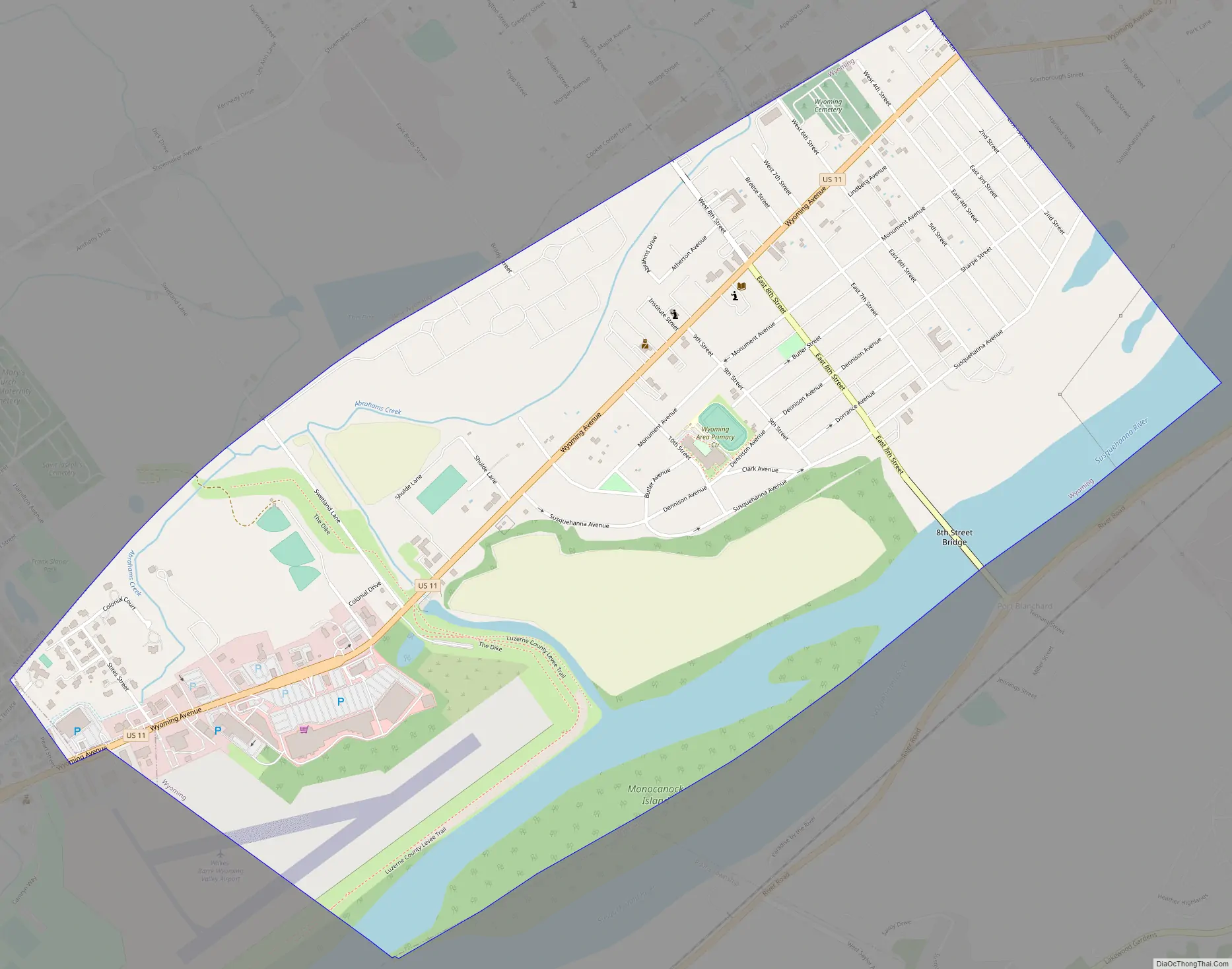
Wyoming Road Map
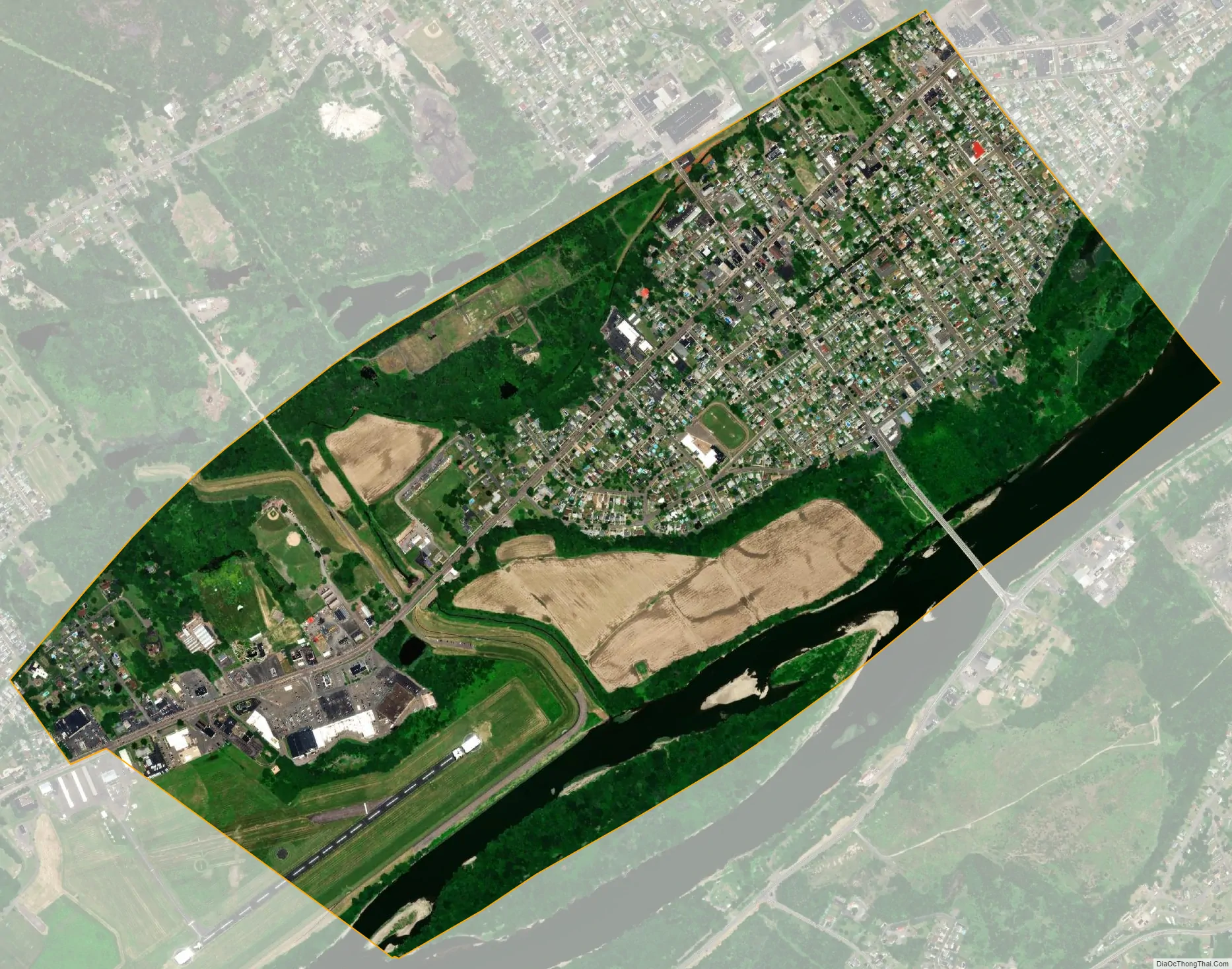
Wyoming city Satellite Map
Geography
Wyoming is located at 41°18′34″N 75°50′13″W / 41.30944°N 75.83694°W / 41.30944; -75.83694 (41.309346, -75.836849). According to the United States Census Bureau, the borough has a total area of 1.6 square miles (4.1 km), of which 1.4 square miles (3.7 km) is land and 0.15 square miles (0.4 km), or 9.26%, is water.
The Borough of Wyoming is a small strip of land on the western bank of the Susquehanna River. The area closest to the river is mostly made up of trees and fertile farmland. Homes and businesses are located further inland. Eighth Street and Wyoming Avenue (U.S. Route 11) run through the heart of the borough. They intersect in the northern half of the community. Many businesses are located along US 11. The Eighth Street Bridge links Wyoming to Jenkins Township, which is on the opposite bank of the Susquehanna River.
A section of the Wilkes-Barre Wyoming Valley Airport is located in southern Wyoming. The airport covers 135 acres (55 ha) at an elevation of 543 feet (166 m). In 2011, the airport had 25,125 aircraft operations (an average of 68 per day). 99.5% was general aviation, while 0.3% was military and 0.2% was air taxi. 51 aircraft were then based at the airport (this consisted of 98% single-engine and 2% multi-engine).
The following communities neighbor Wyoming: West Wyoming Borough (northwest), Exeter Borough (northeast), Jenkins Township (east, southeast), Plains Township (south), and Forty Fort Borough (southwest).
See also
Map of Pennsylvania State and its subdivision:- Adams
- Allegheny
- Armstrong
- Beaver
- Bedford
- Berks
- Blair
- Bradford
- Bucks
- Butler
- Cambria
- Cameron
- Carbon
- Centre
- Chester
- Clarion
- Clearfield
- Clinton
- Columbia
- Crawford
- Cumberland
- Dauphin
- Delaware
- Elk
- Erie
- Fayette
- Forest
- Franklin
- Fulton
- Greene
- Huntingdon
- Indiana
- Jefferson
- Juniata
- Lackawanna
- Lancaster
- Lawrence
- Lebanon
- Lehigh
- Luzerne
- Lycoming
- Mc Kean
- Mercer
- Mifflin
- Monroe
- Montgomery
- Montour
- Northampton
- Northumberland
- Perry
- Philadelphia
- Pike
- Potter
- Schuylkill
- Snyder
- Somerset
- Sullivan
- Susquehanna
- Tioga
- Union
- Venango
- Warren
- Washington
- Wayne
- Westmoreland
- Wyoming
- York
- Alabama
- Alaska
- Arizona
- Arkansas
- California
- Colorado
- Connecticut
- Delaware
- District of Columbia
- Florida
- Georgia
- Hawaii
- Idaho
- Illinois
- Indiana
- Iowa
- Kansas
- Kentucky
- Louisiana
- Maine
- Maryland
- Massachusetts
- Michigan
- Minnesota
- Mississippi
- Missouri
- Montana
- Nebraska
- Nevada
- New Hampshire
- New Jersey
- New Mexico
- New York
- North Carolina
- North Dakota
- Ohio
- Oklahoma
- Oregon
- Pennsylvania
- Rhode Island
- South Carolina
- South Dakota
- Tennessee
- Texas
- Utah
- Vermont
- Virginia
- Washington
- West Virginia
- Wisconsin
- Wyoming


