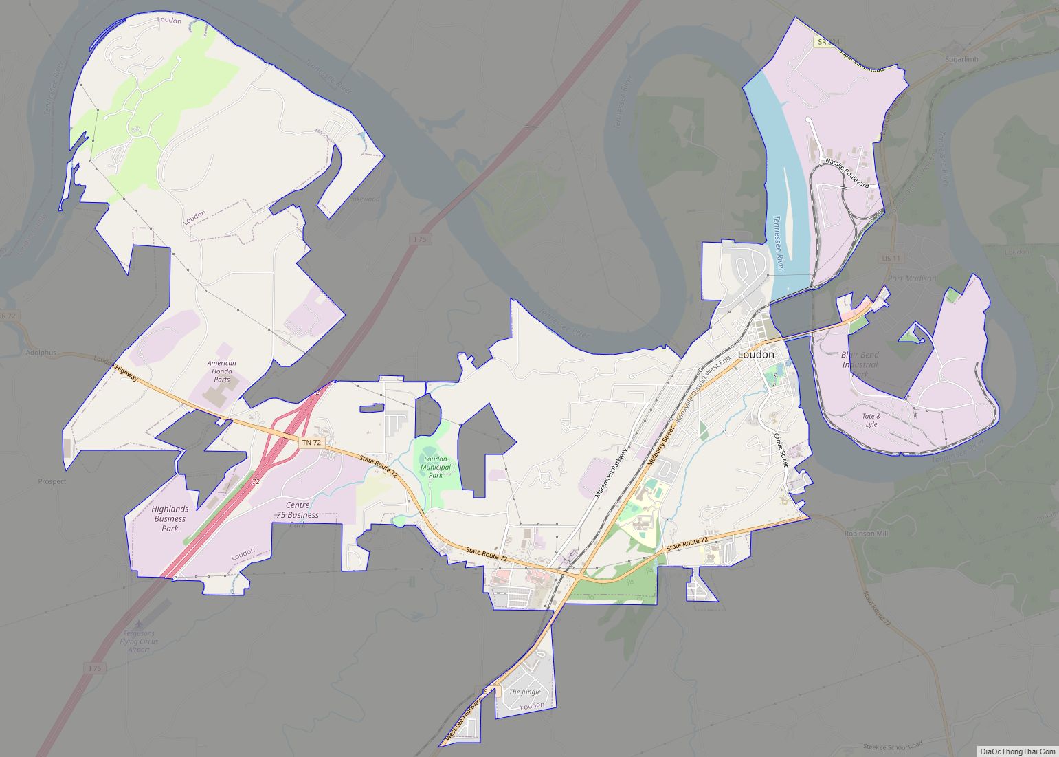
Greenback is a city in Loudon County, Tennessee, United States. Its population was at 1,102, according to the 2020 census. It is included in the Knoxville Metropolitan Statistical Area.
| Name: | Greenback city |
|---|---|
| LSAD Code: | 25 |
| LSAD Description: | city (suffix) |
| State: | Tennessee |
| County: | Loudon County |
| Founded: | 1883 |
| Incorporated: | 1957 |
| Elevation: | 899 ft (274 m) |
| Total Area: | 8.45 sq mi (21.89 km²) |
| Land Area: | 8.31 sq mi (21.53 km²) |
| Water Area: | 0.14 sq mi (0.37 km²) |
| Total Population: | 1,102 |
| Population Density: | 132.60/sq mi (51.20/km²) |
| ZIP code: | 37742 |
| Area code: | 865 |
| FIPS code: | 4730880 |
| GNISfeature ID: | 1286135 |
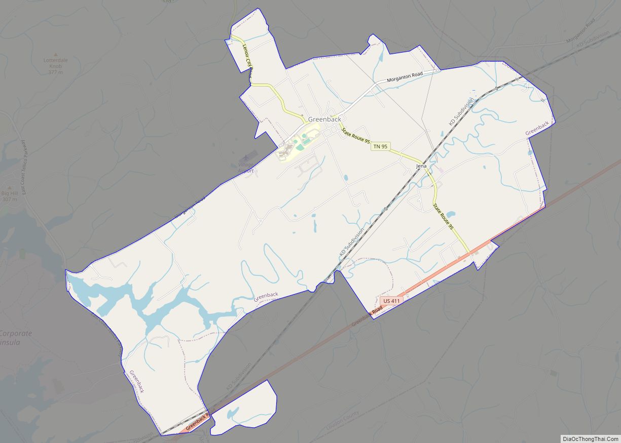
Online Interactive Map
Click on ![]() to view map in "full screen" mode.
to view map in "full screen" mode.
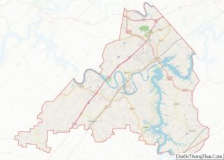
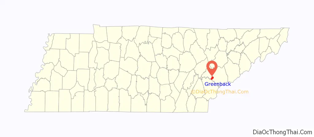
Greenback location map. Where is Greenback city?

History
Early history
Located near modern-day Greenback, Morganton Ferry (initially called Wear’s Ferry) was an important crossing of the Little Tennessee. It was established in the late 18th century, and had grown into a small community known as “Portville” by 1810. The community was chartered as “Morganton” after local merchant Gideon Morgan in 1813. Around this time, the Tellico agent relocated to Fort Southwest Point (now Kingston), and a road quickly developed between this fort and Maryville. Since the road crossed the Little Tennessee at the Morganton Ferry, the road became known locally as Morganton Road.
In the years leading up to the Civil War, a cave in the Morganton and Greenback area is believed to have been a stop on the Underground Railroad, perhaps reflecting the area’s ties to abolitionist-heavy Blount County. The William H. Griffitts House, located just outside Greenback, was also a stop on the Underground Railroad.
In 1859, entrepreneur Jesse Kerr established a hotel and health resort at the mineral-rich Sulphur Springs near the base of Chilhowee Mountain several miles southeast of Morganton (the resort was located near the modern junction of US-129 and TN-336). The resort was connected to Morganton Road by a stagecoach road which roughly paralleled what is now Highway 95. This resort was purchased by Indiana businessman Nathan McCoy in 1885, and a new 3-story, 60-room hotel was completed the following year. The resort was renamed “Allegheny Springs.”
Founding and later history
In 1876, Lorenzo Thompson established Thompson’s Stand, a general store located a few miles east of modern Greenback. In 1882, Thompson applied for federal post office. He initially hoped to use the name “Thompson’s Station,” but the name was already in use. After several other names were rejected, Thompson settled on “Greenback,” a name inspired by the local Greenback Party politician, Jonathan Tipton.
In the late 1880s, the Knoxville Southern Railroad (not to be confused with the larger Southern Railway) began building a rail line connecting Knoxville with Blue Ridge, Georgia. Developers bought up the land surrounding this railroad’s intersection with Morganton Road with plans to develop a town, initially known as “Allegheny” after the resort hotel to the south. Lots were sold, and a depot was constructed in 1891. Thompson moved his post office, still known as “Greenback,” to the Swanay Brothers Store in the new town. The name “Greenback” gradually came to be favored over “Allegheny,” and the railroad changed the name of the station to “Greenback” in 1897.
By the late 1890s, Greenback had three stores, a barbershop, blacksmith shop, school, livery stables, a hotel, and two baseball teams (segregated between white and black players). The Knoxville Southern was purchased by the Marietta and North Georgia Railroad, which was in turn purchased by the Atlanta, Knoxville and Northern Railroad in 1895. The Louisville and Nashville Railroad (L&N), which was building a rail line between Cincinnati and Atlanta, purchased the Atlanta, Knoxville and Northern in 1902. The L&N’s Greenback Depot, completed in 1914, still stands in Greenback, and has since been remodeled by Ron Edmondson as a community events center. The Greenback Drug Company, opened in 1923, still stands and has served as a community restaurant and diner for the past few decades. Locals still call it “the drugstore” and meet there for food and community.
Prior to the Great Depression, thirty-four commercial buildings were constructed in Greenback. Over half of these, however, were destroyed in a series of six major fires during this period. Though the community’s growth slowed, Greenback was officially incorporated in 1957, with Glenn McTeer as its first mayor. A community center— built by the town’s residents with no outside help or outside funding— was completed in 1978. It now houses a library, the city hall, and recreational facilities.
On September 22, 1964, one of the first confrontations between the Tennessee Valley Authority and conservation groups over the proposed Tellico Dam project took place in a meeting at Greenback High School. TVA had called the meeting in hopes of gaining the support of locals, and the agency was surprised when most of the 400 or so in attendance vehemently opposed the project. TVA Chairman Aubrey Wagner, who spoke on the Authority’s behalf, was continuously interrupted throughout his speech. At one point, Wagner was shouted down by legendary Monroe County judge Sue K. Hicks, who as president of the Fort Loudoun Association feared the destruction of the historic fort’s site by the proposed dam’s reservoir.
In 2011, H&R Block featured Greenback in its national advertising campaign. The campaign, known as “Greenbacks for Greenback,” included a review of many of the citizens’ taxes – a program H&R Block calls “second look.” The campaign saved locals more than $14,000 in taxes. The savings were revealed in a celebration with the community at Greenback School. Television, radio and print advertising featured the historic Greenback Depot, the Greenback Drugstore Diner, Greenback School and the Greenback Historical Society as well as many people who call Greenback home.
Greenback Road Map

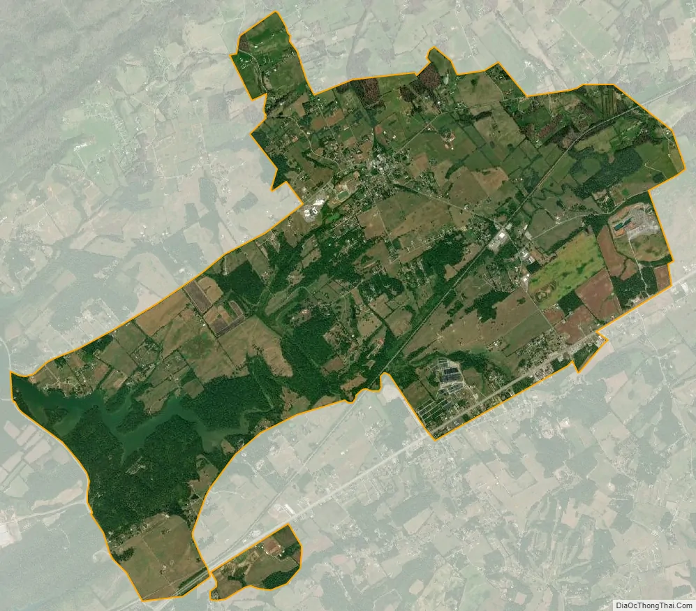
Greenback city Satellite Map
Geography
Greenback is located at 35°39′21″N 84°09′54″W / 35.655751°N 84.164898°W / 35.655751; -84.164898 (35.655751, -84.164898). The city is situated around the junction of Tennessee State Route 95 and Morganton Road, with the greater community extending to U.S. Route 411 to the south and U.S. Route 321 to the north, and along Morganton Road westward to East Tellico Parkway (which follows the shores of Tellico Lake). A small commercial area is located around the intersection of Highway 411 and Highway 95.
The relatively flat land in and around Greenback is part of a valley carved by Baker Creek, a tributary of the Little Tennessee River. Chilhowee Mountain and the Great Smoky Mountains are visible to the south. The Red Knobs, part of a heavily dissected ridge typical of the Appalachian Ridge-and-Valley range, rise just north of Greenback’s city limits.
According to the United States Census Bureau, the city has a total area of 7.2 square miles (19 km), of which 7.1 square miles (18 km) is land and 0.1 square miles (0.26 km) (1.80%) is water.
See also
Map of Tennessee State and its subdivision:- Anderson
- Bedford
- Benton
- Bledsoe
- Blount
- Bradley
- Campbell
- Cannon
- Carroll
- Carter
- Cheatham
- Chester
- Claiborne
- Clay
- Cocke
- Coffee
- Crockett
- Cumberland
- Davidson
- Decatur
- DeKalb
- Dickson
- Dyer
- Fayette
- Fentress
- Franklin
- Gibson
- Giles
- Grainger
- Greene
- Grundy
- Hamblen
- Hamilton
- Hancock
- Hardeman
- Hardin
- Hawkins
- Haywood
- Henderson
- Henry
- Hickman
- Houston
- Humphreys
- Jackson
- Jefferson
- Johnson
- Knox
- Lake
- Lauderdale
- Lawrence
- Lewis
- Lincoln
- Loudon
- Macon
- Madison
- Marion
- Marshall
- Maury
- McMinn
- McNairy
- Meigs
- Monroe
- Montgomery
- Moore
- Morgan
- Obion
- Overton
- Perry
- Pickett
- Polk
- Putnam
- Rhea
- Roane
- Robertson
- Rutherford
- Scott
- Sequatchie
- Sevier
- Shelby
- Smith
- Stewart
- Sullivan
- Sumner
- Tipton
- Trousdale
- Unicoi
- Union
- Van Buren
- Warren
- Washington
- Wayne
- Weakley
- White
- Williamson
- Wilson
- Alabama
- Alaska
- Arizona
- Arkansas
- California
- Colorado
- Connecticut
- Delaware
- District of Columbia
- Florida
- Georgia
- Hawaii
- Idaho
- Illinois
- Indiana
- Iowa
- Kansas
- Kentucky
- Louisiana
- Maine
- Maryland
- Massachusetts
- Michigan
- Minnesota
- Mississippi
- Missouri
- Montana
- Nebraska
- Nevada
- New Hampshire
- New Jersey
- New Mexico
- New York
- North Carolina
- North Dakota
- Ohio
- Oklahoma
- Oregon
- Pennsylvania
- Rhode Island
- South Carolina
- South Dakota
- Tennessee
- Texas
- Utah
- Vermont
- Virginia
- Washington
- West Virginia
- Wisconsin
- Wyoming