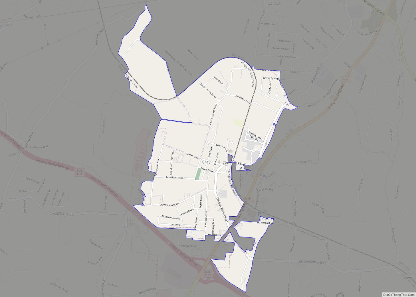
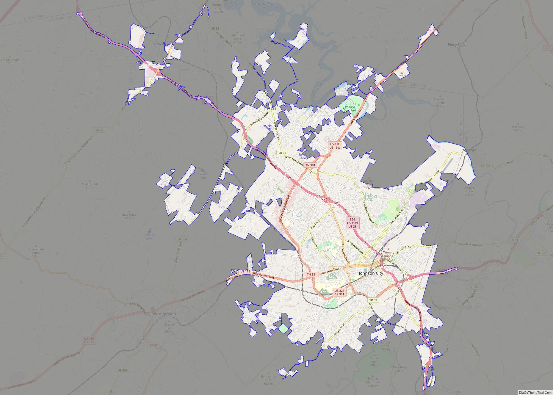
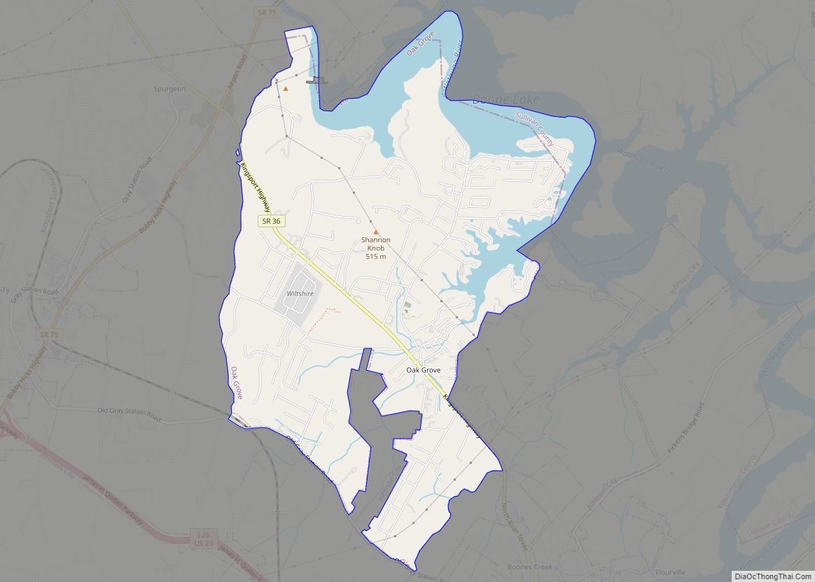
Gray is a census-designated place (CDP) in Washington County, Tennessee, United States and a suburb of Johnson City. It is part of the Johnson City Metropolitan Statistical Area, which is a component of the Johnson City–Kingsport–Bristol, TN-VA Combined Statistical Area – commonly known as the “Tri-Cities” region. The population was 1,222 at the 2010 census.
Gray lies just outside the junction between Interstate 81 and Interstate 26, the latter of which runs directly through the town. The town was founded as Gray Station, Tennessee, as it mainly served as a railway depot; the place became Gray in preferred usage. The Gray area consisted primarily of rural farmland until the 1990s, when some suburban areas began to take shape. Since 2000, the Gray area has gradually grown each year, with the addition of new chain restaurants and a museum known as the Gray Fossil Site. Some of the area has been annexed by Johnson City.
| Name: | Gray CDP |
|---|---|
| LSAD Code: | 57 |
| LSAD Description: | CDP (suffix) |
| State: | Tennessee |
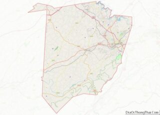
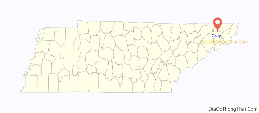
| County: | Washington County |
| Elevation: | 1,575 ft (480 m) |
| Total Area: | 1.49 sq mi (3.86 km²) |
| Land Area: | 1.49 sq mi (3.85 km²) |
| Water Area: | 0.01 sq mi (0.01 km²) |
| Total Population: | 1,293 |
| Population Density: | 870.12/sq mi (335.95/km²) |
| ZIP code: | 37615 |
| Area code: | 423 |
| FIPS code: | 4730700 |
| GNISfeature ID: | 1285984 |
Online Interactive Map
Click on ![]() to view map in "full screen" mode.
to view map in "full screen" mode.
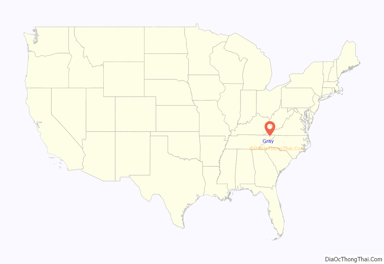
Gray location map. Where is Gray CDP?
Gray Road Map
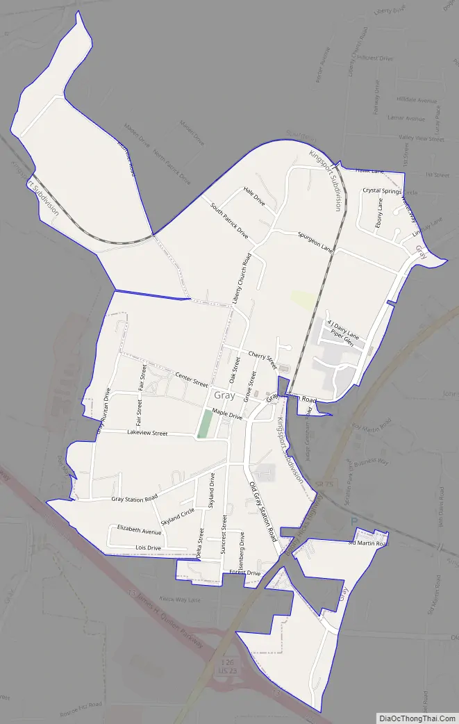
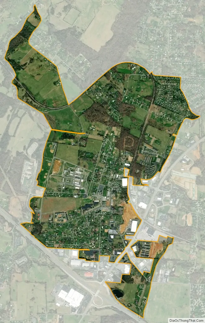
Gray city Satellite Map
Geography
Gray is located at 36°25′3″N 82°28′32″W / 36.41750°N 82.47556°W / 36.41750; -82.47556 (36.417403, -82.475637).
According to the United States Census Bureau, the CDP has a total area of 1.5 square miles (3.9 km), of which, 1.5 square miles (3.9 km) of it is land and 0.33% is water.
See also
Map of Tennessee State and its subdivision:- Anderson
- Bedford
- Benton
- Bledsoe
- Blount
- Bradley
- Campbell
- Cannon
- Carroll
- Carter
- Cheatham
- Chester
- Claiborne
- Clay
- Cocke
- Coffee
- Crockett
- Cumberland
- Davidson
- Decatur
- DeKalb
- Dickson
- Dyer
- Fayette
- Fentress
- Franklin
- Gibson
- Giles
- Grainger
- Greene
- Grundy
- Hamblen
- Hamilton
- Hancock
- Hardeman
- Hardin
- Hawkins
- Haywood
- Henderson
- Henry
- Hickman
- Houston
- Humphreys
- Jackson
- Jefferson
- Johnson
- Knox
- Lake
- Lauderdale
- Lawrence
- Lewis
- Lincoln
- Loudon
- Macon
- Madison
- Marion
- Marshall
- Maury
- McMinn
- McNairy
- Meigs
- Monroe
- Montgomery
- Moore
- Morgan
- Obion
- Overton
- Perry
- Pickett
- Polk
- Putnam
- Rhea
- Roane
- Robertson
- Rutherford
- Scott
- Sequatchie
- Sevier
- Shelby
- Smith
- Stewart
- Sullivan
- Sumner
- Tipton
- Trousdale
- Unicoi
- Union
- Van Buren
- Warren
- Washington
- Wayne
- Weakley
- White
- Williamson
- Wilson
- Alabama
- Alaska
- Arizona
- Arkansas
- California
- Colorado
- Connecticut
- Delaware
- District of Columbia
- Florida
- Georgia
- Hawaii
- Idaho
- Illinois
- Indiana
- Iowa
- Kansas
- Kentucky
- Louisiana
- Maine
- Maryland
- Massachusetts
- Michigan
- Minnesota
- Mississippi
- Missouri
- Montana
- Nebraska
- Nevada
- New Hampshire
- New Jersey
- New Mexico
- New York
- North Carolina
- North Dakota
- Ohio
- Oklahoma
- Oregon
- Pennsylvania
- Rhode Island
- South Carolina
- South Dakota
- Tennessee
- Texas
- Utah
- Vermont
- Virginia
- Washington
- West Virginia
- Wisconsin
- Wyoming