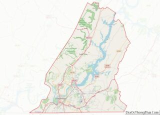
Harrison is a census-designated place (CDP) in Hamilton County, Tennessee, United States. The population was 7,902 at the 2020 census. It is part of the Chattanooga metropolitan area. Harrison Bay State Park, the Hamilton County Landfill, Bear Trace Golf Course, a course designed by Jack Nicklaus, and Skull Island, a recreational area owned by TVA, are all located in Harrison.
| Name: | Harrison CDP |
|---|---|
| LSAD Code: | 57 |
| LSAD Description: | CDP (suffix) |
| State: | Tennessee |
| County: | Hamilton County |
| Elevation: | 768 ft (234 m) |
| Total Area: | 8.59 sq mi (22.25 km²) |
| Land Area: | 6.74 sq mi (17.46 km²) |
| Water Area: | 1.85 sq mi (4.78 km²) |
| Total Population: | 7,902 |
| Population Density: | 1,172.06/sq mi (452.50/km²) |
| ZIP code: | 37341 |
| Area code: | 423 |
| FIPS code: | 4732600 |
| GNISfeature ID: | 1286997 |
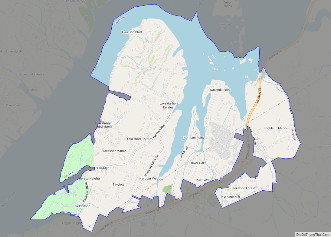
Online Interactive Map
Click on ![]() to view map in "full screen" mode.
to view map in "full screen" mode.
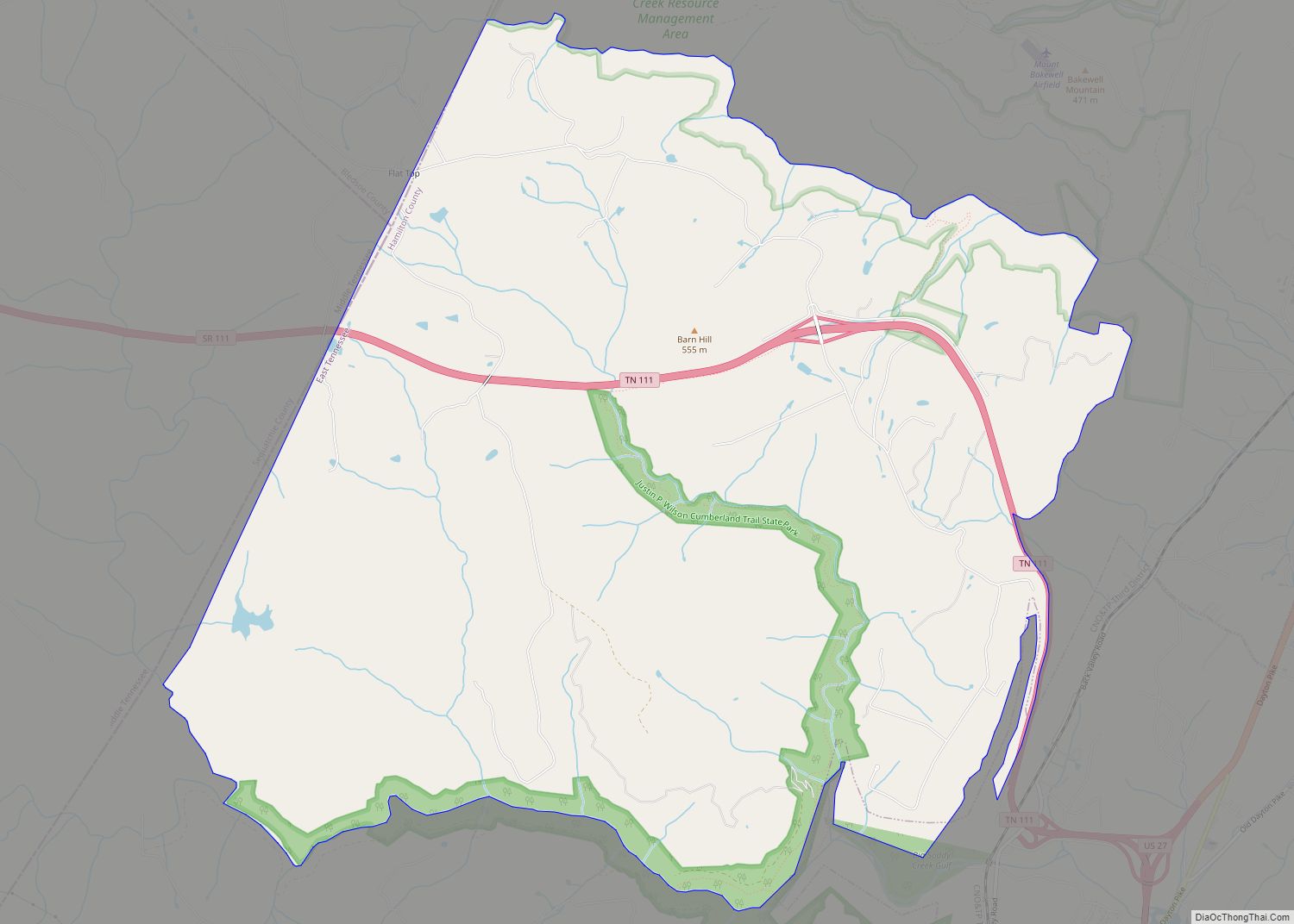
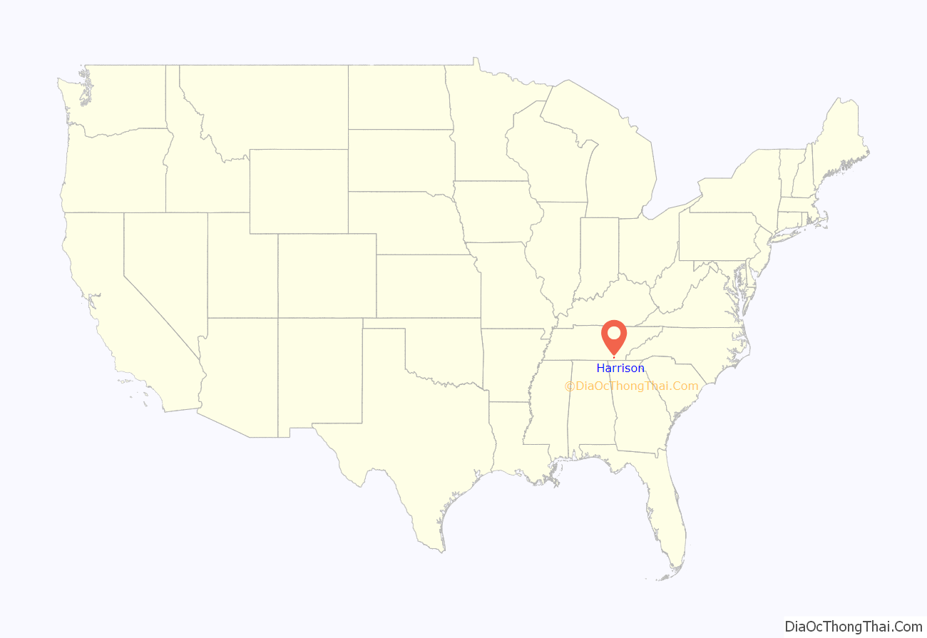
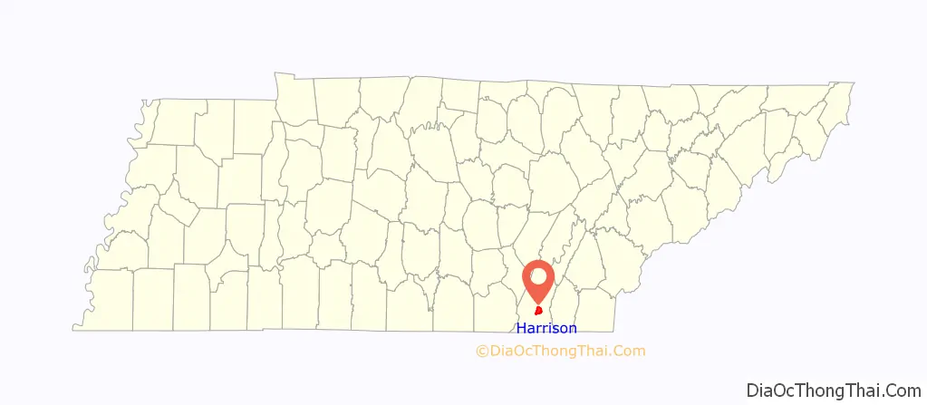
Harrison location map. Where is Harrison CDP?
History
The town developed southeast of Vann’s Ferry (Vann Town), a ferry crossing established by James Vann, a prominent Cherokee trader and planter. It was later named Harrison after President William Henry Harrison and became the seat of Hamilton County in 1840. The county seat was later moved to Chattanooga, Tennessee, after the Civil War. The first post office was opened on June 16, 1841. In 1870 the Hamilton County Courthouse was moved from Harrison to Chattanooga.
Harrison’s borders were once larger than today. When the Chickamauga Dam was completed on the Tennessee River by the Tennessee Valley Authority in 1940, much of the city was flooded, as portrayed in the 1960 movie Wild River. Some parts of the old city, such as old building foundations, roads, and guard rails, can still be seen, especially in and around Harrison Bay, named for the submerged town. Harrison Bay State Park is a TVA-built park in the area now.
Harrison Road Map

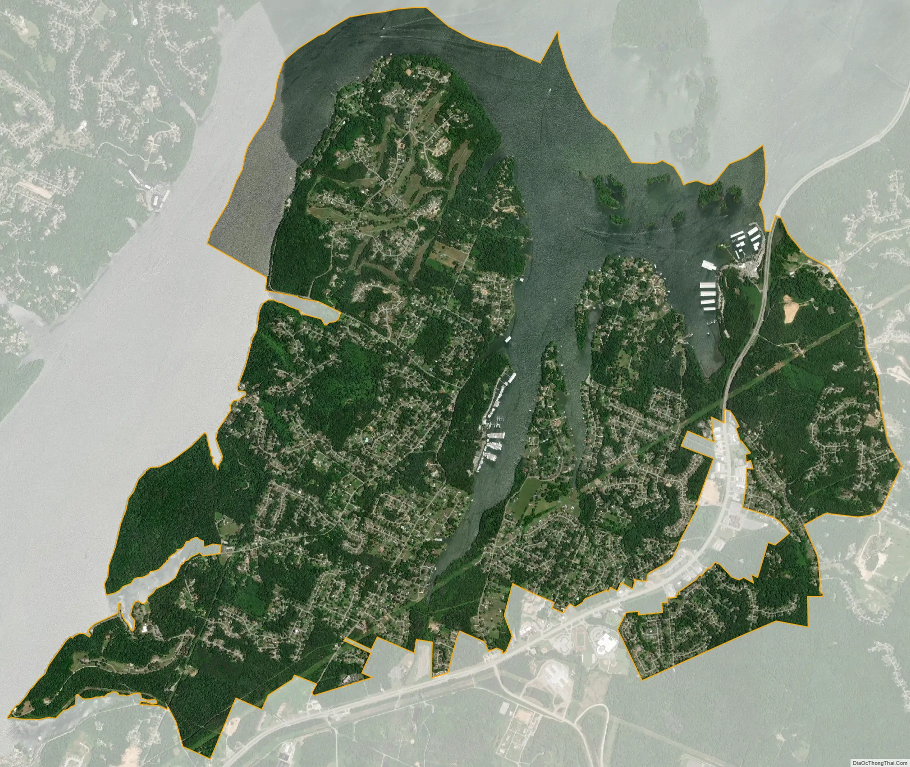
Harrison city Satellite Map
Geography
Harrison is located at 35°7′9″N 85°8′58″W / 35.11917°N 85.14944°W / 35.11917; -85.14944 (35.119296, -85.149487).
According to the United States Census Bureau, the CDP has a total area of 9.0 square miles (23 km), of which, 7.1 square miles (18 km) of it is land and 1.8 square miles (4.7 km) of it (20.57%) is water.
See also
Map of Tennessee State and its subdivision:- Anderson
- Bedford
- Benton
- Bledsoe
- Blount
- Bradley
- Campbell
- Cannon
- Carroll
- Carter
- Cheatham
- Chester
- Claiborne
- Clay
- Cocke
- Coffee
- Crockett
- Cumberland
- Davidson
- Decatur
- DeKalb
- Dickson
- Dyer
- Fayette
- Fentress
- Franklin
- Gibson
- Giles
- Grainger
- Greene
- Grundy
- Hamblen
- Hamilton
- Hancock
- Hardeman
- Hardin
- Hawkins
- Haywood
- Henderson
- Henry
- Hickman
- Houston
- Humphreys
- Jackson
- Jefferson
- Johnson
- Knox
- Lake
- Lauderdale
- Lawrence
- Lewis
- Lincoln
- Loudon
- Macon
- Madison
- Marion
- Marshall
- Maury
- McMinn
- McNairy
- Meigs
- Monroe
- Montgomery
- Moore
- Morgan
- Obion
- Overton
- Perry
- Pickett
- Polk
- Putnam
- Rhea
- Roane
- Robertson
- Rutherford
- Scott
- Sequatchie
- Sevier
- Shelby
- Smith
- Stewart
- Sullivan
- Sumner
- Tipton
- Trousdale
- Unicoi
- Union
- Van Buren
- Warren
- Washington
- Wayne
- Weakley
- White
- Williamson
- Wilson
- Alabama
- Alaska
- Arizona
- Arkansas
- California
- Colorado
- Connecticut
- Delaware
- District of Columbia
- Florida
- Georgia
- Hawaii
- Idaho
- Illinois
- Indiana
- Iowa
- Kansas
- Kentucky
- Louisiana
- Maine
- Maryland
- Massachusetts
- Michigan
- Minnesota
- Mississippi
- Missouri
- Montana
- Nebraska
- Nevada
- New Hampshire
- New Jersey
- New Mexico
- New York
- North Carolina
- North Dakota
- Ohio
- Oklahoma
- Oregon
- Pennsylvania
- Rhode Island
- South Carolina
- South Dakota
- Tennessee
- Texas
- Utah
- Vermont
- Virginia
- Washington
- West Virginia
- Wisconsin
- Wyoming