Lakesite is a city in Hamilton County, Tennessee, United States. The population was 1,856 at the 2020 census. It is a northern suburb of the Chattanooga, TN–GA Metropolitan Statistical Area, located 15 miles north of the city.
| Name: | Lakesite city |
|---|---|
| LSAD Code: | 25 |
| LSAD Description: | city (suffix) |
| State: | Tennessee |
| County: | Hamilton County |
| Incorporated: | 1972 |
| Elevation: | 748 ft (228 m) |
| Total Area: | 1.74 sq mi (4.51 km²) |
| Land Area: | 1.74 sq mi (4.51 km²) |
| Water Area: | 0.00 sq mi (0.00 km²) |
| Total Population: | 1,856 |
| Population Density: | 1,066.67/sq mi (411.81/km²) |
| FIPS code: | 4740540 |
| GNISfeature ID: | 1290516 |
| Website: | http://www.lakesitetn.gov/ |
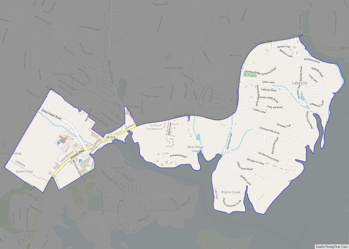
Online Interactive Map
Click on ![]() to view map in "full screen" mode.
to view map in "full screen" mode.
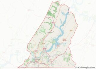
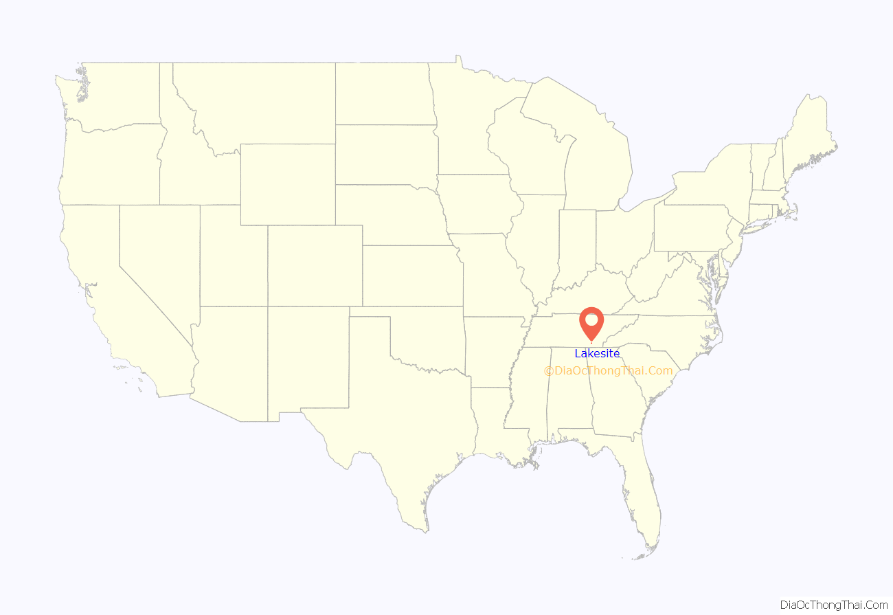
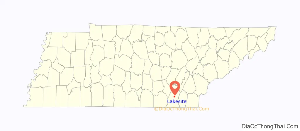
Lakesite location map. Where is Lakesite city?
History
Lakesite was incorporated in 1972 from the efforts of Ray Dodson and Hans Bingham. Upon incorporating, the suburb consisted of 200 homes and a population of 500. In 1994 the neighborhood had grown to about 900 and residents petitioned the Lakesite City Commission for annexation. Upon the annexation, which was completed in mid-1995, the population grew to 1,499 and the land increased 66%.
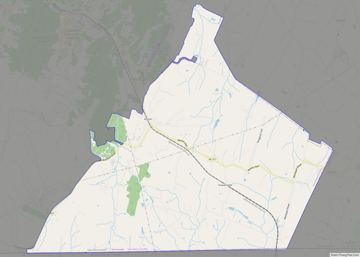
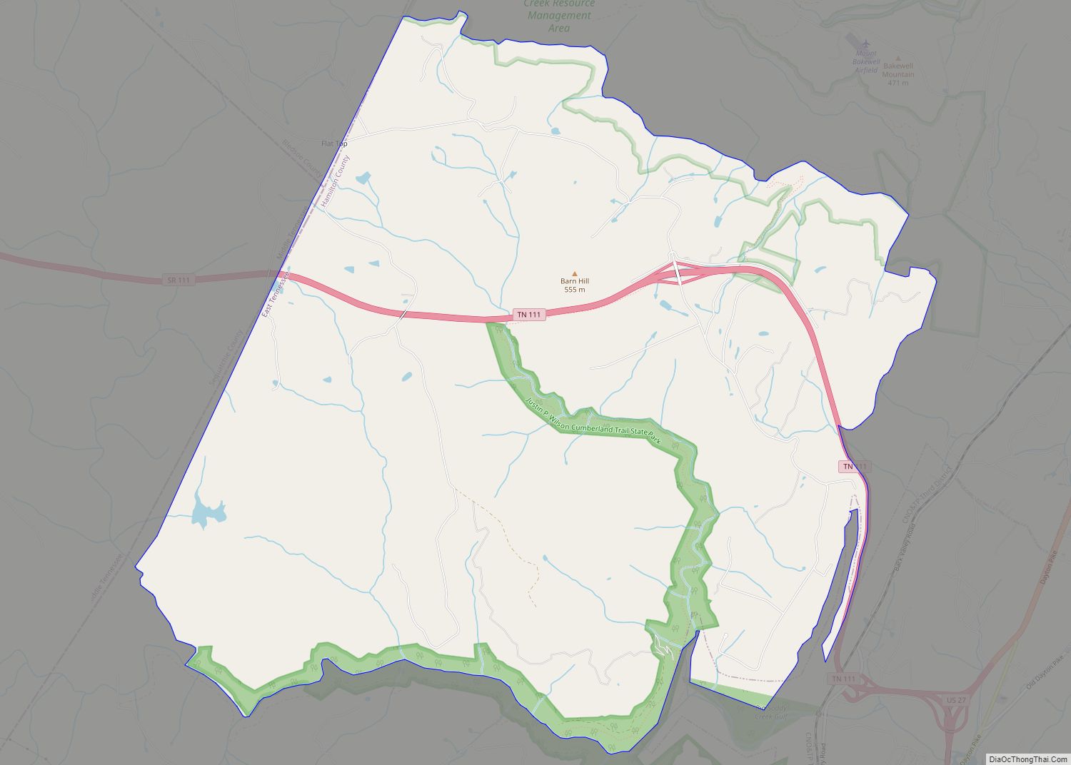
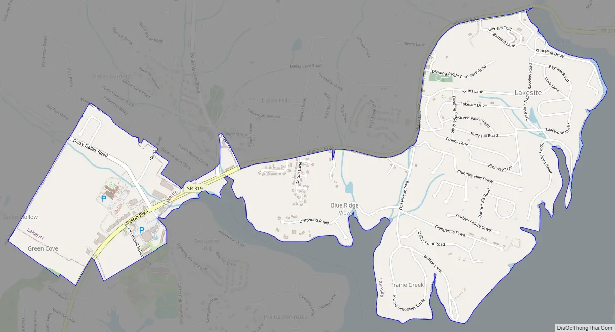
Lakesite Road Map
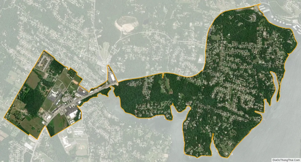
Lakesite city Satellite Map
Geography
Lakesite is located at 35°12′21″N 85°8′11″W / 35.20583°N 85.13639°W / 35.20583; -85.13639 (35.205735, -85.136357).
According to the United States Census Bureau, the city has a total area of 1.7 square miles (4.4 km), all of it land.
See also
Map of Tennessee State and its subdivision:- Anderson
- Bedford
- Benton
- Bledsoe
- Blount
- Bradley
- Campbell
- Cannon
- Carroll
- Carter
- Cheatham
- Chester
- Claiborne
- Clay
- Cocke
- Coffee
- Crockett
- Cumberland
- Davidson
- Decatur
- DeKalb
- Dickson
- Dyer
- Fayette
- Fentress
- Franklin
- Gibson
- Giles
- Grainger
- Greene
- Grundy
- Hamblen
- Hamilton
- Hancock
- Hardeman
- Hardin
- Hawkins
- Haywood
- Henderson
- Henry
- Hickman
- Houston
- Humphreys
- Jackson
- Jefferson
- Johnson
- Knox
- Lake
- Lauderdale
- Lawrence
- Lewis
- Lincoln
- Loudon
- Macon
- Madison
- Marion
- Marshall
- Maury
- McMinn
- McNairy
- Meigs
- Monroe
- Montgomery
- Moore
- Morgan
- Obion
- Overton
- Perry
- Pickett
- Polk
- Putnam
- Rhea
- Roane
- Robertson
- Rutherford
- Scott
- Sequatchie
- Sevier
- Shelby
- Smith
- Stewart
- Sullivan
- Sumner
- Tipton
- Trousdale
- Unicoi
- Union
- Van Buren
- Warren
- Washington
- Wayne
- Weakley
- White
- Williamson
- Wilson
- Alabama
- Alaska
- Arizona
- Arkansas
- California
- Colorado
- Connecticut
- Delaware
- District of Columbia
- Florida
- Georgia
- Hawaii
- Idaho
- Illinois
- Indiana
- Iowa
- Kansas
- Kentucky
- Louisiana
- Maine
- Maryland
- Massachusetts
- Michigan
- Minnesota
- Mississippi
- Missouri
- Montana
- Nebraska
- Nevada
- New Hampshire
- New Jersey
- New Mexico
- New York
- North Carolina
- North Dakota
- Ohio
- Oklahoma
- Oregon
- Pennsylvania
- Rhode Island
- South Carolina
- South Dakota
- Tennessee
- Texas
- Utah
- Vermont
- Virginia
- Washington
- West Virginia
- Wisconsin
- Wyoming