Ridgeside is a city in Hamilton County, Tennessee, United States. The population was 446 at the 2020 census and estimated to be 432 in 2018. Ridgeside is an enclave, as it is completely surrounded by the city limits of Chattanooga. It is part of the Chattanooga, TN–GA Metropolitan Statistical Area. Ridgeside’s name is derived from its location on the eastern slope (side) of Missionary Ridge. Locally, the city is also known as Shepherd Hills, after the bigger of its two subdivisions, the other being Crescent Park.
| Name: | Ridgeside city |
|---|---|
| LSAD Code: | 25 |
| LSAD Description: | city (suffix) |
| State: | Tennessee |
| County: | Hamilton County |
| Incorporated: | 1931 |
| Elevation: | 846 ft (258 m) |
| Total Area: | 0.17 sq mi (0.44 km²) |
| Land Area: | 0.17 sq mi (0.44 km²) |
| Water Area: | 0.00 sq mi (0.00 km²) |
| Population Density: | 2,639.05/sq mi (1,016.28/km²) |
| ZIP code: | 37411 |
| Area code: | 423 |
| FIPS code: | 4763080 |
| GNISfeature ID: | 1299404 |
| Website: | www.ridgeside.net |
Online Interactive Map
Click on ![]() to view map in "full screen" mode.
to view map in "full screen" mode.
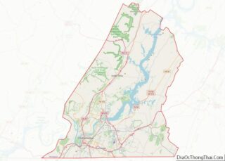
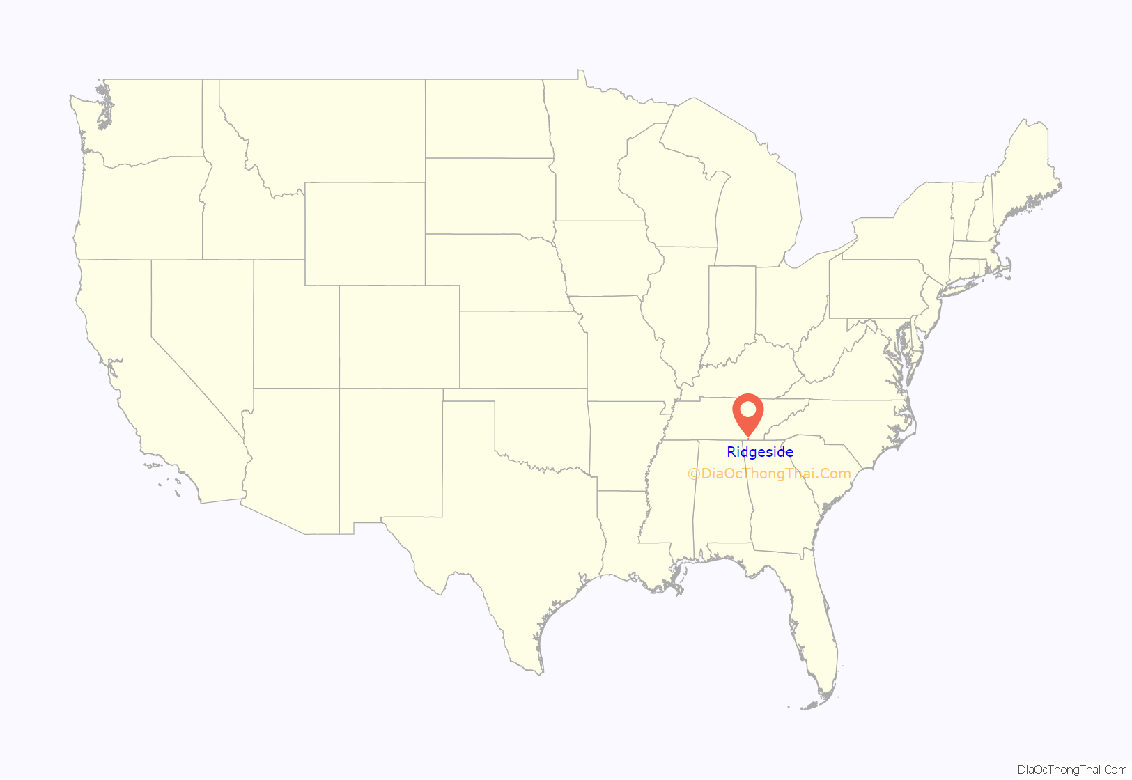
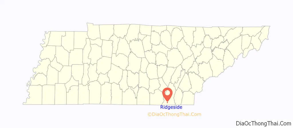
Ridgeside location map. Where is Ridgeside city?
History
Ridgeside is rooted in a dairy farm operated by John T. Shepherd in the early 1900s. In 1922, John’s son, Paul, began building the “Shepherd Hills” subdivision, which was completed in 1952. Shepherd Hills incorporated as a city with the name “Ridgeside” in 1931, in part to avoid being annexed by rapidly growing Chattanooga.
Police services for the city of Ridgeside is served by the East Ridge Police, although at one time the city had its own police department.
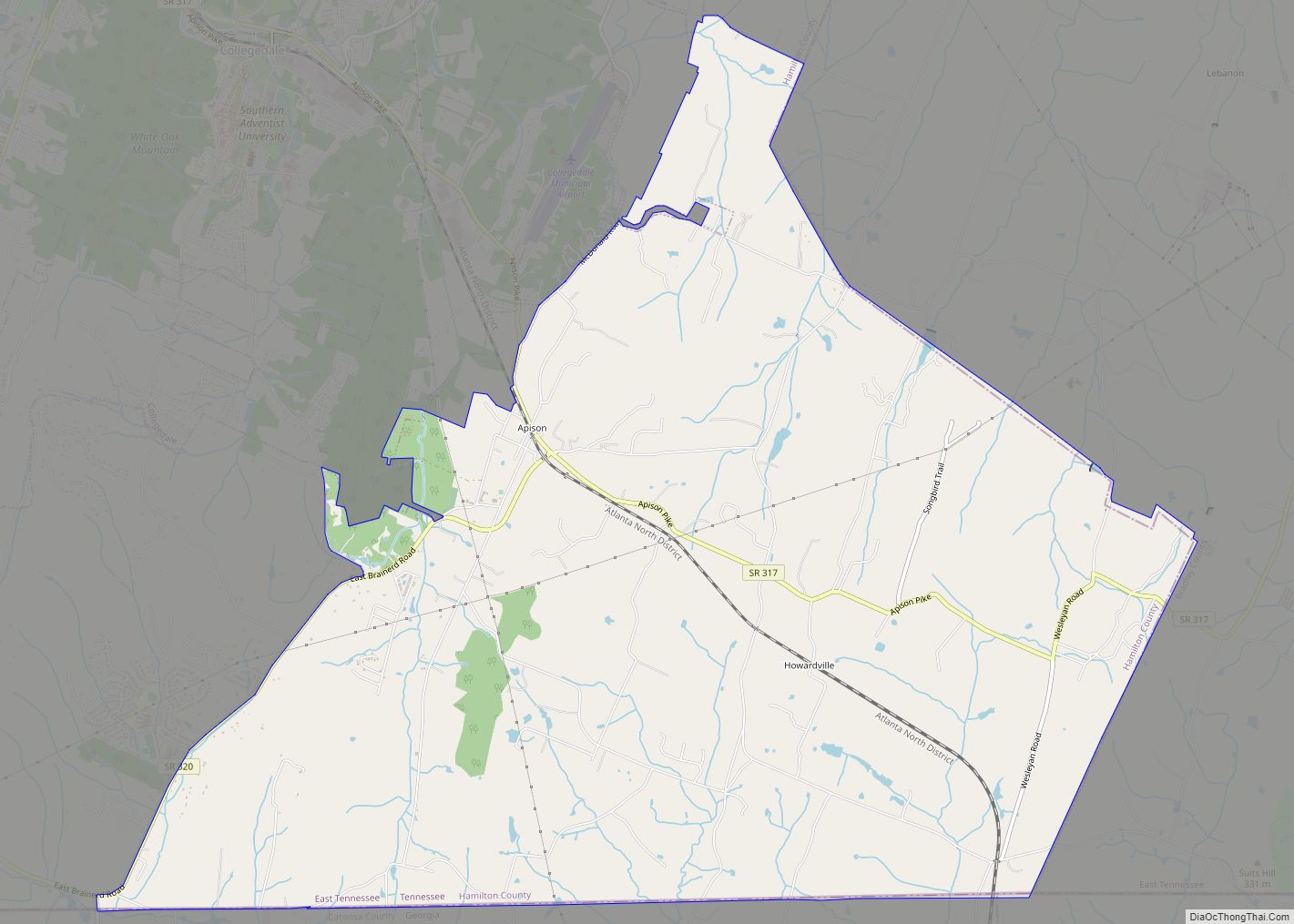
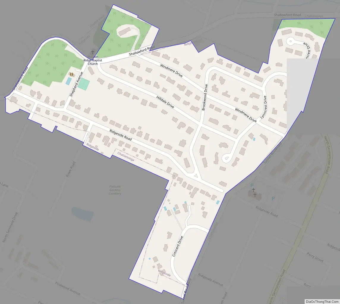
Ridgeside Road Map
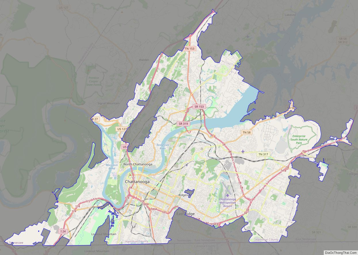
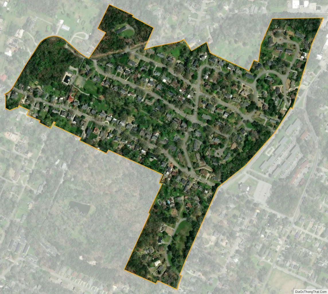
Ridgeside city Satellite Map
Geography
Ridgeside is located in southwestern Hamilton County at 35°02′06″N 85°14′53″W / 35.034975°N 85.248112°W / 35.034975; -85.248112. It is surrounded by the city of Chattanooga and is 4 miles (6 km) east of that city’s downtown.
According to the United States Census Bureau, the city has a total area of 0.2 square miles (0.4 km), all of it land.
See also
Map of Tennessee State and its subdivision:- Anderson
- Bedford
- Benton
- Bledsoe
- Blount
- Bradley
- Campbell
- Cannon
- Carroll
- Carter
- Cheatham
- Chester
- Claiborne
- Clay
- Cocke
- Coffee
- Crockett
- Cumberland
- Davidson
- Decatur
- DeKalb
- Dickson
- Dyer
- Fayette
- Fentress
- Franklin
- Gibson
- Giles
- Grainger
- Greene
- Grundy
- Hamblen
- Hamilton
- Hancock
- Hardeman
- Hardin
- Hawkins
- Haywood
- Henderson
- Henry
- Hickman
- Houston
- Humphreys
- Jackson
- Jefferson
- Johnson
- Knox
- Lake
- Lauderdale
- Lawrence
- Lewis
- Lincoln
- Loudon
- Macon
- Madison
- Marion
- Marshall
- Maury
- McMinn
- McNairy
- Meigs
- Monroe
- Montgomery
- Moore
- Morgan
- Obion
- Overton
- Perry
- Pickett
- Polk
- Putnam
- Rhea
- Roane
- Robertson
- Rutherford
- Scott
- Sequatchie
- Sevier
- Shelby
- Smith
- Stewart
- Sullivan
- Sumner
- Tipton
- Trousdale
- Unicoi
- Union
- Van Buren
- Warren
- Washington
- Wayne
- Weakley
- White
- Williamson
- Wilson
- Alabama
- Alaska
- Arizona
- Arkansas
- California
- Colorado
- Connecticut
- Delaware
- District of Columbia
- Florida
- Georgia
- Hawaii
- Idaho
- Illinois
- Indiana
- Iowa
- Kansas
- Kentucky
- Louisiana
- Maine
- Maryland
- Massachusetts
- Michigan
- Minnesota
- Mississippi
- Missouri
- Montana
- Nebraska
- Nevada
- New Hampshire
- New Jersey
- New Mexico
- New York
- North Carolina
- North Dakota
- Ohio
- Oklahoma
- Oregon
- Pennsylvania
- Rhode Island
- South Carolina
- South Dakota
- Tennessee
- Texas
- Utah
- Vermont
- Virginia
- Washington
- West Virginia
- Wisconsin
- Wyoming