Barrington is a village in Cook County and Lake County, Illinois, United States. The population was 10,722 at the 2020 census. A northwest suburb of Chicago, the area features wetlands, forest preserves, parks, and horse trails in a country-suburban setting.
Barrington is part of the Chicago metropolitan area and serves as the hub of activity for the surrounding 90-square-mile (230 km) region.
| Name: | Barrington village |
|---|---|
| LSAD Code: | 47 |
| LSAD Description: | village (suffix) |
| State: | Illinois |
| County: | Cook County, Lake County |
| Founded: | 1865 |
| Elevation: | 830 ft (250 m) |
| Total Area: | 4.79 sq mi (12.41 km²) |
| Land Area: | 4.61 sq mi (11.93 km²) |
| Water Area: | 0.19 sq mi (0.48 km²) |
| Total Population: | 10,722 |
| Population Density: | 2,327.33/sq mi (898.50/km²) |
| FIPS code: | 1703844 |
| Website: | www.barrington-il.gov |
Online Interactive Map
Click on ![]() to view map in "full screen" mode.
to view map in "full screen" mode.
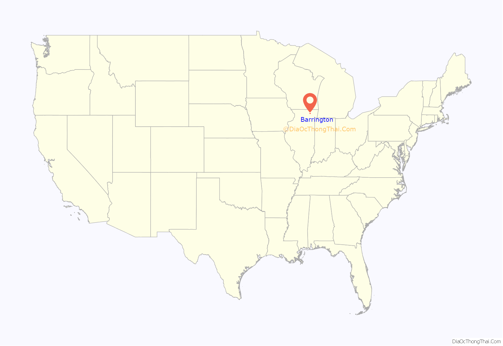
Barrington location map. Where is Barrington village?
History
Early history
The original settlers of the Barrington area were the indigenous peoples of the Native American Prairie Potawatomi or Mascoutin tribes, which later divided into the Potawatomi, Chippewa, and Ottawa tribes. Many local roads still in use today, including Algonquin Road, Rand Road, Higgins Road, and St. Charles Road, were originally Native American trails. For many years, Barrington was considered part of the Northwest Territory, then the Illinois Territory.
19th century
By treaty dated September 26, 1833, ending the Black Hawk War, the Chippewa, Ottawa and Potawatomi tribes ceded to the United States all lands from the west shore of Lake Michigan west to the area that the Winnebago tribe ceded in 1832, north to the area that the Menominees had previously ceded to the United States, and south to the area previously ceded by an 1829 treaty at Prairie du Chien, a total of approximately 5,000,000 acres (20,000 km). Through this treaty, the Sacs, Fox, Winnebago, Chippewa, Ottawa and Pottawatomi tribes ceded all title to the area east of the Mississippi River. Between 1833 and 1835, the U.S. government paid approximately $100,000 in annuities and grants to the Potawatomi, Ottawa, and Chippewa tribes, presumably as payment for the land.
Following this treaty, pioneers traveling from Troy, New York, via Fort Dearborn (now the city of Chicago) to live in Cuba Township in Lake County. The first white pioneers known to have settled in Barrington township were Jesse F. Miller and William Van Orsdal of Steuben County, New York, who arrived in 1834, before the three-year period which had been given the Native Americans to vacate the region, and before local land surveys. Other settlers from Vermont and New York settled in what is now the northwest corner of Cook County.
The combined settlement of these pioneers, located at the intersection of Illinois Route 68 and Sutton Road, was originally called Miller Grove due to the number of families with that surname but later renamed Barrington Center because it “centered” both ways from the present Sutton Road and from Algonquin and Higgins roads. Although residents and historians agree that the name Barrington was taken from Great Barrington in Berkshire County, Massachusetts, and that many settlers immigrated to the area from Berkshire County, there is currently no evidence that settlers emigrated from Great Barrington itself. In addition, several original settlers, including Miller, Van Orsdal, and John W. Seymour, emigrated from Steuben County, New York, which also features a town named Barrington founded in 1822. However, it is currently unknown whether any settlers emigrated from Barrington, New York, itself or whether the New York settlement influenced the naming of Barrington, Illinois.
Much of the history of Barrington since its settlement parallels the development of railroad lines from the port facilities in Chicago. In 1854, the Chicago, St. Paul & Fond du Lac Railroad (now known as the Union Pacific/Northwest Line), led by William Butler Ogden, extended the train line to the northwest corner of Cook County and built a station named Deer Grove.
In 1854, Robert Campbell, a civil engineer who worked for the railroad, purchased a farm 2 miles (3 km) northwest of the Deer Grove station and platted a community on the property. Deer Grove residents protested, and at Campbell’s request, the railroad later moved the Deer Grove station near its current location, which Campbell named Barrington after Barrington Center. In 1855, the village’s first lumber facility began operations on Franklin Street.
By 1863, population growth during the Civil War era increased the number of Barrington residents to 300. In order to provide a tax mechanism to finance improvements, Barrington submitted its request for incorporation in 1863. Delays due to the Civil War resulted in the appropriate incorporation deeds not returning to Barrington for nearly two years. The Illinois legislature granted Barrington’s charter on February 16, 1865. The Village held its first Board meeting on March 20, 1865, and appointed resident Homer Wilmarth as Mayor for one year.
In 1866, resident Milius B. McIntosh became the first elected Village President.
In 1889, the Elgin, Joliet and Eastern Railway (the “EJ&E”) was built through Barrington, crossing what is now the Union Pacific/Northwest Line northwest of town. In the late 19th century, a series of fires damaged numerous downtown buildings. In 1890, fire swept along the north side of East Main Street east of what is now the Union Pacific/Northwest Line, destroying several buildings. In 1893, another fire destroyed most of the block that is now Park Avenue, and in 1898 a fire destroyed several buildings along the north side of Main Street from Hough Street to the Northwest Line railroad tracks. As a result of these fires, residents replaced the burned frame structures with more substantial brick and stone buildings, many of which remain in use today (albeit with substantially altered facades).
20th century
At the beginning of the 20th century, the village streets were unpaved, although the downtown area had wooden slat sidewalks, with some on elevated platforms. The downtown area also featured hitching posts for tethering horses as well as public outhouses. Meanwhile, fenced residential backyards in the village often contained livestock and barnyard animals.
In 1907, the village began replacing its wooden sidewalks with cement pavement. In 1929, the Jewel Tea Company built a new office, warehouse, and coffee roasting facility northeast of the village center, creating hundreds of local jobs despite the Great Depression.
The last major fire in downtown Barrington occurred on December 19, 1989. The fire completely destroyed Lipofsky’s Department Store, then one of the oldest continually operating businesses in the village.
On November 27, 1934, a running gun battle between FBI agents and Public Enemy # 1 Baby Face Nelson took place in Barrington, resulting in the deaths of Special Agent Herman “Ed” Hollis and Inspector Samuel P. Cowley. Nelson, though shot nine times, escaped the gunfight in Hollis’s car with his wife, Helen Gillis. Nelson succumbed from his wounds at approximately 8 p.m. that evening and was unceremoniously dumped near a cemetery in Niles Center (now Skokie), Illinois. Infamous for allegedly killing more federal agents than any other individual, Nelson was later buried at Saint Joseph Cemetery in River Grove, Illinois. A plaque near the entrance to Langendorf Park, part of the Barrington Park District, commemorates the agents killed in the gunfight.
21st century
In April 2009, in a non-binding referendum, residents voted in favor of permitting Barrington Township officials to begin looking into seceding from Cook County in part due to Cook County’s increased sales tax, now the highest in the country. (See Government section below.) Today, Barrington and its nearby villages are considered to be some of the wealthiest in the country.
Since 2008, Barrington has made national news for its opposition to the purchase of the EJ&E by Canadian National Railway, known as “CN”, a purchase that may drastically increase the number of freight trains passing through the village daily. The EJ&E intersects at grade with eight major roads in the Barrington area, including Northwest Highway, Illinois State Route 59 and Lake Cook Road in downtown Barrington, as well as the Metra Union Pacific line. By 2012, CN is expected to run at least 20 trains on the line per day. In summer 2008, Barack Obama, then a U.S. senator for Illinois, voiced opposition to the purchase, vowing to work with affected communities to make sure their views were considered.
On October 15, 2010, the CN railroad crossing at U.S. Route 14, as well as rail crossings at Lake Zurich Road and Cuba Road, were blocked for over one and half hours during the early afternoon rush hour due to a stopped 133-car CN southeast bound freight train. At times during the incident, the Hough Street crossing was also blocked. The stopped train also caused back-ups on the Metra commuter rail service of their “Union Pacific Northwest Line”, which operates over Union Pacific’s Harvard and McHenry subdivisions. That same day, U.S. Rep. Melissa Bean (D-8th) and U.S. Senator Dick Durbin (D-Ill.) released a statement that Barrington will receive a $2.8 million grant to fund the planning, design and engineering of a grade separation at the U.S. Route 14 and CN railroad crossing. Construction of any grade separation at that intersection is estimated to cost approximately $69 million; the source(s) of any such funding are currently unknown, and there are currently no plans to design or construct grade separations at any of the other seven Barrington area CN railroad crossings.
Barrington Road Map
Barrington city Satellite Map
Geography
According to the 2021 census gazetteer files, Barrington has a total area of 4.79 square miles (12.41 km), of which 4.61 square miles (11.94 km) (or 96.12%) is land and 0.19 square miles (0.49 km) (or 3.88%) is water.
Barrington is 30 miles (48 km) northwest of Chicago.
Climate
Barrington has a continental climate (Köppen climate classification Dfa), with summers generally wetter than the winters:
The highest recorded temperature was 103 °F (39 °C) on July 10, 1974; the lowest recorded temperature was −28 °F (−33 °C) on January 31, 2019. Historical tornado activity for the Barrington area is slightly below Illinois state average. On April 11, 1965, an F4 tornado approximately 9.4 miles (15.1 km) away from downtown Barrington killed 6 people and injured 75; on April 21, 1967, another F4 tornado approximately 5.1 miles (8.2 km) away from the village center killed one person, injured approximately 100 people and caused hundreds of thousands of dollars in damage.
See also
Map of Illinois State and its subdivision:- Adams
- Alexander
- Bond
- Boone
- Brown
- Bureau
- Calhoun
- Carroll
- Cass
- Champaign
- Christian
- Clark
- Clay
- Clinton
- Coles
- Cook
- Crawford
- Cumberland
- De Kalb
- De Witt
- Douglas
- Dupage
- Edgar
- Edwards
- Effingham
- Fayette
- Ford
- Franklin
- Fulton
- Gallatin
- Greene
- Grundy
- Hamilton
- Hancock
- Hardin
- Henderson
- Henry
- Iroquois
- Jackson
- Jasper
- Jefferson
- Jersey
- Jo Daviess
- Johnson
- Kane
- Kankakee
- Kendall
- Knox
- La Salle
- Lake
- Lake Michigan
- Lawrence
- Lee
- Livingston
- Logan
- Macon
- Macoupin
- Madison
- Marion
- Marshall
- Mason
- Massac
- McDonough
- McHenry
- McLean
- Menard
- Mercer
- Monroe
- Montgomery
- Morgan
- Moultrie
- Ogle
- Peoria
- Perry
- Piatt
- Pike
- Pope
- Pulaski
- Putnam
- Randolph
- Richland
- Rock Island
- Saint Clair
- Saline
- Sangamon
- Schuyler
- Scott
- Shelby
- Stark
- Stephenson
- Tazewell
- Union
- Vermilion
- Wabash
- Warren
- Washington
- Wayne
- White
- Whiteside
- Will
- Williamson
- Winnebago
- Woodford
- Alabama
- Alaska
- Arizona
- Arkansas
- California
- Colorado
- Connecticut
- Delaware
- District of Columbia
- Florida
- Georgia
- Hawaii
- Idaho
- Illinois
- Indiana
- Iowa
- Kansas
- Kentucky
- Louisiana
- Maine
- Maryland
- Massachusetts
- Michigan
- Minnesota
- Mississippi
- Missouri
- Montana
- Nebraska
- Nevada
- New Hampshire
- New Jersey
- New Mexico
- New York
- North Carolina
- North Dakota
- Ohio
- Oklahoma
- Oregon
- Pennsylvania
- Rhode Island
- South Carolina
- South Dakota
- Tennessee
- Texas
- Utah
- Vermont
- Virginia
- Washington
- West Virginia
- Wisconsin
- Wyoming


