Bethalto is a village in Madison County, Illinois, United States. Bethalto, like the rest of Madison County, is part of the Illinois Metro East portion of the Greater St. Louis metropolitan area.
Early in its history, the village was a railway town along the Terre Haute and Alton Railroad. In the 19th century, industry in the town included milling of grain from local farms and coal mining. In the early 20th century, the railroad was rerouted to go through nearby Edwardsville. By the mid 20th century, the rail industry had pulled out entirely and the village became known as a bedroom town.
At the 2020 census, the population of Bethalto was 9,310.
| Name: | Bethalto village |
|---|---|
| LSAD Code: | 47 |
| LSAD Description: | village (suffix) |
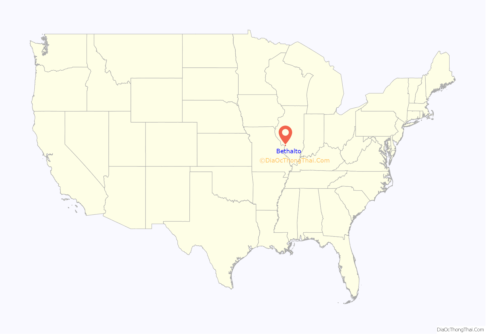
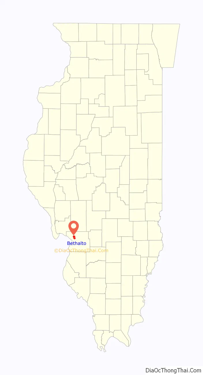
| State: | Illinois |
| County: | Madison County |
| Elevation: | 532 ft (162 m) |
| Total Area: | 7.64 sq mi (19.79 km²) |
| Land Area: | 7.59 sq mi (19.66 km²) |
| Water Area: | 0.05 sq mi (0.13 km²) |
| Total Population: | 9,310 |
| Population Density: | 1,226.45/sq mi (473.52/km²) |
| ZIP code: | 62010 |
| Area code: | 618 |
| FIPS code: | 1705599 |
| GNISfeature ID: | 2398108 |
| Website: | www.bethalto.com |
Online Interactive Map
Click on ![]() to view map in "full screen" mode.
to view map in "full screen" mode.
Bethalto location map. Where is Bethalto village?
History
Toponymy
The name “Bethalto” is commonly believed to be derived from Bethel (the original name of the town) and nearby Alton. The name “Bethel” came from the first church located in the area, with the Post Office Department requiring it to change its name to avoid confusion with the Clay County village of Bethel.
Early history
Before pioneering American settlers arrived, there were numerous Native Americans in the area, and Kickapoo villages lined nearby Indian Creek. In 1804, a man named Thomas Rattan arrived in the area from Ohio and established the first pioneer settlement, often referred to in those days as “Rattan’s Prairie”. The town was laid out by Joel U. Starkey, with the town plat being recorded June 23, 1854.
Milling industry
In the late 1800s, the principal industry of Bethalto was milling. In 1859, the President Mill and Elevator Company was established by James Neimrich. The company was bought, sold and expanded various times over the years, eventually coming into the ownership of John W. Kaufman in 1881. In either 1895 or 1896, the flour mill was destroyed in a fire. Kauffman declined to rebuild the mill, instead opting to purchase the Eagle flour mill of St. Louis. The loss of the mill had a profound impact on the village. In 1890, the population of Bethalto was 879. By 1900, it had fallen to 477 and in 1910 the population of the village was just 447.
1996 plane crash
On June 19, 1996, a McDonnell Douglas F/A-18 Hornet crashed into a home, shortly after taking off from St. Louis Regional Airport. The plane originally belonged to the US Navy, but had been leased back to the manufacturer, McDonnell Douglas. A spokesperson for McDonnell Douglass said the pilot had been practicing for an air show the next week in the Czech Republic. One eyewitness stated, “He started doing an outside roll … and when he got to the top of the roll something went wrong; he stalled or something. He started coming down, and I lost him behind some trees. Then I heard a thump―not an explosion, just a loud thump―and I knew what’d happened.”
Red Barn
A longtime landmark just north of Bethalto was an old barn at the intersection of Culp Lane and Bethalto Road, known to residents as simply “the red barn”. On July 26, 2012, the owner of the barn was spraying insecticides inside the barn to kill wasps. After spraying for wasps, the owner left and at some point a fire broke out. Fosterburg, Bethalto and Brighton volunteer fire departments responded to the blaze, but it was too late to save the structure. It was believed the barn had been there for around a hundred years. Often, residents would give directions based on the red barn.
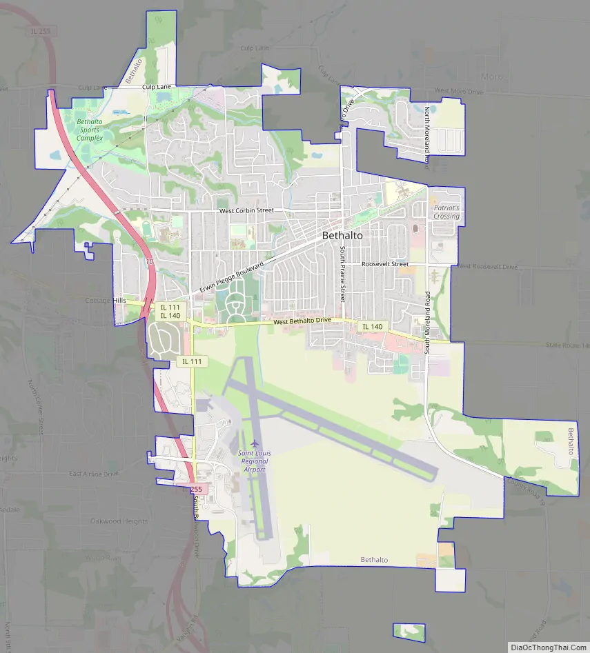
Bethalto Road Map
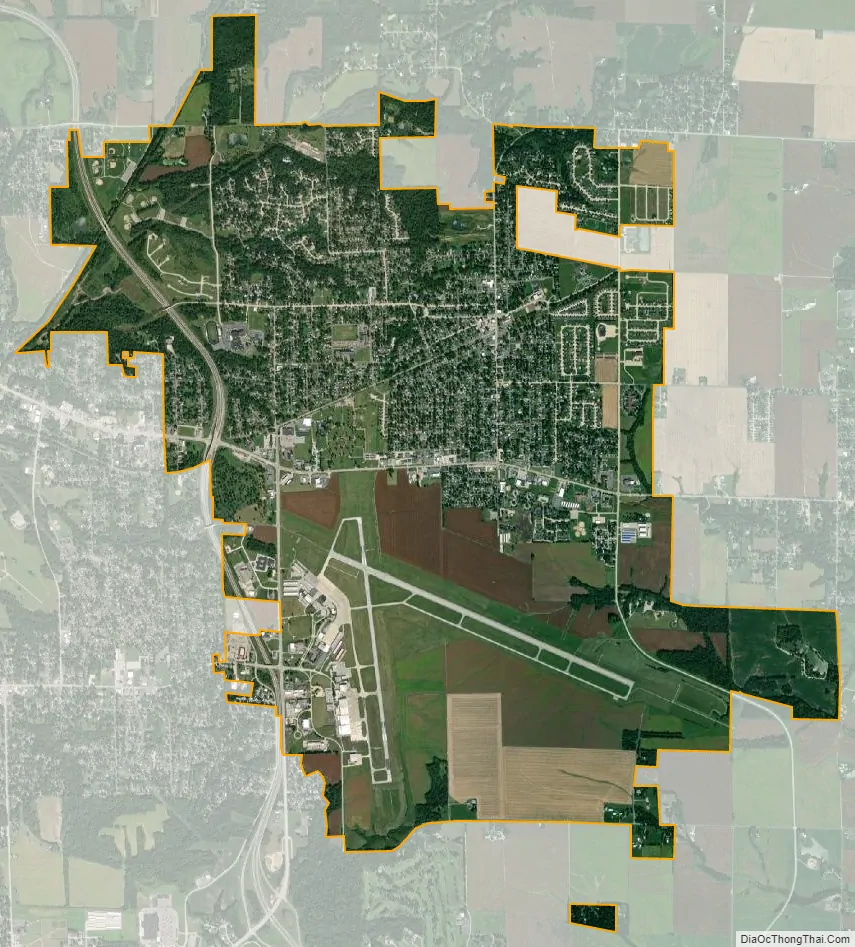
Bethalto city Satellite Map
Geography
Bethalto is located in northwestern Madison County at 38°54′15″N 90°2′48″W / 38.90417°N 90.04667°W / 38.90417; -90.04667 (38.904197, -90.046579). It is 9 miles (14 km) east of Alton, 10 miles (16 km) northwest of Edwardsville, the county seat, and 30 miles (48 km) north-northeast of St. Louis.
According to the U.S. Census Bureau, Bethalto has a total area of 7.64 square miles (19.79 km), of which 7.59 square miles (19.66 km) are land and 0.05 square miles (0.13 km), or 0.63%, are water. Most of the village drains west to the East Fork of the Wood River, a southwest-flowing direct tributary of the Mississippi River. The east part of the village drains east to Indian Creek, a south-flowing tributary of Cahokia Creek, which joins the Mississippi in Hartford.
See also
Map of Illinois State and its subdivision:- Adams
- Alexander
- Bond
- Boone
- Brown
- Bureau
- Calhoun
- Carroll
- Cass
- Champaign
- Christian
- Clark
- Clay
- Clinton
- Coles
- Cook
- Crawford
- Cumberland
- De Kalb
- De Witt
- Douglas
- Dupage
- Edgar
- Edwards
- Effingham
- Fayette
- Ford
- Franklin
- Fulton
- Gallatin
- Greene
- Grundy
- Hamilton
- Hancock
- Hardin
- Henderson
- Henry
- Iroquois
- Jackson
- Jasper
- Jefferson
- Jersey
- Jo Daviess
- Johnson
- Kane
- Kankakee
- Kendall
- Knox
- La Salle
- Lake
- Lake Michigan
- Lawrence
- Lee
- Livingston
- Logan
- Macon
- Macoupin
- Madison
- Marion
- Marshall
- Mason
- Massac
- McDonough
- McHenry
- McLean
- Menard
- Mercer
- Monroe
- Montgomery
- Morgan
- Moultrie
- Ogle
- Peoria
- Perry
- Piatt
- Pike
- Pope
- Pulaski
- Putnam
- Randolph
- Richland
- Rock Island
- Saint Clair
- Saline
- Sangamon
- Schuyler
- Scott
- Shelby
- Stark
- Stephenson
- Tazewell
- Union
- Vermilion
- Wabash
- Warren
- Washington
- Wayne
- White
- Whiteside
- Will
- Williamson
- Winnebago
- Woodford
- Alabama
- Alaska
- Arizona
- Arkansas
- California
- Colorado
- Connecticut
- Delaware
- District of Columbia
- Florida
- Georgia
- Hawaii
- Idaho
- Illinois
- Indiana
- Iowa
- Kansas
- Kentucky
- Louisiana
- Maine
- Maryland
- Massachusetts
- Michigan
- Minnesota
- Mississippi
- Missouri
- Montana
- Nebraska
- Nevada
- New Hampshire
- New Jersey
- New Mexico
- New York
- North Carolina
- North Dakota
- Ohio
- Oklahoma
- Oregon
- Pennsylvania
- Rhode Island
- South Carolina
- South Dakota
- Tennessee
- Texas
- Utah
- Vermont
- Virginia
- Washington
- West Virginia
- Wisconsin
- Wyoming


