Blue Island is a city in Cook County, Illinois, located approximately 16 miles (26 km) south of Chicago’s Loop. Blue Island is adjacent to the city of Chicago and shares its northern boundary with that city’s Morgan Park neighborhood. The population was 22,558 at the 2020 United States Census.
Blue Island was established in the 1830s as a way station for settlers traveling on the Vincennes Trace, and the settlement prospered because it was conveniently situated a day’s journey outside of Chicago. The late-nineteenth-century historian and publisher Alfred T. Andreas made the following observation regarding the appearance of the young community in History of Cook County Illinois (1884), “The location of Blue Island Village is a beautiful one. Nowhere about Chicago is there to be found a more pleasant and desirable resident locality.”
Since its founding, the city has been an important commercial center in the south Cook County region, although its position in that respect has been eclipsed in recent years as other significant population centers developed around it and the region’s commercial resources became spread over a wider area. In addition to its broad long-standing industrial base, the city enjoyed notable growth in the 1840s during the construction of the feeder canal (now the Calumet Sag Channel) for the Illinois and Michigan Canal and as the center of a large brick-making industry beginning in the 1850s, which eventually gave Blue Island the status of brick-making capital of the world. Beginning in 1883, Blue Island was also host to the car shops of the Rock Island Railroad. Blue Island was home to several breweries, who used the east side of the hill to store their product before the advent of refrigeration, until the Eighteenth Amendment made these breweries illegal in 1919. A large regional hospital and two major clinics are also located in the city.
Although initially settled by “Yankee” stock, Blue Island has been the point of entry for many of America’s immigrants, beginning in the 1840s with the arrival of a large German population that remained a prominent part of the city’s ethnic makeup for many years. By 1850, half of Blue Island’s population was either foreign-born or the children of foreign-born residents. Later, significant groups came from Italy, Poland, Sweden and Mexico.
The city is one of eleven incorporated areas in Illinois to have been designated by the White House as a “Preserve America” community.
| Name: | Blue Island city |
|---|---|
| LSAD Code: | 25 |
| LSAD Description: | city (suffix) |
| State: | Illinois |
| County: | Cook County |
| Incorporated: | October 26, 1872 |
| Elevation: | 640 ft (195 m) |
| Total Area: | 4.16 sq mi (10.77 km²) |
| Land Area: | 4.07 sq mi (10.54 km²) |
| Water Area: | 0.09 sq mi (0.22 km²) 2.16% |
| Total Population: | 22,558 |
| Population Density: | 5,541.14/sq mi (2,139.34/km²) |
| ZIP code: | 60406 |
| FIPS code: | 1706704 |
| Website: | www.blueisland.org |
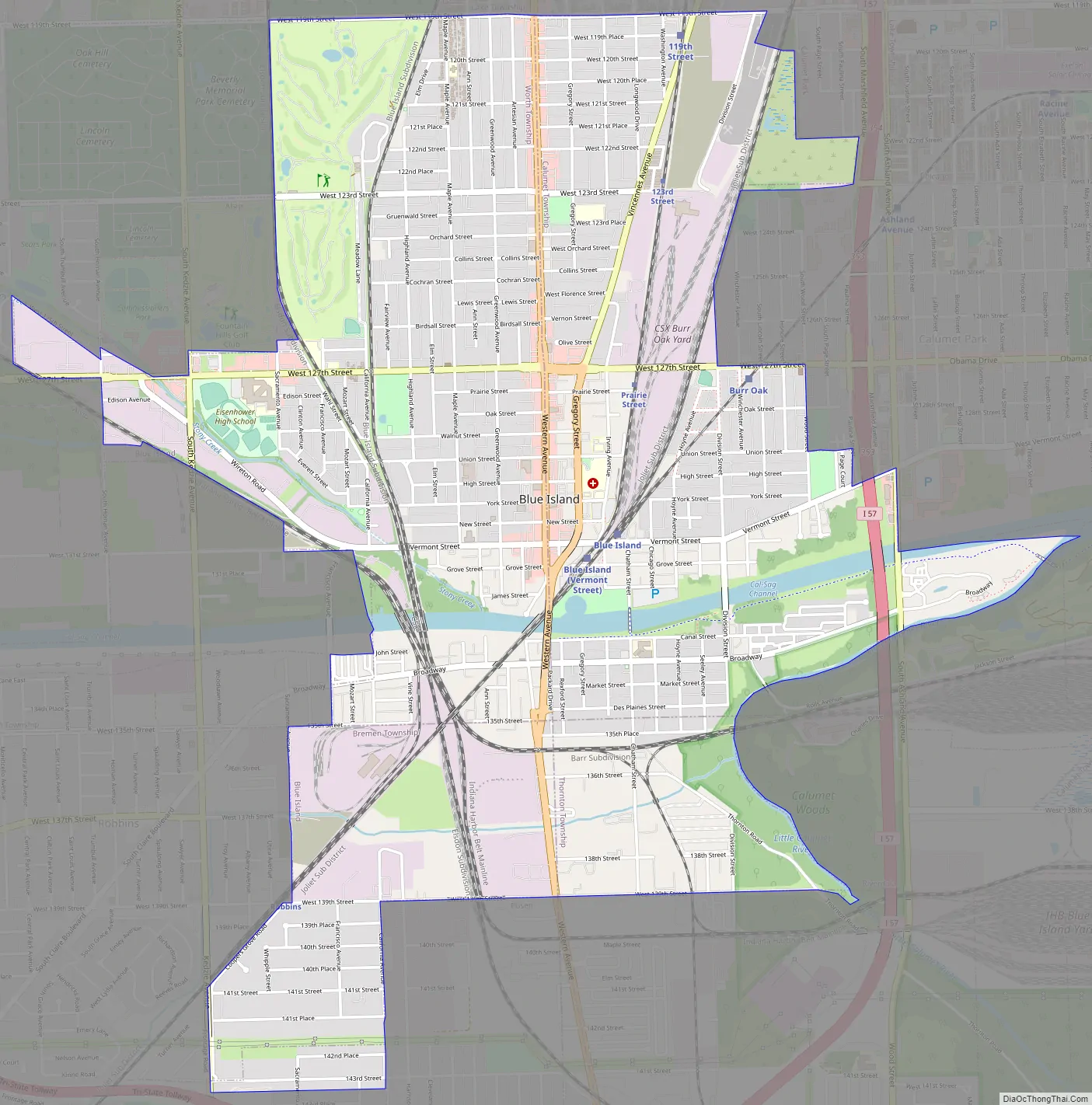
Online Interactive Map
Click on ![]() to view map in "full screen" mode.
to view map in "full screen" mode.
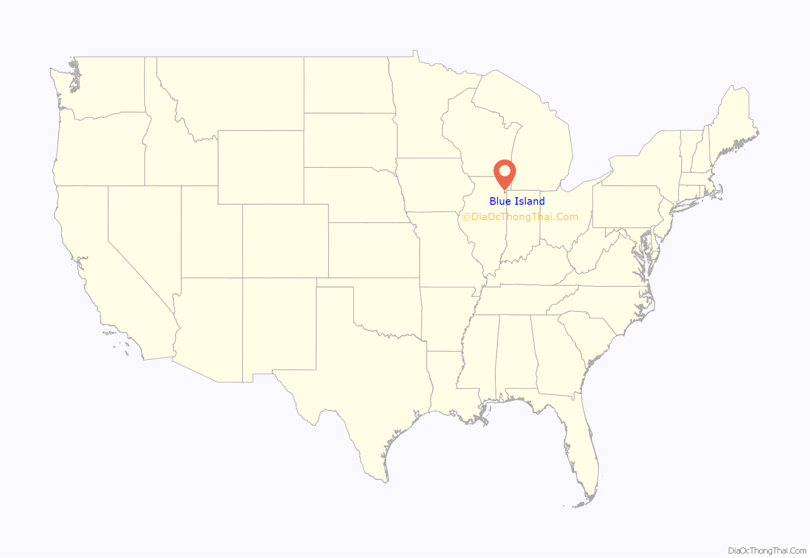
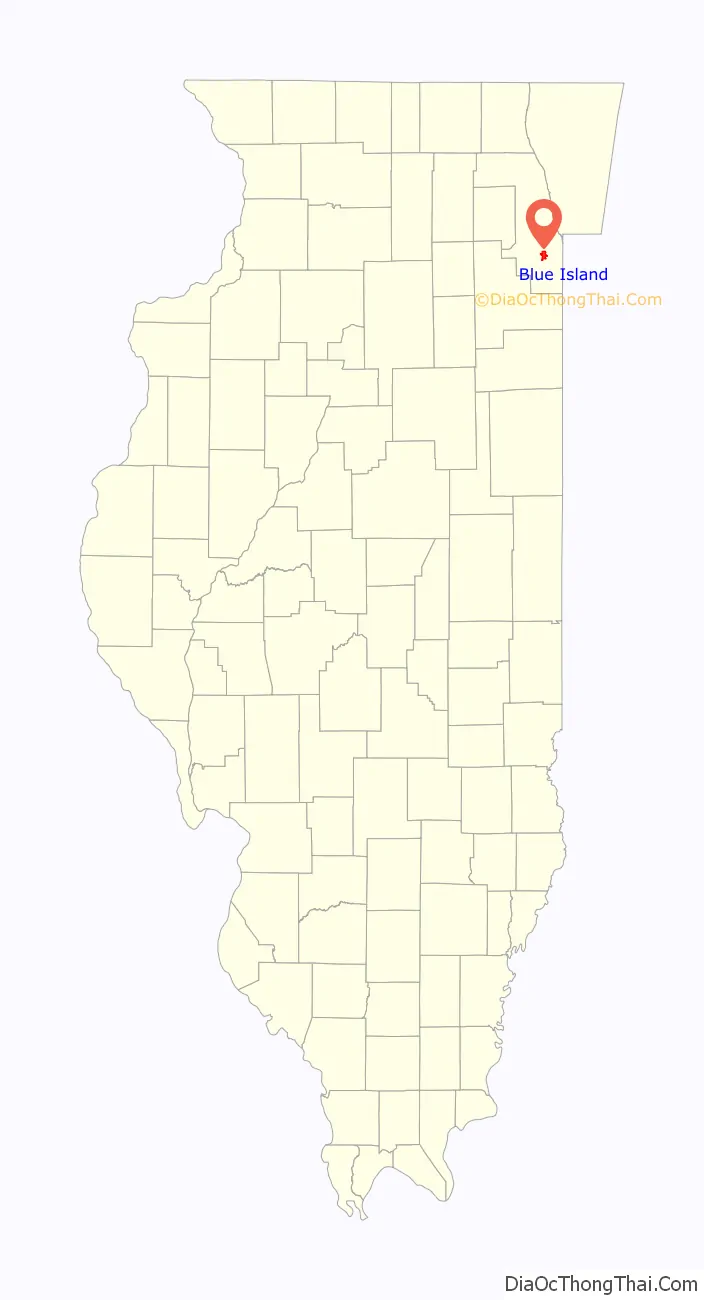
Blue Island location map. Where is Blue Island city?
History
Uptown
Norman Rexford came to Chicago from Charlotte, Vermont in 1835 and in 1836 became the first permanent settler of Blue Island when he established the Blue Island House near the intersection of present-day Western Avenue and Gregory Street just north of the Western Avenue bridge. Before Rexford built the Blue Island House he had constructed a four-room log cabin in the wilderness at the north end of the Blue Island ridge that he intended as a tavern for wayfarers, but after a year realized that the place was not likely to be profitable for him and began to look for another site where he might have more success. Although farther from Fort Dearborn and the settlement at Chicago (which by that time was incorporated and had a population of several thousand persons) by about 3 miles (5 km), the new inn was better situated because it was located on the Wabash Road (in Blue Island now Western Avenue), which was then a part of the Vincennes trail that went from Chicago to Vincennes, Indiana. It was considerably larger and more refined than Rexford’s previous venture, being a two-and-a half-story white frame building that also had various outbuildings to accommodate the needs of his guests. Because it was a day’s journey from Chicago, within a few years the inn became the nucleus for a group of businesses that catered to the soldiers, cattlemen (with their herds) and other travelers who arrived by stagecoach or otherwise frequented the Vincennes trail. Events hosted by the inn frequently lasted until the small hours of the morning, requiring an overnight stay before guests returned the next morning to their homes and places of business in Chicago and the hinterland.
Through the 1970s, Blue Island’s central business district (“uptown” to the locals) was regarded as an important regional commercial center, with stores such as Woolworth’s, Kline’s, Sears, Montgomery Ward, Spiegel and Steak ‘n Shake. Today, downtown Blue Island is better known for its antique stores, art galleries, ethnic delicatessens and fine dining. Much of this shift in business activity has been brought on by “big box” development outside of town that space constraints make it impossible for uptown to accommodate. However, several local businesses have served the area for generations: DeMar’s Restaurant, for example, opened its doors in 1950; Jebens Hardware was established in 1876; and Krueger Funeral Home was founded in 1858. In the 21st century, the city and a dedicated group of volunteers, working with the Metropolitan Planning Council of Chicago and the Center for Neighborhood Technology devised the Blue Island Plan for Economic Development, which addresses not only the commercial expansion of the historic uptown business district, but also the continued improvement of the housing stock and industrial base.
The Blue Island Opera House was built by Blue Island’s first mayor John L. Zacharias to replace the Robinson Block, which was destroyed by the Great Blue Island Fire of that year. The opera house was host to vaudeville and repertoire shows until 1913, when it became the Grand Theater and a venue for motion pictures. In later years the building was home to the Blue Island Sun-Standard newspaper and Kline’s Department Store. Although the auditorium has been remodeled out of existence, the building, with its award-winning exterior restoration, today provides both commercial and office space to the historic “uptown” district. The building has been designated as a landmark by the Blue Island Historic Preservation Commission It was designed by the American/Canadian architect Hugh Griffith Jones, who also designed Blue Island’s first Greenwood School (demolished) and a commercial building with a flat above (c. 1895, extant, also now a city landmark) for Albert and Emma Schmidt at 312 (now 13022) Western Avenue. The architect’s drawings for the opera house were used by Jones in the package he prepared to justify his successful application for membership in the Royal Architectural Institute of Canada.
Moraine Valley Community College operates a satellite facility uptown.
The Blue Island Market
For many years on the first Thursday of every month, Western Avenue south of the canal and to the city limits on 139th Street was host to an open-air market, the Blue Island Market, more commonly known as Market Day. The market was a place where farmers from a wide area surrounding Blue Island came to town to sell their wares to each other and to the public at large. As the postcard image to the right shows, items offered included produce, farm equipment, and livestock, with a local band thrown in to provide entertainment. Market Day began sometime in the last quarter of the 19th century and lasted until May 1924, when it was closed by the city council after a gradual influx of peddlers offering shoddy merchandise discouraged farmer participation and the market was deemed a public nuisance.
Brickyards
After it was discovered in the early 1850s that rich deposits of clay surrounded the ridge, Blue Island became the center of a significant brick-making industry that lasted for over a century. In the early years, these efforts were small, with the bricks being made by hand and the turnout created mostly for local use, but by 1886 the Illinois Pressed Brick Company (organized in 1884) was employing about 80 men and using “steam power and the most approved machinery”, which allowed them to produce 50,000 bricks per day. By 1900, the Clifton Brickyard alone—which had opened in 1883 under the name of Purington at the far northeast corner of the village—was producing 150,000,000 bricks a year. In 1886, the Chicago architectural firm of Adler and Sullivan designed a large complex for the Wahl Brothers brickyard (the main building of which was 250 by 350 feet (76 by 107 m)) on the west side of the Grand Trunk tracks south of 123rd street. These buildings had been demolished by 1935, and all of Blue Island’s brickyards were re-purposed by the latter part of the mid-20th century. The larger ones for a while become landfills, and the Wahl Brothers location is now the site of the Meadows Golf Club.
The Portland question
Some sources state that the city of Blue Island was once officially (or commonly) known as Portland. This claim is erroneous.
- Norman Rexford became the community’s first permanent resident when he established the “Blue Island House” at the southern edge of the ridge in November 1836, where in 1838 he became the settlement’s first postmaster. In his reminiscences published in the Blue Island Standard in 1876, Heber Rexford (who first came to the area in 1834 and was Cook County treasurer at the time of the Great Chicago Fire in 1871) related the following:
- On April 13, 1839, Peter Barton and his partners (who included Gurdon Hubbard and John H. Kinzie) registered the plat of “Portland” with the state of Illinois. Portland had been laid out on land purchased from the federal government which was situated south of Vermont Street (more or less) and east of Wabash Road (what is now Western Avenue uptown, again, more or less). The Little Calumet River ran through the center of the platted area, and its promoters felt with this advantage that it would become a prosperous river town. They used their influence to have the local post office name changed from Blue Island to Portland (a circumstance that as time went by would be a source of aggravation to the people of Blue Island), and on May 1, 1839, this was accomplished. The post office, however, wasn’t located within the platted area of Portland since there were no buildings in which to operate it, but in fact was on contiguous property to the west at the Blue Island House. Portland was never incorporated – it existed for many years by and large only as a plat of survey. No buildings of any consequence were erected there for nearly half a century. While some of the street names from Portland remain (although sometimes not entirely on their original courses), any of them that were laid out (and in fact a majority of them never were) waited in most cases for many years until they were needed. About half of the area was eventually annexed within what would become the corporate boundaries of Blue Island as time went by, and significant other sections of it became parts of the villages of Calumet Park and Riverdale, the Joe Louis the Champ golf course, and unincorporated Calumet Township. According to John Volp, whose family had lived in Blue Island since 1862:
- For reasons that remain unclear (but most likely because all of the development that was taking place in the area was occurring in the as yet unincorporated settlement of Blue Island to the north and west), the state legislature changed the name of the platted “town” of Portland to correspond with that of its neighbor. From the Laws of Illinois – 1842 and 1843:
At the same time, the post office department in Washington, D.C. changed the name of the post office to “Blue Island”. In the 1903 edition of Blue Book for the State of Illinois, the state shows 1843 as the year Blue Island was granted “incorporation under special acts”, recognizing the existence of Portland, but not as an incorporated entity. (Blue Island would not officially incorporate for almost another three decades – see below.)
- On April 20, 1850, the post office name was changed to “Worth”, this time to coincide with the name of the township in which it was located.
- The Rock Island Railroad inaugurated service to the community in 1852. From the Chicago Journal, May 27, 1852:
- On January 10, 1860, the post office name reverted again to “Blue Island”.
- On October 26, 1872, Blue Island incorporated as a village using the name by which it has always been known. Although about twenty percent of Portland was included within the corporate boundaries of the new village, that Portland was not an incorporated entity can be determined from the following excerpt that was taken from the petition that was submitted to the state to permit the election to consider incorporation: “… Your petitioners further represent that the territory herein described and bounded is not more than two (2) square miles, and that no part of the same is now included within the limits of any incorporated town, Village or City …”
Historic buildings and structures
Bertrand Goldberg designed the Dr. Aaron Heimbach House (1939). The house is one of only six surviving residential designs by the architect, and is a designated landmark in the City of Blue Island. In 2009, its owners received the Richard H. Driehaus Foundation Preservation Award from Landmarks Illinois for the outstanding quality of the restoration work performed on the house during the previous four years.
Because of its long history, the built environment of Blue Island exhibits a broad range of architectural styles and periods. Although largely built in the vernacular tradition, the works of notable architects, including Adler and Sullivan, George Maher, August Fiedler, Oscar Wenderoth, Robert E. Seyfarth, Perkins and Will, and Bertrand Goldberg, are featured throughout the community.
The Bell/Hendriks house was designed and construction in 1947 for the Prize Homes competition which was sponsored and promoted by the Chicago Tribune, and several thousand persons toured the “modified Colonial” home when it was built, with many of the visitors’ comments reported in the newspaper during the month the house was open to the public for tours. Opening ceremonies were broadcast over WGN radio, and plans of the house and of the other twenty-three prize-winning designs from the competition were the subject of an exhibition at the Art Institute of Chicago the previous year.
The oldest section of Blue Island’s city hall, built in 1891, was designed by Edmund R. Krause, who was the architect of the Majestic Building (along with its recently restored Bank of America Theatre) in Chicago’s Loop The first buildings of Northwest Gas, Light and Coke Company in Blue Island were designed by Holabird & Roche in 1902 (demolished). The city also has 22 houses known to have been built with mail-order kits sold by Sears Modern Homes. There is one building in Blue Island listed on the National Register of Historic Places, 27 are included as part of the Illinois Historic Preservation Agency’s Historic Architectural and Archaeology Resources Geographic Information System, and 41 individual buildings and one district have been designated as local landmarks by the Blue Island Historic Preservation Commission. The city’s newest development is Fay’s Point, a gated community built at the confluence of the Calumet River and the Calumet Sag Channel on the site of the home of Jerome Fay, who had settled there in 1850.
The Libby, McNeill and Libby Building, which operated as Libby, McNeill and Libby’s main Midwest processing plant from 1918 to 1968, is a prominent historic remnant of Blue Island’s industrial heritage, located three blocks south of downtown Blue Island on Western Avenue.
One of the oldest buildings in Blue Island, the American House was built in 1839 as the courthouse for Lake County, Indiana—a function it never actually had the chance to serve, as the county seat was moved from Liverpool to Crown Point in 1840. In 1844, the building was disassembled, sent by raft up the Little Calumet River, and reassembled in Blue Island.
The building originally stood on the west side of Western Avenue north of Vermont Street, (where Three Sisters Antique Mall stands today. It was popular among Southerners who used it as a summer boarding house and with the contractors who built the feeder canal for the Illinois and Michigan Canal. After the Civil War it was used as a home for retired soldiers. Although it was built after the invention of balloon framing, the building is constructed using the timber framing method, evidence of which is still clearly visible in the basement and attic. However, while its Greek Revival roots are discernible, the building is much remodeled and serves today as a private residence.
Greek Revival was the architectural style of choice in the early years of Blue Island’s history. Many of the buildings that remain from those days have been similarly remodeled, but some of the most well-preserved examples of the style, albeit in a vernacular form, can be seen either in the Walter P. Roche House on York Street or the Henry Schuemann House on Western Avenue.
An ad appeared in the book Chicago and Its Suburbs, which was published in 1874 in part to promote the interests of real estate developers in the Chicago area. Note the mention of the firm’s holdings in Englewood, South Lawn (later Harvey), Homewood and Washington Heights (later Morgan Park), the latter of which was purchased in 1869 for $150 per acre from the 1,500-acre (610 ha) tract that was then being developed by the Blue Island Land and Building Co.
The house was built by Carlton Wadhams (1810–1891), who came to Blue Island in 1839 from Goshen, Connecticut, and farmed on land north of the village until he opened the American House Hotel (building extant) in 1844. During his time in Blue Island, Wadhams made his first fortune as the owner of the hotel and as a cattle dealer, staying until c. 1857 when he sold his holdings and moved to South Bend, Indiana. In South Bend he was one of the founders of the Dodge Manufacturing Company and of the First National Bank, where he was a director until his death. Wadhams sold the house along with all of the property on which it was located, which included the American House and all of the land between what is today Western Avenue, Maple Avenue, Burr Oak Avenue and Vermont Street to Joshua Palmer Young (1818–1889), who, by himself beginning in 1848 and in a partnership with John K. Rowley that was established in 1866, played an important role in the development of the Chicago communities of Beverly Hills, Morgan Park, Near West Side, Washington Heights and Englewood, as well as the suburban communities of Blue Island, South Lawn (now Harvey), Homewood and South Holland.
Young operated the hotel for a time and was otherwise active in local affairs. He served from 1878–1880 as the president of the village board, and was a founder of the Congregational church (now Christ Memorial United Church of Christ). He was one of the incorporators, a director and secretary of the Chicago, Blue Island and Indiana Railroad Company (now part of the Grand Trunk Railway), whose charter was approved by the state of Illinois on March 7, 1867.
The house is listed on the National Register of Historic Places and is included in the State of Illinois’ Historic Architectural and Archaeology Resources Geographic Information System.
On December 28, 1944, 91 days after her keel was laid, the USS Blue Island Victory was launched from the Bethlehem-Fairfield Shipyard in Baltimore, Maryland. Dubbed “the Ugly Duckling of the merchant marine” by President Franklin D. Roosevelt, Victory ships were armed cargo ships that were built during World War II to transport troops and supplies wherever in the world their services were required. Of the 550 or so built, 218 were named after American cities.
The USS Blue Island Victory was a type VC 2-S-AP2, which was 455 feet (139 m) long, 62 feet (19 m) wide, and had a 25-foot (7.6 m) draft. It was equipped with a 5-inch (130 mm) gun on the stern for enemy submarines, a 3-inch (76 mm) anti-aircraft gun, and a 20 mm cannon. The Blue Island Victory served variously as a troop ship and as a cattle transport ship, and saw service in the Korean War. It was scrapped in 1972.
The oldest portion of Blue Island’s city hall was built in 1891 and designed by Edmund R. Krause, a prominent Chicago architect who among other buildings designed the 20-story Majestic Theatre building in Chicago’s Loop at what is now 22 W. Monroe Street (the theater, whose interiors were designed by Rapp and Rapp, has been renamed several time in the last fifty years – most recently in 2015 when it became the PrivateBank Theatre). An annex to city hall was built in 1925 according to plans by the Chicago architectural firm of Doerr, Lindquist and Doerr. The design for the annex was apparently a conscious effort to complement the post office building across the street and built using similar brick and a closely related architectural style, although not on as grand a scale. The Blue Island Post Office was designed by Oscar Wenderoth and built in 1914. Wenderoth was associated with the building of many government buildings of the period, including the Senate and House Office Buildings in Washington, D.C.
Beginning in the 1870s, the water supply for Blue Island was supplied by three artesian wells, whose water was pumped by a windmill to a 10 short tons (9.1 t) storage tank that sat on top of a 50-foot (15 m) high stone tower behind the City Hall building. The city began to receive its water from Lake Michigan in August 1915 after the water from the wells began to acquire a gaseous odor whose source was apparently the Public Service Company whose facilities were located about a quarter mile to the southwest, and the tank was subsequently removed.
Religion
Although religious gatherings have taken place in Blue Island almost since the community was founded in 1836, the first denominational services took place in 1850 with the founding of the Central Methodist Church (predecessor to today’s Grace United Methodist Church). Blue Island continues to respect the tradition of its early settlers by maintaining many of the congregations that were established there during these early years, and also by hosting new places of worship that serve the needs of new residents of this culturally diverse community.
Etymology
The north-central section of the city of Blue Island is located at the south end of a glacial moraine that once was an island when the waters from Lake Chicago covered the surrounding area at the former lake’s Glenwood Stage. Early pioneers gave the ridge the name because at a distance it looked like an island set in a trackless prairie sea. The blue color was attributed to atmospheric scattering or to blue flowers growing on the ridge. The Chicago Democrat, February, 1834 described it:
Blue Island Road Map
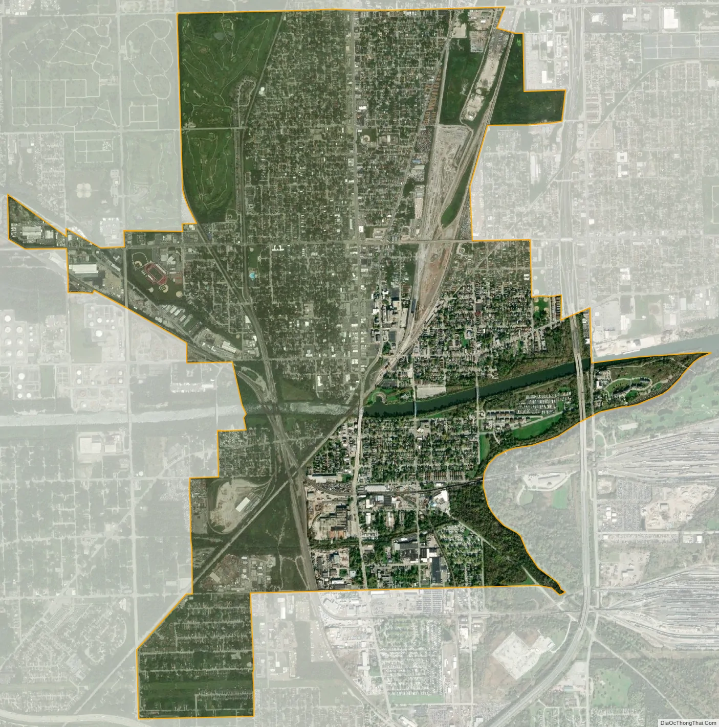
Blue Island city Satellite Map
Geography
According to the 2021 census gazetteer files, Blue Island has a total area of 4.16 square miles (10.77 km), of which 4.07 square miles (10.54 km) (or 97.93%) is land and 0.09 square miles (0.23 km) (or 2.07%) is water.
Surrounding areas
See also
Map of Illinois State and its subdivision:- Adams
- Alexander
- Bond
- Boone
- Brown
- Bureau
- Calhoun
- Carroll
- Cass
- Champaign
- Christian
- Clark
- Clay
- Clinton
- Coles
- Cook
- Crawford
- Cumberland
- De Kalb
- De Witt
- Douglas
- Dupage
- Edgar
- Edwards
- Effingham
- Fayette
- Ford
- Franklin
- Fulton
- Gallatin
- Greene
- Grundy
- Hamilton
- Hancock
- Hardin
- Henderson
- Henry
- Iroquois
- Jackson
- Jasper
- Jefferson
- Jersey
- Jo Daviess
- Johnson
- Kane
- Kankakee
- Kendall
- Knox
- La Salle
- Lake
- Lake Michigan
- Lawrence
- Lee
- Livingston
- Logan
- Macon
- Macoupin
- Madison
- Marion
- Marshall
- Mason
- Massac
- McDonough
- McHenry
- McLean
- Menard
- Mercer
- Monroe
- Montgomery
- Morgan
- Moultrie
- Ogle
- Peoria
- Perry
- Piatt
- Pike
- Pope
- Pulaski
- Putnam
- Randolph
- Richland
- Rock Island
- Saint Clair
- Saline
- Sangamon
- Schuyler
- Scott
- Shelby
- Stark
- Stephenson
- Tazewell
- Union
- Vermilion
- Wabash
- Warren
- Washington
- Wayne
- White
- Whiteside
- Will
- Williamson
- Winnebago
- Woodford
- Alabama
- Alaska
- Arizona
- Arkansas
- California
- Colorado
- Connecticut
- Delaware
- District of Columbia
- Florida
- Georgia
- Hawaii
- Idaho
- Illinois
- Indiana
- Iowa
- Kansas
- Kentucky
- Louisiana
- Maine
- Maryland
- Massachusetts
- Michigan
- Minnesota
- Mississippi
- Missouri
- Montana
- Nebraska
- Nevada
- New Hampshire
- New Jersey
- New Mexico
- New York
- North Carolina
- North Dakota
- Ohio
- Oklahoma
- Oregon
- Pennsylvania
- Rhode Island
- South Carolina
- South Dakota
- Tennessee
- Texas
- Utah
- Vermont
- Virginia
- Washington
- West Virginia
- Wisconsin
- Wyoming


