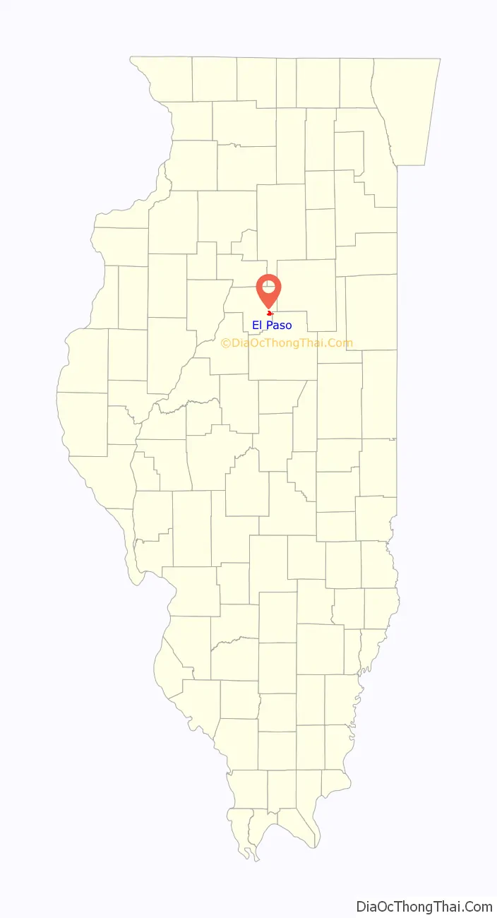
El Paso is a city in Woodford and McLean counties in the U.S. state of Illinois. The population was 2,756 at the 2020 census. The Woodford County portion of El Paso is part of the Peoria Metropolitan Statistical Area.
El Paso is a small community in central Illinois that took on more characteristics of a highway community after the construction of Interstate 39, which supplanted the older alignment of U.S. Highway 51.
| Name: | El Paso city |
|---|---|
| LSAD Code: | 25 |
| LSAD Description: | city (suffix) |
| State: | Illinois |
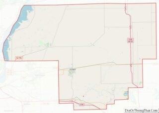
| County: | McLean County, Woodford County |
| Elevation: | 748 ft (228 m) |
| Total Area: | 2.15 sq mi (5.56 km²) |
| Land Area: | 2.15 sq mi (5.56 km²) |
| Water Area: | 0.00 sq mi (0.00 km²) |
| Total Population: | 2,756 |
| Population Density: | 1,284.85/sq mi (496.04/km²) |
| ZIP code: | 61738 |
| Area code: | 309 |
| FIPS code: | 1723737 |
| Website: | www.elpasoil.org |
Online Interactive Map
Click on ![]() to view map in "full screen" mode.
to view map in "full screen" mode.
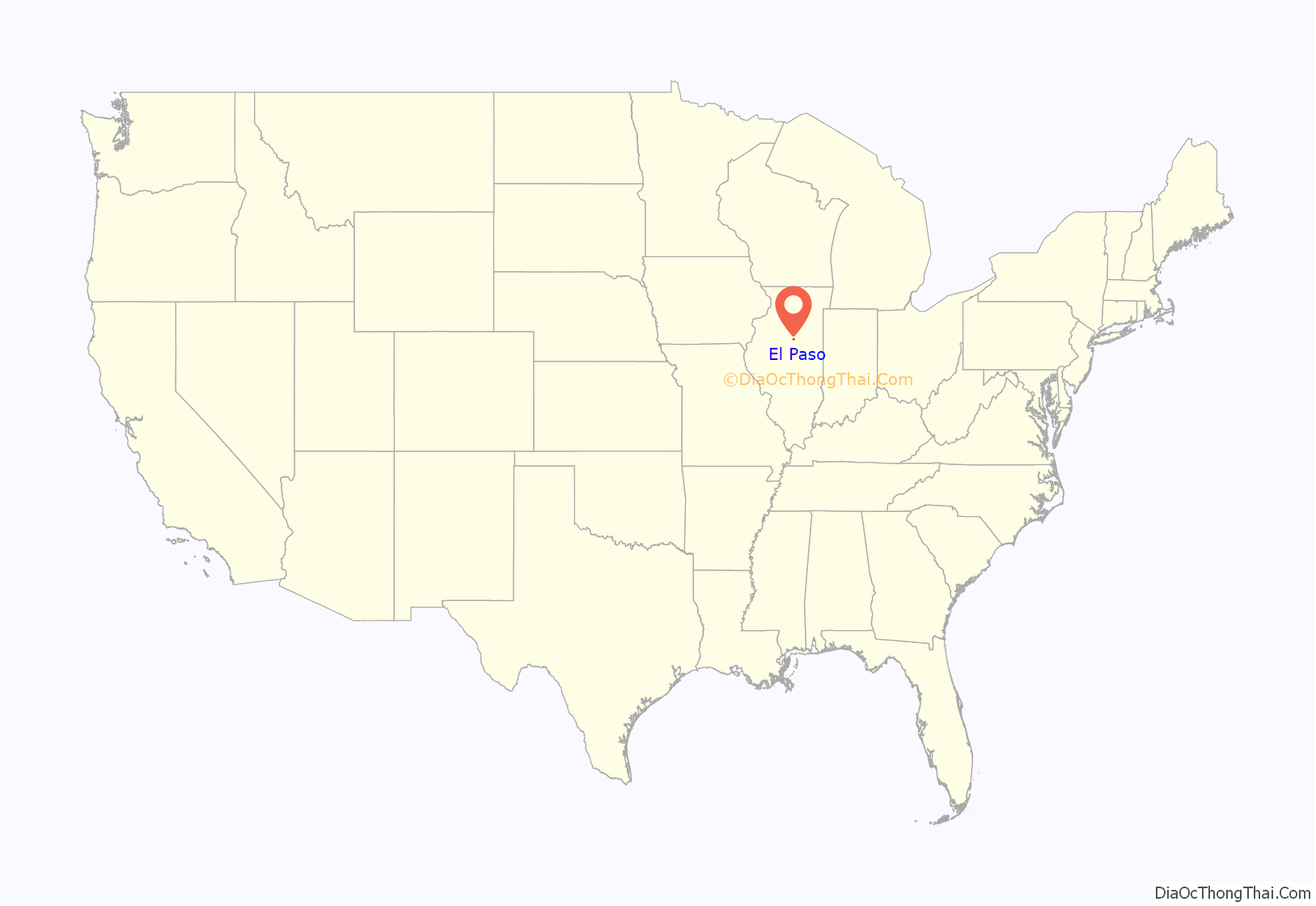
El Paso location map. Where is El Paso city?
History
El Paso was founded by George Gibson and James Wathen. Gibson gave it the Spanish name “El Paso”, either after El Paso, Texas, or because of a nearby railroad junction.
In August 1975, the city became the last locality in the contiguous United States to convert its telephone service from manual switching; prior to that time, telephones in the city could not be dialed directly from any outside location. The assistance of an operator was necessary to place the call, and local telephone numbers consisted of four digits. Parts of the outer Aleutian Islands in Alaska could not be dialed directly until the early 1980s.
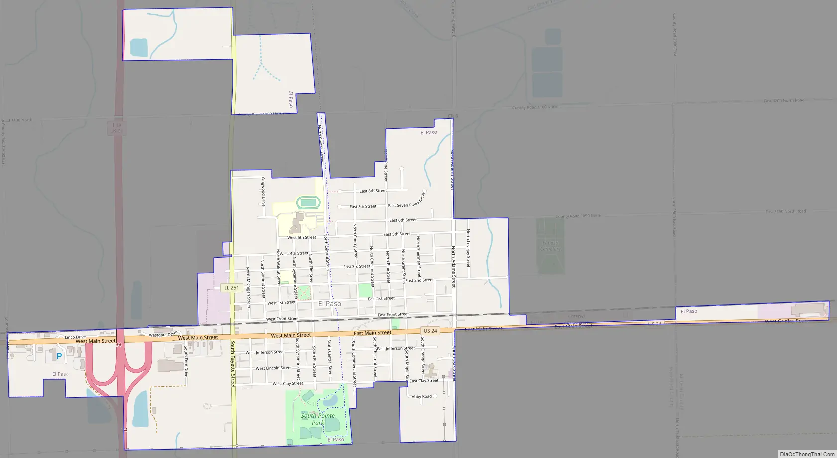
El Paso Road Map
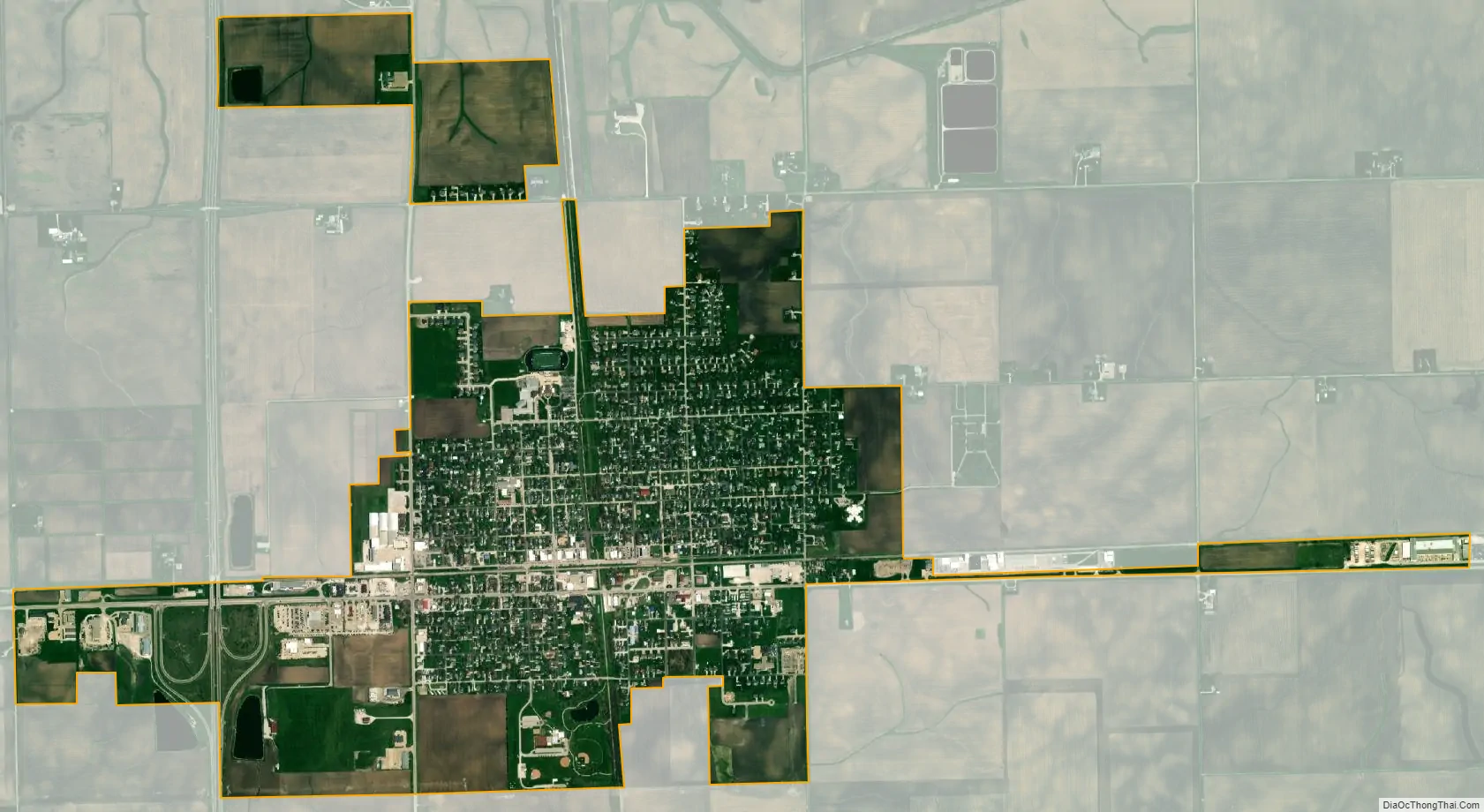
El Paso city Satellite Map
Geography
El Paso is located in southeastern Woodford County at 40°44′20″N 89°0′58″W / 40.73889°N 89.01611°W / 40.73889; -89.01611 (40.738800, -89.016034). A small portion of the city limits extends east along U.S. Route 24 into northern McLean County. US 24 leads east 15 miles (24 km) to Interstate 55 in Chenoa and west 32 miles (51 km) to Peoria. Interstate 39 crosses the west side of El Paso, with access from Exit 14 (US 24); the Interstate highway leads south 14 miles (23 km) to Interstate 55 in Normal and north 45 miles (72 km) to La Salle. Illinois Route 251 follows the former alignment of U.S. Route 51 through the center of El Paso, leading north 11 miles (18 km) to Minonk and south 5 miles (8 km) to Kappa.
According to the U.S. Census Bureau, El Paso has a total area of 2.15 square miles (5.57 km), all land. The city sits on high ground that drains north to the East Branch of Panther Creek and south to the headwaters of Wolf Creek. Both creek systems are south-flowing tributaries of the Mackinaw River and part of the Illinois River watershed.
See also
Map of Illinois State and its subdivision:- Adams
- Alexander
- Bond
- Boone
- Brown
- Bureau
- Calhoun
- Carroll
- Cass
- Champaign
- Christian
- Clark
- Clay
- Clinton
- Coles
- Cook
- Crawford
- Cumberland
- De Kalb
- De Witt
- Douglas
- Dupage
- Edgar
- Edwards
- Effingham
- Fayette
- Ford
- Franklin
- Fulton
- Gallatin
- Greene
- Grundy
- Hamilton
- Hancock
- Hardin
- Henderson
- Henry
- Iroquois
- Jackson
- Jasper
- Jefferson
- Jersey
- Jo Daviess
- Johnson
- Kane
- Kankakee
- Kendall
- Knox
- La Salle
- Lake
- Lake Michigan
- Lawrence
- Lee
- Livingston
- Logan
- Macon
- Macoupin
- Madison
- Marion
- Marshall
- Mason
- Massac
- McDonough
- McHenry
- McLean
- Menard
- Mercer
- Monroe
- Montgomery
- Morgan
- Moultrie
- Ogle
- Peoria
- Perry
- Piatt
- Pike
- Pope
- Pulaski
- Putnam
- Randolph
- Richland
- Rock Island
- Saint Clair
- Saline
- Sangamon
- Schuyler
- Scott
- Shelby
- Stark
- Stephenson
- Tazewell
- Union
- Vermilion
- Wabash
- Warren
- Washington
- Wayne
- White
- Whiteside
- Will
- Williamson
- Winnebago
- Woodford
- Alabama
- Alaska
- Arizona
- Arkansas
- California
- Colorado
- Connecticut
- Delaware
- District of Columbia
- Florida
- Georgia
- Hawaii
- Idaho
- Illinois
- Indiana
- Iowa
- Kansas
- Kentucky
- Louisiana
- Maine
- Maryland
- Massachusetts
- Michigan
- Minnesota
- Mississippi
- Missouri
- Montana
- Nebraska
- Nevada
- New Hampshire
- New Jersey
- New Mexico
- New York
- North Carolina
- North Dakota
- Ohio
- Oklahoma
- Oregon
- Pennsylvania
- Rhode Island
- South Carolina
- South Dakota
- Tennessee
- Texas
- Utah
- Vermont
- Virginia
- Washington
- West Virginia
- Wisconsin
- Wyoming