Kappa is a village in Woodford County, Illinois, United States. The population was 227 at the 2010 census, up from 170 in 2000. It is part of the Peoria, Illinois Metropolitan Statistical Area.
In 1833 Thomas Dixon became the first settler in the Kappa area. Over the next few years, other settlers moved in around the area, and eventually a railroad was built through the area. On May 23, 1853, rail service began, and postal service began. The first postmaster, William Jones, appointed the name Montrose, but the Illinois Central Railroad preferred Kappa. Kappa is the tenth letter in the Greek alphabet, and was applied to the town because it was the tenth town between Dunleith (modern-day East Dubuque, Illinois) and Bloomington.
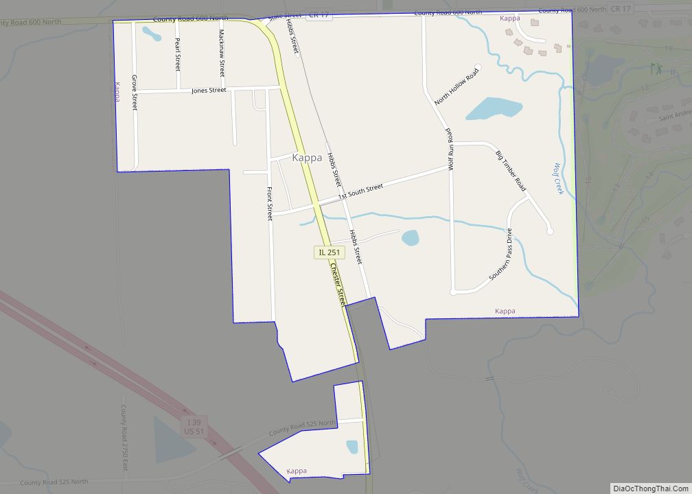
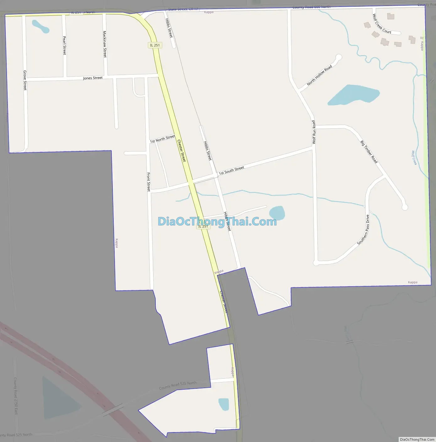
Kappa sits on the north side of the Mackinaw River. Approximately five miles to the southeast is Lake Bloomington, while five miles to the southwest is Evergreen Lake.
Since its inception, the railroad line from East Dubuque to Bloomington has been decommissioned. In the early 1900s, SBI Route 2 was founded, and then changed to U.S. Route 51. U.S. 51 now bypasses the town to the west, leaving Illinois Route 251 as the main north–south road through town.
| Name: | Kappa village |
|---|---|
| LSAD Code: | 47 |
| LSAD Description: | village (suffix) |
| State: | Illinois |
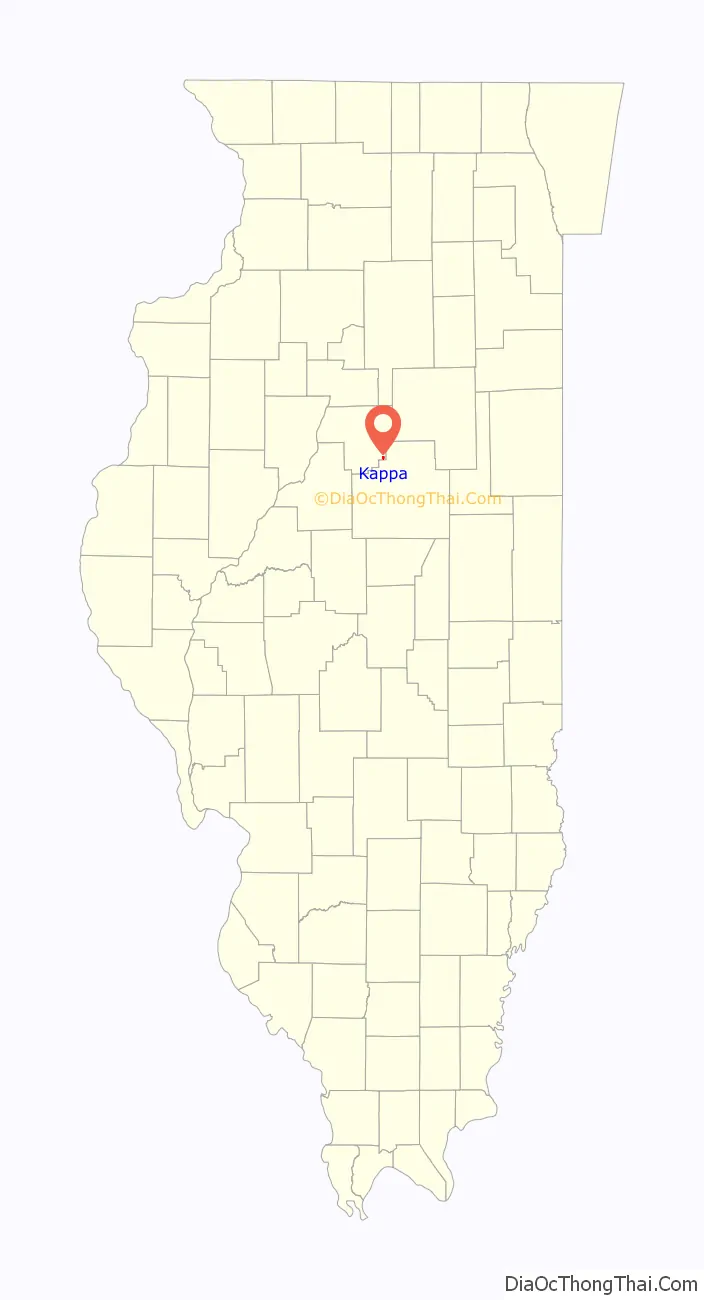
| County: | Woodford County |
| Elevation: | 729 ft (222 m) |
| Total Area: | 0.36 sq mi (0.93 km²) |
| Land Area: | 0.36 sq mi (0.93 km²) |
| Water Area: | 0.00 sq mi (0.00 km²) |
| Total Population: | 229 |
| Population Density: | 641.46/sq mi (247.55/km²) |
| Area code: | 309 |
| FIPS code: | 1739038 |
Online Interactive Map
Click on ![]() to view map in "full screen" mode.
to view map in "full screen" mode.
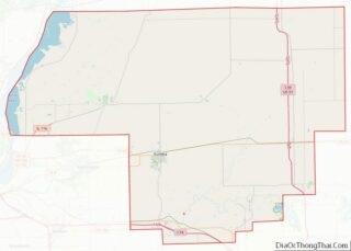
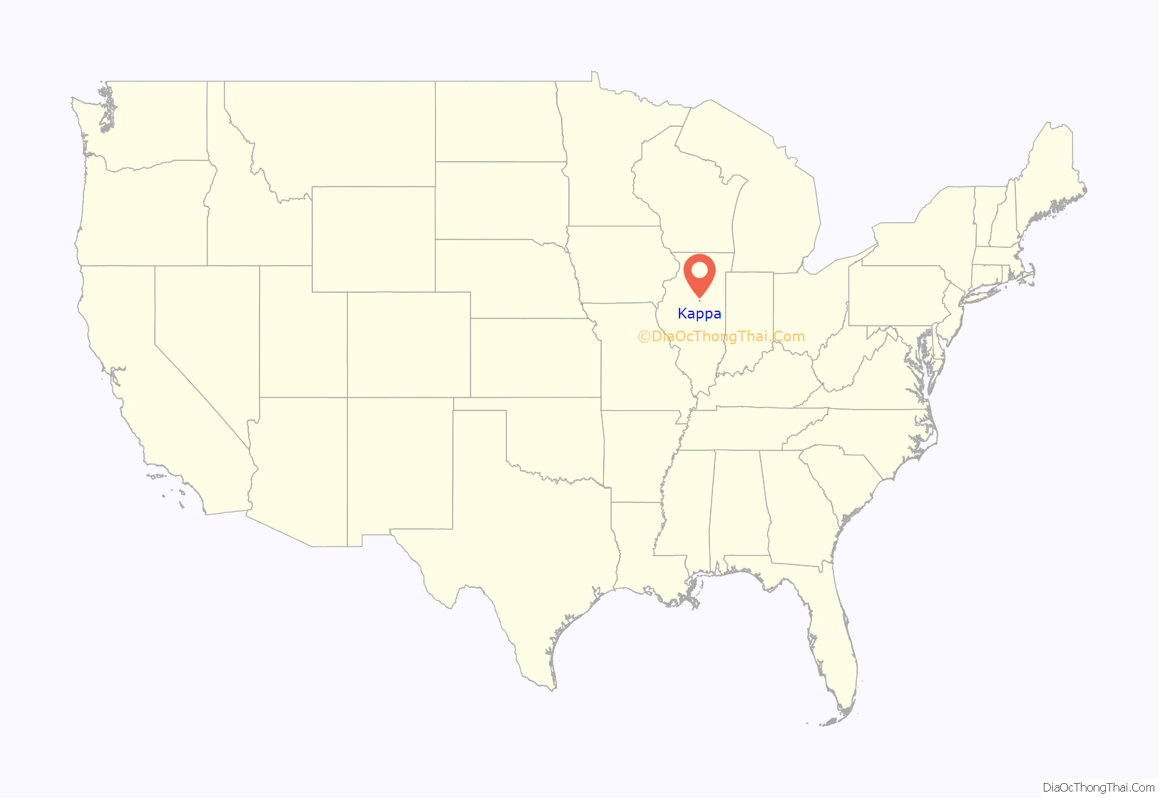
Kappa location map. Where is Kappa village?
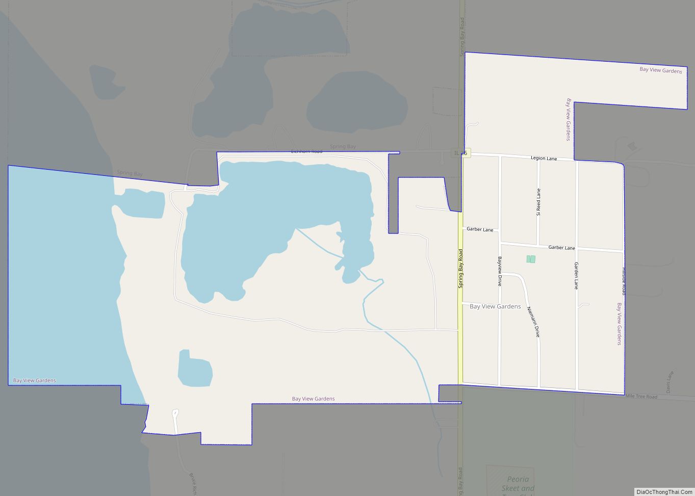
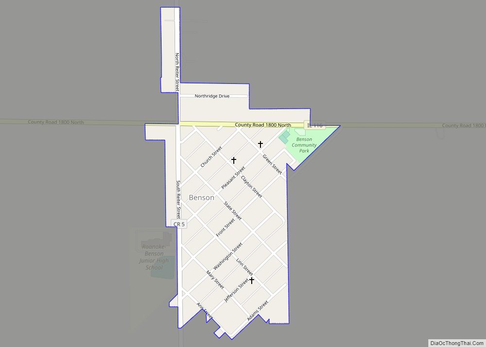
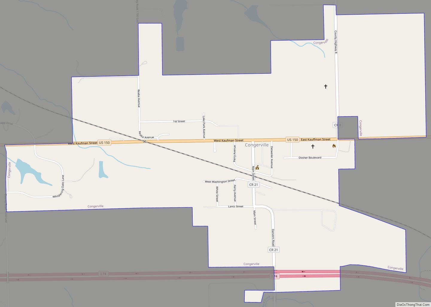
Kappa Road Map
Kappa city Satellite Map

Geography
Kappa is located at 40°40′35″N 89°0′34″W / 40.67639°N 89.00944°W / 40.67639; -89.00944 (40.676439, -89.009349).
According to the 2010 census, Kappa has a total area of 0.34 square miles (0.88 km), all land.
See also
Map of Illinois State and its subdivision:- Adams
- Alexander
- Bond
- Boone
- Brown
- Bureau
- Calhoun
- Carroll
- Cass
- Champaign
- Christian
- Clark
- Clay
- Clinton
- Coles
- Cook
- Crawford
- Cumberland
- De Kalb
- De Witt
- Douglas
- Dupage
- Edgar
- Edwards
- Effingham
- Fayette
- Ford
- Franklin
- Fulton
- Gallatin
- Greene
- Grundy
- Hamilton
- Hancock
- Hardin
- Henderson
- Henry
- Iroquois
- Jackson
- Jasper
- Jefferson
- Jersey
- Jo Daviess
- Johnson
- Kane
- Kankakee
- Kendall
- Knox
- La Salle
- Lake
- Lake Michigan
- Lawrence
- Lee
- Livingston
- Logan
- Macon
- Macoupin
- Madison
- Marion
- Marshall
- Mason
- Massac
- McDonough
- McHenry
- McLean
- Menard
- Mercer
- Monroe
- Montgomery
- Morgan
- Moultrie
- Ogle
- Peoria
- Perry
- Piatt
- Pike
- Pope
- Pulaski
- Putnam
- Randolph
- Richland
- Rock Island
- Saint Clair
- Saline
- Sangamon
- Schuyler
- Scott
- Shelby
- Stark
- Stephenson
- Tazewell
- Union
- Vermilion
- Wabash
- Warren
- Washington
- Wayne
- White
- Whiteside
- Will
- Williamson
- Winnebago
- Woodford
- Alabama
- Alaska
- Arizona
- Arkansas
- California
- Colorado
- Connecticut
- Delaware
- District of Columbia
- Florida
- Georgia
- Hawaii
- Idaho
- Illinois
- Indiana
- Iowa
- Kansas
- Kentucky
- Louisiana
- Maine
- Maryland
- Massachusetts
- Michigan
- Minnesota
- Mississippi
- Missouri
- Montana
- Nebraska
- Nevada
- New Hampshire
- New Jersey
- New Mexico
- New York
- North Carolina
- North Dakota
- Ohio
- Oklahoma
- Oregon
- Pennsylvania
- Rhode Island
- South Carolina
- South Dakota
- Tennessee
- Texas
- Utah
- Vermont
- Virginia
- Washington
- West Virginia
- Wisconsin
- Wyoming