Highwood is a North Shore suburb of Chicago in Moraine Township, Lake County, Illinois, United States. As of the 2020 census, the population was 5,074. It is known for its entertainment, restaurants, bars, and festivals.
| Name: | Highwood city |
|---|---|
| LSAD Code: | 25 |
| LSAD Description: | city (suffix) |
| State: | Illinois |
| County: | Lake County |
| Total Area: | 0.72 sq mi (1.86 km²) |
| Land Area: | 0.72 sq mi (1.86 km²) |
| Water Area: | 0.00 sq mi (0.00 km²) |
| Total Population: | 5,074 |
| Population Density: | 7,047.22/sq mi (2,721.29/km²) |
| Area code: | 847 |
| FIPS code: | 1734865 |
| Website: | www.cityofhighwood.com |
Online Interactive Map
Click on ![]() to view map in "full screen" mode.
to view map in "full screen" mode.
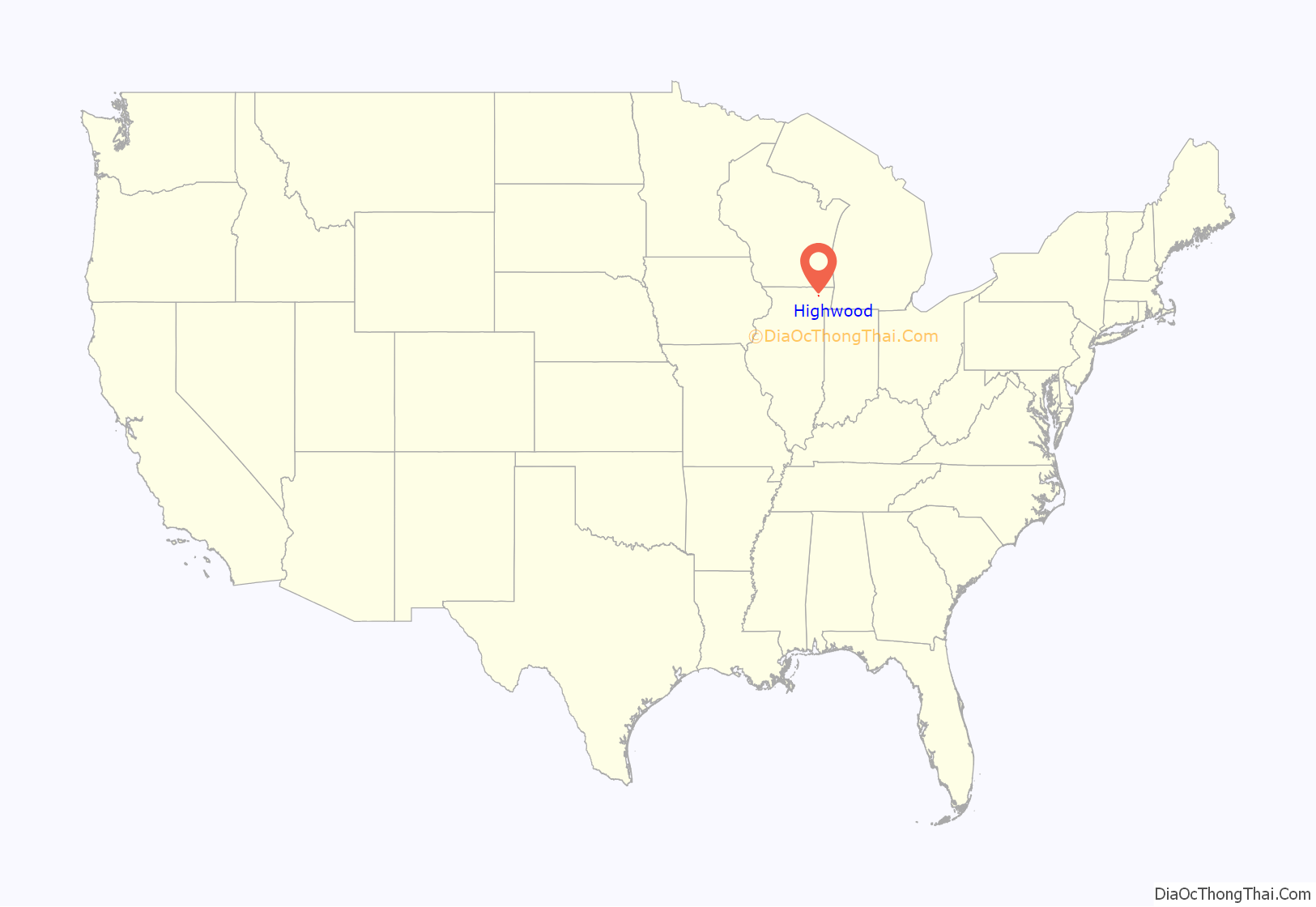
Highwood location map. Where is Highwood city?
History
Originally, the land was owned by the Potawatomi until it was ceded to the United States through the 1833 Treaty of Chicago. The first non-Native American settled in the town in 1846. In 1851 Highwood became the headquarter location of the Chicago North Shore and Milwaukee Railroad, which ran parallel to the Chicago and North Western Railway, and is known today as Metra’s Union Pacific / North Line. Thomas Curley suggested the name High Woods because the land was the highest ground between Chicago and Milwaukee and was covered with trees.
In 1886 civil and labor unrest in Chicago eventually led to the Haymarket Riot. Chicago businessmen felt that having a military presence near the city would help alleviate tensions within the city and on November 8, 1887 purchased Camp Highwood. This land would come to host members of the Sixth Infantry Regiment. On February 27, 1888 Camp Highwood was officially named Fort Sheridan in honor of General Philip Sheridan for his ability to maintain order after the Chicago Fire of 1871.
Highwood provided several business and employment opportunities and following the fire, many of those who lost their home and a wave of immigrants settled into the town. Highwood can also give credit to much of their economic success to the Chicago and Milwaukee Electric Railway. However, with increased transportation it also caused a sudden rise in gambling dens and illegal “blind-pig” taverns which catered to off duty soldiers. This eventually provoked federal authorities to enact the “Highwood Quadrangle” which prohibited the sale of liquor within 1 1/8th miles of the army base.
Fort Sheridan acted as an entertainment center for the town and on July 18, 1888 the trustees voted to change the name from Highwood to the Village of Fort Sheridan to capitalize on its military glamour. However, 8 years later in 1894 the name was changed back to Highwood due to resident frustration and confusion with postal misrouting. The city’s business district became filled with bars and taverns which led Theodore Roosevelt to call the city “one of the toughest towns in America”.
In the 1920s a large number of Northern Italian immigrants (originally from Modena) moved to Highwood, many from Dalzell, Illinois, a coal mining town in Bureau County, to seek jobs. The national prohibition of alcohol at the time also attracted bootleggers who smuggled large quantities of liquor into the city. The fight to prevent Highwood from being known as a whisky den largely brought the community together.
Following the start of World War II Fort Sheridan was used as an active training ground. By the end of the war Highwood had experienced another wave of immigration, this time a majority of immigrants coming from Europe and Mexico. Since then Highwood’s business have continued to flourish and the city has become the destination for North Shore dining and nightlife. The city frequently hosts festivals for residents known as Celebrate Highwood which is hosted by the city chambers.
Highwood Road Map
Highwood city Satellite Map
Geography
Highwood is located in southeastern Lake County at 42°12′19″N 87°48′44″W / 42.205357°N 87.812345°W / 42.205357; -87.812345, on a ridge 100 feet (30 m) above the elevation of Lake Michigan.
According to the 2010 census, Highwood has a total area of 0.71 square miles (1.84 km), all land.
The city is located next to Highland Park and Fort Sheridan, and south of the Fort Sheridan Forest Preserve.
See also
Map of Illinois State and its subdivision:- Adams
- Alexander
- Bond
- Boone
- Brown
- Bureau
- Calhoun
- Carroll
- Cass
- Champaign
- Christian
- Clark
- Clay
- Clinton
- Coles
- Cook
- Crawford
- Cumberland
- De Kalb
- De Witt
- Douglas
- Dupage
- Edgar
- Edwards
- Effingham
- Fayette
- Ford
- Franklin
- Fulton
- Gallatin
- Greene
- Grundy
- Hamilton
- Hancock
- Hardin
- Henderson
- Henry
- Iroquois
- Jackson
- Jasper
- Jefferson
- Jersey
- Jo Daviess
- Johnson
- Kane
- Kankakee
- Kendall
- Knox
- La Salle
- Lake
- Lake Michigan
- Lawrence
- Lee
- Livingston
- Logan
- Macon
- Macoupin
- Madison
- Marion
- Marshall
- Mason
- Massac
- McDonough
- McHenry
- McLean
- Menard
- Mercer
- Monroe
- Montgomery
- Morgan
- Moultrie
- Ogle
- Peoria
- Perry
- Piatt
- Pike
- Pope
- Pulaski
- Putnam
- Randolph
- Richland
- Rock Island
- Saint Clair
- Saline
- Sangamon
- Schuyler
- Scott
- Shelby
- Stark
- Stephenson
- Tazewell
- Union
- Vermilion
- Wabash
- Warren
- Washington
- Wayne
- White
- Whiteside
- Will
- Williamson
- Winnebago
- Woodford
- Alabama
- Alaska
- Arizona
- Arkansas
- California
- Colorado
- Connecticut
- Delaware
- District of Columbia
- Florida
- Georgia
- Hawaii
- Idaho
- Illinois
- Indiana
- Iowa
- Kansas
- Kentucky
- Louisiana
- Maine
- Maryland
- Massachusetts
- Michigan
- Minnesota
- Mississippi
- Missouri
- Montana
- Nebraska
- Nevada
- New Hampshire
- New Jersey
- New Mexico
- New York
- North Carolina
- North Dakota
- Ohio
- Oklahoma
- Oregon
- Pennsylvania
- Rhode Island
- South Carolina
- South Dakota
- Tennessee
- Texas
- Utah
- Vermont
- Virginia
- Washington
- West Virginia
- Wisconsin
- Wyoming
