Hurst is a city in Williamson County, Illinois, United States. The population was 795 at the 2010 census.
| Name: | Hurst city |
|---|---|
| LSAD Code: | 25 |
| LSAD Description: | city (suffix) |
| State: | Illinois |
| County: | Williamson County |
| Founded: | 1903 |
| Elevation: | 394 ft (120 m) |
| Total Area: | 0.89 sq mi (2.31 km²) |
| Land Area: | 0.89 sq mi (2.30 km²) |
| Water Area: | 0.01 sq mi (0.02 km²) |
| Total Population: | 764 |
| Population Density: | 861.33/sq mi (332.72/km²) |
| ZIP code: | 62949 |
| Area code: | 618 |
| FIPS code: | 1736815 |
| GNISfeature ID: | 2394459 |
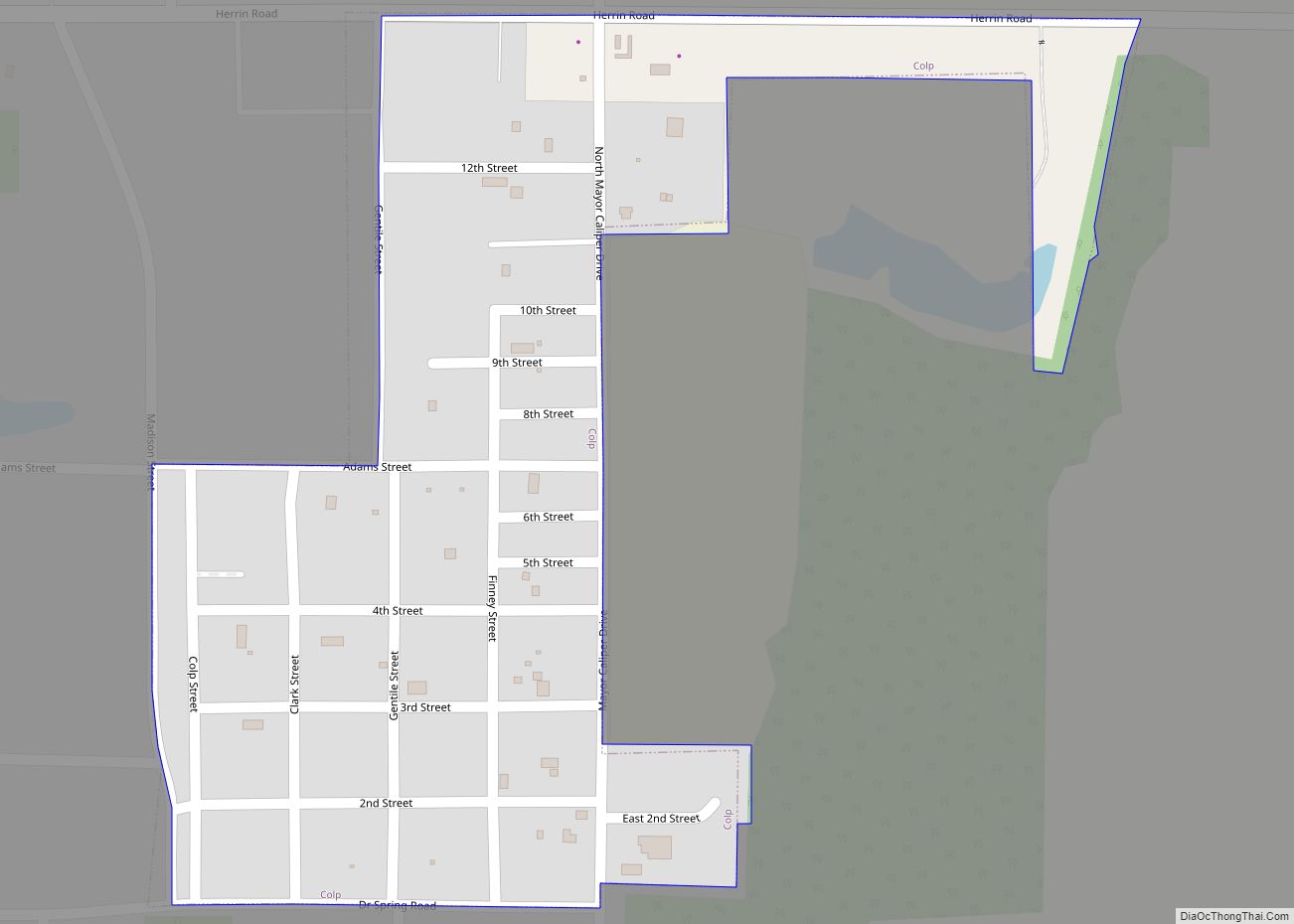
Online Interactive Map
Click on ![]() to view map in "full screen" mode.
to view map in "full screen" mode.
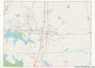
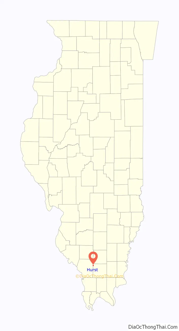
Hurst location map. Where is Hurst city?

History
Hurst was founded in 1903 as a stop along the St. Louis, Iron Mountain and Southern Railway, which had extended a line to the area from De Soto. Thomas Philip Russell, who donated some of the land for the new city, initially sought to name it after his family, but the name “Russell” was already in use elsewhere in Illinois. He then agreed to name it after his friend, William Charles Hurst, a railroad official who had stayed at his house during visits to the area.
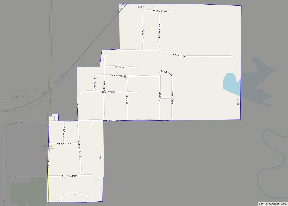
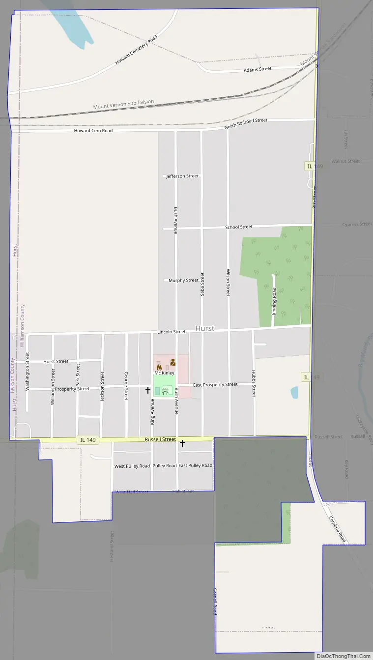
Hurst Road Map
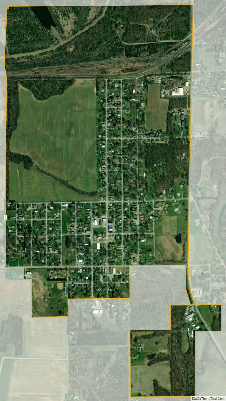
Hurst city Satellite Map
Geography
Hurst is located at 37°49′57″N 89°8′40″W / 37.83250°N 89.14444°W / 37.83250; -89.14444 (37.832366, -89.144475).
According to the 2010 census, Hurst has a total area of 0.862 square miles (2.23 km), of which 0.86 square miles (2.23 km) (or 99.77%) is land and 0.002 square miles (0.01 km) (or 0.23%) is water.
See also
Map of Illinois State and its subdivision:- Adams
- Alexander
- Bond
- Boone
- Brown
- Bureau
- Calhoun
- Carroll
- Cass
- Champaign
- Christian
- Clark
- Clay
- Clinton
- Coles
- Cook
- Crawford
- Cumberland
- De Kalb
- De Witt
- Douglas
- Dupage
- Edgar
- Edwards
- Effingham
- Fayette
- Ford
- Franklin
- Fulton
- Gallatin
- Greene
- Grundy
- Hamilton
- Hancock
- Hardin
- Henderson
- Henry
- Iroquois
- Jackson
- Jasper
- Jefferson
- Jersey
- Jo Daviess
- Johnson
- Kane
- Kankakee
- Kendall
- Knox
- La Salle
- Lake
- Lake Michigan
- Lawrence
- Lee
- Livingston
- Logan
- Macon
- Macoupin
- Madison
- Marion
- Marshall
- Mason
- Massac
- McDonough
- McHenry
- McLean
- Menard
- Mercer
- Monroe
- Montgomery
- Morgan
- Moultrie
- Ogle
- Peoria
- Perry
- Piatt
- Pike
- Pope
- Pulaski
- Putnam
- Randolph
- Richland
- Rock Island
- Saint Clair
- Saline
- Sangamon
- Schuyler
- Scott
- Shelby
- Stark
- Stephenson
- Tazewell
- Union
- Vermilion
- Wabash
- Warren
- Washington
- Wayne
- White
- Whiteside
- Will
- Williamson
- Winnebago
- Woodford
- Alabama
- Alaska
- Arizona
- Arkansas
- California
- Colorado
- Connecticut
- Delaware
- District of Columbia
- Florida
- Georgia
- Hawaii
- Idaho
- Illinois
- Indiana
- Iowa
- Kansas
- Kentucky
- Louisiana
- Maine
- Maryland
- Massachusetts
- Michigan
- Minnesota
- Mississippi
- Missouri
- Montana
- Nebraska
- Nevada
- New Hampshire
- New Jersey
- New Mexico
- New York
- North Carolina
- North Dakota
- Ohio
- Oklahoma
- Oregon
- Pennsylvania
- Rhode Island
- South Carolina
- South Dakota
- Tennessee
- Texas
- Utah
- Vermont
- Virginia
- Washington
- West Virginia
- Wisconsin
- Wyoming