Lake Catherine is an unincorporated community and census-designated place (CDP) in Lake County, Illinois, United States. Per the 2020 census, the population was 1,279.
| Name: | Lake Catherine CDP |
|---|---|
| LSAD Code: | 57 |
| LSAD Description: | CDP (suffix) |
| State: | Illinois |
| County: | Lake County |
| Elevation: | 748 ft (228 m) |
| Total Area: | 1.45 sq mi (3.76 km²) |
| Land Area: | 0.91 sq mi (2.35 km²) |
| Water Area: | 0.54 sq mi (1.41 km²) |
| Total Population: | 1,279 |
| Population Density: | 1,407.04/sq mi (543.34/km²) |
| FIPS code: | 1740988 |
Online Interactive Map
Click on ![]() to view map in "full screen" mode.
to view map in "full screen" mode.
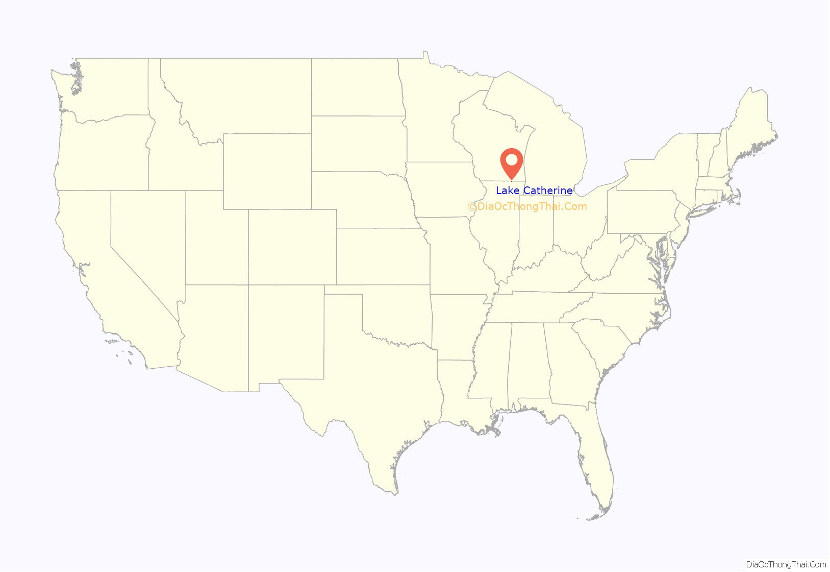
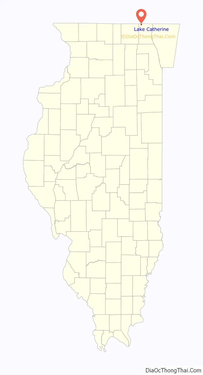
Lake Catherine location map. Where is Lake Catherine CDP?
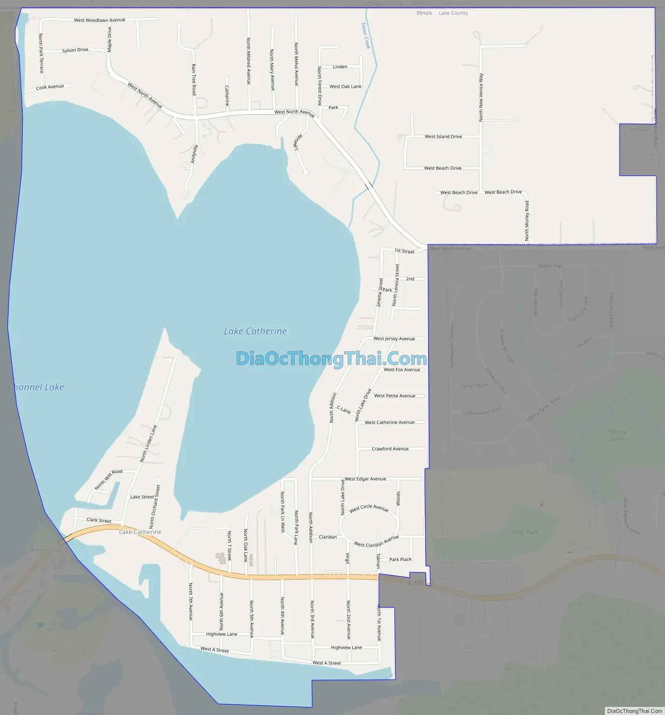
Lake Catherine Road Map
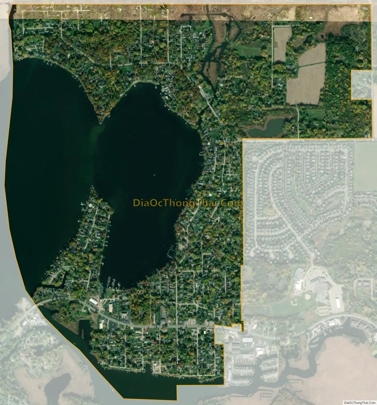
Lake Catherine city Satellite Map
Geography
Lake Catherine is located in northwestern Lake County at 42°29′2″N 88°7′27″W / 42.48389°N 88.12417°W / 42.48389; -88.12417 (42.483969, -88.124172). It is bordered to the north by Kenosha County, Wisconsin, to the east by the village of Antioch, and to the west by the community of Channel Lake. It surrounds Lake Catherine, a bay of Channel Lake, one of the Chain O’Lakes of northern Illinois.
Illinois Route 173 passes through the community, leading east through Antioch village 16 miles (26 km) to Zion and west 9 miles (14 km) to Richmond. Chicago is 55 miles (89 km) to the southeast, and Kenosha, Wisconsin, is 20 miles (32 km) to the northeast.
According to the United States Census Bureau, the Lake Catherine CDP has a total area of 1.5 square miles (3.8 km), of which 0.93 square miles (2.4 km) are land and 0.54 square miles (1.4 km), or 37.45%, are water.
See also
Map of Illinois State and its subdivision:- Adams
- Alexander
- Bond
- Boone
- Brown
- Bureau
- Calhoun
- Carroll
- Cass
- Champaign
- Christian
- Clark
- Clay
- Clinton
- Coles
- Cook
- Crawford
- Cumberland
- De Kalb
- De Witt
- Douglas
- Dupage
- Edgar
- Edwards
- Effingham
- Fayette
- Ford
- Franklin
- Fulton
- Gallatin
- Greene
- Grundy
- Hamilton
- Hancock
- Hardin
- Henderson
- Henry
- Iroquois
- Jackson
- Jasper
- Jefferson
- Jersey
- Jo Daviess
- Johnson
- Kane
- Kankakee
- Kendall
- Knox
- La Salle
- Lake
- Lake Michigan
- Lawrence
- Lee
- Livingston
- Logan
- Macon
- Macoupin
- Madison
- Marion
- Marshall
- Mason
- Massac
- McDonough
- McHenry
- McLean
- Menard
- Mercer
- Monroe
- Montgomery
- Morgan
- Moultrie
- Ogle
- Peoria
- Perry
- Piatt
- Pike
- Pope
- Pulaski
- Putnam
- Randolph
- Richland
- Rock Island
- Saint Clair
- Saline
- Sangamon
- Schuyler
- Scott
- Shelby
- Stark
- Stephenson
- Tazewell
- Union
- Vermilion
- Wabash
- Warren
- Washington
- Wayne
- White
- Whiteside
- Will
- Williamson
- Winnebago
- Woodford
- Alabama
- Alaska
- Arizona
- Arkansas
- California
- Colorado
- Connecticut
- Delaware
- District of Columbia
- Florida
- Georgia
- Hawaii
- Idaho
- Illinois
- Indiana
- Iowa
- Kansas
- Kentucky
- Louisiana
- Maine
- Maryland
- Massachusetts
- Michigan
- Minnesota
- Mississippi
- Missouri
- Montana
- Nebraska
- Nevada
- New Hampshire
- New Jersey
- New Mexico
- New York
- North Carolina
- North Dakota
- Ohio
- Oklahoma
- Oregon
- Pennsylvania
- Rhode Island
- South Carolina
- South Dakota
- Tennessee
- Texas
- Utah
- Vermont
- Virginia
- Washington
- West Virginia
- Wisconsin
- Wyoming


