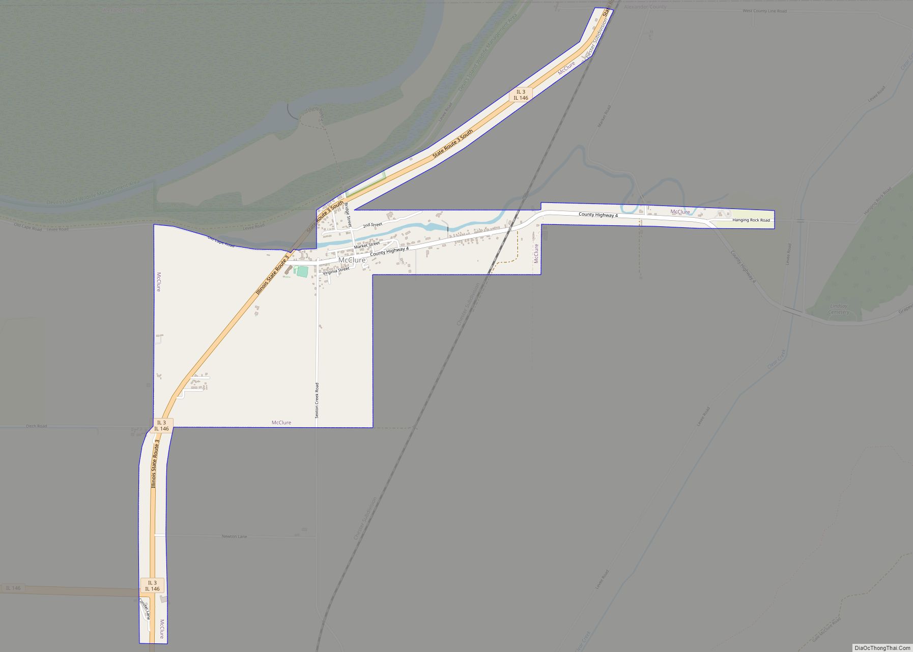
McClure is a village in McClure Precinct, Alexander County, Illinois, United States. It was incorporated in 2004 and had a population of 256 at the 2020 census.
McClure is part of the Cape Girardeau–Jackson Metropolitan Statistical Area.
| Name: | McClure village |
|---|---|
| LSAD Code: | 47 |
| LSAD Description: | village (suffix) |
| State: | Illinois |
| County: | Alexander County |
| Elevation: | 338 ft (103 m) |
| Total Area: | 1.53 sq mi (3.96 km²) |
| Land Area: | 1.53 sq mi (3.96 km²) |
| Water Area: | 0.00 sq mi (0.00 km²) 0% |
| Total Population: | 256 |
| Population Density: | 167.54/sq mi (64.69/km²) |
| Area code: | 618 |
| FIPS code: | 1745525 |
| GNISfeature ID: | 2399286 |
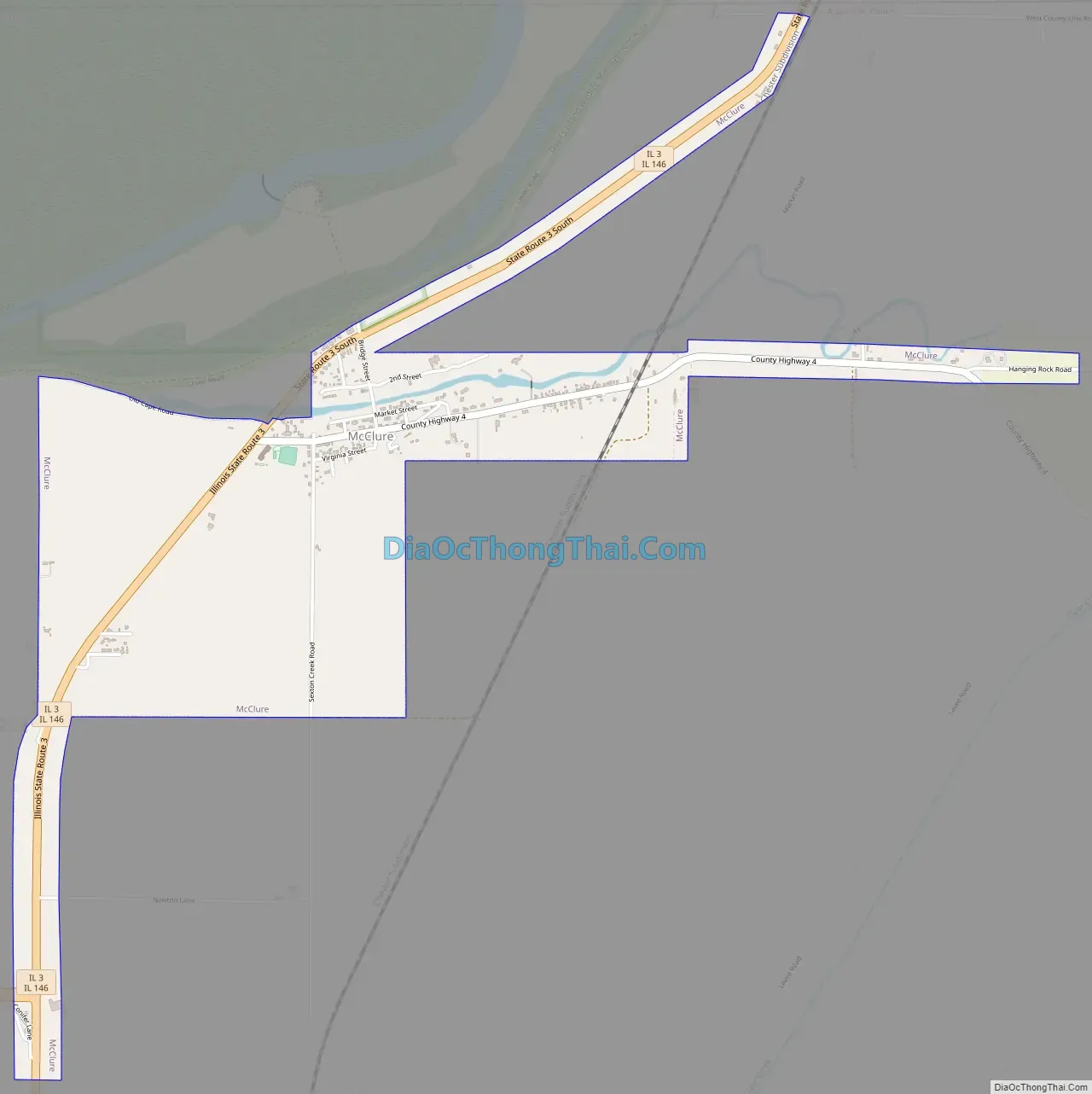
Online Interactive Map
Click on ![]() to view map in "full screen" mode.
to view map in "full screen" mode.
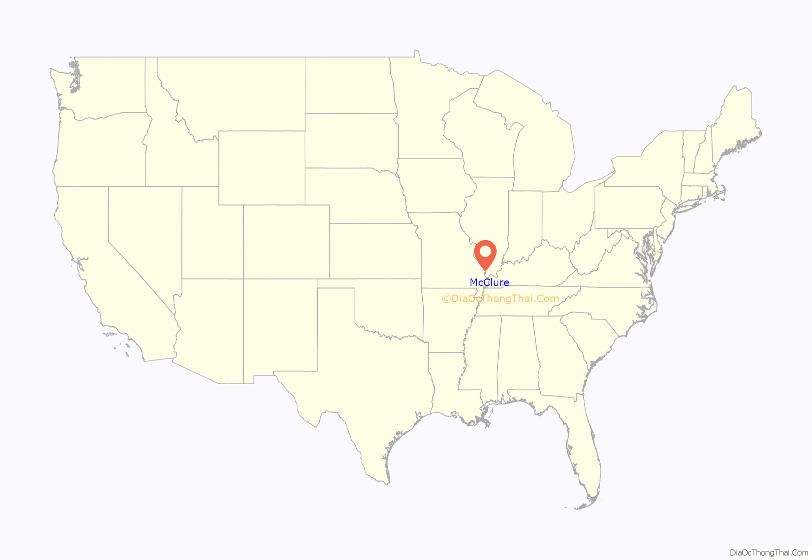
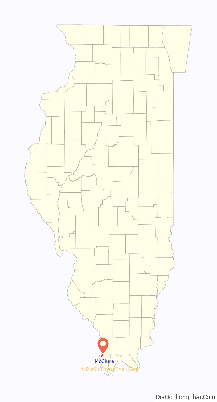
McClure location map. Where is McClure village?
History
The community of McClure was established prior to 1836, the year its post office opened, and was originally known as Clear Creek Landing or Clear Creek. The community’s name was changed to Wheatland in 1887 due to the large wheat fields in the region. Thomas J. McClure, for whose family the village was eventually named, moved to the village in 1842; he and his wife Caroline became prominent local farmers and raised seven children. Their son J. T. became the village postmaster, and he had the post office’s name changed to McClure in 1895 to avoid confusion with the Wheaton, Illinois post office. By the 1930s, the village had two train stations, a sizable business district, and a population of roughly 400. The village has since declined and now has relatively few businesses.
The McClure family’s house has been listed on the National Register of Historic Places.
McClure Road Map
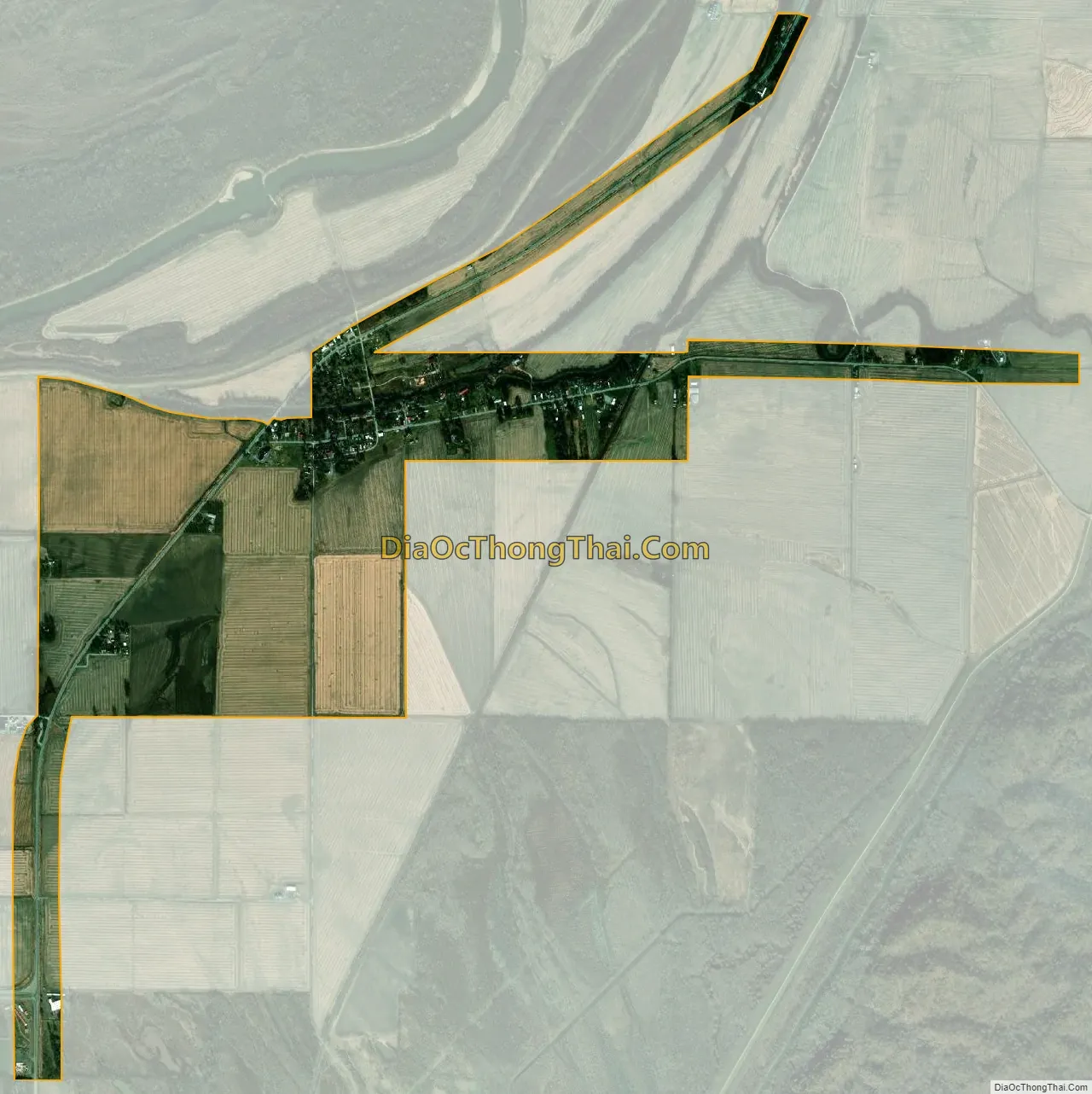
McClure city Satellite Map
Geography
McClure is located at 37°18′45″N 89°25′54″W / 37.312582°N 89.431560°W / 37.312582; -89.431560. According to the 2021 census gazetteer files, McClure has a total area of 1.53 square miles (3.96 km), all land.
See also
Map of Illinois State and its subdivision:- Adams
- Alexander
- Bond
- Boone
- Brown
- Bureau
- Calhoun
- Carroll
- Cass
- Champaign
- Christian
- Clark
- Clay
- Clinton
- Coles
- Cook
- Crawford
- Cumberland
- De Kalb
- De Witt
- Douglas
- Dupage
- Edgar
- Edwards
- Effingham
- Fayette
- Ford
- Franklin
- Fulton
- Gallatin
- Greene
- Grundy
- Hamilton
- Hancock
- Hardin
- Henderson
- Henry
- Iroquois
- Jackson
- Jasper
- Jefferson
- Jersey
- Jo Daviess
- Johnson
- Kane
- Kankakee
- Kendall
- Knox
- La Salle
- Lake
- Lake Michigan
- Lawrence
- Lee
- Livingston
- Logan
- Macon
- Macoupin
- Madison
- Marion
- Marshall
- Mason
- Massac
- McDonough
- McHenry
- McLean
- Menard
- Mercer
- Monroe
- Montgomery
- Morgan
- Moultrie
- Ogle
- Peoria
- Perry
- Piatt
- Pike
- Pope
- Pulaski
- Putnam
- Randolph
- Richland
- Rock Island
- Saint Clair
- Saline
- Sangamon
- Schuyler
- Scott
- Shelby
- Stark
- Stephenson
- Tazewell
- Union
- Vermilion
- Wabash
- Warren
- Washington
- Wayne
- White
- Whiteside
- Will
- Williamson
- Winnebago
- Woodford
- Alabama
- Alaska
- Arizona
- Arkansas
- California
- Colorado
- Connecticut
- Delaware
- District of Columbia
- Florida
- Georgia
- Hawaii
- Idaho
- Illinois
- Indiana
- Iowa
- Kansas
- Kentucky
- Louisiana
- Maine
- Maryland
- Massachusetts
- Michigan
- Minnesota
- Mississippi
- Missouri
- Montana
- Nebraska
- Nevada
- New Hampshire
- New Jersey
- New Mexico
- New York
- North Carolina
- North Dakota
- Ohio
- Oklahoma
- Oregon
- Pennsylvania
- Rhode Island
- South Carolina
- South Dakota
- Tennessee
- Texas
- Utah
- Vermont
- Virginia
- Washington
- West Virginia
- Wisconsin
- Wyoming