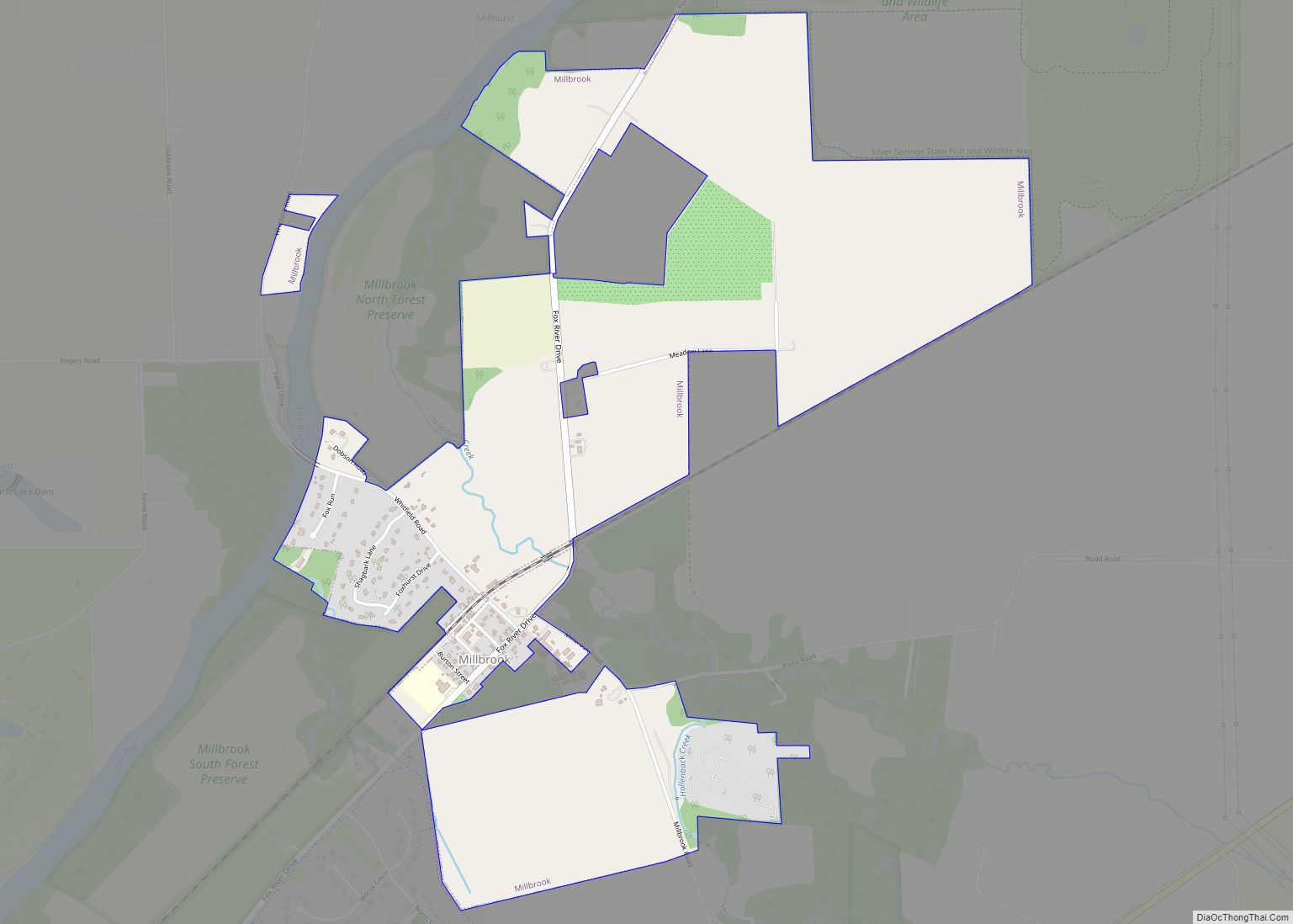
Millbrook is a village in Kendall County, Illinois, United States. It was incorporated on November 5, 2002, and had a population of 335 at the 2010 census.
The village is part of the Chicago metropolitan area.
| Name: | Millbrook village |
|---|---|
| LSAD Code: | 47 |
| LSAD Description: | village (suffix) |
| State: | Illinois |
| County: | Kendall County |
| Elevation: | 627 ft (191 m) |
| Total Area: | 1.85 sq mi (4.78 km²) |
| Land Area: | 1.85 sq mi (4.78 km²) |
| Water Area: | 0.00 sq mi (0.00 km²) |
| Total Population: | 277 |
| Population Density: | 150.05/sq mi (57.94/km²) |
| ZIP code: | 60536 |
| Area code: | Area code 630 |
| FIPS code: | 1749100 |
| GNISfeature ID: | 2399351 |
| Website: | www.thevillageofmillbrook.com |
Online Interactive Map
Click on ![]() to view map in "full screen" mode.
to view map in "full screen" mode.
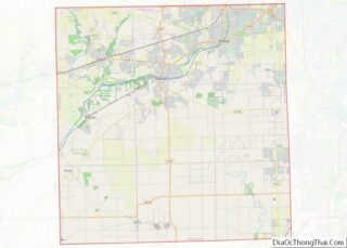
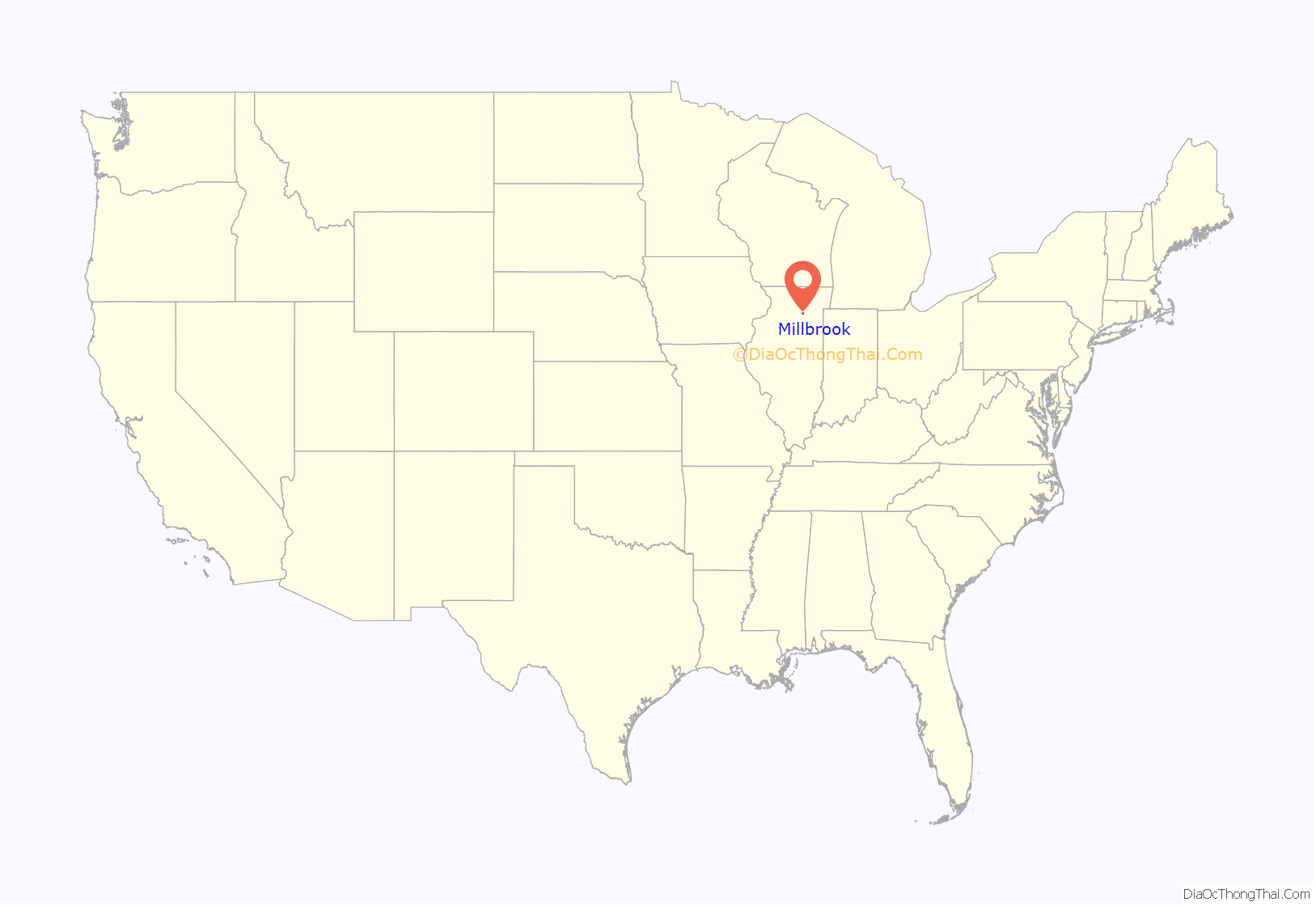
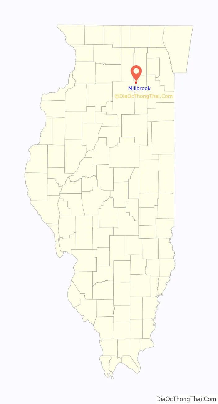
Millbrook location map. Where is Millbrook village?
Millbrook Road Map
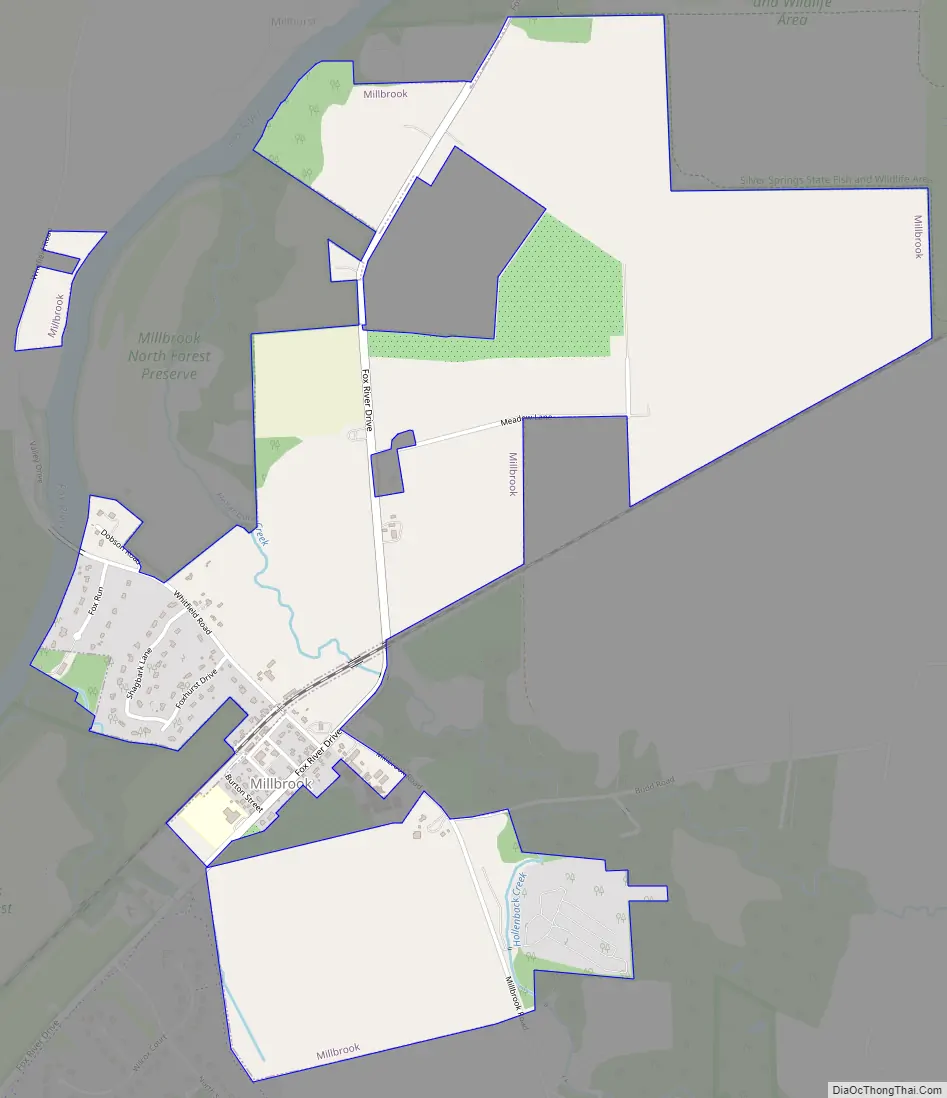
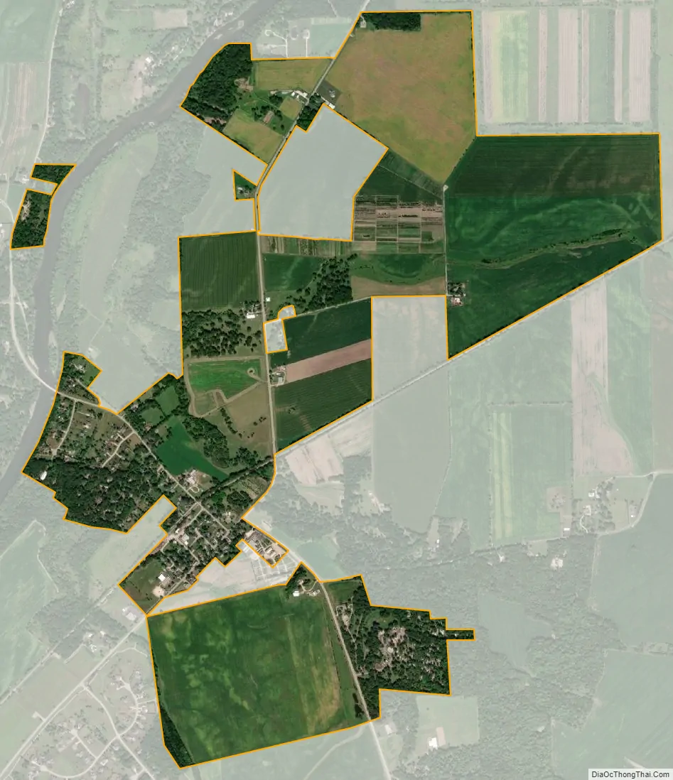
Millbrook city Satellite Map
Geography
Millbrook is in western Kendall County on the southeast side of the Fox River. It is 7 miles (11 km) southwest of Yorkville, the county seat, 19 miles (31 km) southwest of Aurora, and 28 miles (45 km) west-northwest of Joliet. The village is bordered to the northeast by Silver Springs State Fish and Wildlife Area, along the Fox River.
According to the 2010 census, Millbrook has a total area of 2.08 square miles (5.39 km), all land.
See also
Map of Illinois State and its subdivision:- Adams
- Alexander
- Bond
- Boone
- Brown
- Bureau
- Calhoun
- Carroll
- Cass
- Champaign
- Christian
- Clark
- Clay
- Clinton
- Coles
- Cook
- Crawford
- Cumberland
- De Kalb
- De Witt
- Douglas
- Dupage
- Edgar
- Edwards
- Effingham
- Fayette
- Ford
- Franklin
- Fulton
- Gallatin
- Greene
- Grundy
- Hamilton
- Hancock
- Hardin
- Henderson
- Henry
- Iroquois
- Jackson
- Jasper
- Jefferson
- Jersey
- Jo Daviess
- Johnson
- Kane
- Kankakee
- Kendall
- Knox
- La Salle
- Lake
- Lake Michigan
- Lawrence
- Lee
- Livingston
- Logan
- Macon
- Macoupin
- Madison
- Marion
- Marshall
- Mason
- Massac
- McDonough
- McHenry
- McLean
- Menard
- Mercer
- Monroe
- Montgomery
- Morgan
- Moultrie
- Ogle
- Peoria
- Perry
- Piatt
- Pike
- Pope
- Pulaski
- Putnam
- Randolph
- Richland
- Rock Island
- Saint Clair
- Saline
- Sangamon
- Schuyler
- Scott
- Shelby
- Stark
- Stephenson
- Tazewell
- Union
- Vermilion
- Wabash
- Warren
- Washington
- Wayne
- White
- Whiteside
- Will
- Williamson
- Winnebago
- Woodford
- Alabama
- Alaska
- Arizona
- Arkansas
- California
- Colorado
- Connecticut
- Delaware
- District of Columbia
- Florida
- Georgia
- Hawaii
- Idaho
- Illinois
- Indiana
- Iowa
- Kansas
- Kentucky
- Louisiana
- Maine
- Maryland
- Massachusetts
- Michigan
- Minnesota
- Mississippi
- Missouri
- Montana
- Nebraska
- Nevada
- New Hampshire
- New Jersey
- New Mexico
- New York
- North Carolina
- North Dakota
- Ohio
- Oklahoma
- Oregon
- Pennsylvania
- Rhode Island
- South Carolina
- South Dakota
- Tennessee
- Texas
- Utah
- Vermont
- Virginia
- Washington
- West Virginia
- Wisconsin
- Wyoming