New Athens (/ˈeɪθənz/) is a village in St. Clair County, Illinois, United States. Based upon common usage, the ‘A’ is always sounded with a long vowel, rather than a short vowel, by its residents, unlike the most commonly used English pronunciation of the city in Greece.
The population was 2,054 at the 2010 census. New Athens sits on the Kaskaskia River and was originally called Athens. The village was laid out in 1836 and incorporated in 1866. The name change to New Athens came in 1868 after it was discovered there was already an Athens in another part of the state.
The area is known for the water sports recreation, including annual boat races and fishing derby. It is also the home of the Peabody River King Conservation Area.
Since New Athens is in the Metro East area of greater St. Louis, it also has a place in the local brewery history. New Athens was home to Mound City Brewery until the 1950s. Baseball is a major sport in the area and the village has produced a number of athletes who have played professionally. One of the favorite sons is Whitey Herzog, a former Major League Baseball outfielder and manager. Other former major leaguers with New Athens ties include Larry Stahl, Mickey Haefner, Warren Hacker and Rich Hacker.
New Athens is home to several churches, including St. Agatha Catholic Church, St. John United Church of Christ, St. Paul Lutheran Church, The United Methodist Church of New Athens, and First Baptist Church.
| Name: | New Athens village |
|---|---|
| LSAD Code: | 47 |
| LSAD Description: | village (suffix) |
| State: | Illinois |
| County: | St. Clair County |
| Elevation: | 430 ft (130 m) |
| Total Area: | 2.30 sq mi (5.95 km²) |
| Land Area: | 2.11 sq mi (5.47 km²) |
| Water Area: | 0.18 sq mi (0.48 km²) |
| Total Population: | 1,955 |
| Population Density: | 925.66/sq mi (357.35/km²) |
| Area code: | 618 |
| FIPS code: | 1752116 |
| GNISfeature ID: | 2399452 |
| Website: | www.newathens.us |
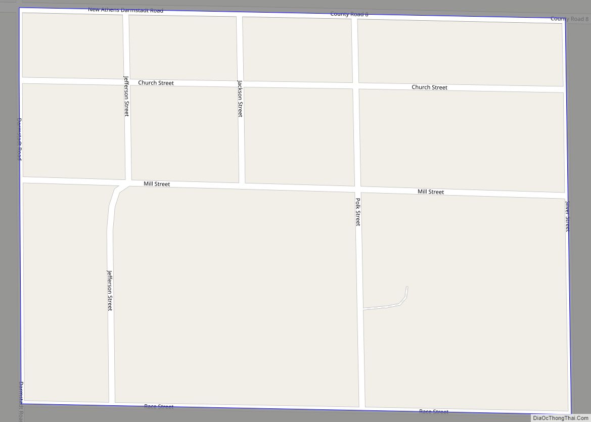
Online Interactive Map
Click on ![]() to view map in "full screen" mode.
to view map in "full screen" mode.
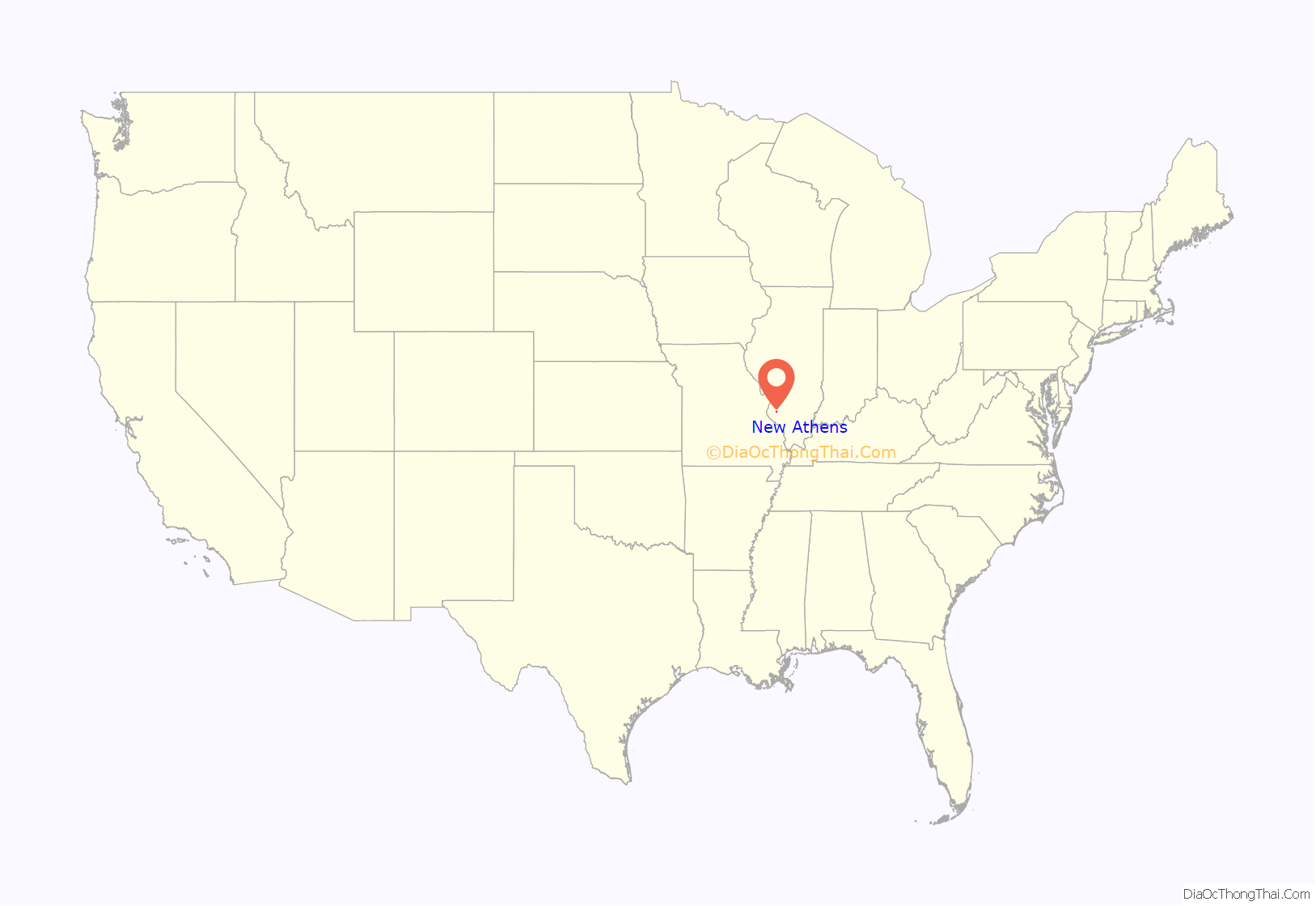
New Athens location map. Where is New Athens village?
History
The first organized settlement in what would later become the future town of New Athens, Illinois was Manville Ferry named after early settler and ferryman on the Kaskaskia River, Ira Manville. Manville ran the ferry until his death in 1821. By 1818, the third generation of the Sturdivant family counterfeiters, known as the “Sturdivant Gang”, were organized by Roswell S. Sturdivant and his brother, Merrick Sturdivant, who led the criminal organization, would base their southwestern Illinois counterfeiting operations at Manville Ferry and the other part of their criminal operation in southeastern Illinois on the Ohio River at Sturdivant’s Fort, in Pope County, Illinois, now present-day Rosiclare, Hardin County, Illinois.
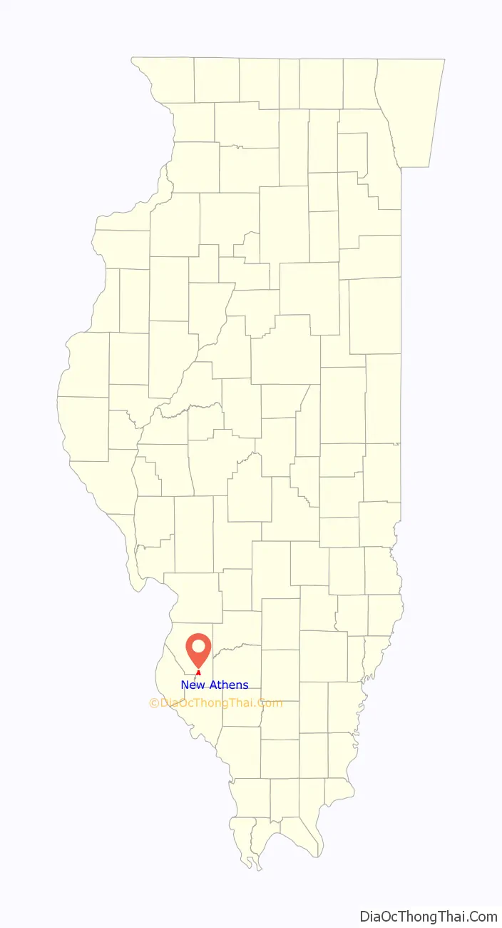
New Athens Road Map
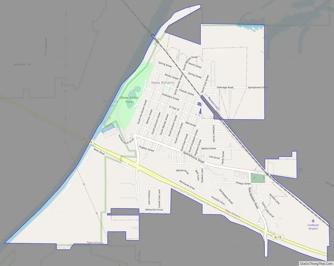
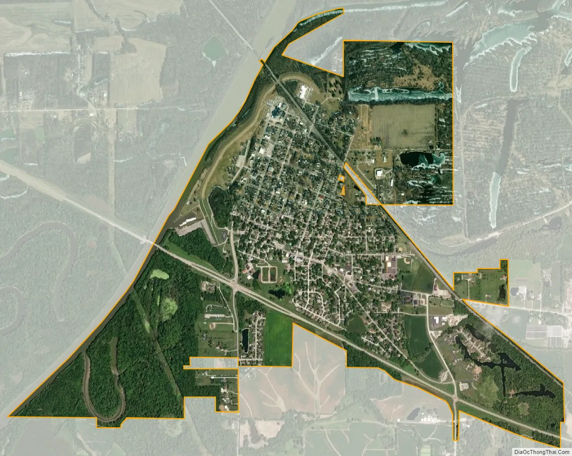
New Athens city Satellite Map
Geography
New Athens is located at 38°19′22″N 89°52′29″W / 38.32278°N 89.87472°W / 38.32278; -89.87472 (38.322660, -89.874811).
According to the 2010 census, New Athens has a total area of 2.129 square miles (5.51 km), of which 1.92 square miles (4.97 km) (or 90.18%) is land and 0.209 square miles (0.54 km) (or 9.82%) is water.
See also
Map of Illinois State and its subdivision:- Adams
- Alexander
- Bond
- Boone
- Brown
- Bureau
- Calhoun
- Carroll
- Cass
- Champaign
- Christian
- Clark
- Clay
- Clinton
- Coles
- Cook
- Crawford
- Cumberland
- De Kalb
- De Witt
- Douglas
- Dupage
- Edgar
- Edwards
- Effingham
- Fayette
- Ford
- Franklin
- Fulton
- Gallatin
- Greene
- Grundy
- Hamilton
- Hancock
- Hardin
- Henderson
- Henry
- Iroquois
- Jackson
- Jasper
- Jefferson
- Jersey
- Jo Daviess
- Johnson
- Kane
- Kankakee
- Kendall
- Knox
- La Salle
- Lake
- Lake Michigan
- Lawrence
- Lee
- Livingston
- Logan
- Macon
- Macoupin
- Madison
- Marion
- Marshall
- Mason
- Massac
- McDonough
- McHenry
- McLean
- Menard
- Mercer
- Monroe
- Montgomery
- Morgan
- Moultrie
- Ogle
- Peoria
- Perry
- Piatt
- Pike
- Pope
- Pulaski
- Putnam
- Randolph
- Richland
- Rock Island
- Saint Clair
- Saline
- Sangamon
- Schuyler
- Scott
- Shelby
- Stark
- Stephenson
- Tazewell
- Union
- Vermilion
- Wabash
- Warren
- Washington
- Wayne
- White
- Whiteside
- Will
- Williamson
- Winnebago
- Woodford
- Alabama
- Alaska
- Arizona
- Arkansas
- California
- Colorado
- Connecticut
- Delaware
- District of Columbia
- Florida
- Georgia
- Hawaii
- Idaho
- Illinois
- Indiana
- Iowa
- Kansas
- Kentucky
- Louisiana
- Maine
- Maryland
- Massachusetts
- Michigan
- Minnesota
- Mississippi
- Missouri
- Montana
- Nebraska
- Nevada
- New Hampshire
- New Jersey
- New Mexico
- New York
- North Carolina
- North Dakota
- Ohio
- Oklahoma
- Oregon
- Pennsylvania
- Rhode Island
- South Carolina
- South Dakota
- Tennessee
- Texas
- Utah
- Vermont
- Virginia
- Washington
- West Virginia
- Wisconsin
- Wyoming