Rosewood Heights is an unincorporated community and census-designated place (CDP) in Madison County, Illinois, United States. The population was 3,971 at the 2020 census. It is part of the Metro East region of the Greater St. Louis metropolitan area.
| Name: | Rosewood Heights CDP |
|---|---|
| LSAD Code: | 57 |
| LSAD Description: | CDP (suffix) |
| State: | Illinois |
| County: | Madison County |
| Elevation: | 535 ft (163 m) |
| Total Area: | 1.674 sq mi (4.34 km²) |
| Land Area: | 1.671 sq mi (4.33 km²) |
| Water Area: | 0.003 sq mi (0.008 km²) |
| Total Population: | 3,971 |
| Population Density: | 2,376.4/sq mi (917.5/km²) |
| FIPS code: | 1765884 |
Online Interactive Map
Click on ![]() to view map in "full screen" mode.
to view map in "full screen" mode.
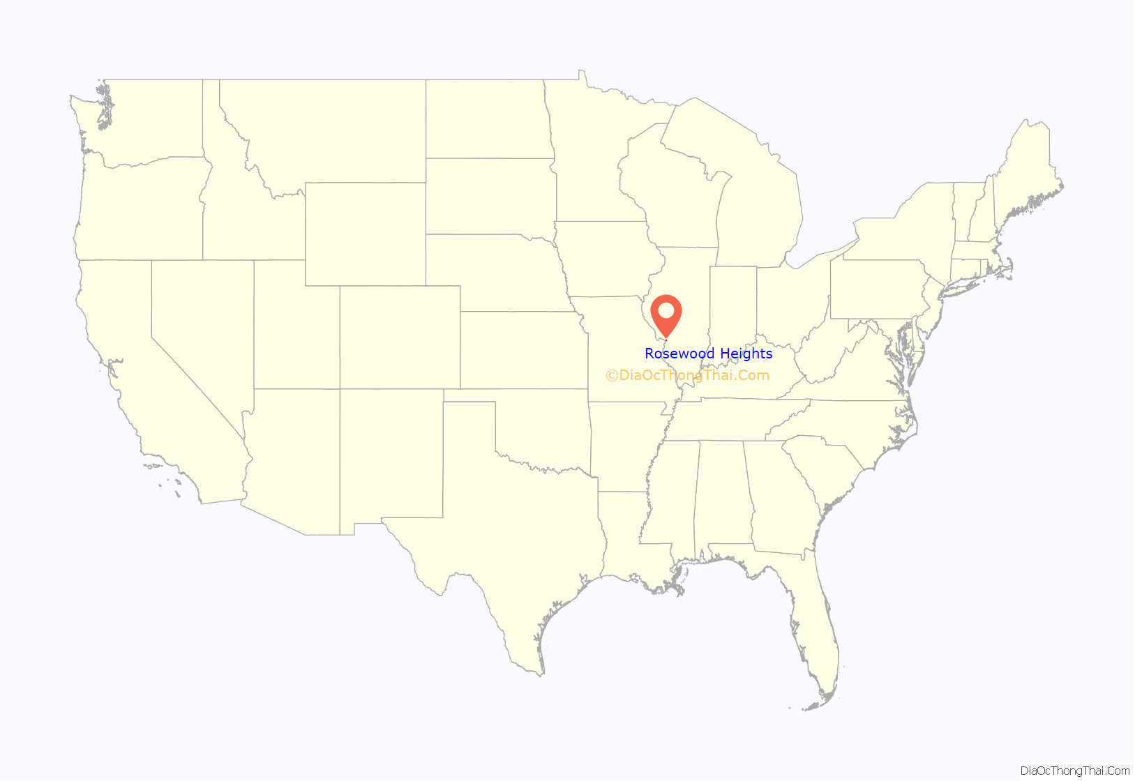
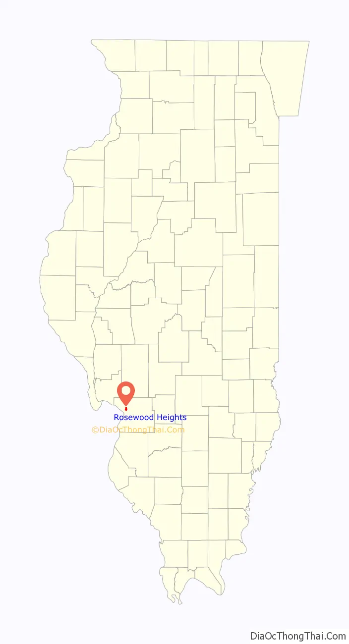
Rosewood Heights location map. Where is Rosewood Heights CDP?
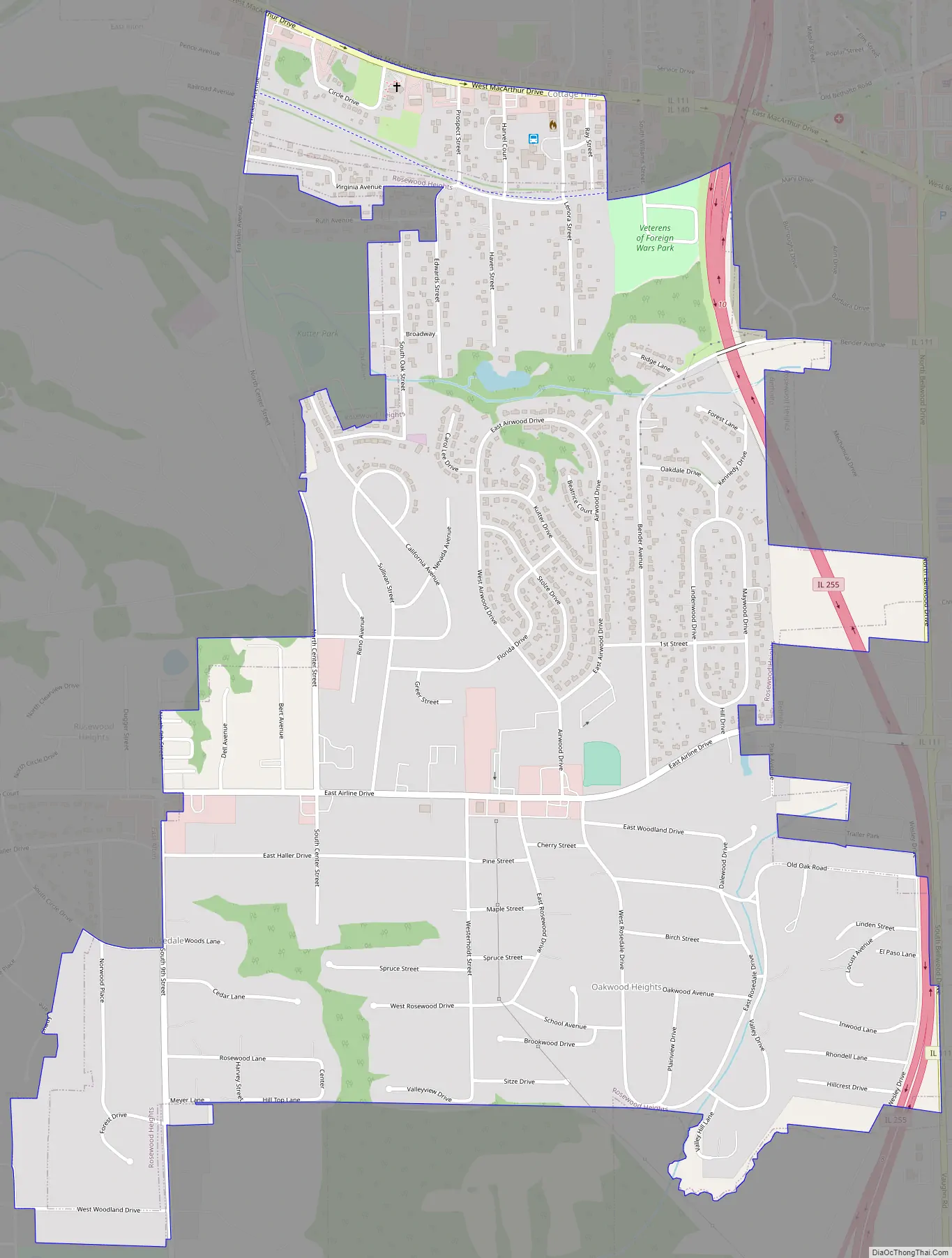
Rosewood Heights Road Map
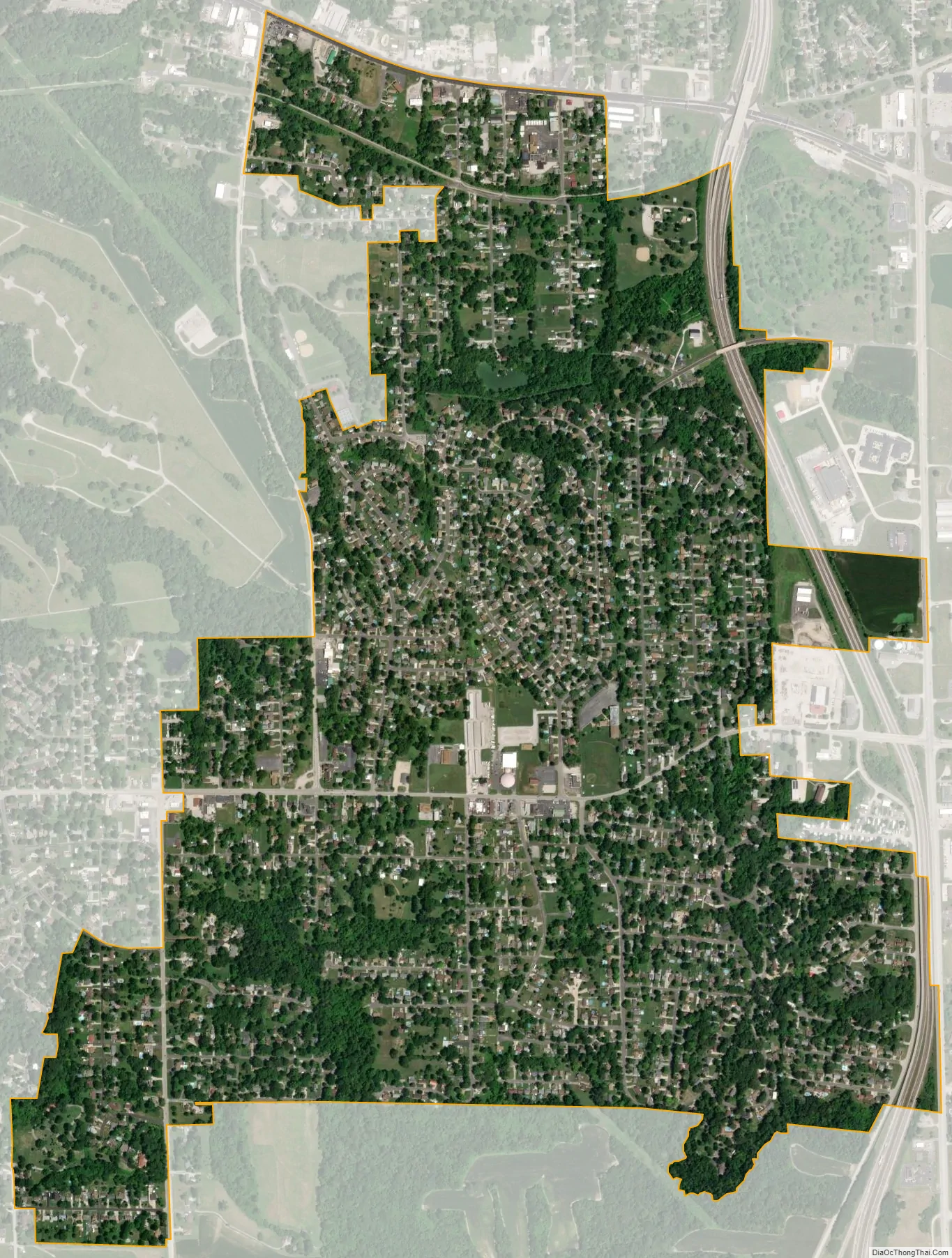
Rosewood Heights city Satellite Map
Geography
Rosewood Heights is located in northwestern Madison County at 38°53′29″N 90°4′19″W / 38.89139°N 90.07194°W / 38.89139; -90.07194 (38.891414, -90.071813). It is bordered to the east by Bethalto, to the south by Wood River, to the west by East Alton, and to the north by Cottage Hills.
Illinois Routes 111 and 140 (West MacArthur Drive) form the northern border of the CDP. IL 140 leads west 6 miles (10 km) to Alton and east through Bethalto 12 miles (19 km) to Hamel, while IL 111 leads northwest 9 miles (14 km) to Godfrey and south 4 miles (6 km) to the center of Wood River. Illinois Route 255, a four-lane expressway, runs along the east edge of Rosewood Heights, with access from Exit 10 (IL 111-140). IL 255 leads south 10 miles (16 km) to Interstates 255 and 270 and northwest 9 miles (14 km) to its end at U.S. Route 67 in Godfrey. Downtown St. Louis is 27 miles (43 km) southwest of Rosewood Heights.
According to the United States Census Bureau, the CDP has a total area of 1.7 square miles (4.4 km), of which 0.003 square miles (0.008 km), or 0.18%, are water. The community drains northwest toward the East Fork of the Wood River, which joins the Mississippi River at East Alton.
See also
Map of Illinois State and its subdivision:- Adams
- Alexander
- Bond
- Boone
- Brown
- Bureau
- Calhoun
- Carroll
- Cass
- Champaign
- Christian
- Clark
- Clay
- Clinton
- Coles
- Cook
- Crawford
- Cumberland
- De Kalb
- De Witt
- Douglas
- Dupage
- Edgar
- Edwards
- Effingham
- Fayette
- Ford
- Franklin
- Fulton
- Gallatin
- Greene
- Grundy
- Hamilton
- Hancock
- Hardin
- Henderson
- Henry
- Iroquois
- Jackson
- Jasper
- Jefferson
- Jersey
- Jo Daviess
- Johnson
- Kane
- Kankakee
- Kendall
- Knox
- La Salle
- Lake
- Lake Michigan
- Lawrence
- Lee
- Livingston
- Logan
- Macon
- Macoupin
- Madison
- Marion
- Marshall
- Mason
- Massac
- McDonough
- McHenry
- McLean
- Menard
- Mercer
- Monroe
- Montgomery
- Morgan
- Moultrie
- Ogle
- Peoria
- Perry
- Piatt
- Pike
- Pope
- Pulaski
- Putnam
- Randolph
- Richland
- Rock Island
- Saint Clair
- Saline
- Sangamon
- Schuyler
- Scott
- Shelby
- Stark
- Stephenson
- Tazewell
- Union
- Vermilion
- Wabash
- Warren
- Washington
- Wayne
- White
- Whiteside
- Will
- Williamson
- Winnebago
- Woodford
- Alabama
- Alaska
- Arizona
- Arkansas
- California
- Colorado
- Connecticut
- Delaware
- District of Columbia
- Florida
- Georgia
- Hawaii
- Idaho
- Illinois
- Indiana
- Iowa
- Kansas
- Kentucky
- Louisiana
- Maine
- Maryland
- Massachusetts
- Michigan
- Minnesota
- Mississippi
- Missouri
- Montana
- Nebraska
- Nevada
- New Hampshire
- New Jersey
- New Mexico
- New York
- North Carolina
- North Dakota
- Ohio
- Oklahoma
- Oregon
- Pennsylvania
- Rhode Island
- South Carolina
- South Dakota
- Tennessee
- Texas
- Utah
- Vermont
- Virginia
- Washington
- West Virginia
- Wisconsin
- Wyoming


