Salem is a city in and the county seat of Marion County, Illinois, United States. The population was 7,282 at the 2020 census.
| Name: | Salem city |
|---|---|
| LSAD Code: | 25 |
| LSAD Description: | city (suffix) |
| State: | Illinois |
| County: | Marion County |
| Elevation: | 545 ft (166 m) |
| Total Area: | 7.15 sq mi (18.51 km²) |
| Land Area: | 6.99 sq mi (18.11 km²) |
| Water Area: | 0.15 sq mi (0.40 km²) |
| Total Population: | 7,282 |
| Population Density: | 1,041.62/sq mi (402.18/km²) |
| ZIP code: | 62881 |
| Area code: | 618 |
| FIPS code: | 1767236 |
| Website: | www.salemil.us |
Online Interactive Map
Click on ![]() to view map in "full screen" mode.
to view map in "full screen" mode.
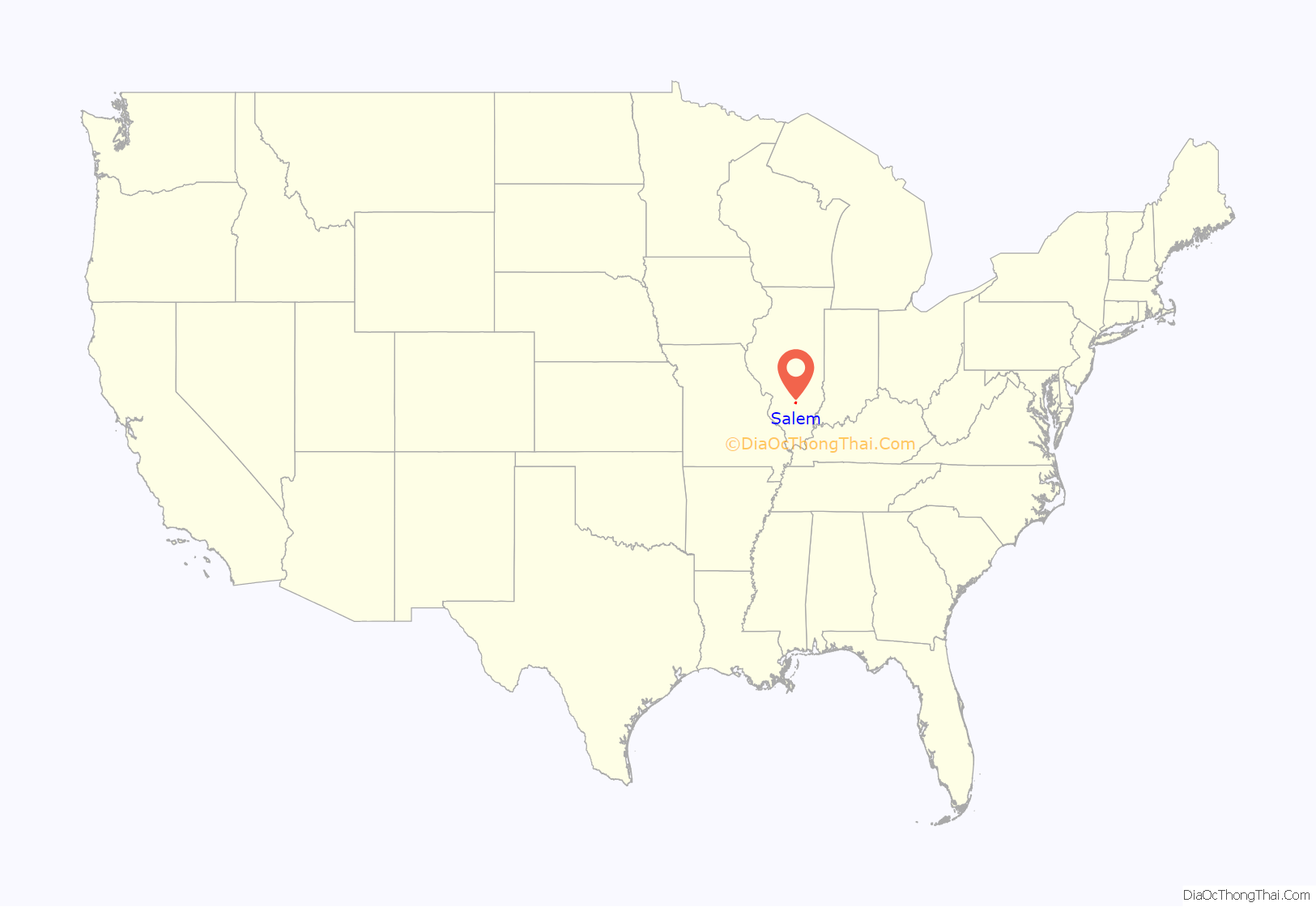
Salem location map. Where is Salem city?
History
Salem was formerly a sundown town. For decades, Salem had signs on each main road going into town telling African Americans that they were not allowed in town after sundown.
Salem Road Map
Salem city Satellite Map
Geography
Salem is located in central Marion County. U.S. Route 50 passes through the city center as Main Street, leading east 26 miles (42 km) to Flora and west 23 miles (37 km) to Carlyle. Illinois Route 37 (Broadway) crosses US 50 in the center of town, leading north 7 miles (11 km) to Alma and south 15 miles (24 km) to Dix. Interstate 57 passes through the west side of Salem, with access from Exit 116 (US 50); the Interstate leads northeast 45 miles (72 km) to Effingham and south 21 miles (34 km) to Mount Vernon.
According to the U.S. Census Bureau, Salem has a total area of 7.15 square miles (18.52 km), of which 6.99 square miles (18.10 km) are land and 0.16 square miles (0.41 km), or 2.17%, are water. Town Creek flows through the east side of the city, running to Crooked Creek just south of the city limits. Via Crooked Creek, Salem is part of the Kaskaskia River watershed.
Climate
See also
Map of Illinois State and its subdivision:- Adams
- Alexander
- Bond
- Boone
- Brown
- Bureau
- Calhoun
- Carroll
- Cass
- Champaign
- Christian
- Clark
- Clay
- Clinton
- Coles
- Cook
- Crawford
- Cumberland
- De Kalb
- De Witt
- Douglas
- Dupage
- Edgar
- Edwards
- Effingham
- Fayette
- Ford
- Franklin
- Fulton
- Gallatin
- Greene
- Grundy
- Hamilton
- Hancock
- Hardin
- Henderson
- Henry
- Iroquois
- Jackson
- Jasper
- Jefferson
- Jersey
- Jo Daviess
- Johnson
- Kane
- Kankakee
- Kendall
- Knox
- La Salle
- Lake
- Lake Michigan
- Lawrence
- Lee
- Livingston
- Logan
- Macon
- Macoupin
- Madison
- Marion
- Marshall
- Mason
- Massac
- McDonough
- McHenry
- McLean
- Menard
- Mercer
- Monroe
- Montgomery
- Morgan
- Moultrie
- Ogle
- Peoria
- Perry
- Piatt
- Pike
- Pope
- Pulaski
- Putnam
- Randolph
- Richland
- Rock Island
- Saint Clair
- Saline
- Sangamon
- Schuyler
- Scott
- Shelby
- Stark
- Stephenson
- Tazewell
- Union
- Vermilion
- Wabash
- Warren
- Washington
- Wayne
- White
- Whiteside
- Will
- Williamson
- Winnebago
- Woodford
- Alabama
- Alaska
- Arizona
- Arkansas
- California
- Colorado
- Connecticut
- Delaware
- District of Columbia
- Florida
- Georgia
- Hawaii
- Idaho
- Illinois
- Indiana
- Iowa
- Kansas
- Kentucky
- Louisiana
- Maine
- Maryland
- Massachusetts
- Michigan
- Minnesota
- Mississippi
- Missouri
- Montana
- Nebraska
- Nevada
- New Hampshire
- New Jersey
- New Mexico
- New York
- North Carolina
- North Dakota
- Ohio
- Oklahoma
- Oregon
- Pennsylvania
- Rhode Island
- South Carolina
- South Dakota
- Tennessee
- Texas
- Utah
- Vermont
- Virginia
- Washington
- West Virginia
- Wisconsin
- Wyoming
