Williamson is a village in Madison County, Illinois, United States. The population was 183 at the 2020 census, down from 230 in 2010.
| Name: | Williamson village |
|---|---|
| LSAD Code: | 47 |
| LSAD Description: | village (suffix) |
| State: | Illinois |
| County: | Madison County |
| Elevation: | 604 ft (184 m) |
| Total Area: | 1.22 sq mi (3.16 km²) |
| Land Area: | 1.17 sq mi (3.03 km²) |
| Water Area: | 0.05 sq mi (0.12 km²) |
| Total Population: | 183 |
| Population Density: | 156.28/sq mi (60.32/km²) |
| ZIP code: | 62088 (Staunton) |
| Area code: | 618 |
| FIPS code: | 1781815 |
| GNISfeature ID: | 2399696 |
Online Interactive Map
Click on ![]() to view map in "full screen" mode.
to view map in "full screen" mode.
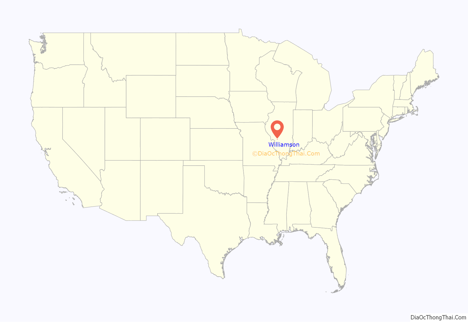
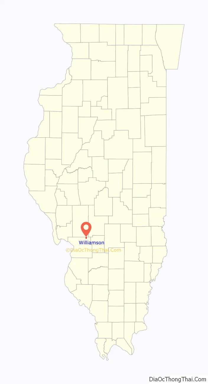
Williamson location map. Where is Williamson village?
History
Williamson had its start as a coal town. The village is named for the land’s original owners, John and Matthew Williamson.
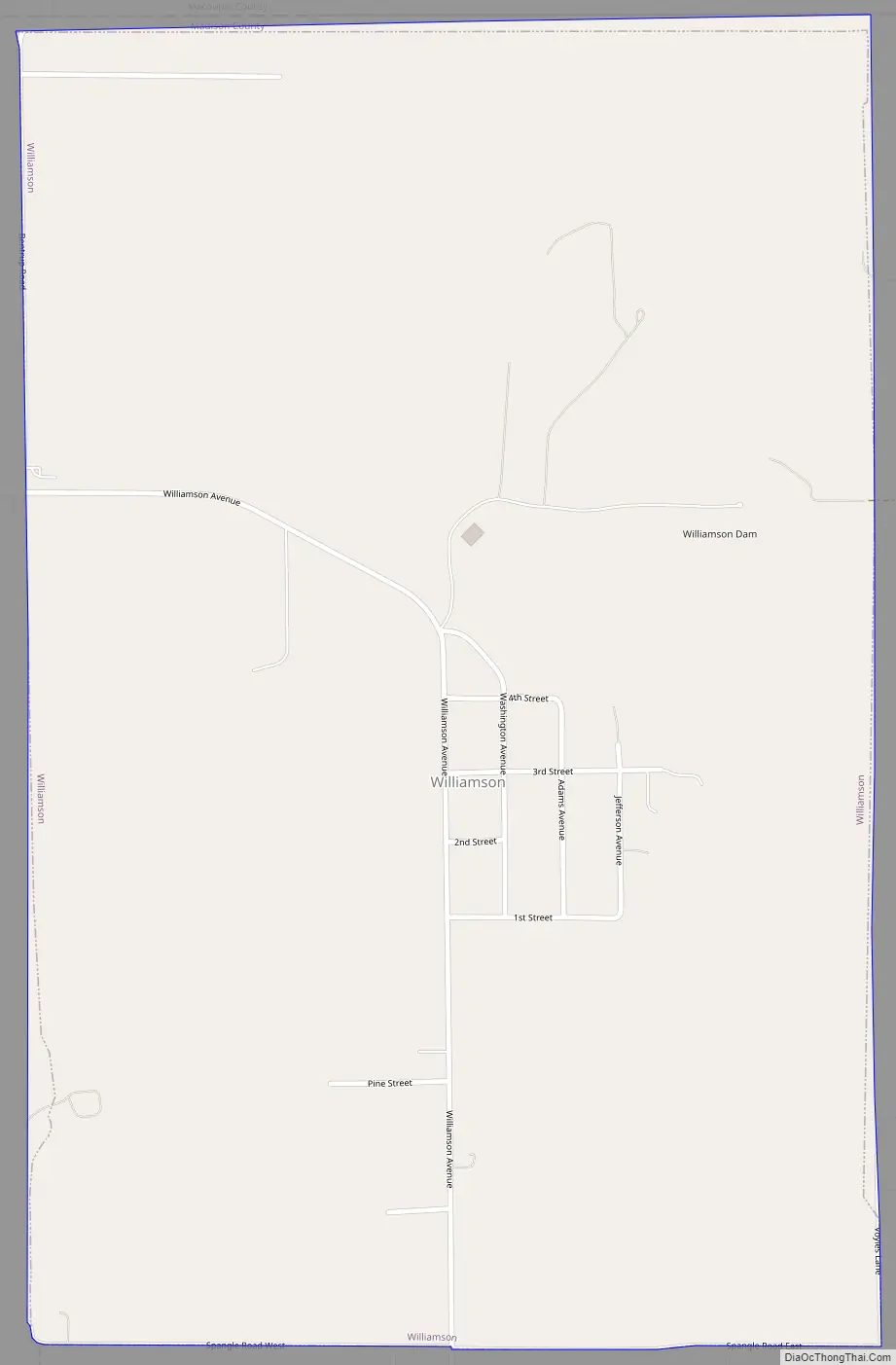
Williamson Road Map
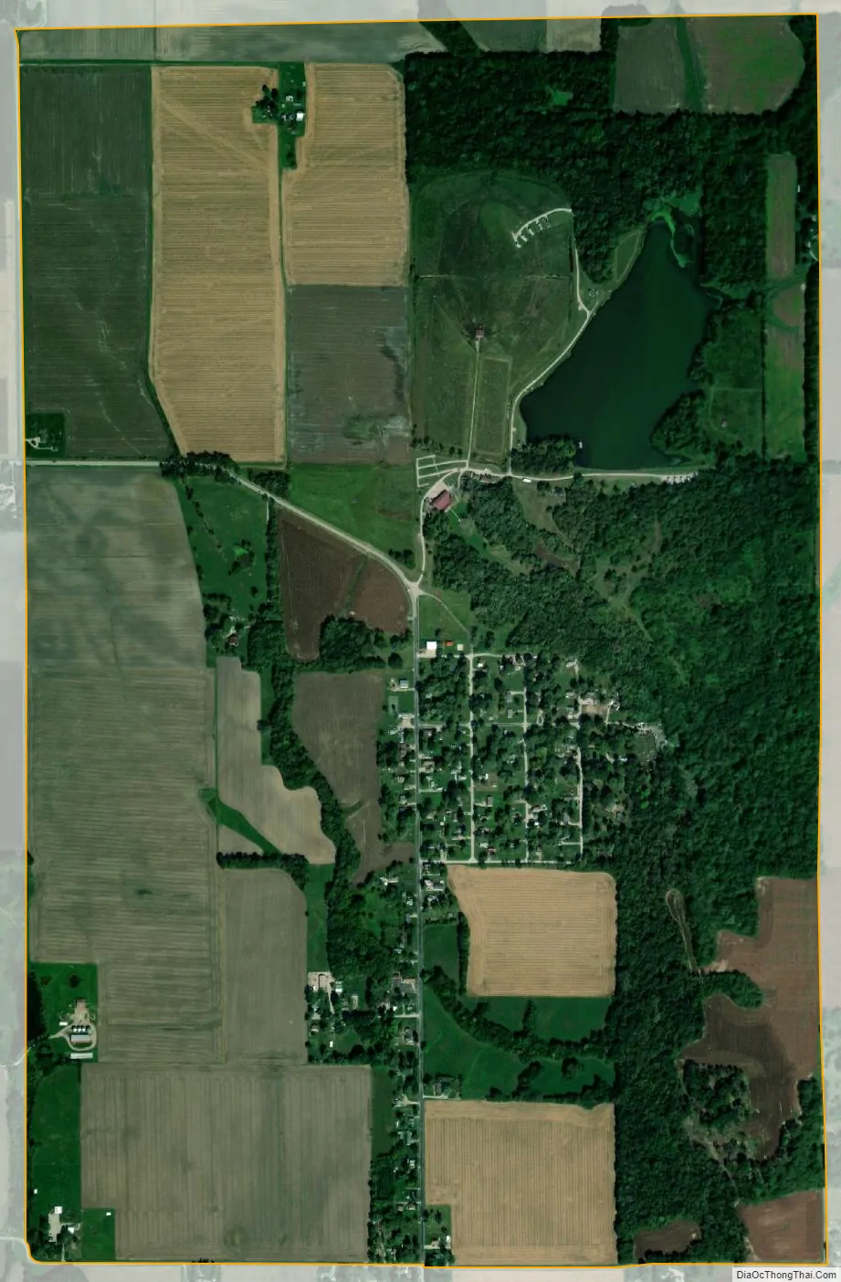
Williamson city Satellite Map
Geography
Williamson is bordered to the south by the village of Livingston and to the north by Macoupin County. Interstate 55 passes just east of the village, with access from Exit 37 in Livingston. St. Louis is 40 miles (64 km) to the southwest, and Springfield is 58 miles (93 km) to the north.
According to the U.S. Census Bureau, Williamson has a total area of 1.2 square miles (3.1 km), of which 0.05 square miles (0.13 km), or 3.86%, are water. The village is drained to the southeast by tributaries of Silver Creek, a south-flowing tributary of the Kaskaskia River.
See also
Map of Illinois State and its subdivision:- Adams
- Alexander
- Bond
- Boone
- Brown
- Bureau
- Calhoun
- Carroll
- Cass
- Champaign
- Christian
- Clark
- Clay
- Clinton
- Coles
- Cook
- Crawford
- Cumberland
- De Kalb
- De Witt
- Douglas
- Dupage
- Edgar
- Edwards
- Effingham
- Fayette
- Ford
- Franklin
- Fulton
- Gallatin
- Greene
- Grundy
- Hamilton
- Hancock
- Hardin
- Henderson
- Henry
- Iroquois
- Jackson
- Jasper
- Jefferson
- Jersey
- Jo Daviess
- Johnson
- Kane
- Kankakee
- Kendall
- Knox
- La Salle
- Lake
- Lake Michigan
- Lawrence
- Lee
- Livingston
- Logan
- Macon
- Macoupin
- Madison
- Marion
- Marshall
- Mason
- Massac
- McDonough
- McHenry
- McLean
- Menard
- Mercer
- Monroe
- Montgomery
- Morgan
- Moultrie
- Ogle
- Peoria
- Perry
- Piatt
- Pike
- Pope
- Pulaski
- Putnam
- Randolph
- Richland
- Rock Island
- Saint Clair
- Saline
- Sangamon
- Schuyler
- Scott
- Shelby
- Stark
- Stephenson
- Tazewell
- Union
- Vermilion
- Wabash
- Warren
- Washington
- Wayne
- White
- Whiteside
- Will
- Williamson
- Winnebago
- Woodford
- Alabama
- Alaska
- Arizona
- Arkansas
- California
- Colorado
- Connecticut
- Delaware
- District of Columbia
- Florida
- Georgia
- Hawaii
- Idaho
- Illinois
- Indiana
- Iowa
- Kansas
- Kentucky
- Louisiana
- Maine
- Maryland
- Massachusetts
- Michigan
- Minnesota
- Mississippi
- Missouri
- Montana
- Nebraska
- Nevada
- New Hampshire
- New Jersey
- New Mexico
- New York
- North Carolina
- North Dakota
- Ohio
- Oklahoma
- Oregon
- Pennsylvania
- Rhode Island
- South Carolina
- South Dakota
- Tennessee
- Texas
- Utah
- Vermont
- Virginia
- Washington
- West Virginia
- Wisconsin
- Wyoming


