Clinton is a home rule-class city and the county seat of Hickman County, Kentucky, United States. The population was 1,388 at the 2010 census, a decline from 1,415 in 2000.
| Name: | Clinton city |
|---|---|
| LSAD Code: | 25 |
| LSAD Description: | city (suffix) |
| State: | Kentucky |
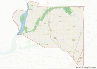
| County: | Hickman County |
| Elevation: | 371 ft (113 m) |
| Total Area: | 1.62 sq mi (4.19 km²) |
| Land Area: | 1.61 sq mi (4.18 km²) |
| Water Area: | 0.01 sq mi (0.01 km²) |
| Total Population: | 1,222 |
| Population Density: | 757.59/sq mi (292.59/km²) |
| ZIP code: | 42031 |
| Area code: | 270 & 364 |
| FIPS code: | 2115742 |
| GNISfeature ID: | 0489694 |
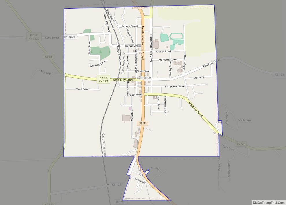
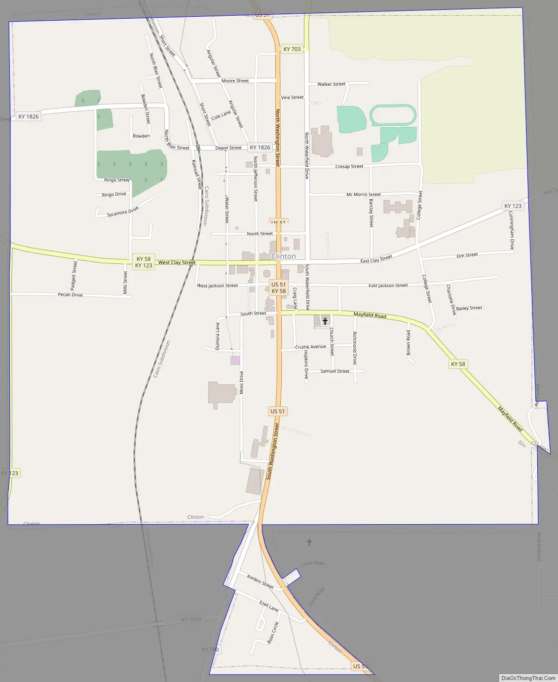
Online Interactive Map
Click on ![]() to view map in "full screen" mode.
to view map in "full screen" mode.
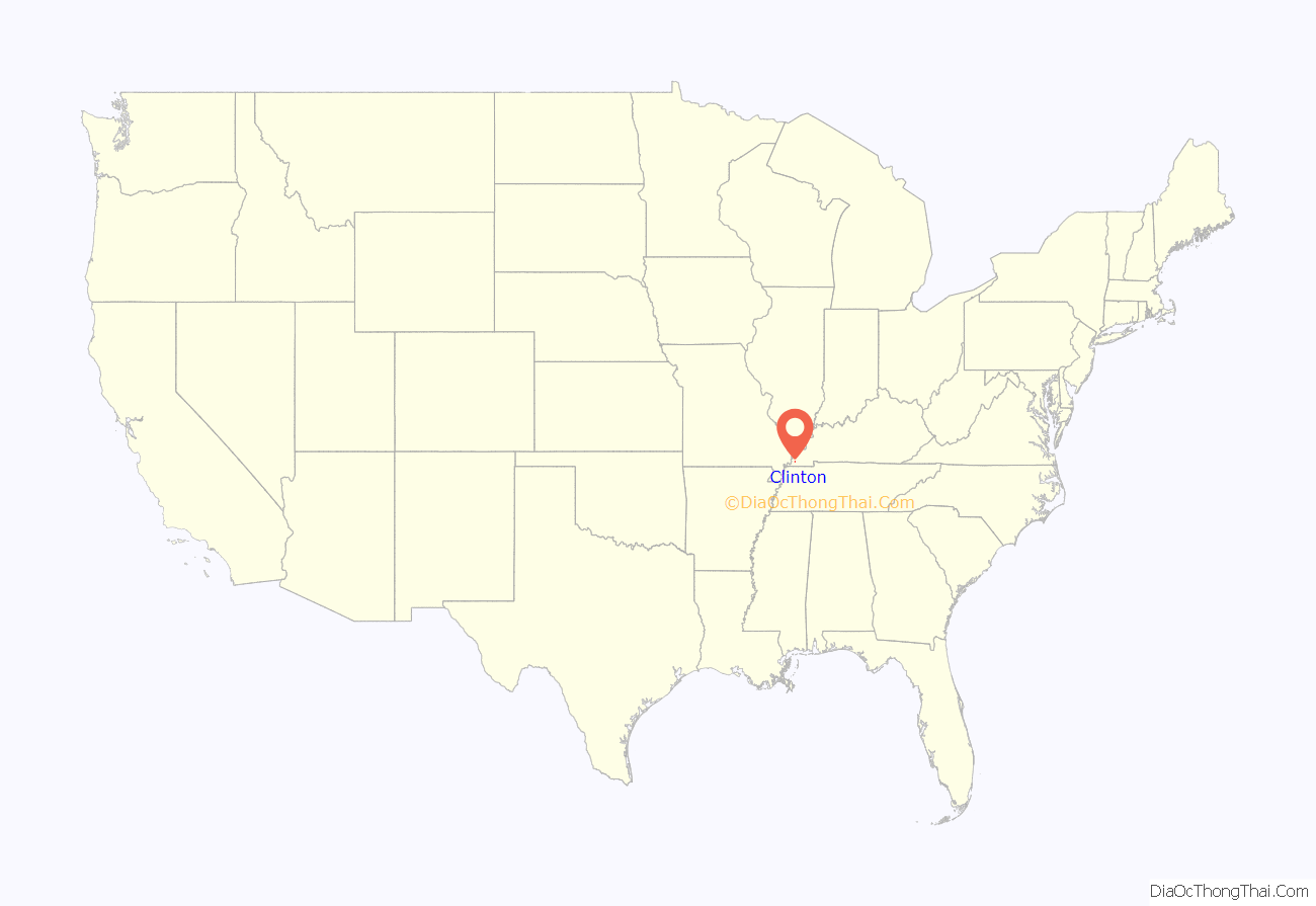
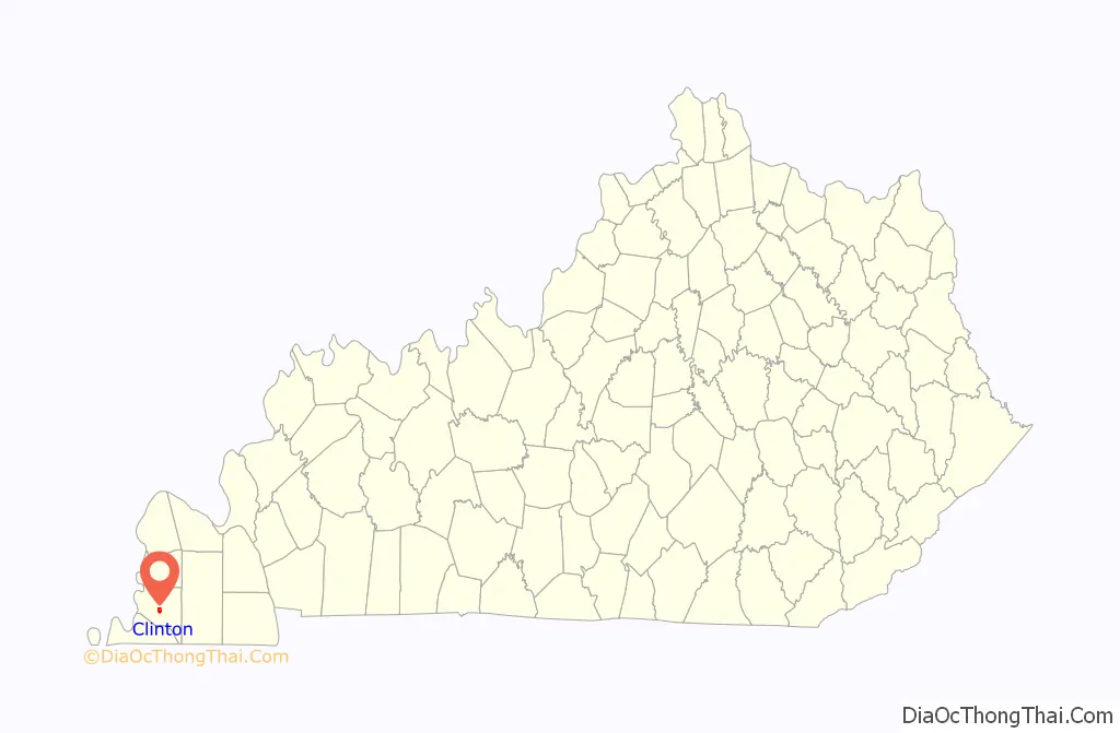
Clinton location map. Where is Clinton city?
History
Clinton appears to have been named after a riverboat or military captain who was stationed at the location around the time it was settled in the late 1820s. Clinton was incorporated in 1831.
It was the home to Clinton College from 1871 to 1915.
Clinton Road Map
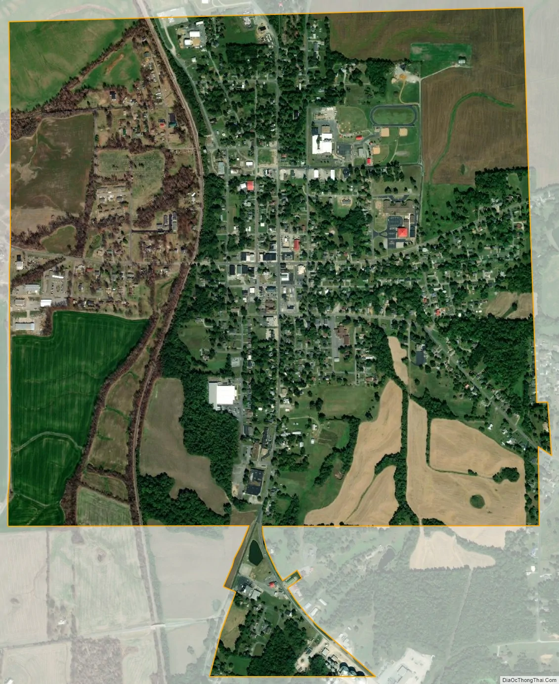
Clinton city Satellite Map
Geography
Clinton is located in central Hickman County at 36°40′1″N 88°59′39″W / 36.66694°N 88.99417°W / 36.66694; -88.99417 (36.667040, -88.994103). U.S. Route 51 passes through the center of town as Washington Street, leading north 30 miles (48 km) to Cairo, Illinois, and south 14 miles (23 km) to Fulton on the Tennessee border.
According to the United States Census Bureau, Clinton has a total area of 1.6 square miles (4.2 km), of which 0.004 square miles (0.01 km), or 0.29%, are water.
See also
Map of Kentucky State and its subdivision:- Adair
- Allen
- Anderson
- Ballard
- Barren
- Bath
- Bell
- Boone
- Bourbon
- Boyd
- Boyle
- Bracken
- Breathitt
- Breckinridge
- Bullitt
- Butler
- Caldwell
- Calloway
- Campbell
- Carlisle
- Carroll
- Carter
- Casey
- Christian
- Clark
- Clay
- Clinton
- Crittenden
- Cumberland
- Daviess
- Edmonson
- Elliott
- Estill
- Fayette
- Fleming
- Floyd
- Franklin
- Fulton
- Gallatin
- Garrard
- Grant
- Graves
- Grayson
- Green
- Greenup
- Hancock
- Hardin
- Harlan
- Harrison
- Hart
- Henderson
- Henry
- Hickman
- Hopkins
- Jackson
- Jefferson
- Jessamine
- Johnson
- Kenton
- Knott
- Knox
- Larue
- Laurel
- Lawrence
- Lee
- Leslie
- Letcher
- Lewis
- Lincoln
- Livingston
- Logan
- Lyon
- Madison
- Magoffin
- Marion
- Marshall
- Martin
- Mason
- McCracken
- McCreary
- McLean
- Meade
- Menifee
- Mercer
- Metcalfe
- Monroe
- Montgomery
- Morgan
- Muhlenberg
- Nelson
- Nicholas
- Ohio
- Oldham
- Owen
- Owsley
- Pendleton
- Perry
- Pike
- Powell
- Pulaski
- Robertson
- Rockcastle
- Rowan
- Russell
- Scott
- Shelby
- Simpson
- Spencer
- Taylor
- Todd
- Trigg
- Trimble
- Union
- Warren
- Washington
- Wayne
- Webster
- Whitley
- Wolfe
- Woodford
- Alabama
- Alaska
- Arizona
- Arkansas
- California
- Colorado
- Connecticut
- Delaware
- District of Columbia
- Florida
- Georgia
- Hawaii
- Idaho
- Illinois
- Indiana
- Iowa
- Kansas
- Kentucky
- Louisiana
- Maine
- Maryland
- Massachusetts
- Michigan
- Minnesota
- Mississippi
- Missouri
- Montana
- Nebraska
- Nevada
- New Hampshire
- New Jersey
- New Mexico
- New York
- North Carolina
- North Dakota
- Ohio
- Oklahoma
- Oregon
- Pennsylvania
- Rhode Island
- South Carolina
- South Dakota
- Tennessee
- Texas
- Utah
- Vermont
- Virginia
- Washington
- West Virginia
- Wisconsin
- Wyoming