Cynthiana is a home rule-class city in Harrison County, Kentucky, in the United States. The population was 6,402 at the 2010 census. It is the seat of its county.
| Name: | Cynthiana city |
|---|---|
| LSAD Code: | 25 |
| LSAD Description: | city (suffix) |
| State: | Kentucky |
| County: | Harrison County |
| Elevation: | 735 ft (224 m) |
| Total Area: | 4.44 sq mi (11.50 km²) |
| Land Area: | 4.39 sq mi (11.37 km²) |
| Water Area: | 0.05 sq mi (0.13 km²) |
| Total Population: | 6,333 |
| Population Density: | 1,442.60/sq mi (556.99/km²) |
| ZIP code: | 41031 |
| Area code: | 859 |
| FIPS code: | 2119432 |
| GNISfeature ID: | 0490519 |
| Website: | www.cynthianaky.com |
Online Interactive Map
Click on ![]() to view map in "full screen" mode.
to view map in "full screen" mode.
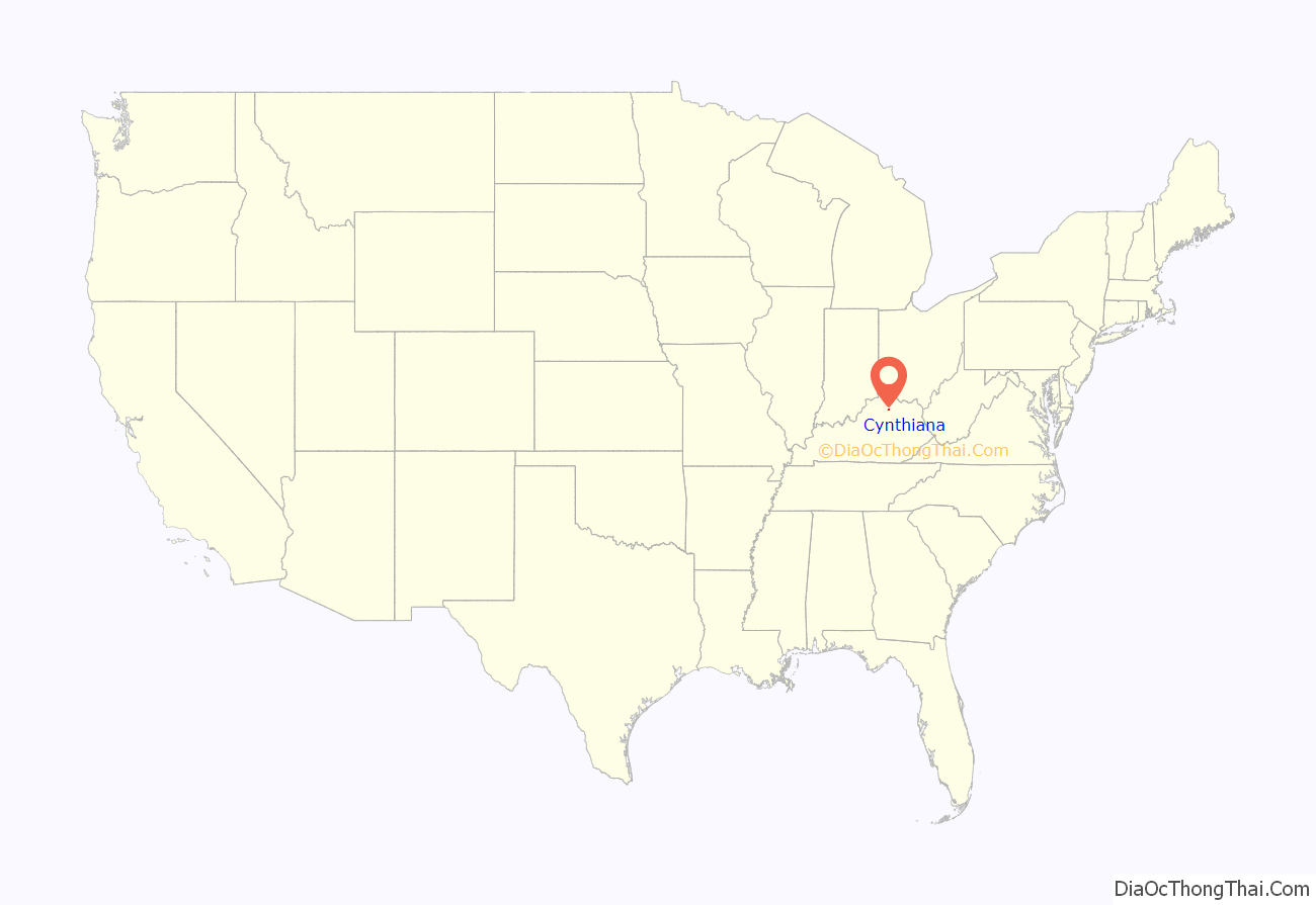
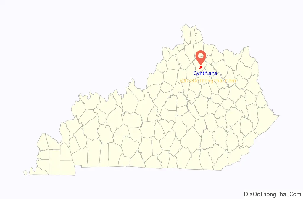
Cynthiana location map. Where is Cynthiana city?
History
The settlement developed on both sides of the South Fork of the Licking River. It was named after Cynthia and Anna Harrison, daughters of Robert Harrison, who had donated land to establish the town center. Harrison County, on the other hand, was named after Colonel Benjamin Harrison, an early settler in the area who had served as sheriff of Bourbon County.
Two Civil War battles were fought in Cynthiana. The first on July 17, 1862, was part of a cavalry raid into Kentucky (which stayed in the Union) by Confederate General John Hunt Morgan; the second, on June 11 and 12, 1864, resulted in Union defeat of Confederate forces during Morgan’s last raid into the state.
On January 23, 1877, an LL chondrite meteorite fell in Cynthiana.
On March 2, 1997, the South Fork of the Licking River flooded, causing extensive damage in Cynthiana and neighboring communities.
In early March 2020, near the beginning of the COVID-19 pandemic in the United States, Cynthiana was reported to have the first case of the disease diagnosed in Kentucky. Four more cases soon followed, and by March 12, most businesses, schools and churches closed in an effort to prevent further spread.
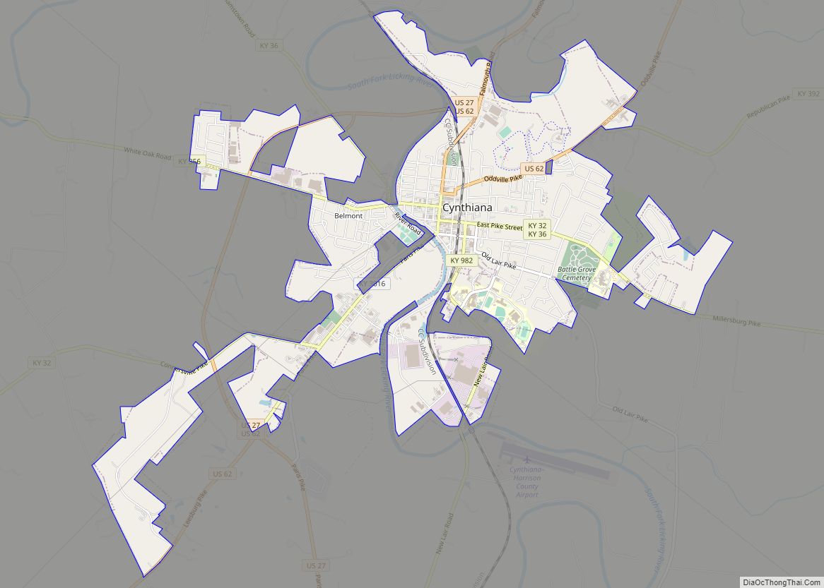
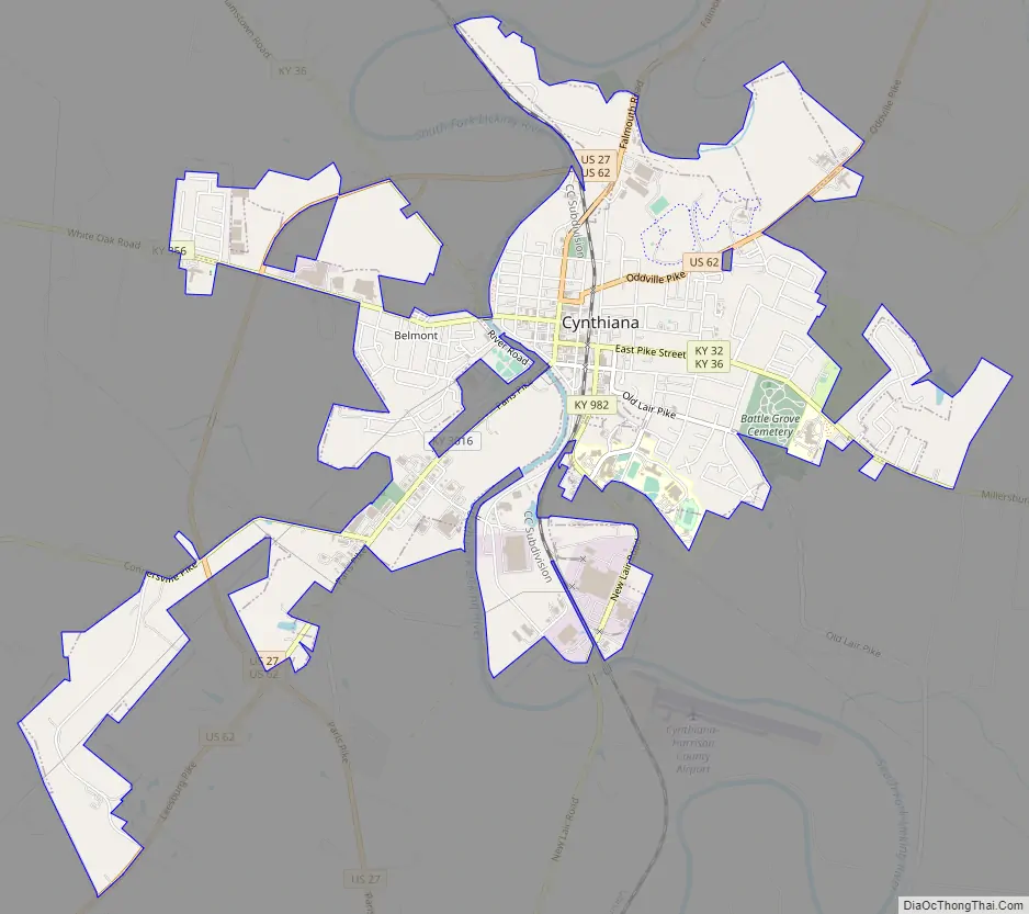
Cynthiana Road Map
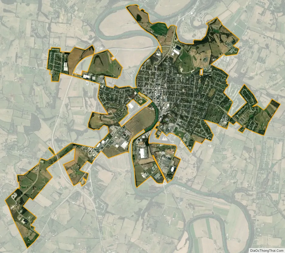
Cynthiana city Satellite Map
Geography
Cynthiana is located in southern Harrison County at 38°23′18″N 84°17′49″W / 38.38833°N 84.29694°W / 38.38833; -84.29694 (38.388292, -84.296841). U.S. Routes 27 and 62 pass through the city, passing west of the downtown area. US 27 leads north 56 miles (90 km) to Cincinnati and south 14 miles (23 km) to Paris, while US 62 leads northeast 46 miles (74 km) to Maysville and southwest 21 miles (34 km) to Georgetown. Lexington is 31 miles (50 km) to the southwest via US 27 or 29 miles (47 km) via Kentucky Route 353.
According to the United States Census Bureau, the city has a total area of 4.1 square miles (10.5 km), of which 4.0 square miles (10.4 km) are land and 0.04 square miles (0.1 km), or 1.09%, are water. The South Fork of the Licking River, a tributary of the Ohio River, flows south to north through the city, passing west of the downtown area.
Climate
The climate in this area is characterized by hot, humid summers and generally mild to cool winters. According to the Köppen Climate Classification system, Cynthiana has a humid subtropical climate, abbreviated “Cfa” on climate maps.
See also
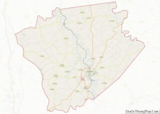
Map of Kentucky State and its subdivision:- Adair
- Allen
- Anderson
- Ballard
- Barren
- Bath
- Bell
- Boone
- Bourbon
- Boyd
- Boyle
- Bracken
- Breathitt
- Breckinridge
- Bullitt
- Butler
- Caldwell
- Calloway
- Campbell
- Carlisle
- Carroll
- Carter
- Casey
- Christian
- Clark
- Clay
- Clinton
- Crittenden
- Cumberland
- Daviess
- Edmonson
- Elliott
- Estill
- Fayette
- Fleming
- Floyd
- Franklin
- Fulton
- Gallatin
- Garrard
- Grant
- Graves
- Grayson
- Green
- Greenup
- Hancock
- Hardin
- Harlan
- Harrison
- Hart
- Henderson
- Henry
- Hickman
- Hopkins
- Jackson
- Jefferson
- Jessamine
- Johnson
- Kenton
- Knott
- Knox
- Larue
- Laurel
- Lawrence
- Lee
- Leslie
- Letcher
- Lewis
- Lincoln
- Livingston
- Logan
- Lyon
- Madison
- Magoffin
- Marion
- Marshall
- Martin
- Mason
- McCracken
- McCreary
- McLean
- Meade
- Menifee
- Mercer
- Metcalfe
- Monroe
- Montgomery
- Morgan
- Muhlenberg
- Nelson
- Nicholas
- Ohio
- Oldham
- Owen
- Owsley
- Pendleton
- Perry
- Pike
- Powell
- Pulaski
- Robertson
- Rockcastle
- Rowan
- Russell
- Scott
- Shelby
- Simpson
- Spencer
- Taylor
- Todd
- Trigg
- Trimble
- Union
- Warren
- Washington
- Wayne
- Webster
- Whitley
- Wolfe
- Woodford
- Alabama
- Alaska
- Arizona
- Arkansas
- California
- Colorado
- Connecticut
- Delaware
- District of Columbia
- Florida
- Georgia
- Hawaii
- Idaho
- Illinois
- Indiana
- Iowa
- Kansas
- Kentucky
- Louisiana
- Maine
- Maryland
- Massachusetts
- Michigan
- Minnesota
- Mississippi
- Missouri
- Montana
- Nebraska
- Nevada
- New Hampshire
- New Jersey
- New Mexico
- New York
- North Carolina
- North Dakota
- Ohio
- Oklahoma
- Oregon
- Pennsylvania
- Rhode Island
- South Carolina
- South Dakota
- Tennessee
- Texas
- Utah
- Vermont
- Virginia
- Washington
- West Virginia
- Wisconsin
- Wyoming