Georgetown is a home rule-class city in Scott County, Kentucky, United States. The population was 37,086 at the 2020 census. It is the 6th-largest city by population in the U.S. state of Kentucky. It is the seat of its county. It was originally called Lebanon when founded by Rev. Elijah Craig and was renamed in 1790 in honor of President George Washington. It is the home of Georgetown College, a private liberal arts college. Georgetown is part of the Lexington-Fayette, KY Metropolitan Statistical Area. At one time the city served as the training camp home for the NFL’s Cincinnati Bengals.
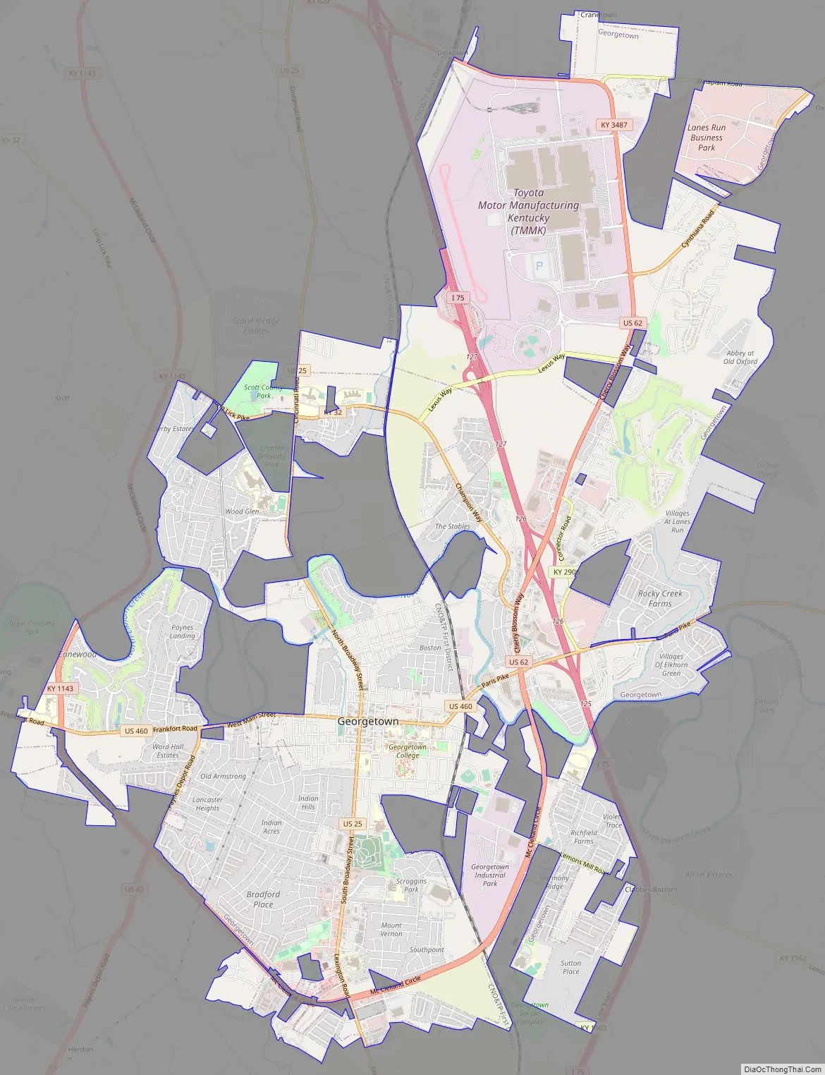
The city’s growth began in the mid-1980s, when Toyota built Toyota Motor Manufacturing Kentucky, its first wholly owned United States plant, in Georgetown. The plant opened in 1988; it builds the Camry, Camry Hybrid, Avalon, Lexus ES, and RAV4 Hybrid automobiles.
| Name: | Georgetown city |
|---|---|
| LSAD Code: | 25 |
| LSAD Description: | city (suffix) |
| State: | Kentucky |
| County: | Scott County |
| Elevation: | 846 ft (258 m) |
| Land Area: | 16.98 sq mi (43.99 km²) |
| Water Area: | 0.17 sq mi (0.43 km²) |
| Population Density: | 2,183.6/sq mi (843.09/km²) |
| ZIP code: | 40324 |
| Area code: | 502 |
| FIPS code: | 2130700 |
| GNISfeature ID: | 0492790 |
| Website: | georgetownky.gov |
Online Interactive Map
Click on ![]() to view map in "full screen" mode.
to view map in "full screen" mode.
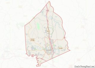
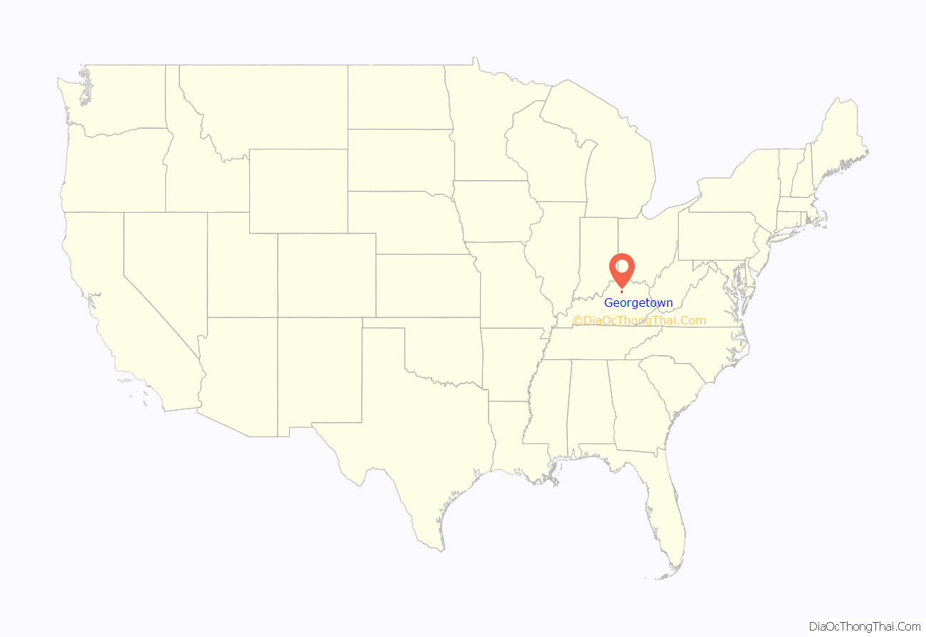
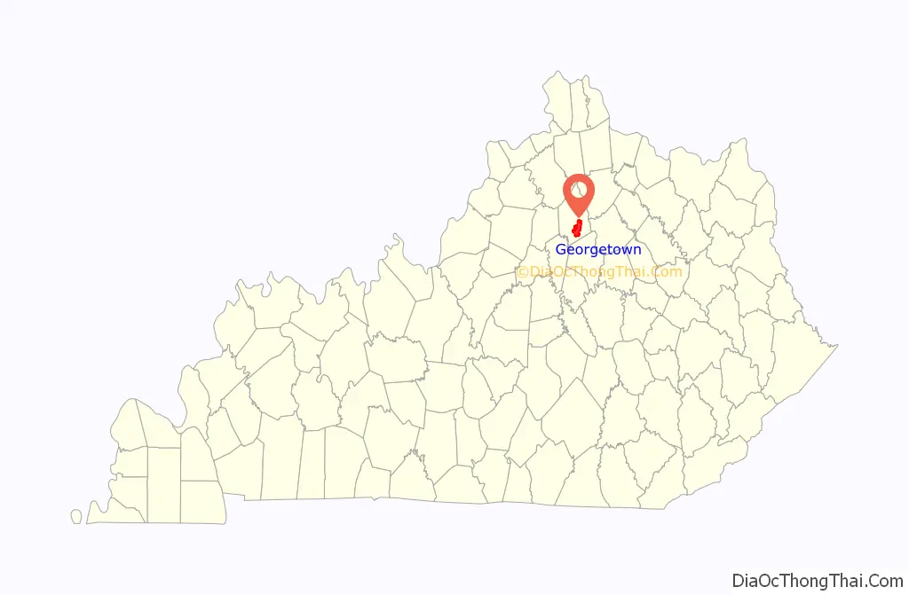
Georgetown location map. Where is Georgetown city?
History
Native peoples have lived along the banks of Elkhorn Creek in what is now Scott County for at least 15,000 years. At the time of European encounter, the historic Shawnee people occupied this area.
Anglo-American exploration can be dated to the late colonial period and a June 1774 surveying expedition from Fincastle County, Virginia, led by Colonel John Floyd. For his military service, he was granted a claim of 1,000 acres (4.0 km) in the area by the state of Virginia. He named it Royal Spring but did not settle it. John McClellan was the first English colonist to settle the area and established McClellan’s Station there in 1775, but the compound was abandoned following an Indian attack on December 29, 1776.
In 1782, the Baptist preacher Elijah Craig led his congregation to the site from Orange County, Virginia, and established a new settlement which he called Lebanon. This was incorporated by the Virginia legislature in 1784. At the time, Virginia claimed this territory under its colonial charter. Craig established some of the first mills west of the Appalachian Mountains along the Royal Spring Branch, where he also manufactured cloth and paper. He also founded a distillery in 1789, as well as a school called the Rittenhouse Academy. This eventually developed as Georgetown College.
The city’s name was changed to George Town in honor of President George Washington in 1790. When Kentucky became the 15th U.S. state in 1792 and formed Scott County, George Town became the county seat. Its name was formally changed to Georgetown in 1846.
The county developed an agricultural economy, as it was part of the fertile Bluegrass Region. Planters cultivated tobacco and hemp, and raised blooded livestock, including Thoroughbred racehorses, and cattle and sheep. During the Civil War, Kentucky stayed in the Union. Georgetown was raided by Confederate Gen. John Hunt Morgan twice, once on July 15, 1862, and the second time on July 10, 1864.
Following the war, the town became a railroad hub, connected to the Cincinnati Southern, the Louisville Southern, and the Frankfort & Cincinnati. The last was considered the “whiskey route” and carried much of the region’s bourbon to markets along the Ohio River.
In 1896 a girl’s academy was founded by the Catholic Sisters of Visitation. The school closed in 1987, and was adapted as the Cardome Centre. It previously served as a community center for the city of Georgetown, but was purchased by the Catholic Diocese of Lexington in 2019.
20th century to present
Throughout the 20th century, Georgetown has been in transition from an economy based primarily on agriculture, to one mixing manufacturing, small business, and the family farm. During the 1960s, the construction of Interstate 75 placed the city on one of the nation’s busiest highways. The selection of Georgetown as the site of Toyota Motor Manufacturing Kentucky in 1985 has resulted in the greatest period of growth in the city’s history.
The historic Ward Hall, now home to The Ward Hall Preservation Foundation, is located just outside Georgetown. Ward Hall was the summer home of Junius Ward. The home represents the height of the Greek Revival period of architecture in Kentucky and is listed on the National Register of Historic Places (NRHP).
The Georgetown business section has a historic district known as the Oxford Historic District. It is also listed on the NRHP.
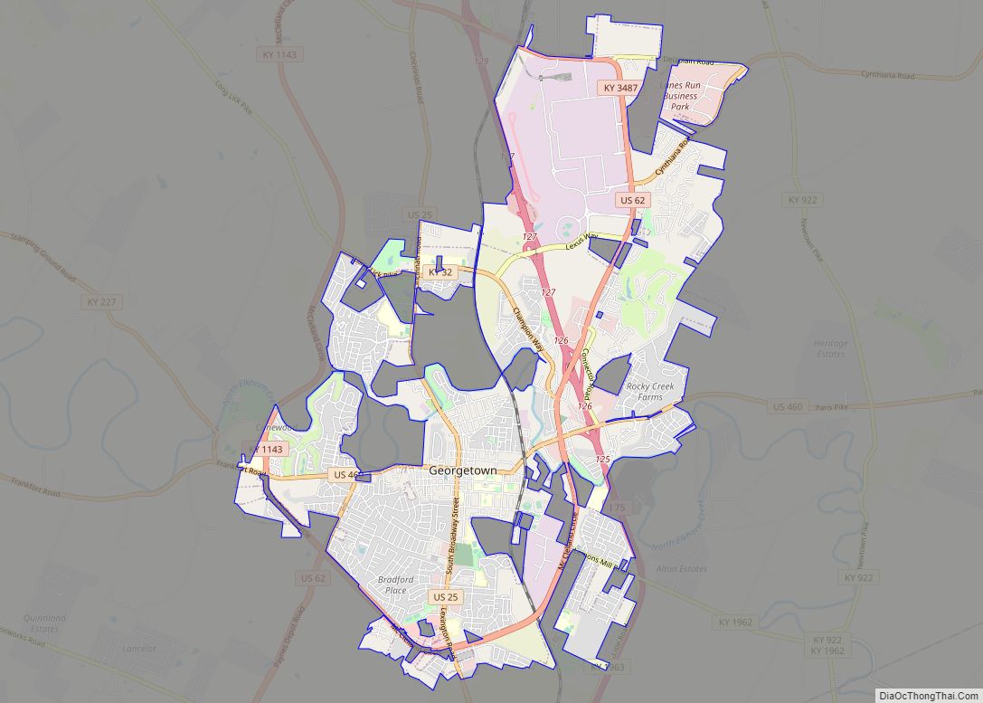
Georgetown Road Map
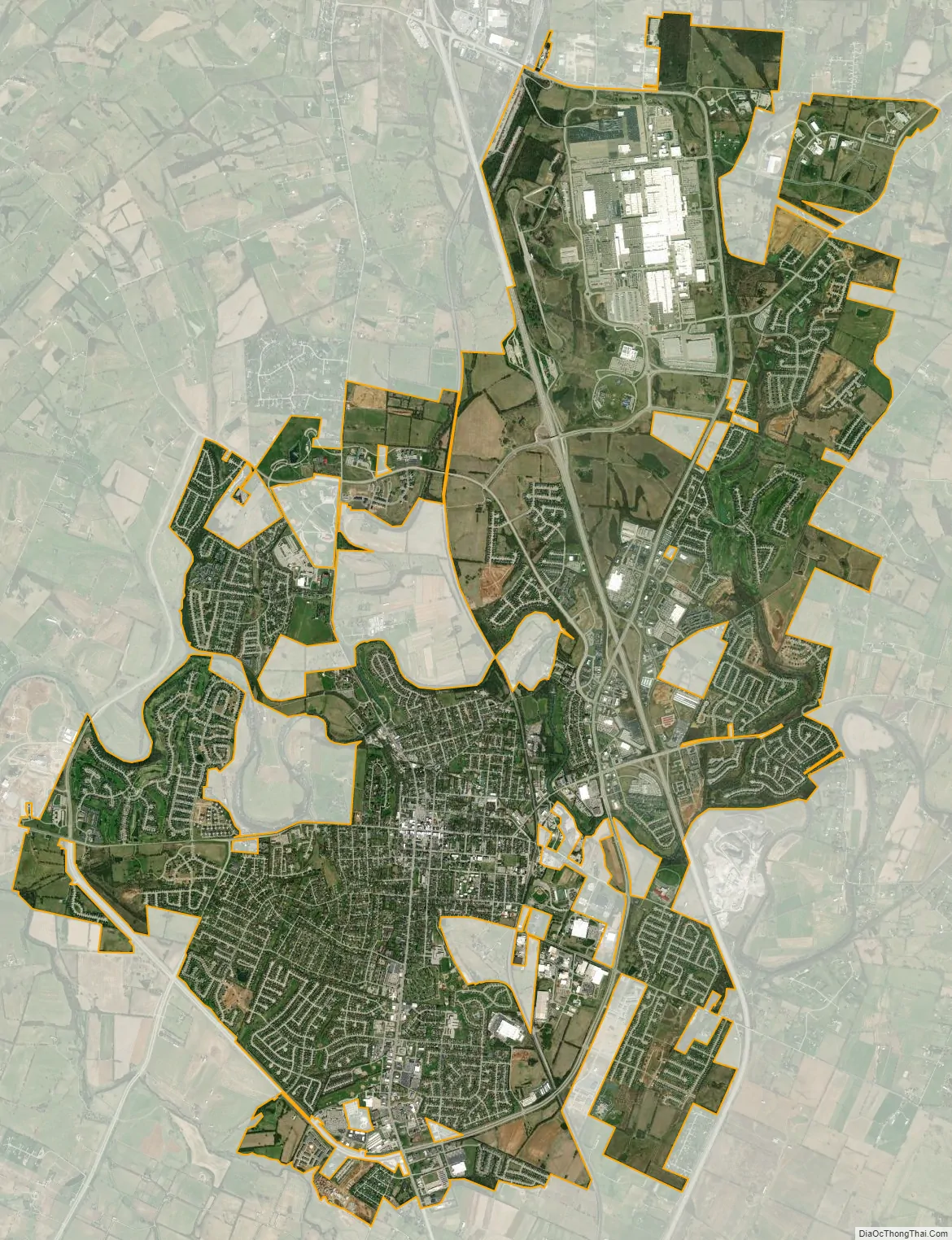
Georgetown city Satellite Map
Geography
Georgetown is located north of Lexington in the Bluegrass region of the state. Major highways that run through the city include Interstate 75 and US Routes 25, 62, and 460. Numerous state highways run through the city. I-75 runs to the east of downtown, with access from exits 125, 126, 127, and 129. Via I-75, downtown Lexington is 16 mi (26 km) south, and Cincinnati, Ohio is 69 mi (111 km) north. US 25 runs through the center of town, leading south to Lexington and north 22 mi (35 km) to Corinth. US 62 runs along the southern and eastern part of the city as a bypass, leading northeast 21 mi (34 km) to Cynthiana and southwest 11 mi (18 km) to Midway. US 460 runs east−west through the town, leading east 17 mi (27 km) to Paris and west 18 mi (29 km) to Frankfort, the state capital.
According to the United States Census Bureau, the city has a total area of 15.85 square miles (41 km), all land.
Climate
Georgetown has a humid subtropical climate (Köppen Cfa), with warm summers and moderately cold winters. Precipitation is relatively well spread (although the late spring and summer months are typically wetter), with an average of 45.28 in (1,150 mm).
See also
Map of Kentucky State and its subdivision:- Adair
- Allen
- Anderson
- Ballard
- Barren
- Bath
- Bell
- Boone
- Bourbon
- Boyd
- Boyle
- Bracken
- Breathitt
- Breckinridge
- Bullitt
- Butler
- Caldwell
- Calloway
- Campbell
- Carlisle
- Carroll
- Carter
- Casey
- Christian
- Clark
- Clay
- Clinton
- Crittenden
- Cumberland
- Daviess
- Edmonson
- Elliott
- Estill
- Fayette
- Fleming
- Floyd
- Franklin
- Fulton
- Gallatin
- Garrard
- Grant
- Graves
- Grayson
- Green
- Greenup
- Hancock
- Hardin
- Harlan
- Harrison
- Hart
- Henderson
- Henry
- Hickman
- Hopkins
- Jackson
- Jefferson
- Jessamine
- Johnson
- Kenton
- Knott
- Knox
- Larue
- Laurel
- Lawrence
- Lee
- Leslie
- Letcher
- Lewis
- Lincoln
- Livingston
- Logan
- Lyon
- Madison
- Magoffin
- Marion
- Marshall
- Martin
- Mason
- McCracken
- McCreary
- McLean
- Meade
- Menifee
- Mercer
- Metcalfe
- Monroe
- Montgomery
- Morgan
- Muhlenberg
- Nelson
- Nicholas
- Ohio
- Oldham
- Owen
- Owsley
- Pendleton
- Perry
- Pike
- Powell
- Pulaski
- Robertson
- Rockcastle
- Rowan
- Russell
- Scott
- Shelby
- Simpson
- Spencer
- Taylor
- Todd
- Trigg
- Trimble
- Union
- Warren
- Washington
- Wayne
- Webster
- Whitley
- Wolfe
- Woodford
- Alabama
- Alaska
- Arizona
- Arkansas
- California
- Colorado
- Connecticut
- Delaware
- District of Columbia
- Florida
- Georgia
- Hawaii
- Idaho
- Illinois
- Indiana
- Iowa
- Kansas
- Kentucky
- Louisiana
- Maine
- Maryland
- Massachusetts
- Michigan
- Minnesota
- Mississippi
- Missouri
- Montana
- Nebraska
- Nevada
- New Hampshire
- New Jersey
- New Mexico
- New York
- North Carolina
- North Dakota
- Ohio
- Oklahoma
- Oregon
- Pennsylvania
- Rhode Island
- South Carolina
- South Dakota
- Tennessee
- Texas
- Utah
- Vermont
- Virginia
- Washington
- West Virginia
- Wisconsin
- Wyoming