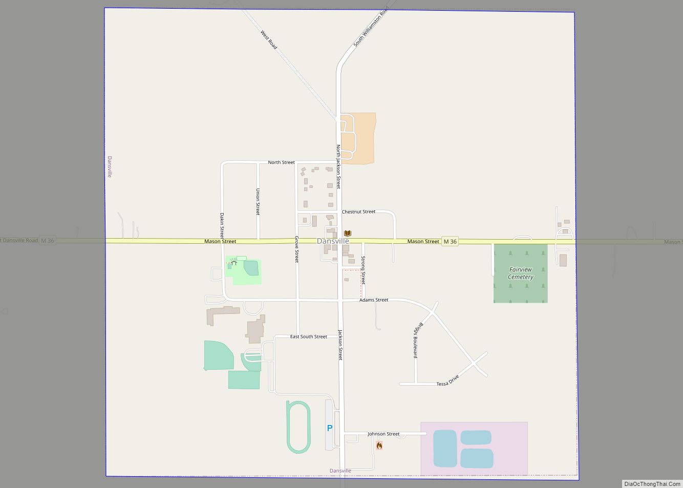
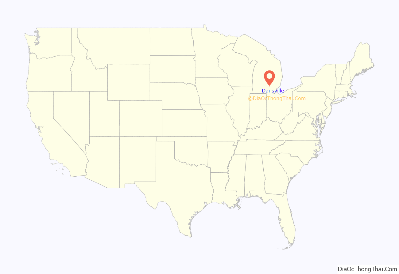
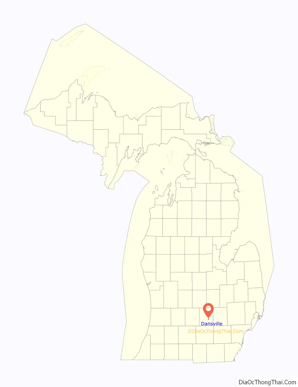
Dansville is a village in Ingham County in the U.S. state of Michigan. It is centered along M-36 within Ingham Township about 22 miles (35 km) southeast of downtown Lansing. The population was 563 at the 2010 census.
| Name: | Dansville village |
|---|---|
| LSAD Code: | 47 |
| LSAD Description: | village (suffix) |
| State: | Michigan |
| County: | Ingham County |
| Incorporated: | 1867 |
| Elevation: | 968 ft (295 m) |
| Total Area: | 1.01 sq mi (2.61 km²) |
| Land Area: | 1.00 sq mi (2.60 km²) |
| Water Area: | 0.00 sq mi (0.00 km²) |
| Total Population: | 529 |
| Population Density: | 526.37/sq mi (203.13/km²) |
| Area code: | 517 |
| FIPS code: | 2619780 |
| GNISfeature ID: | 2398680 |
| Website: | www.inghamtownship.com/VillageofDansville.aspx |
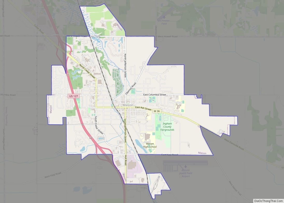
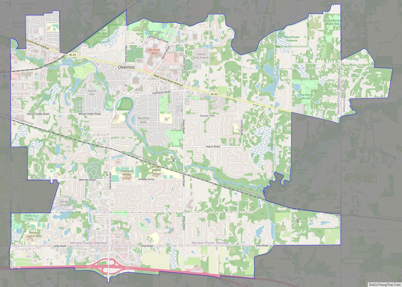
Online Interactive Map
Click on ![]() to view map in "full screen" mode.
to view map in "full screen" mode.
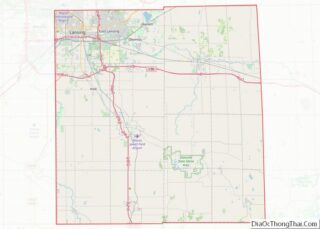
Dansville location map. Where is Dansville village?
History
As far as European settlement is concerned, the area that is now the village of Dansville was originally settled by Samuel Crossman in 1844, who, like many settlers at the time, had come from the state of New York in search of a new life. Samuel Crossman’s son, Daniel Crossman, officially platted the village in 1857, naming it after himself and the village’s first postmaster, Dr. Daniel T. Weston. The settlement was not actually incorporated as a village until 1867.
Dansville is one of the earliest settlements in Ingham County. Permanent home-seekers located there as early as 1836-40, and the first business establishment was a small store, with a general stock, opened by Samuel Crossman about 1847. The first hotel was the Union Hotel, built in 1856-7 by David D. Fox. A post office was established in the southern part of Ingham Township in 1846, and was first kept by John B. Lobdell. Later it was moved to Hayne’s Corners, one and one-half mile south of the present village, and Henry Densmore was postmaster. It finally came to Dansville, where Daniel T. Weston was the first postmaster in 1855. The original plat of the village was laid out May BG, 1857, by Samuel Crossman and Ephraim Hillaird. D. L. Crossman and Dakin and Otis made additions in 1866.
Today, Dansville is a small village with much of its economy based on agriculture. While the village is in proximity to the state capital and Michigan State University, it has seen little commercial development over its history. The small town’s economy is supported primarily by small business, agriculture research, and production.
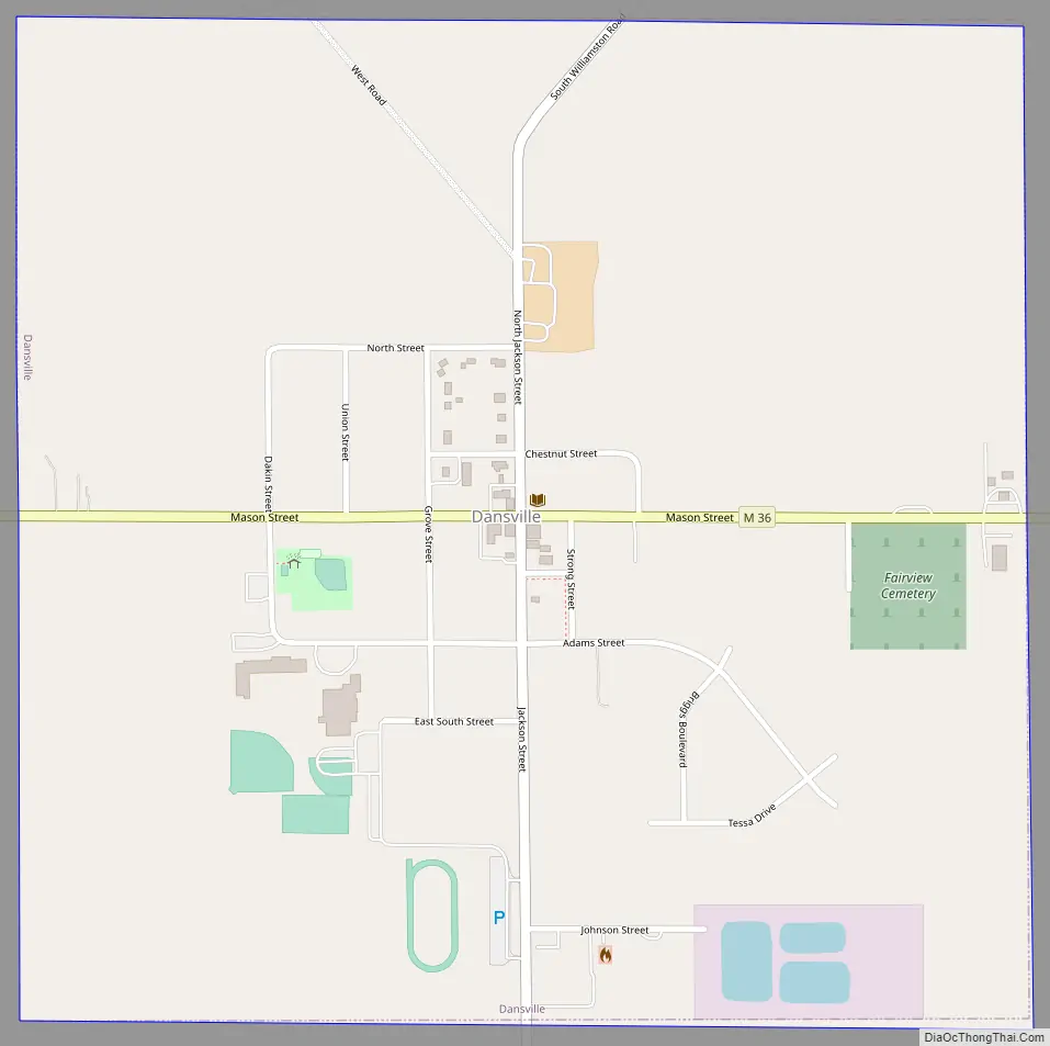
Dansville Road Map
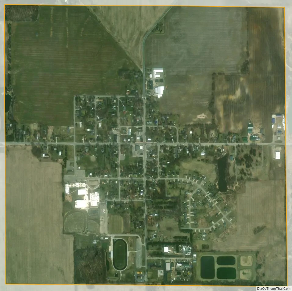
Dansville city Satellite Map
Geography
According to the United States Census Bureau, the village has a total area of 1.01 square miles (2.62 km), all land.
See also
Map of Michigan State and its subdivision:- Alcona
- Alger
- Allegan
- Alpena
- Antrim
- Arenac
- Baraga
- Barry
- Bay
- Benzie
- Berrien
- Branch
- Calhoun
- Cass
- Charlevoix
- Cheboygan
- Chippewa
- Clare
- Clinton
- Crawford
- Delta
- Dickinson
- Eaton
- Emmet
- Genesee
- Gladwin
- Gogebic
- Grand Traverse
- Gratiot
- Hillsdale
- Houghton
- Huron
- Ingham
- Ionia
- Iosco
- Iron
- Isabella
- Jackson
- Kalamazoo
- Kalkaska
- Kent
- Keweenaw
- Lake
- Lake Hurron
- Lake Michigan
- Lake St. Clair
- Lake Superior
- Lapeer
- Leelanau
- Lenawee
- Livingston
- Luce
- Mackinac
- Macomb
- Manistee
- Marquette
- Mason
- Mecosta
- Menominee
- Midland
- Missaukee
- Monroe
- Montcalm
- Montmorency
- Muskegon
- Newaygo
- Oakland
- Oceana
- Ogemaw
- Ontonagon
- Osceola
- Oscoda
- Otsego
- Ottawa
- Presque Isle
- Roscommon
- Saginaw
- Saint Clair
- Saint Joseph
- Sanilac
- Schoolcraft
- Shiawassee
- Tuscola
- Van Buren
- Washtenaw
- Wayne
- Wexford
- Alabama
- Alaska
- Arizona
- Arkansas
- California
- Colorado
- Connecticut
- Delaware
- District of Columbia
- Florida
- Georgia
- Hawaii
- Idaho
- Illinois
- Indiana
- Iowa
- Kansas
- Kentucky
- Louisiana
- Maine
- Maryland
- Massachusetts
- Michigan
- Minnesota
- Mississippi
- Missouri
- Montana
- Nebraska
- Nevada
- New Hampshire
- New Jersey
- New Mexico
- New York
- North Carolina
- North Dakota
- Ohio
- Oklahoma
- Oregon
- Pennsylvania
- Rhode Island
- South Carolina
- South Dakota
- Tennessee
- Texas
- Utah
- Vermont
- Virginia
- Washington
- West Virginia
- Wisconsin
- Wyoming