Davison is a city in Genesee County in the U.S. state of Michigan and a suburb of Flint. The population was 5,536 at the 2000 census and fell to 5,173 by the 2010 census. Davison is located within Davison Township survey township area (7N 8E), but is administratively autonomous.
Davison was named after Judge Norman Davison, a judge of Lapeer County and a delegate to state constitution convention of 1835. He resided in a nearby hamlet formerly known as Davisonville, now known as Atlas.
| Name: | Davison city |
|---|---|
| LSAD Code: | 25 |
| LSAD Description: | city (suffix) |
| State: | Michigan |
| County: | Genesee County |
| Incorporated: | 1889 (village) 1938 (city) |
| Elevation: | 794 ft (242 m) |
| Total Area: | 1.99 sq mi (5.14 km²) |
| Land Area: | 1.99 sq mi (5.14 km²) |
| Water Area: | 0.00 sq mi (0.00 km²) |
| Total Population: | 5,143 |
| Population Density: | 2,589.63/sq mi (999.70/km²) |
| Area code: | 810 |
| FIPS code: | 2619880 |
| GNISfeature ID: | 0624356 |
| Website: | cityofdavison.org |
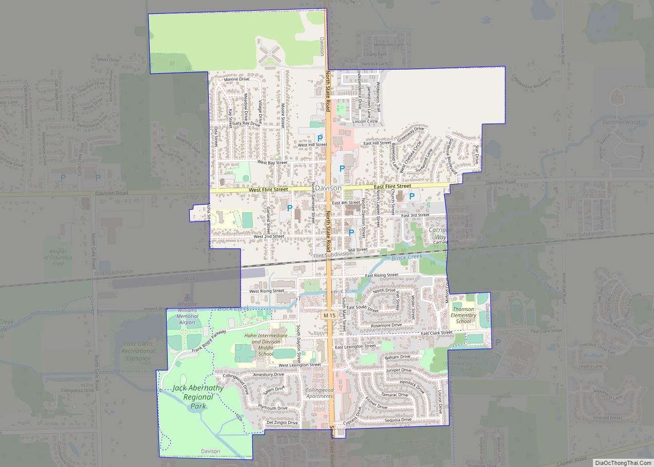
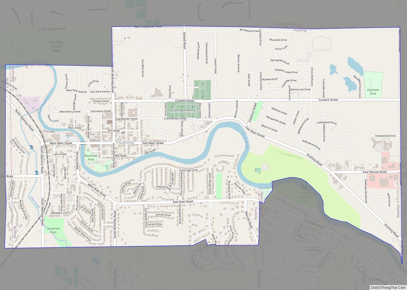
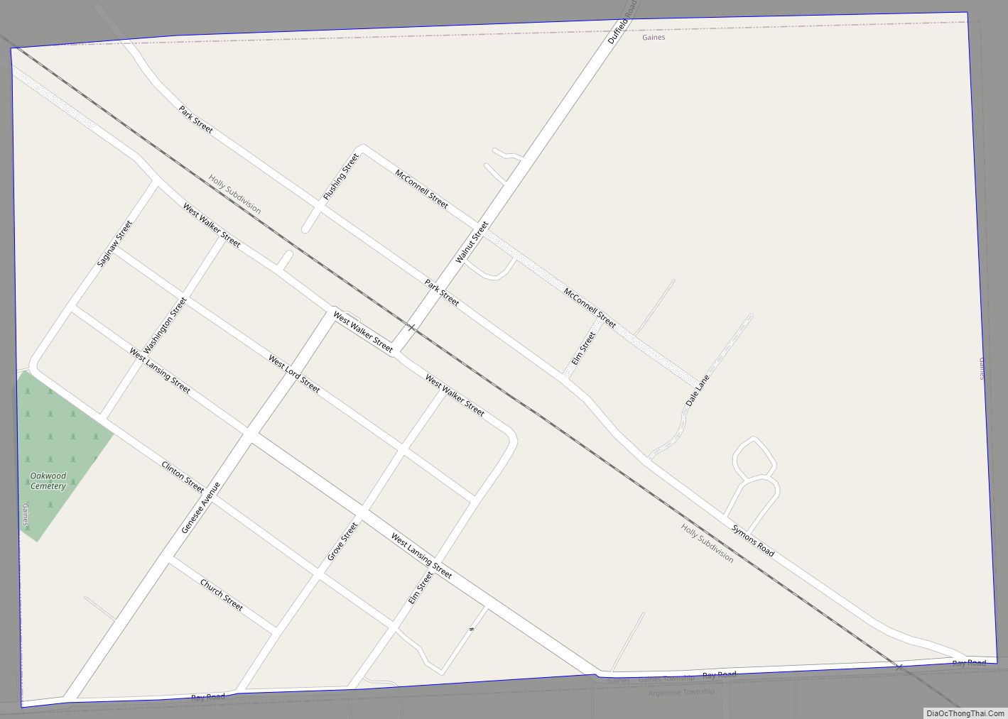
Online Interactive Map
Click on ![]() to view map in "full screen" mode.
to view map in "full screen" mode.
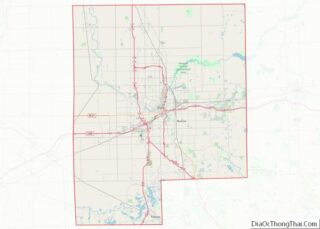
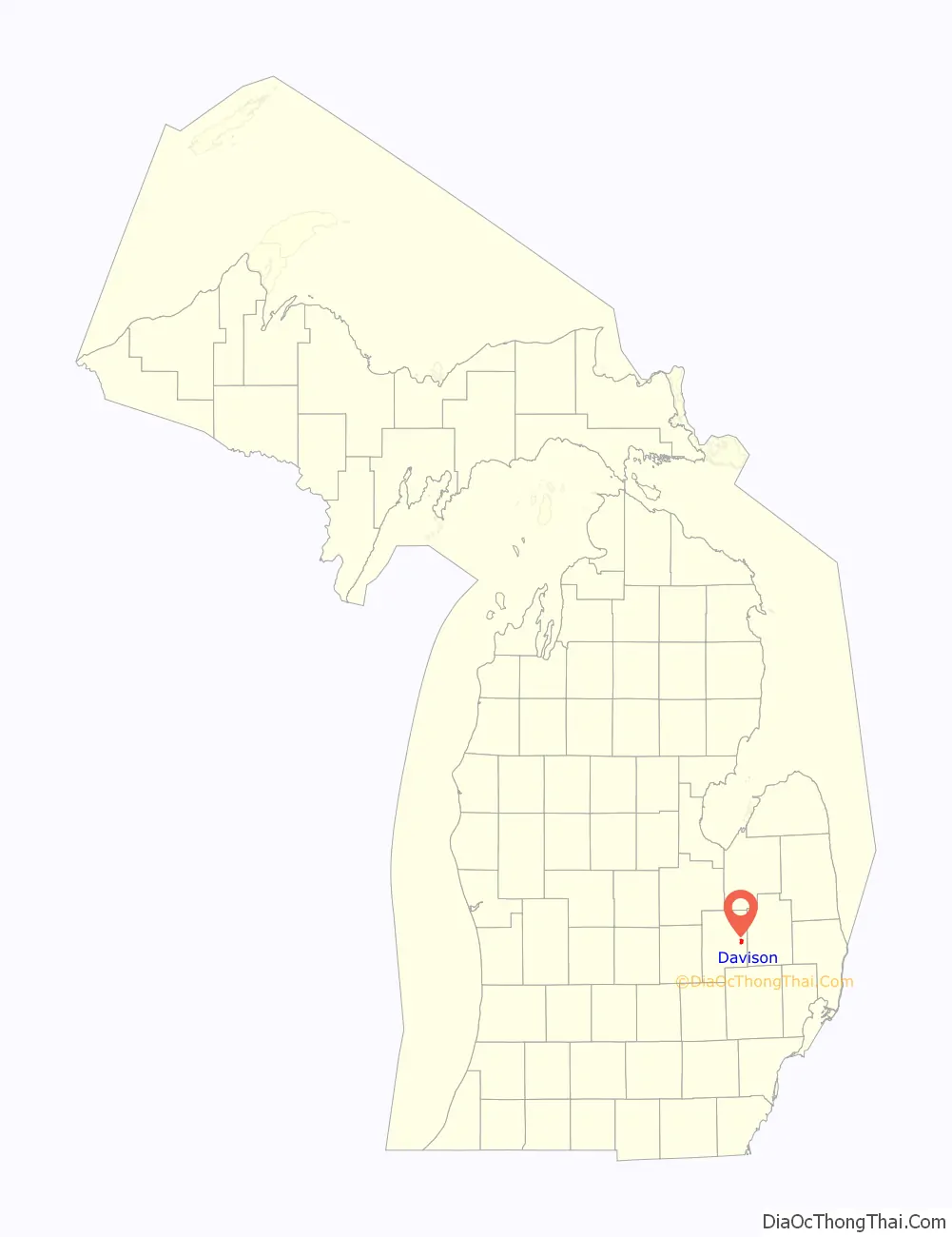
Davison location map. Where is Davison city?

History
Davison Station
Township section 3, 9 and 10 was Davison Station, which was first settled in 1842 by Eleazer Thurston in section 10. The line of the Chicago and Lake Huron Railroad (now Canadian National Railway) through the settlement was finished in 1871 marked the beginning of Davison Station. The first saw mill in the township was also built here that year by Dunn and Darling. The township and the settlement had in 1872 a number of firsts: doctor, L. W. Hanson, merchant Damon Stewart and tavern owned and operated by Henry S. Rising. On April 10, 1872, Davison Station post office open with Stewart as the postmaster. The Free Will Baptist Church, formed in 1859 at and hosted at Herrick Schoolhouse two miles away, moved to a frame church building in the village in 1872.
In 1873, a cheese factory and flouring mill opened. The Davison Station post office was renamed to just Davison on June 30, 1893.
Davison Village
Davison was incorporated as a village on May 20, 1889. On April 30, 1894, part of downtown, dubbed the Rotten Row, caught fire and wiped the section out. By 1895, the village had a Rosemoor Park with a race track used for horse then add cars. In 1916, the village had an auditorium, a state bank, Masonic and Odd Fellows lodges, four churches, the Catholic, the Methodist Episcopal, the Free Methodist and the Baptist. The estimated population was 700. Rosemoor Park began in 1919 hold the county fair every year except one until 1938.
Davison City
Davison separated itself from Davison Township by incorporating as a city on December 5, 1938. In 1943, Rosemoor Park closed permanently. The track’s owner in 1946 developed a subdivision on the track property.
In January 2010, it was announced that Davison City Manager Dale Martin and Davison Township, Michigan Supervisor Kurt Soper had begun preliminary meetings discussing the possibility of merging the two municipalities.
Davison Road Map

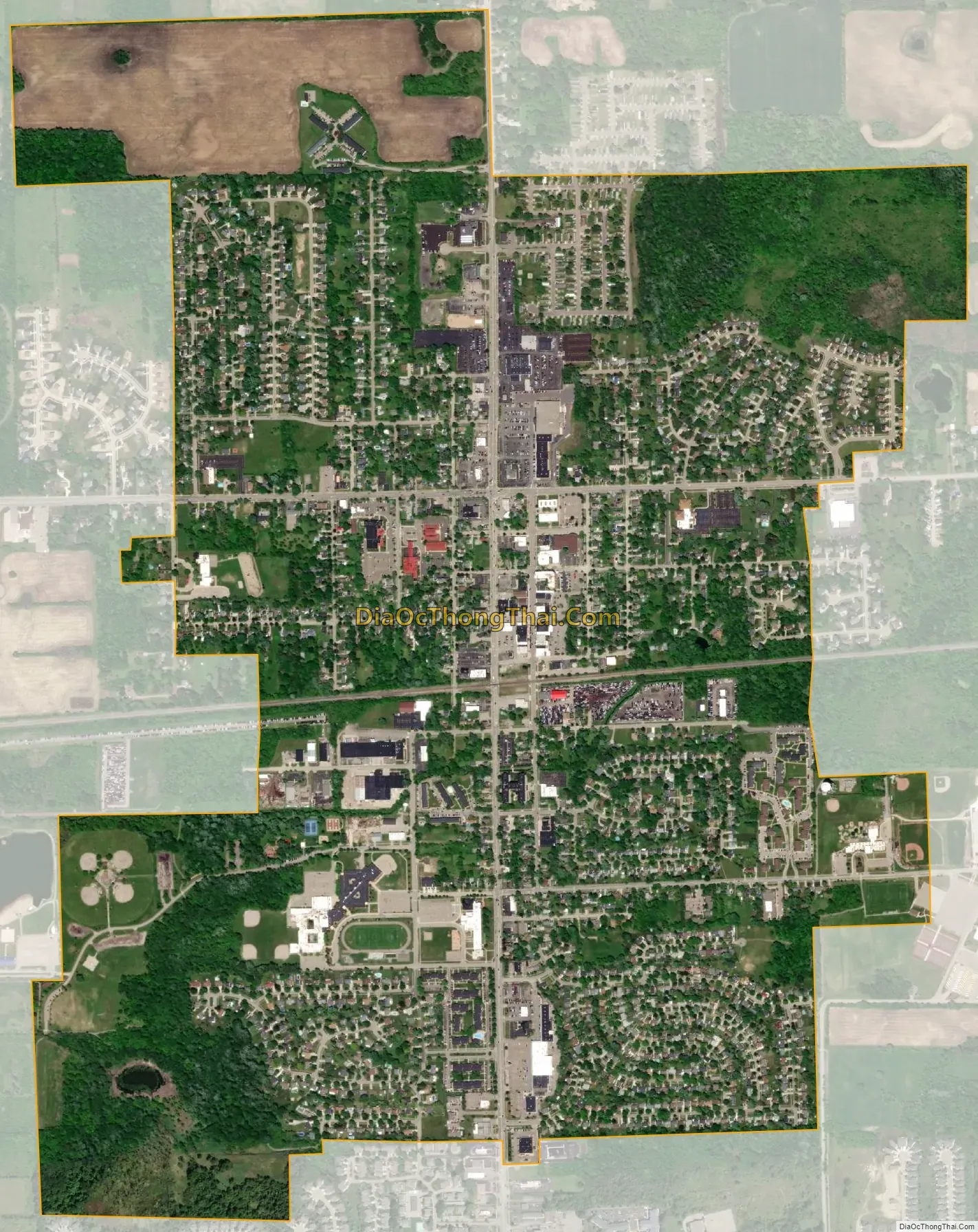
Davison city Satellite Map
Geography
According to the United States Census Bureau, the city has a total area of 1.98 square miles (5.13 km), all land.
See also
Map of Michigan State and its subdivision:- Alcona
- Alger
- Allegan
- Alpena
- Antrim
- Arenac
- Baraga
- Barry
- Bay
- Benzie
- Berrien
- Branch
- Calhoun
- Cass
- Charlevoix
- Cheboygan
- Chippewa
- Clare
- Clinton
- Crawford
- Delta
- Dickinson
- Eaton
- Emmet
- Genesee
- Gladwin
- Gogebic
- Grand Traverse
- Gratiot
- Hillsdale
- Houghton
- Huron
- Ingham
- Ionia
- Iosco
- Iron
- Isabella
- Jackson
- Kalamazoo
- Kalkaska
- Kent
- Keweenaw
- Lake
- Lake Hurron
- Lake Michigan
- Lake St. Clair
- Lake Superior
- Lapeer
- Leelanau
- Lenawee
- Livingston
- Luce
- Mackinac
- Macomb
- Manistee
- Marquette
- Mason
- Mecosta
- Menominee
- Midland
- Missaukee
- Monroe
- Montcalm
- Montmorency
- Muskegon
- Newaygo
- Oakland
- Oceana
- Ogemaw
- Ontonagon
- Osceola
- Oscoda
- Otsego
- Ottawa
- Presque Isle
- Roscommon
- Saginaw
- Saint Clair
- Saint Joseph
- Sanilac
- Schoolcraft
- Shiawassee
- Tuscola
- Van Buren
- Washtenaw
- Wayne
- Wexford
- Alabama
- Alaska
- Arizona
- Arkansas
- California
- Colorado
- Connecticut
- Delaware
- District of Columbia
- Florida
- Georgia
- Hawaii
- Idaho
- Illinois
- Indiana
- Iowa
- Kansas
- Kentucky
- Louisiana
- Maine
- Maryland
- Massachusetts
- Michigan
- Minnesota
- Mississippi
- Missouri
- Montana
- Nebraska
- Nevada
- New Hampshire
- New Jersey
- New Mexico
- New York
- North Carolina
- North Dakota
- Ohio
- Oklahoma
- Oregon
- Pennsylvania
- Rhode Island
- South Carolina
- South Dakota
- Tennessee
- Texas
- Utah
- Vermont
- Virginia
- Washington
- West Virginia
- Wisconsin
- Wyoming