Farmington Hills is a city in Oakland County in the U.S. state of Michigan. Part of the affluent suburbs northwest of Detroit, Farmington Hills is the second most-populated city in Oakland County, after Troy, with a population of 83,986 at the 2020 census.
Farmington Hills consistently ranks as one of the safest cities in the United States, as well as in the state of Michigan. The area ranked as the 30th safest city in the U.S. in 2010 and as the 2nd safest city in Michigan in 2020. Farmington Hills also ranks as the 36th highest-income place in the United States with a population of 50,000 or more and ranked as 14th America’s best cities to live by 24/7 Wall St. in 2016.
Although the two cities have separate services and addresses, Farmington and Farmington Hills are often thought of as the same community. These two cities combined were part of Farmington Township in the time of the Northwest Territory. Features of the community include a recently renovated downtown, boutiques, a vintage cinema, numerous restaurants, exotic car dealerships, art galleries, and public parks including Heritage Park. There are several historical sites including the Longacre House and the Governor Warner Mansion. Both cities are served by Farmington Public Schools and the Farmington Community Library.
Farmington Hills is the home of the Holocaust Memorial Center, the only Holocaust memorial in the State of Michigan. The center’s mission is to educate the public about the tragedy and evils of the Holocaust. The Holocaust Memorial Center was originally located in neighboring West Bloomfield Township, but has since expanded and moved to its current facility.
| Name: | Farmington Hills city |
|---|---|
| LSAD Code: | 25 |
| LSAD Description: | city (suffix) |
| State: | Michigan |
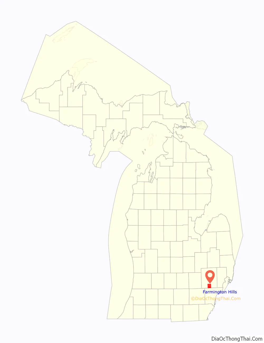
| County: | Oakland County |
| Incorporated: | 1973 (city) |
| Elevation: | 860 ft (262 m) |
| Land Area: | 33.27 sq mi (86.16 km²) |
| Water Area: | 0.03 sq mi (0.07 km²) |
| Population Density: | 2,524.53/sq mi (974.72/km²) |
| Area code: | 248 |
| FIPS code: | 2627440 |
| GNISfeature ID: | 1616988 |
Online Interactive Map
Click on ![]() to view map in "full screen" mode.
to view map in "full screen" mode.
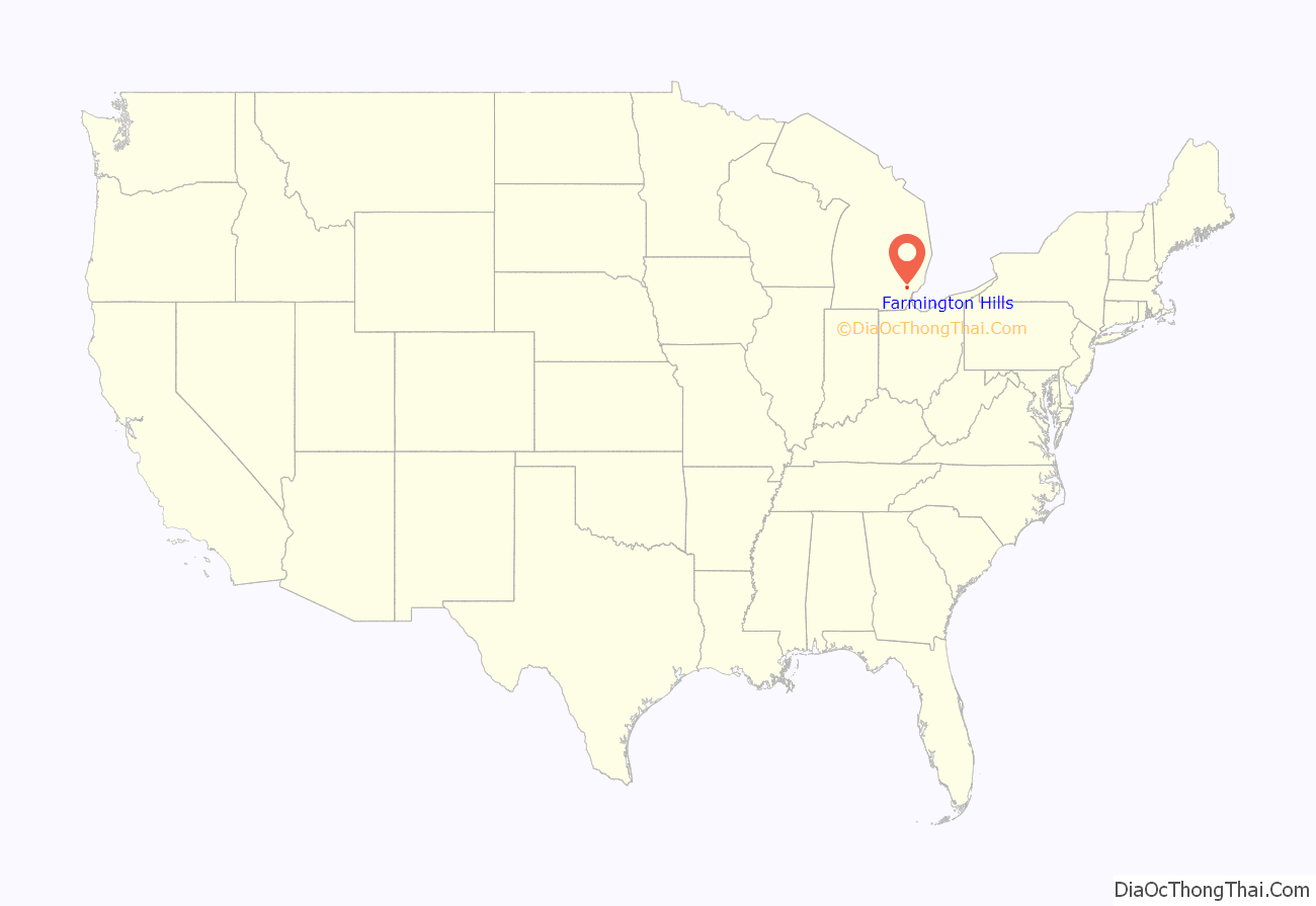
Farmington Hills location map. Where is Farmington Hills city?
History
The first white settler in what became Farmington Township was a Quaker from Farmington, New York, named Arthur Power. He purchased land in 1823 and returned in 1824 with a group of families and associates to clear the land. The settlement became known as Quakertown. A post office was established in February 1826 with the name of Farmington. The original post office is still standing today, and is a designated historical site. The township of Farmington was organized in 1827, and the settlement was incorporated as the village of Farmington in the winter of 1866–67. A fire on October 9, 1872, destroyed many buildings in the village center. Farmington was incorporated as a city in 1926.
A small settlement was also developed in Clarenceville, in the extreme southeast corner of the township on the boundary with Livonia in Wayne County. Stephen Jennings built a tavern and a general store to accommodate travelers on the plank road between Detroit and Howell. The name remains in the Clarenceville School District. Even though the school buildings for Clarenceville are in Livonia in Wayne County, the school district serves a portion of Farmington Hills.
In 1839, a post office named East Farmington was opened, but it closed in 1842.
In 1847, a post office named North Farmington was established a mile south of the township line as Wolcott’s Corners. After the death of postmaster Chauncey D. Walcott in 1865, the office moved to the township line in the northeast quarter of section 4 (near the intersection of 14 Mile Road and Farmington Road). The post office functioned until September 1902.
Before the remainder of Farmington Township was incorporated as the city of Farmington Hills, there were two other incorporated entities within its boundaries. The first began as a subdivision named Quaker Valley Farms that was incorporated as the village of Quakertown in 1959. The other was Wood Creek Farms, developed in 1937 as a subdivision by George Wellington of Franklin, who named it after a New England estate. It was incorporated as a village in 1957. The villages, together with the remainder of Farmington Township, were incorporated into the City of Farmington Hills in 1973.
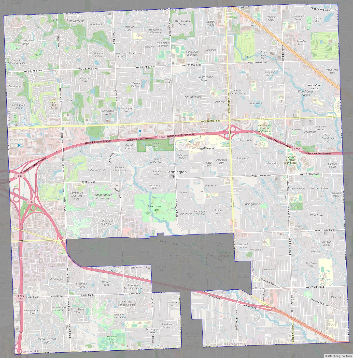
Farmington Hills Road Map
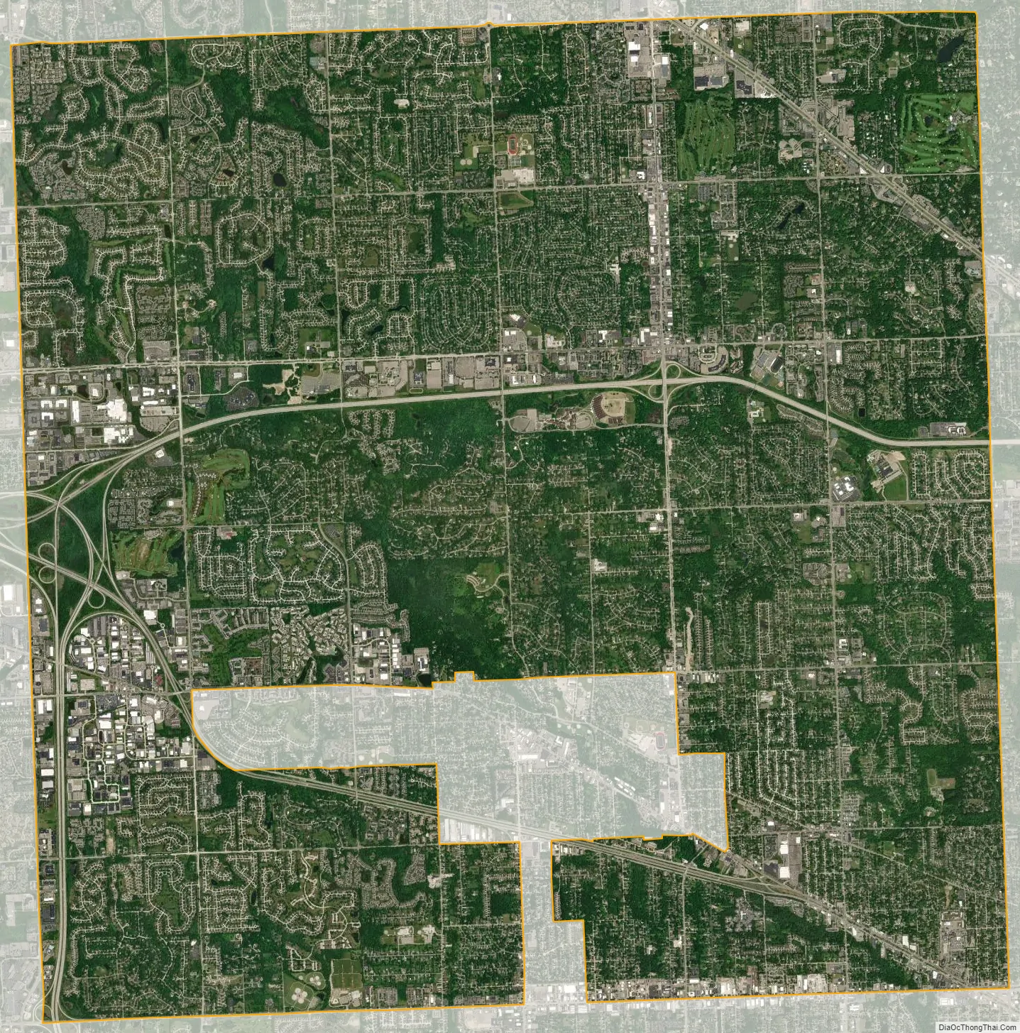
Farmington Hills city Satellite Map
Geography
According to the United States Census Bureau, the city has a total area of 33.31 square miles (86.27 km), of which 33.28 square miles (86.19 km) is land and 0.03 square miles (0.08 km) is water.
See also
Map of Michigan State and its subdivision:- Alcona
- Alger
- Allegan
- Alpena
- Antrim
- Arenac
- Baraga
- Barry
- Bay
- Benzie
- Berrien
- Branch
- Calhoun
- Cass
- Charlevoix
- Cheboygan
- Chippewa
- Clare
- Clinton
- Crawford
- Delta
- Dickinson
- Eaton
- Emmet
- Genesee
- Gladwin
- Gogebic
- Grand Traverse
- Gratiot
- Hillsdale
- Houghton
- Huron
- Ingham
- Ionia
- Iosco
- Iron
- Isabella
- Jackson
- Kalamazoo
- Kalkaska
- Kent
- Keweenaw
- Lake
- Lake Hurron
- Lake Michigan
- Lake St. Clair
- Lake Superior
- Lapeer
- Leelanau
- Lenawee
- Livingston
- Luce
- Mackinac
- Macomb
- Manistee
- Marquette
- Mason
- Mecosta
- Menominee
- Midland
- Missaukee
- Monroe
- Montcalm
- Montmorency
- Muskegon
- Newaygo
- Oakland
- Oceana
- Ogemaw
- Ontonagon
- Osceola
- Oscoda
- Otsego
- Ottawa
- Presque Isle
- Roscommon
- Saginaw
- Saint Clair
- Saint Joseph
- Sanilac
- Schoolcraft
- Shiawassee
- Tuscola
- Van Buren
- Washtenaw
- Wayne
- Wexford
- Alabama
- Alaska
- Arizona
- Arkansas
- California
- Colorado
- Connecticut
- Delaware
- District of Columbia
- Florida
- Georgia
- Hawaii
- Idaho
- Illinois
- Indiana
- Iowa
- Kansas
- Kentucky
- Louisiana
- Maine
- Maryland
- Massachusetts
- Michigan
- Minnesota
- Mississippi
- Missouri
- Montana
- Nebraska
- Nevada
- New Hampshire
- New Jersey
- New Mexico
- New York
- North Carolina
- North Dakota
- Ohio
- Oklahoma
- Oregon
- Pennsylvania
- Rhode Island
- South Carolina
- South Dakota
- Tennessee
- Texas
- Utah
- Vermont
- Virginia
- Washington
- West Virginia
- Wisconsin
- Wyoming


