Fenton is a city in the U.S. state of Michigan that lies mostly in Genesee County, with small portions in neighboring Oakland County and Livingston County. It is part of the Flint Metropolitan statistical area.
| Name: | Fenton city |
|---|---|
| LSAD Code: | 25 |
| LSAD Description: | city (suffix) |
| State: | Michigan |
| County: | Genesee County, Livingston County, Oakland County |
| Incorporated: | 1863 (village) 1964 (city) |
| Elevation: | 902 ft (275 m) |
| Total Area: | 6.97 sq mi (18.07 km²) |
| Land Area: | 6.65 sq mi (17.23 km²) |
| Water Area: | 0.32 sq mi (0.84 km²) 4.57% |
| Total Population: | 12,050 |
| Population Density: | 1,811.76/sq mi (699.49/km²) |
| Area code: | 248 and 810 |
| FIPS code: | 2627760 |
| GNISfeature ID: | 0625893 |
| Website: | www.cityoffenton.org |
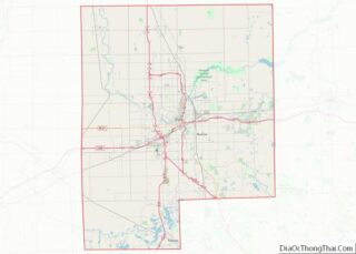
Online Interactive Map
Click on ![]() to view map in "full screen" mode.
to view map in "full screen" mode.
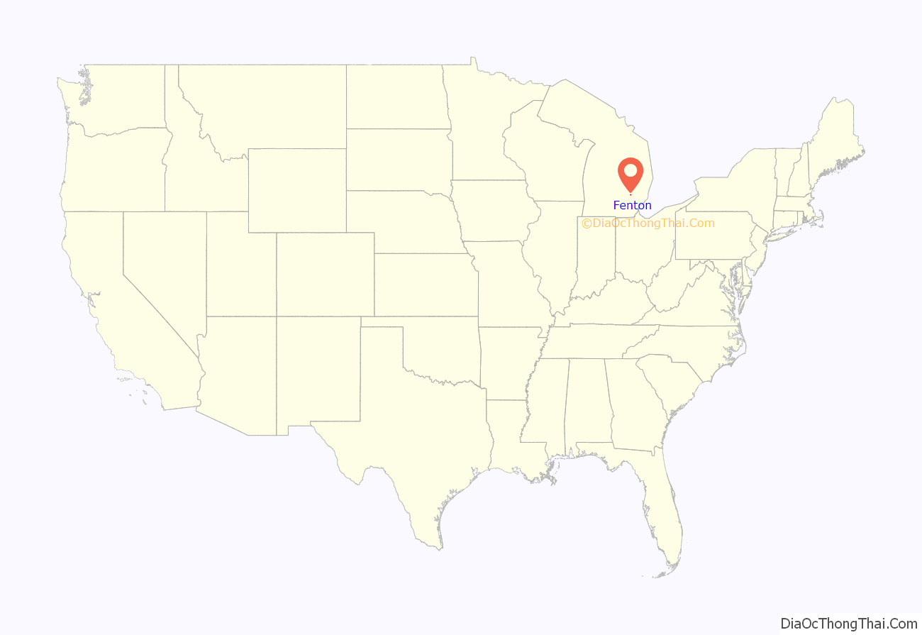
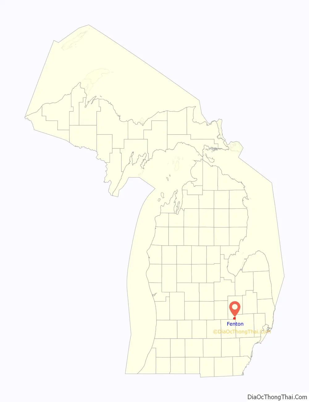
Fenton location map. Where is Fenton city?
History
It was first established in 1834 and was originally named “Dibbleville” after Clark Dibble, one of the first settlers. It was platted in 1837 as “Fentonville” by William M. Fenton who would later become lieutenant-governor of Michigan. When the settlement was incorporated as a village in 1863 the name Fenton was used. The settlement’s post office used the name Fentonville from 1837 until 1886, when it adopted the current name.
In the 1970s, the city leveled its downtown buildings and closed Leroy Street as part of an urban renewal plan. On August 24, 2007, an EF2 tornado hit Fenton, damaging several homes and a school, and almost completely destroying the soon to be opened Tractor Supply Company, tearing off its roof. This caused many people to go without power, leaving the city in a state of emergency. There were no fatalities or serious injuries. In July 2011, the first proposed building, Cornerstone, to restore the city’s old downtown area was announced.
As of the 2010 census, the city population was 11,756. The city was incorporated from Fenton Township in Genesee County, and the city and township are administratively autonomous. Fenton includes several historic buildings. It was home to the first aviation school in Michigan and the A.J. Phillips Fenton Museum.
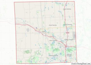
Fenton Road Map
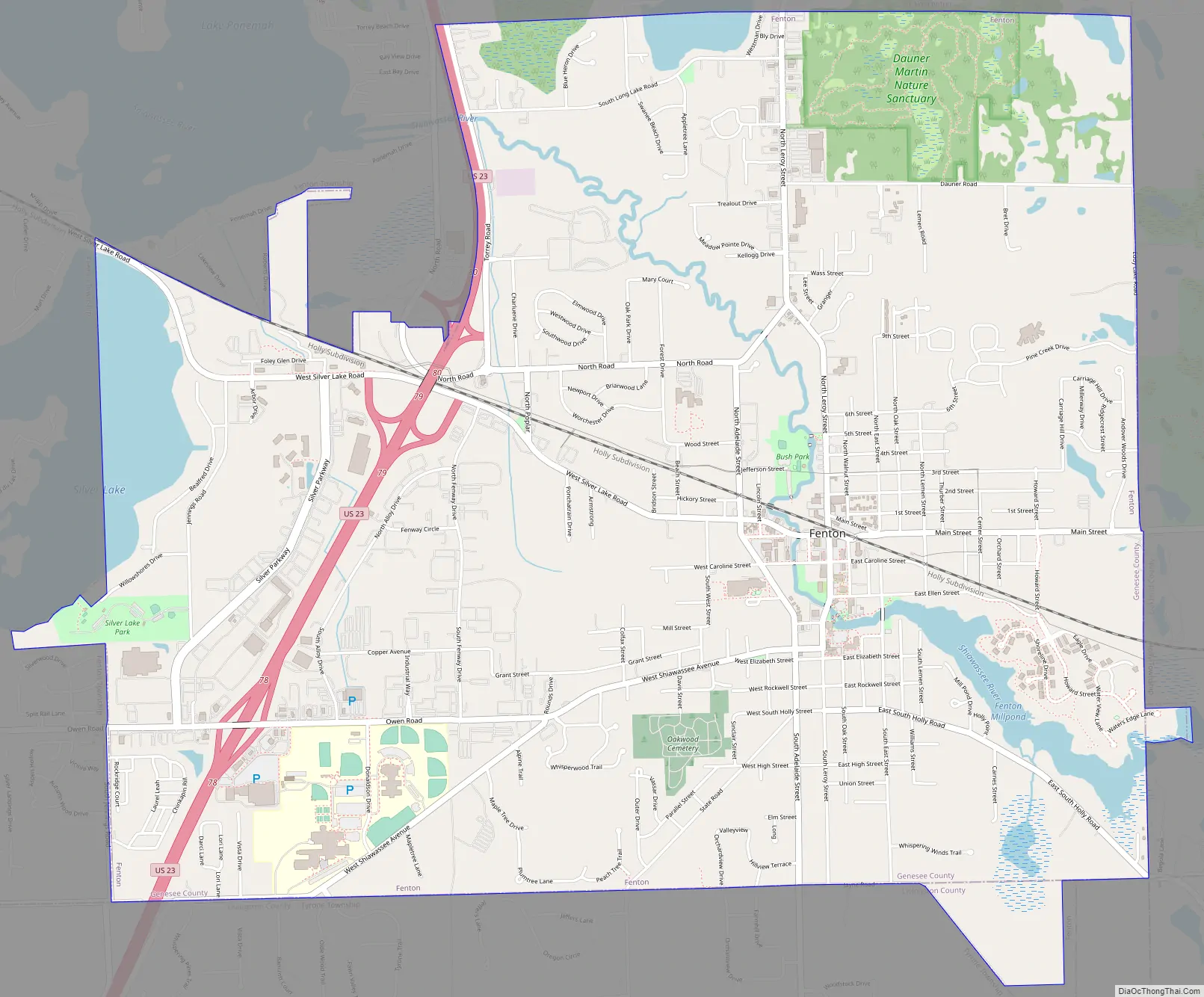
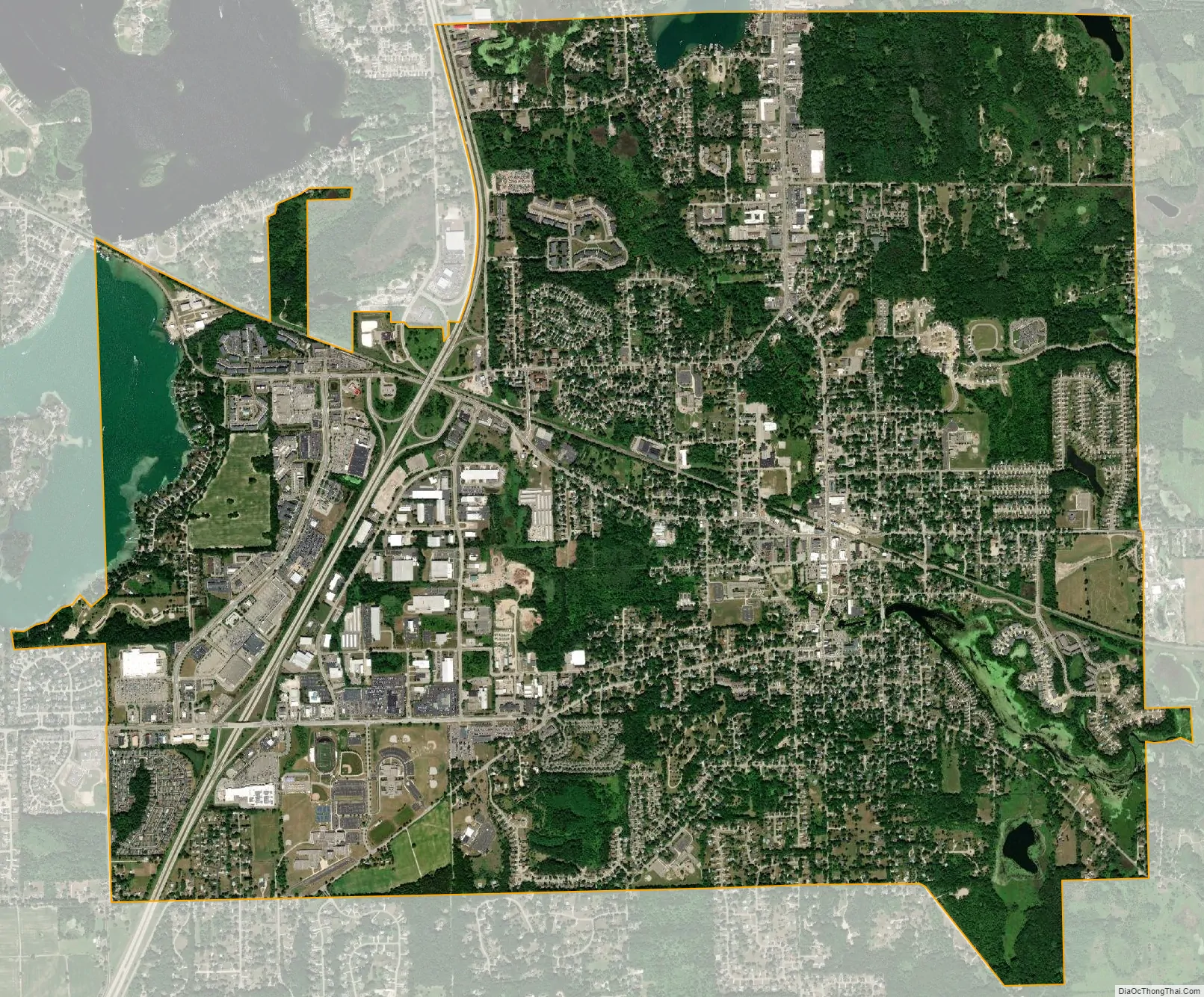
Fenton city Satellite Map
Geography
According to the United States Census Bureau, the city has a total area of 7.00 square miles (18.13 km), of which 6.68 square miles (17.30 km) is land and 0.32 square miles (0.83 km) (4.57%) is water.
Numerous municipalities in Michigan span two counties, but Fenton is one of two municipalities in the state of Michigan to span three counties; the other being the capital city of Lansing. The overwhelming majority of Fenton is located within Genesee County, with a total area of 6.88 square miles (17.82 km), of which 6.56 square miles (16.99 km) is land and 0.32 square miles (0.83 km) is water. The Genesee County portion represents 98.29% of Fenton’s total area and 99.99% of its population. Of Fenton’s 11,747 residents, all but 10 residents live in Genesee County. The separate 10 residents live in the Livingston County portion of Fenton, which contains a land area of 0.11 square miles (0.28 km). A minuscule portion with no residents extends into Oakland County with a total land area of 0.01 square miles (0.03 km).
The Tipsico Lake Project is a brownfield redevelopment project to restore the land and surrounding area.
See also
Map of Michigan State and its subdivision:- Alcona
- Alger
- Allegan
- Alpena
- Antrim
- Arenac
- Baraga
- Barry
- Bay
- Benzie
- Berrien
- Branch
- Calhoun
- Cass
- Charlevoix
- Cheboygan
- Chippewa
- Clare
- Clinton
- Crawford
- Delta
- Dickinson
- Eaton
- Emmet
- Genesee
- Gladwin
- Gogebic
- Grand Traverse
- Gratiot
- Hillsdale
- Houghton
- Huron
- Ingham
- Ionia
- Iosco
- Iron
- Isabella
- Jackson
- Kalamazoo
- Kalkaska
- Kent
- Keweenaw
- Lake
- Lake Hurron
- Lake Michigan
- Lake St. Clair
- Lake Superior
- Lapeer
- Leelanau
- Lenawee
- Livingston
- Luce
- Mackinac
- Macomb
- Manistee
- Marquette
- Mason
- Mecosta
- Menominee
- Midland
- Missaukee
- Monroe
- Montcalm
- Montmorency
- Muskegon
- Newaygo
- Oakland
- Oceana
- Ogemaw
- Ontonagon
- Osceola
- Oscoda
- Otsego
- Ottawa
- Presque Isle
- Roscommon
- Saginaw
- Saint Clair
- Saint Joseph
- Sanilac
- Schoolcraft
- Shiawassee
- Tuscola
- Van Buren
- Washtenaw
- Wayne
- Wexford
- Alabama
- Alaska
- Arizona
- Arkansas
- California
- Colorado
- Connecticut
- Delaware
- District of Columbia
- Florida
- Georgia
- Hawaii
- Idaho
- Illinois
- Indiana
- Iowa
- Kansas
- Kentucky
- Louisiana
- Maine
- Maryland
- Massachusetts
- Michigan
- Minnesota
- Mississippi
- Missouri
- Montana
- Nebraska
- Nevada
- New Hampshire
- New Jersey
- New Mexico
- New York
- North Carolina
- North Dakota
- Ohio
- Oklahoma
- Oregon
- Pennsylvania
- Rhode Island
- South Carolina
- South Dakota
- Tennessee
- Texas
- Utah
- Vermont
- Virginia
- Washington
- West Virginia
- Wisconsin
- Wyoming