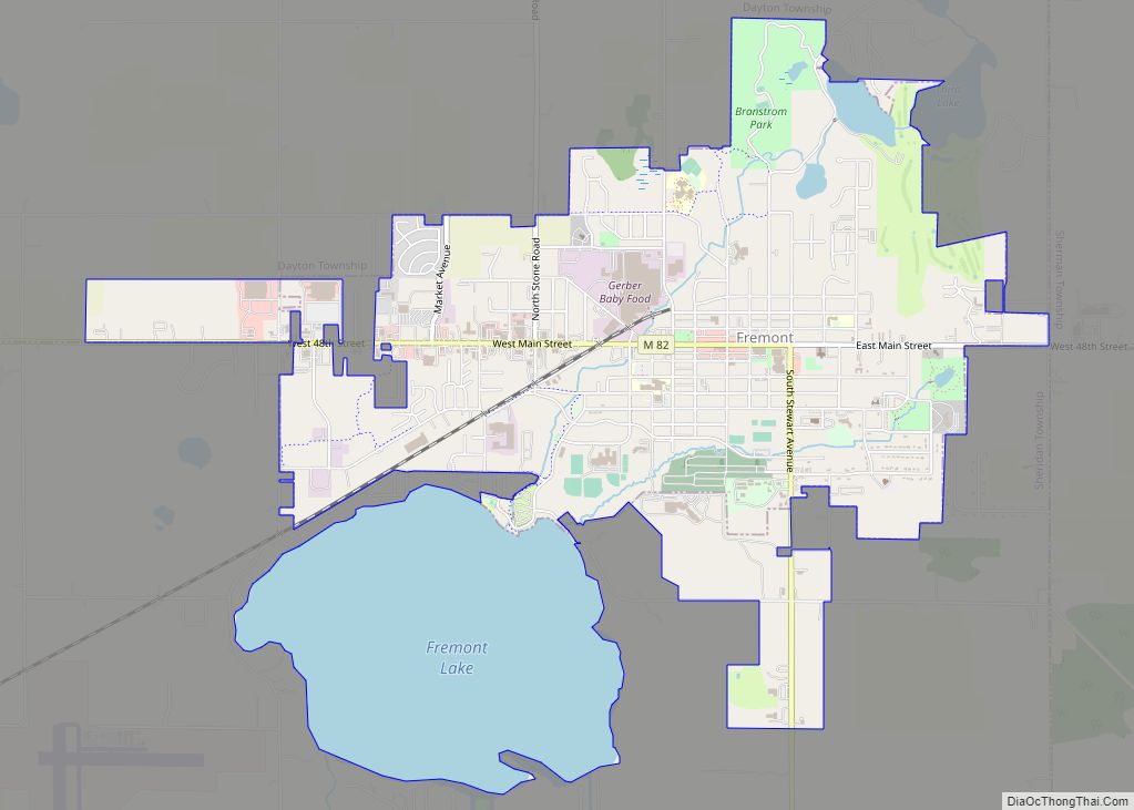
Fremont is a city in Newaygo County, Michigan, United States. The population was 4,516 at the time of the 2020 census.
| Name: | Fremont city |
|---|---|
| LSAD Code: | 25 |
| LSAD Description: | city (suffix) |
| State: | Michigan |
| County: | Newaygo County |
| Elevation: | 817 ft (249 m) |
| Total Area: | 4.89 sq mi (12.68 km²) |
| Land Area: | 3.60 sq mi (9.33 km²) |
| Water Area: | 1.29 sq mi (3.35 km²) |
| Total Population: | 4,516 |
| Population Density: | 1,253.75/sq mi (484.14/km²) |
| ZIP code: | 49412-49413 |
| Area code: | 231 |
| FIPS code: | 2630700 |
| GNISfeature ID: | 0626466 |
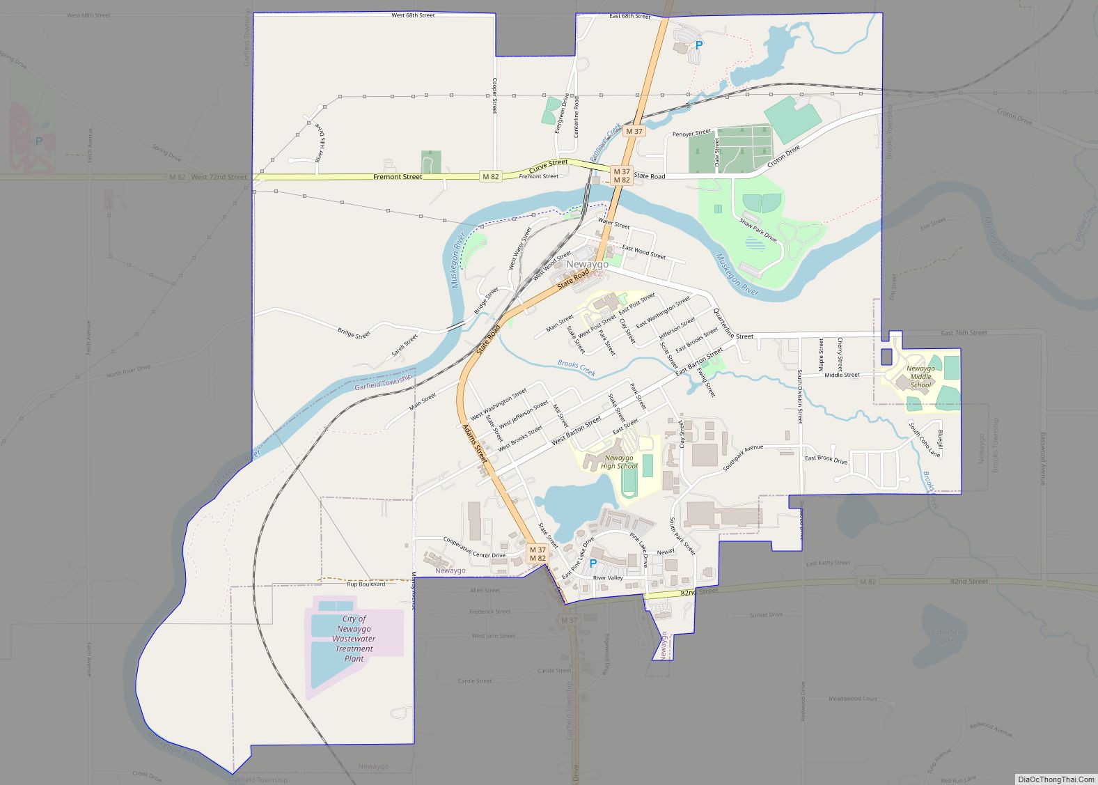
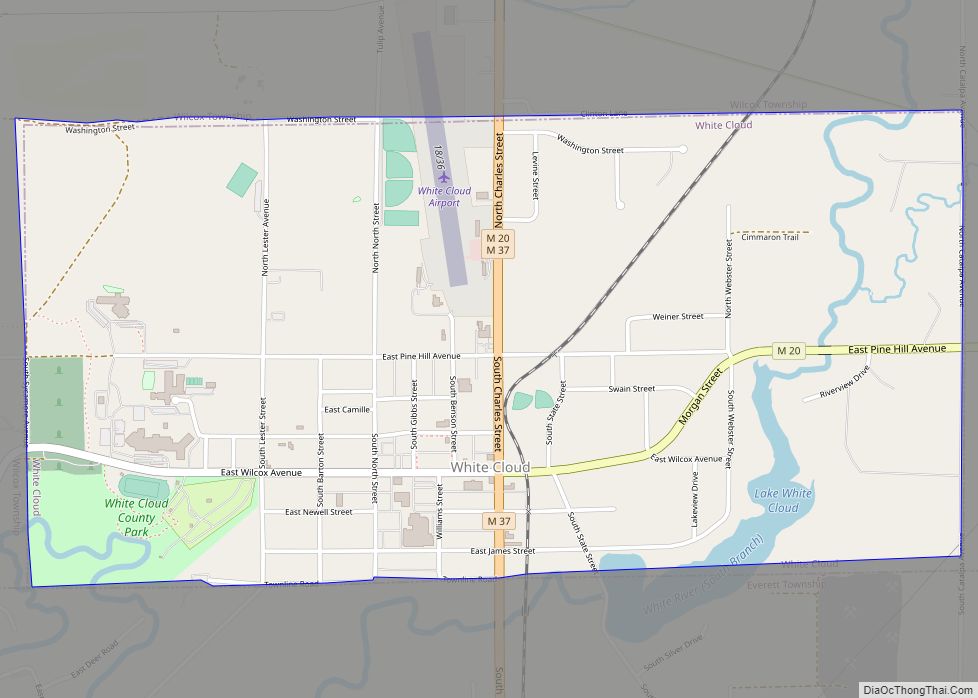
Online Interactive Map
Click on ![]() to view map in "full screen" mode.
to view map in "full screen" mode.
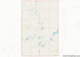
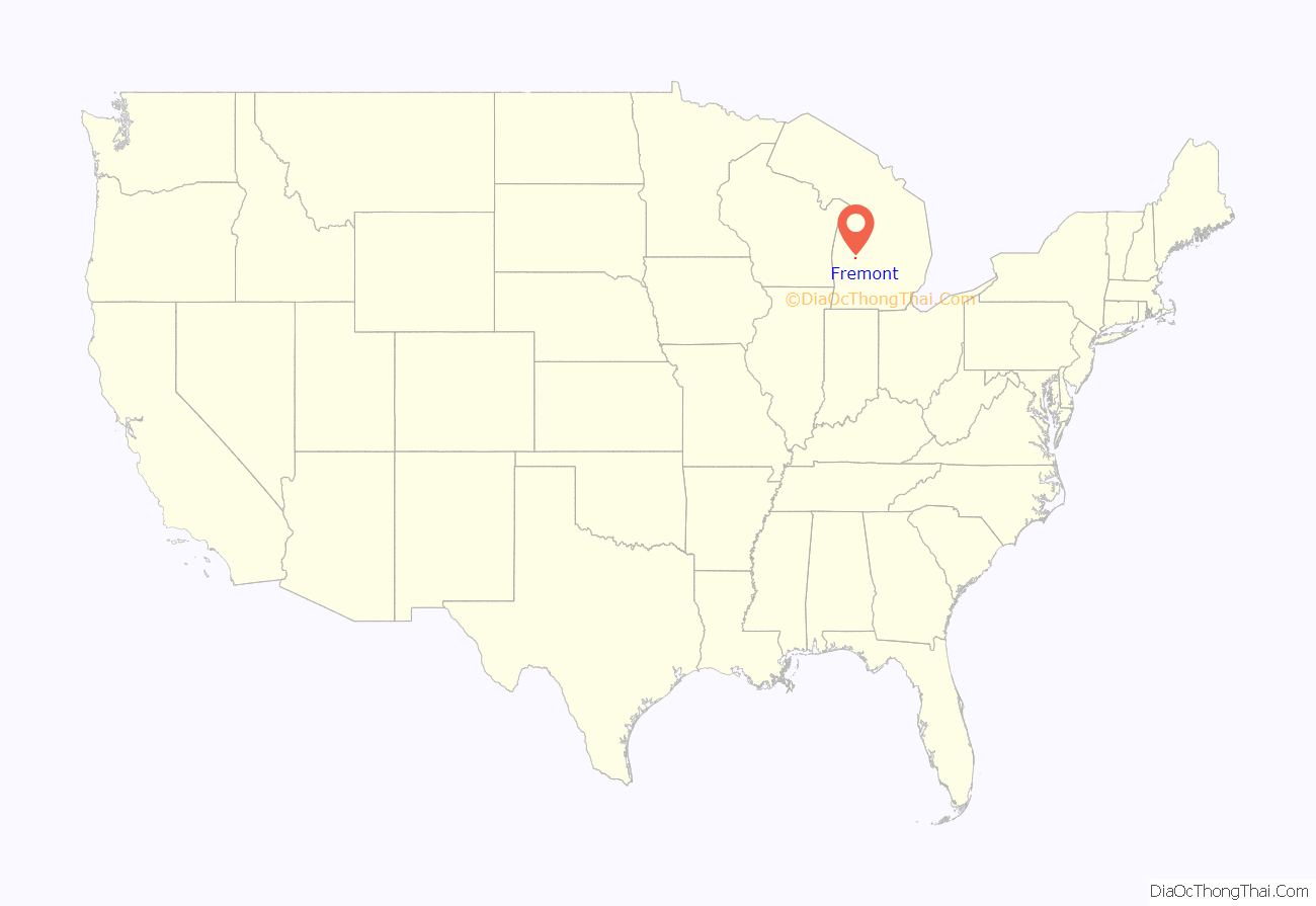
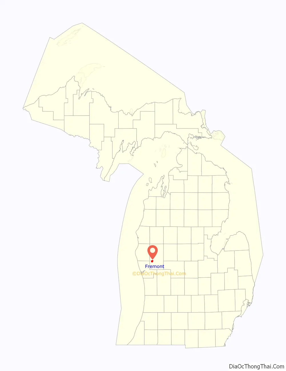
Fremont location map. Where is Fremont city?
History
The first inhabitants of the Fremont area were Native Americans. A group of settlers led by Daniel Weaver first settled the area in 1855, the Weaver homestead serving as the first post office and public school. In November 1855, Fremont Township was established and named in honor of John C. Fremont, western explorer and Republican Party candidate for United States President. Weaver and his fellow settlers cleared the dense timber in order to farm. Early in the 1870s, Dutch immigrant families came from Holland and Muskegon, Michigan; and Fremont continues to recognize its early Dutch heritage in local festivals and pageants.
Due to rich stands of virgin timber, lumbering became a major industry, and a railroad spur soon linked Fremont to the national rail network. The lumbering industry declined in the 1860s because of the American Civil War; and in 1871, Fremont experienced a major forest fire that caused extensive damage, especially to the lumber mills. Nevertheless, Fremont rebuilt and was even able to supply some lumber to rebuild Chicago after the Great Fire of 1871.
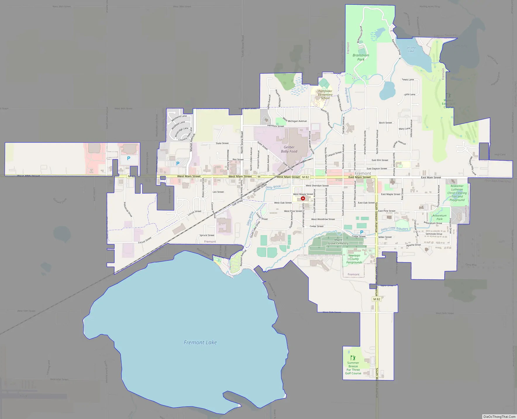
Fremont Road Map
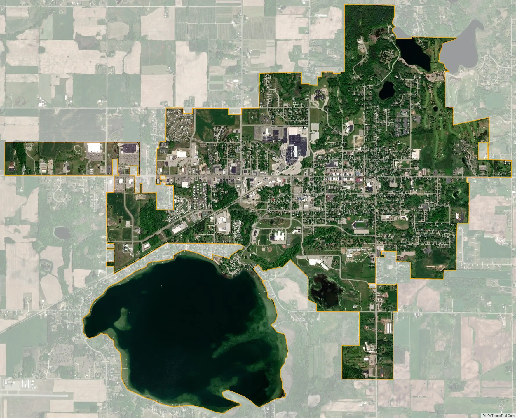
Fremont city Satellite Map
Geography
According to the United States Census Bureau, the city has a total area of 4.72 square miles (12.22 km), of which 3.42 square miles (8.86 km) is land and 1.30 square miles (3.37 km) is water.
See also
Map of Michigan State and its subdivision:- Alcona
- Alger
- Allegan
- Alpena
- Antrim
- Arenac
- Baraga
- Barry
- Bay
- Benzie
- Berrien
- Branch
- Calhoun
- Cass
- Charlevoix
- Cheboygan
- Chippewa
- Clare
- Clinton
- Crawford
- Delta
- Dickinson
- Eaton
- Emmet
- Genesee
- Gladwin
- Gogebic
- Grand Traverse
- Gratiot
- Hillsdale
- Houghton
- Huron
- Ingham
- Ionia
- Iosco
- Iron
- Isabella
- Jackson
- Kalamazoo
- Kalkaska
- Kent
- Keweenaw
- Lake
- Lake Hurron
- Lake Michigan
- Lake St. Clair
- Lake Superior
- Lapeer
- Leelanau
- Lenawee
- Livingston
- Luce
- Mackinac
- Macomb
- Manistee
- Marquette
- Mason
- Mecosta
- Menominee
- Midland
- Missaukee
- Monroe
- Montcalm
- Montmorency
- Muskegon
- Newaygo
- Oakland
- Oceana
- Ogemaw
- Ontonagon
- Osceola
- Oscoda
- Otsego
- Ottawa
- Presque Isle
- Roscommon
- Saginaw
- Saint Clair
- Saint Joseph
- Sanilac
- Schoolcraft
- Shiawassee
- Tuscola
- Van Buren
- Washtenaw
- Wayne
- Wexford
- Alabama
- Alaska
- Arizona
- Arkansas
- California
- Colorado
- Connecticut
- Delaware
- District of Columbia
- Florida
- Georgia
- Hawaii
- Idaho
- Illinois
- Indiana
- Iowa
- Kansas
- Kentucky
- Louisiana
- Maine
- Maryland
- Massachusetts
- Michigan
- Minnesota
- Mississippi
- Missouri
- Montana
- Nebraska
- Nevada
- New Hampshire
- New Jersey
- New Mexico
- New York
- North Carolina
- North Dakota
- Ohio
- Oklahoma
- Oregon
- Pennsylvania
- Rhode Island
- South Carolina
- South Dakota
- Tennessee
- Texas
- Utah
- Vermont
- Virginia
- Washington
- West Virginia
- Wisconsin
- Wyoming