Goodrich is a village in Genesee County in the U.S. state of Michigan. The population was 1,860 at the 2010 census. The village is a suburb of Flint located within Atlas Township.
| Name: | Goodrich village |
|---|---|
| LSAD Code: | 47 |
| LSAD Description: | village (suffix) |
| State: | Michigan |
| County: | Genesee County |
| Incorporated: | 1957 |
| Elevation: | 873 ft (266 m) |
| Total Area: | 2.27 sq mi (5.87 km²) |
| Land Area: | 2.19 sq mi (5.69 km²) |
| Water Area: | 0.07 sq mi (0.19 km²) 3.10% |
| Total Population: | 2,022 |
| Population Density: | 921.18/sq mi (355.63/km²) |
| Area code: | 810 |
| FIPS code: | 2632980 |
| GNISfeature ID: | 0626948 |
| Website: | www.villageofgoodrich.com |
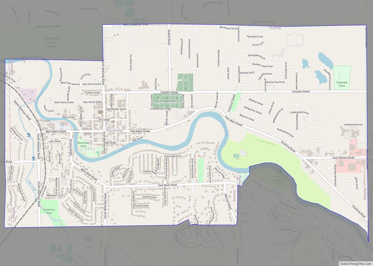
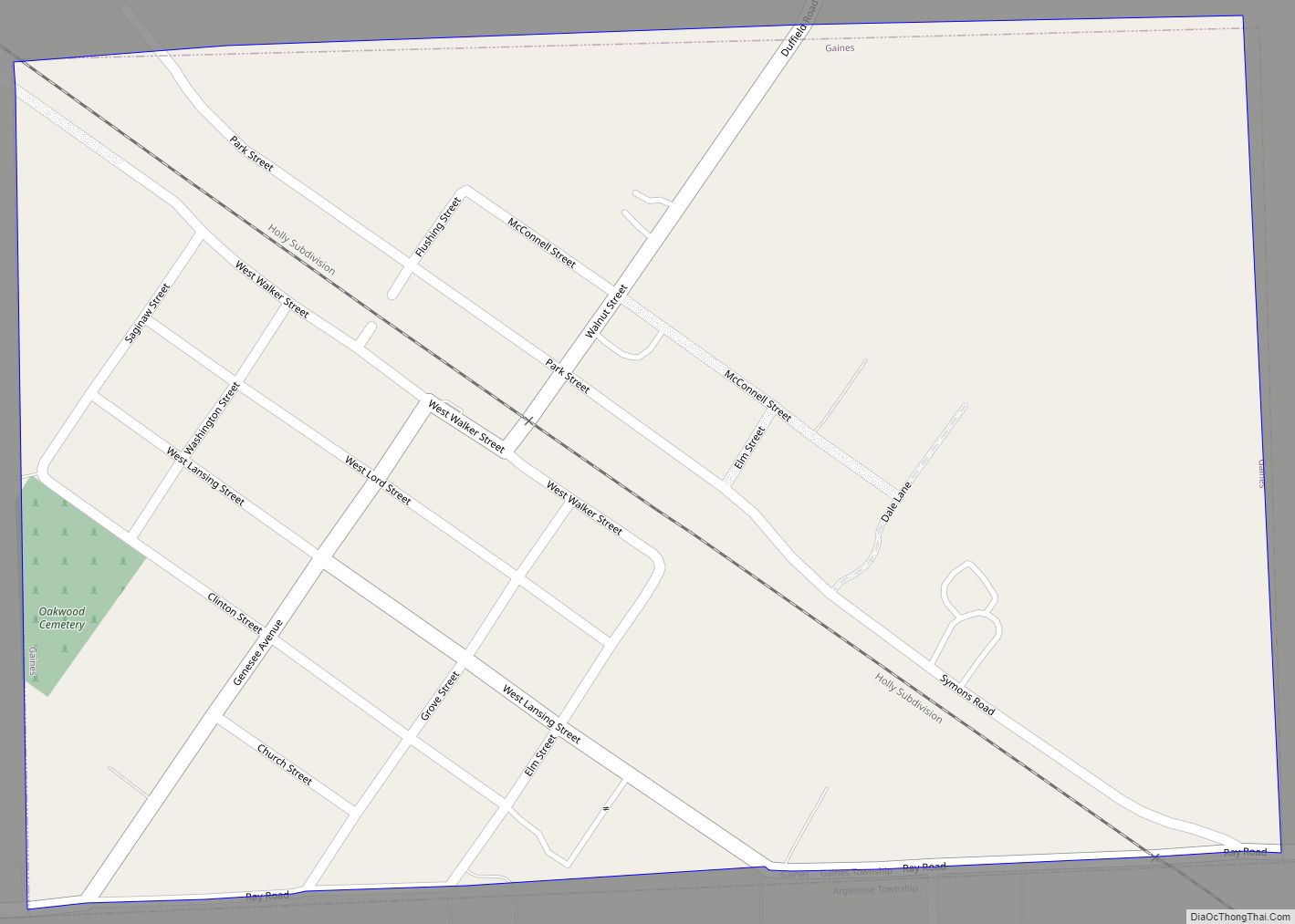
Online Interactive Map
Click on ![]() to view map in "full screen" mode.
to view map in "full screen" mode.
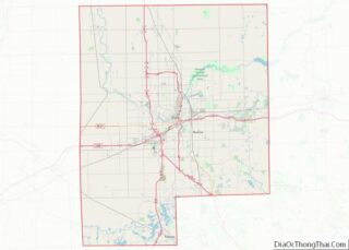
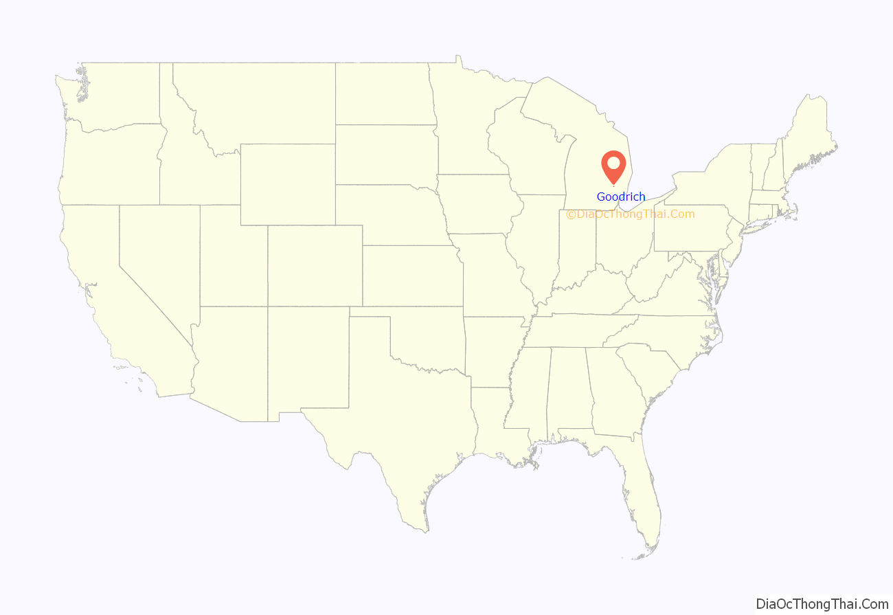
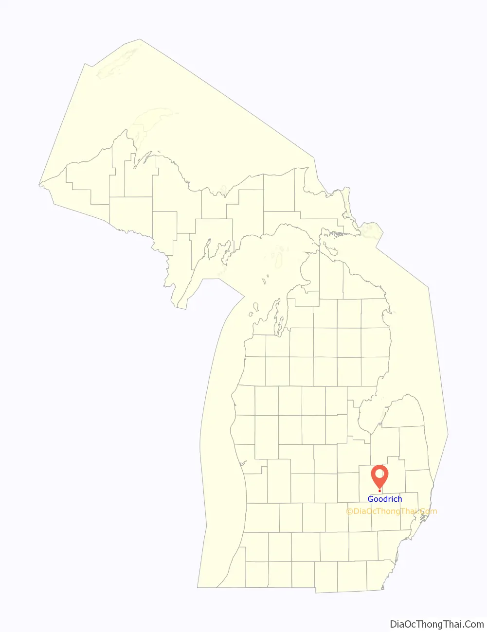
Goodrich location map. Where is Goodrich village?
History
Mr. and Mrs. Levi H. Goodrich traveled via steam ship from Buffalo to Detroit to settle after they had sold their home in the summer of 1835. They journeyed from Detroit towards modern-day Pontiac, where they met land explorers who told them of the land’s beauty. When they reached the vicinity of Davison’s Mill (now Atlas), they found rich, fertile soil, an excess of timber, and readily available water. They returned to Detroit and purchased one thousand acres (4 km) at $1.25 per acre. They returned to their old home in Clarence, New York and prepared to return to their purchased property. It was decided that Moses and Levi, the eldest and third of the six brothers, would travel back via Canada. They completed their journey in 16 days, and built a cabin before the family arrived on May 20, 1836. The first wood-frame house was built for Enos Goodrich in 1838.
The first tavern, The Goodrich House, was built in 1866 by a Mr. Matthew Davidson. This was a popular spot for trading and salesman. In over one hundred years, there were several owners, the most notable being Ben Yerkey, The Cicote Brothers (famous for their baseball career) and Emery Rockafellow. After the Death of Rockefellow, the tavern was bought by S. M. Hegel. The house fell victim to a fire in 2009 and was subsequently torn down.
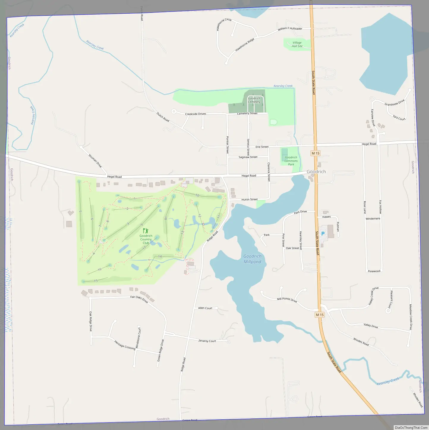
Goodrich Road Map
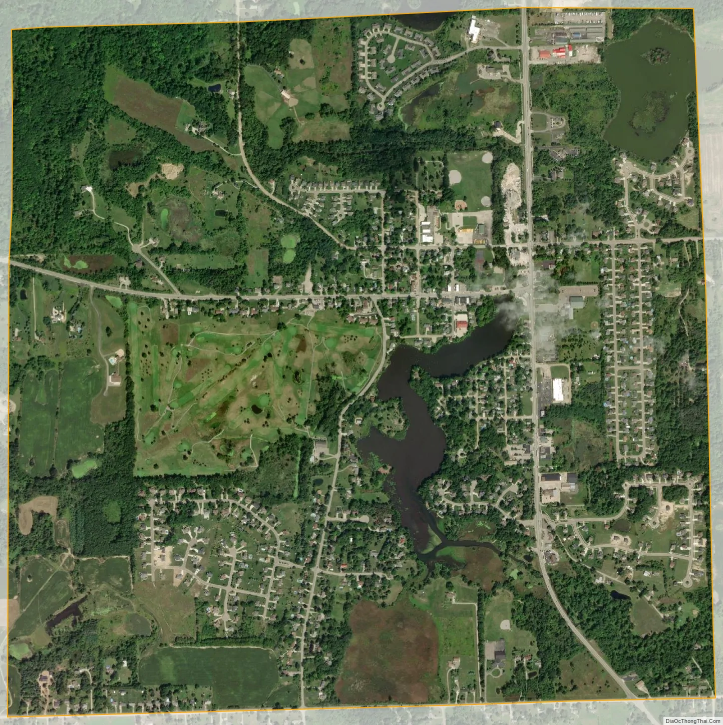
Goodrich city Satellite Map
Geography
According to the United States Census Bureau, the village has a total area of 2.26 square miles (5.85 km), of which 2.19 square miles (5.67 km) is land and 0.07 square miles (0.18 km) is water.
See also
Map of Michigan State and its subdivision:- Alcona
- Alger
- Allegan
- Alpena
- Antrim
- Arenac
- Baraga
- Barry
- Bay
- Benzie
- Berrien
- Branch
- Calhoun
- Cass
- Charlevoix
- Cheboygan
- Chippewa
- Clare
- Clinton
- Crawford
- Delta
- Dickinson
- Eaton
- Emmet
- Genesee
- Gladwin
- Gogebic
- Grand Traverse
- Gratiot
- Hillsdale
- Houghton
- Huron
- Ingham
- Ionia
- Iosco
- Iron
- Isabella
- Jackson
- Kalamazoo
- Kalkaska
- Kent
- Keweenaw
- Lake
- Lake Hurron
- Lake Michigan
- Lake St. Clair
- Lake Superior
- Lapeer
- Leelanau
- Lenawee
- Livingston
- Luce
- Mackinac
- Macomb
- Manistee
- Marquette
- Mason
- Mecosta
- Menominee
- Midland
- Missaukee
- Monroe
- Montcalm
- Montmorency
- Muskegon
- Newaygo
- Oakland
- Oceana
- Ogemaw
- Ontonagon
- Osceola
- Oscoda
- Otsego
- Ottawa
- Presque Isle
- Roscommon
- Saginaw
- Saint Clair
- Saint Joseph
- Sanilac
- Schoolcraft
- Shiawassee
- Tuscola
- Van Buren
- Washtenaw
- Wayne
- Wexford
- Alabama
- Alaska
- Arizona
- Arkansas
- California
- Colorado
- Connecticut
- Delaware
- District of Columbia
- Florida
- Georgia
- Hawaii
- Idaho
- Illinois
- Indiana
- Iowa
- Kansas
- Kentucky
- Louisiana
- Maine
- Maryland
- Massachusetts
- Michigan
- Minnesota
- Mississippi
- Missouri
- Montana
- Nebraska
- Nevada
- New Hampshire
- New Jersey
- New Mexico
- New York
- North Carolina
- North Dakota
- Ohio
- Oklahoma
- Oregon
- Pennsylvania
- Rhode Island
- South Carolina
- South Dakota
- Tennessee
- Texas
- Utah
- Vermont
- Virginia
- Washington
- West Virginia
- Wisconsin
- Wyoming