Grand Blanc is a city in Genesee County in the U.S. state of Michigan and a suburb of Flint. The population was 7,784 as of the 2020 US Census.
| Name: | Grand Blanc city |
|---|---|
| LSAD Code: | 25 |
| LSAD Description: | city (suffix) |
| State: | Michigan |
| County: | Genesee County |
| Incorporated: | 1930 |
| Elevation: | 837 ft (255 m) |
| Total Area: | 3.63 sq mi (9.40 km²) |
| Land Area: | 3.61 sq mi (9.36 km²) |
| Water Area: | 0.02 sq mi (0.05 km²) 0.55% |
| Total Population: | 8,091 |
| Population Density: | 2,240.03/sq mi (864.85/km²) |
| Area code: | 810 |
| FIPS code: | 2633280 |
| GNISfeature ID: | 0627081 |
| Website: | cityofgrandblanc.com |
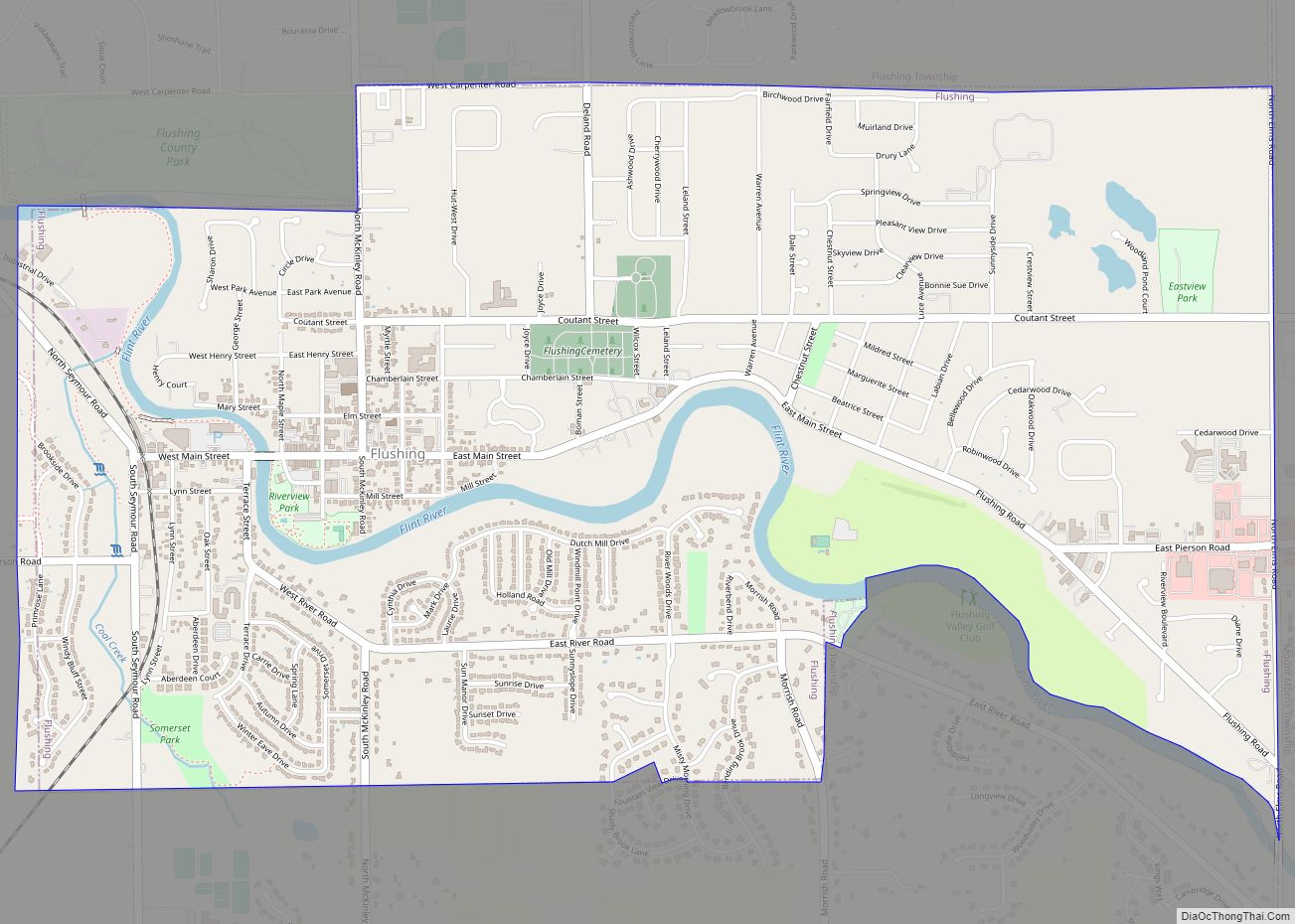
Online Interactive Map
Click on ![]() to view map in "full screen" mode.
to view map in "full screen" mode.
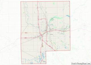
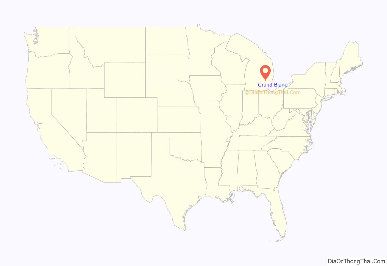
Grand Blanc location map. Where is Grand Blanc city?
History
The unincorporated village of Grand Blanc, or Grumlaw, was a former Indian campground first settled by Jacob Stevens in spring 1822. Several years later, settlers improved the Indian trail to Saginaw; they laid out and staked it in 1829 as Saginaw Road. Grand Blanc Township was formed in 1833 with area that would become the city. The township center began to boom in 1864 with the arrival of the railroad (now known as the CSX Saginaw Subdivision). With the post office there, the village was called Grand Blanc Centre by 1873, with the former Grand Blanc assuming the name Gibsonville (not Gibbonsville.)
By 1916, the community (population 400) had a grade school, a private bank, flour mill, an elevator, a creamery, and two churches, the Methodist Episcopal and the Congregational. The community was equipped with electrical lighting.
City
Grand Blanc Centre incorporated as the City of Grand Blanc in 1930. In 1939, the township and the city started a joint fire department. In the 1970s, the Grand Blanc city, township and school district formed a joint parks and recreation department under a commission with 2 members from each entity. In 1973, Grand Blanc-McFarlen Library, was built featuring approximately 45,000 books and offering a host of other materials.
A ballot question in the May 2, 2006 Genesee County general election ended governmental research into a plan to consolidate the city and township governments; 68.62% of city voters opposed consolidation efforts whereas 31.38% were in favor.
On January 20, 2019, the Township Board voted to rescind its joint fire department agreement in 90 days unless a new agreement is reached. After eight decades of a shared fire department with Grand Blanc Township, the city decided to start up their own department starting July 25, 2019, and named a fire chief. Previously, the joint department was funded by each municipal levying a special levy of 0.5 mil for the department and designating 0.5 mil of general levy to the department.
After looking at the lack of management knowledge on the parks and recreation commission in the spring of 2019, the township and city decided to dissolve the commission. In January 2020, the decision was formalized in January 2020 with the township taking over the department to provide services to both municipalities. The city would go on to develop its own parks plan before starting its own department.
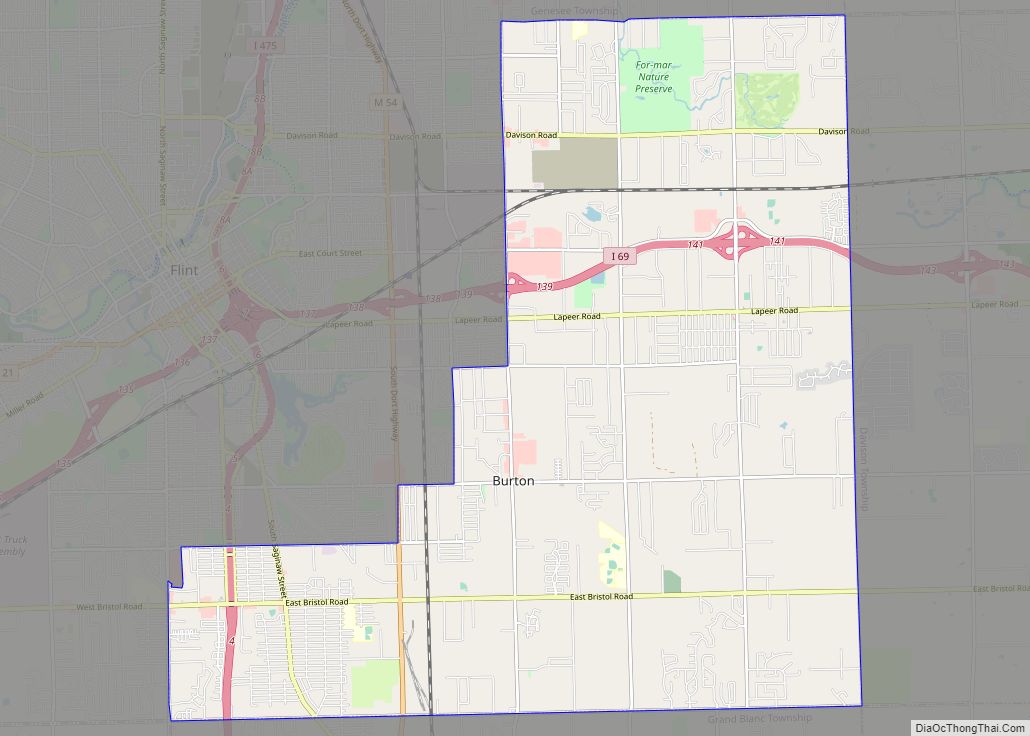
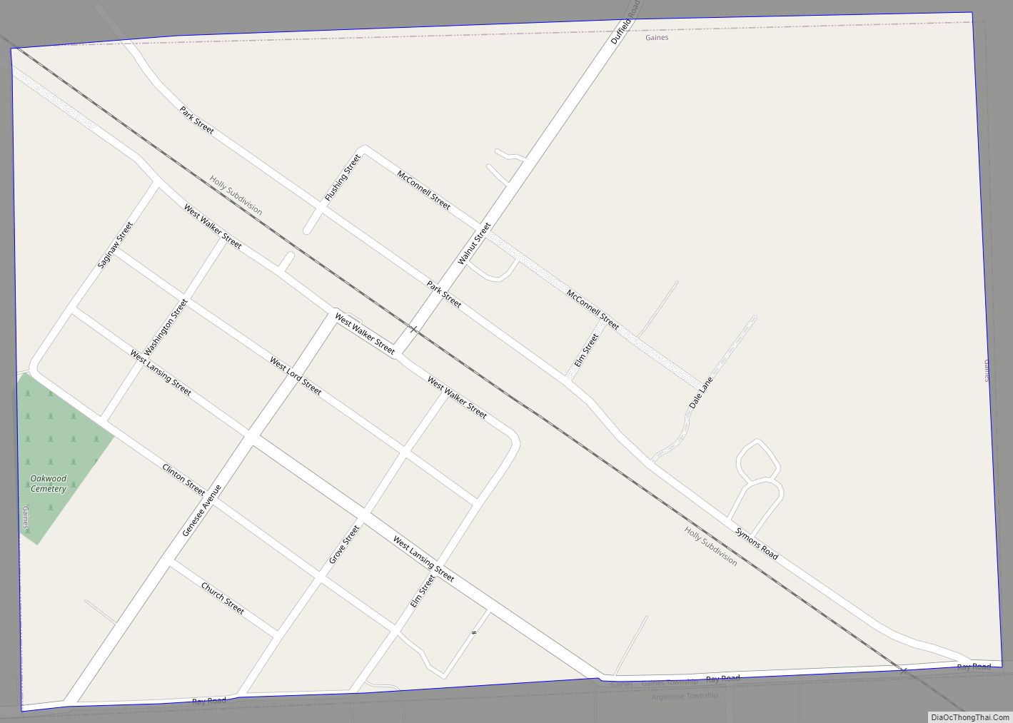
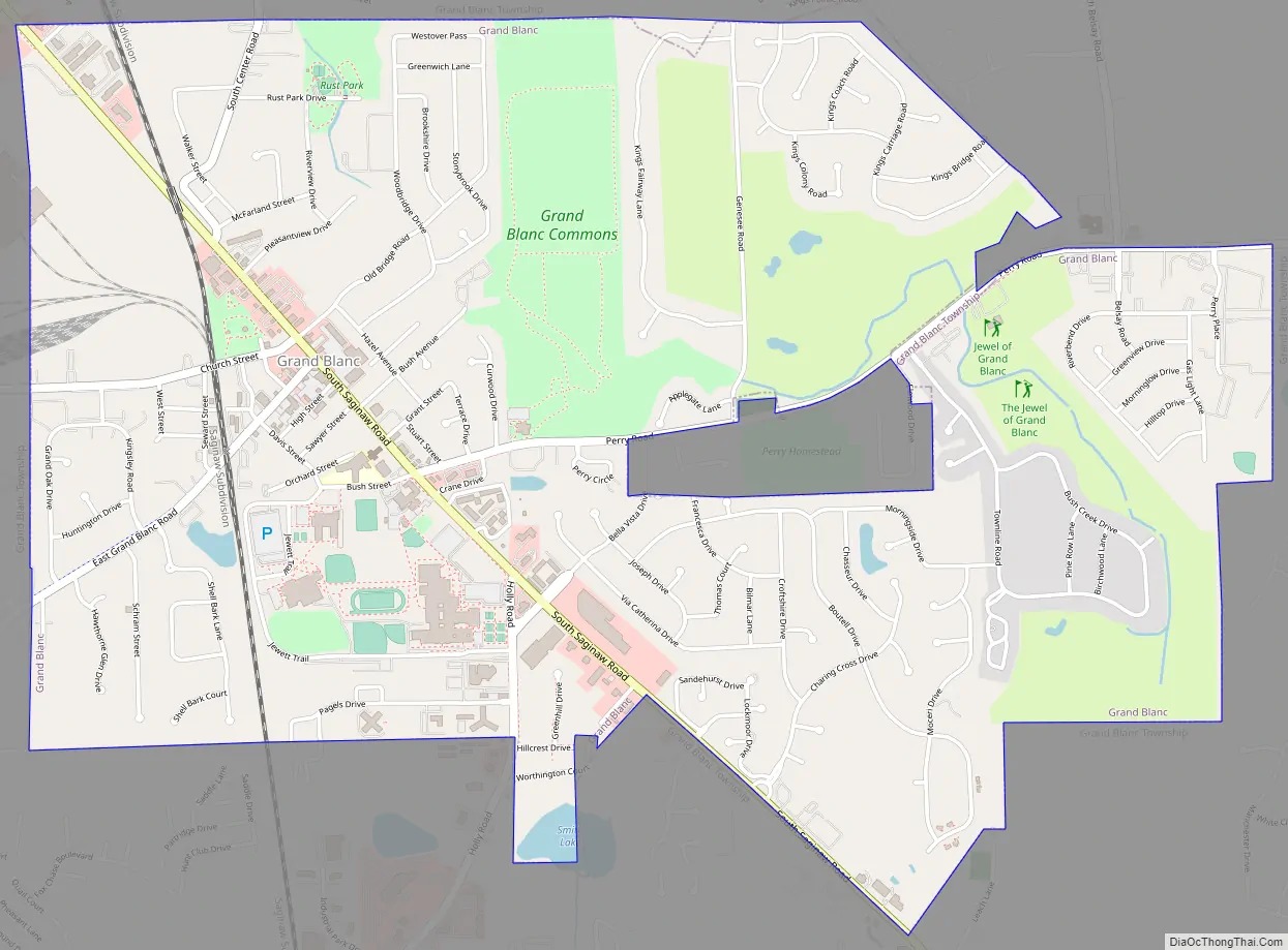
Grand Blanc Road Map
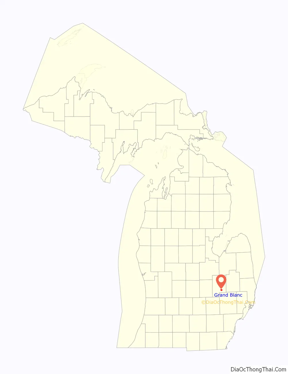
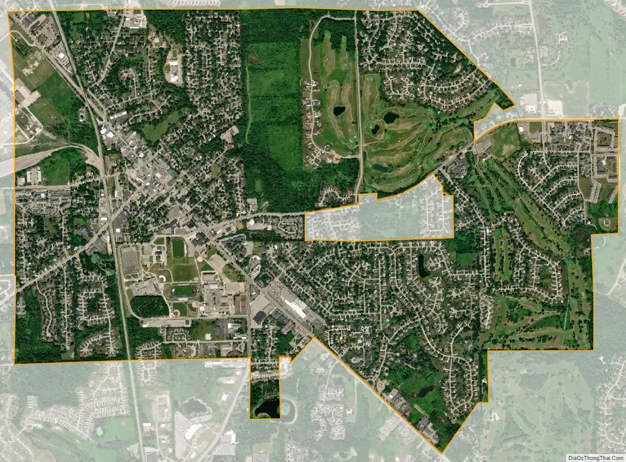
Grand Blanc city Satellite Map
Geography
According to the United States Census Bureau, the city has a total area of 3.63 square miles (9.40 km), of which, 3.61 square miles (9.35 km) is land and 0.02 square miles (0.05 km) is water.
See also
Map of Michigan State and its subdivision:- Alcona
- Alger
- Allegan
- Alpena
- Antrim
- Arenac
- Baraga
- Barry
- Bay
- Benzie
- Berrien
- Branch
- Calhoun
- Cass
- Charlevoix
- Cheboygan
- Chippewa
- Clare
- Clinton
- Crawford
- Delta
- Dickinson
- Eaton
- Emmet
- Genesee
- Gladwin
- Gogebic
- Grand Traverse
- Gratiot
- Hillsdale
- Houghton
- Huron
- Ingham
- Ionia
- Iosco
- Iron
- Isabella
- Jackson
- Kalamazoo
- Kalkaska
- Kent
- Keweenaw
- Lake
- Lake Hurron
- Lake Michigan
- Lake St. Clair
- Lake Superior
- Lapeer
- Leelanau
- Lenawee
- Livingston
- Luce
- Mackinac
- Macomb
- Manistee
- Marquette
- Mason
- Mecosta
- Menominee
- Midland
- Missaukee
- Monroe
- Montcalm
- Montmorency
- Muskegon
- Newaygo
- Oakland
- Oceana
- Ogemaw
- Ontonagon
- Osceola
- Oscoda
- Otsego
- Ottawa
- Presque Isle
- Roscommon
- Saginaw
- Saint Clair
- Saint Joseph
- Sanilac
- Schoolcraft
- Shiawassee
- Tuscola
- Van Buren
- Washtenaw
- Wayne
- Wexford
- Alabama
- Alaska
- Arizona
- Arkansas
- California
- Colorado
- Connecticut
- Delaware
- District of Columbia
- Florida
- Georgia
- Hawaii
- Idaho
- Illinois
- Indiana
- Iowa
- Kansas
- Kentucky
- Louisiana
- Maine
- Maryland
- Massachusetts
- Michigan
- Minnesota
- Mississippi
- Missouri
- Montana
- Nebraska
- Nevada
- New Hampshire
- New Jersey
- New Mexico
- New York
- North Carolina
- North Dakota
- Ohio
- Oklahoma
- Oregon
- Pennsylvania
- Rhode Island
- South Carolina
- South Dakota
- Tennessee
- Texas
- Utah
- Vermont
- Virginia
- Washington
- West Virginia
- Wisconsin
- Wyoming