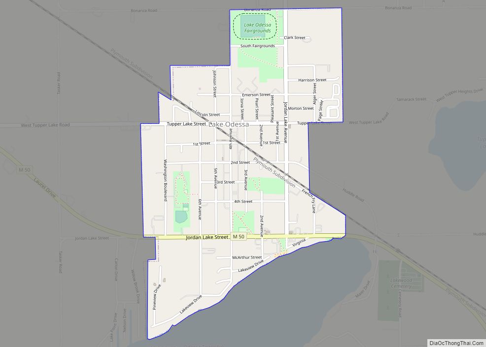
Lake Odessa is a village in Ionia County of the U.S. state of Michigan. The population was 2,018 at the 2010 census. It is located in the southern portion of the county in Odessa Township on the northeast shore of Jordan Lake, which is the boundary with Barry County.
Since 1987, Lake Odessa has been named a “Tree City USA” by the National Arbor Day Foundation.
| Name: | Lake Odessa village |
|---|---|
| LSAD Code: | 47 |
| LSAD Description: | village (suffix) |
| State: | Michigan |
| County: | Ionia County |
| Elevation: | 850 ft (260 m) |
| Total Area: | 0.89 sq mi (2.31 km²) |
| Land Area: | 0.89 sq mi (2.30 km²) |
| Water Area: | 0.00 sq mi (0.00 km²) |
| Total Population: | 1,994 |
| Population Density: | 2,240.45/sq mi (865.52/km²) |
| ZIP code: | 48849 |
| Area code: | 616 |
| FIPS code: | 2644880 |
| GNISfeature ID: | 2398383 |
Online Interactive Map
Click on ![]() to view map in "full screen" mode.
to view map in "full screen" mode.
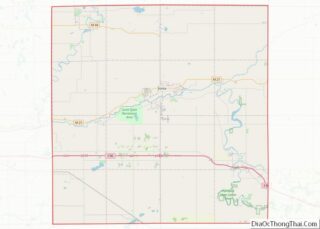
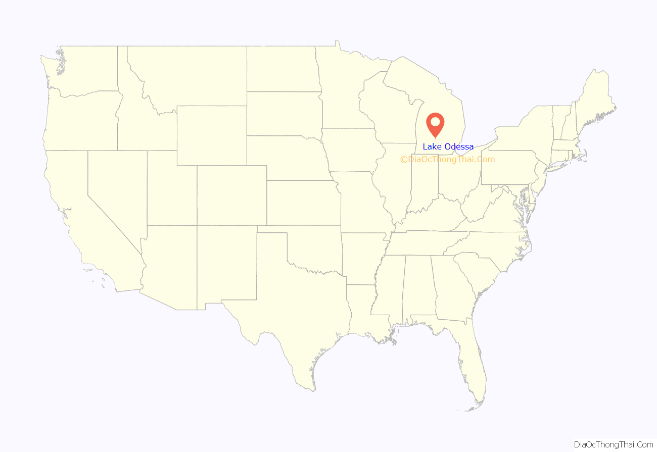
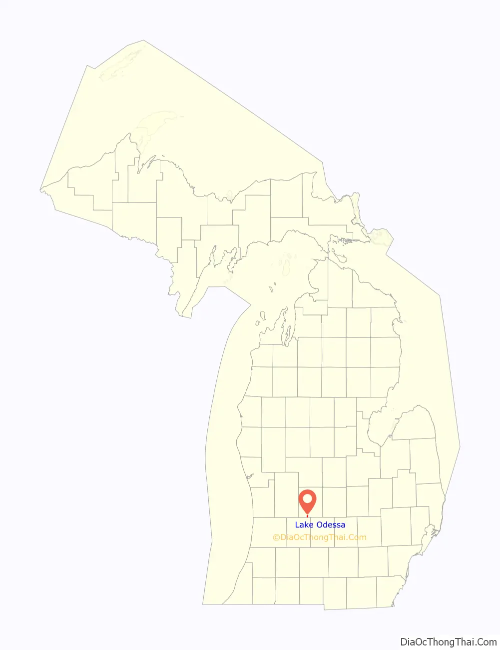
Lake Odessa location map. Where is Lake Odessa village?
History
Several brothers in the Russell family began settling here around 1839 and it became known as the “Russell Settlement”. It later became known as “Bonanza” and a Post Office with that name was established in 1880. When the Detroit, Lansing and Northern Railroad (later the Pere Marquette Railroad) was built through the area in the 1880s, the village was moved about a mile southwest. At that time the name was changed to “Lake Odessa”, derived from the nearby Jordan Lake and the name of Odessa Township, which had been established in 1846. The township had been named for the city of Odesa in Ukraine, reflecting an interest of one of the founders in Ukraine as well as a desire for a distinctive name. Investor Humphrey Wager purchased 80 acres (320,000 m) of farmland on Jordan Lake and platted the village in 1887. With the advantage of a station on the new railroad, the new village quickly eclipsed the former settlement at Bonanza. The village incorporated in 1889. John R. Waite, a local man with an interest in history, has been credited with significant historical research for the village of Lake Odessa. John is also recognized as the President of the Lake Odessa Area Historical Society and is involved with the Train Depot Museum.
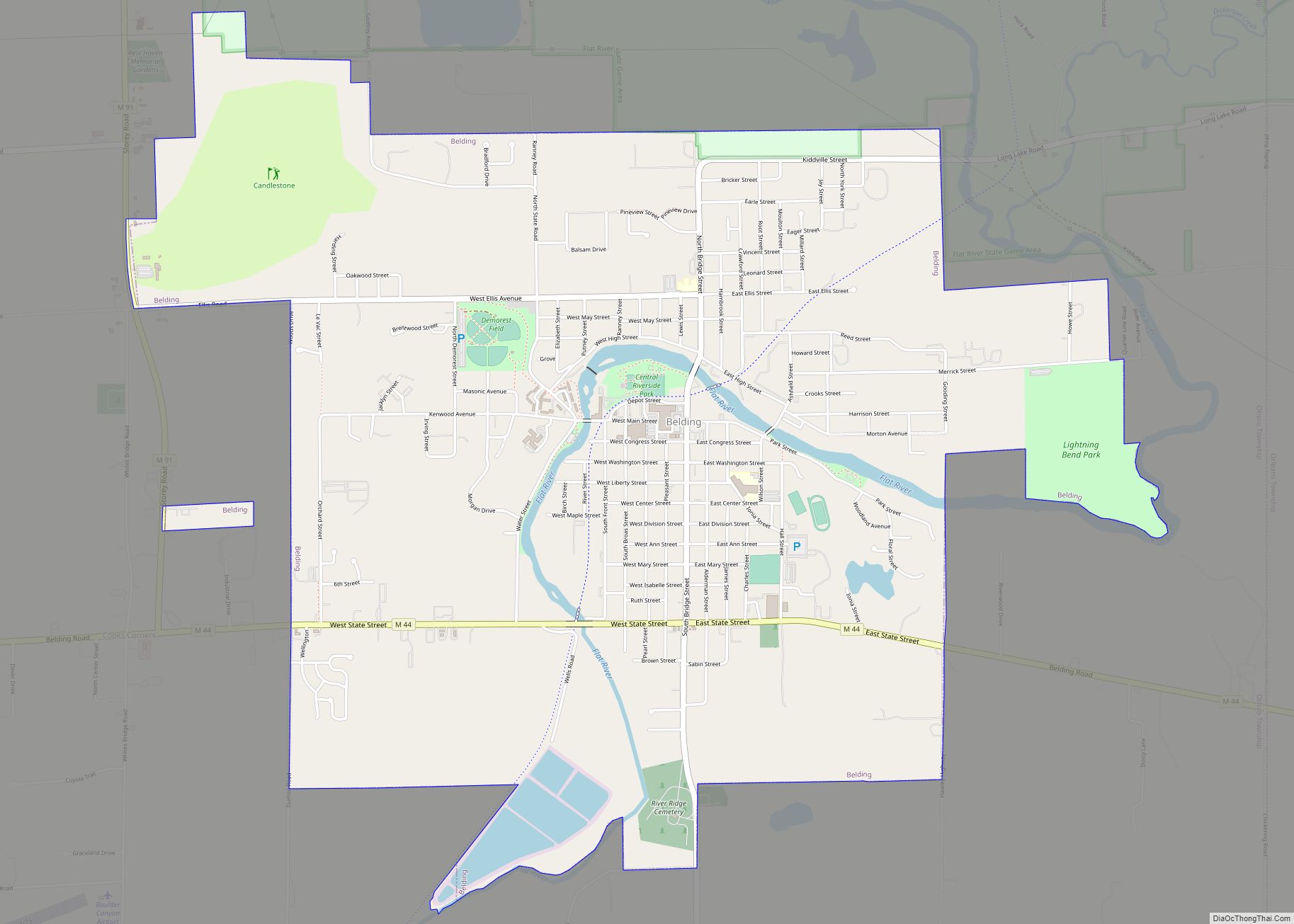
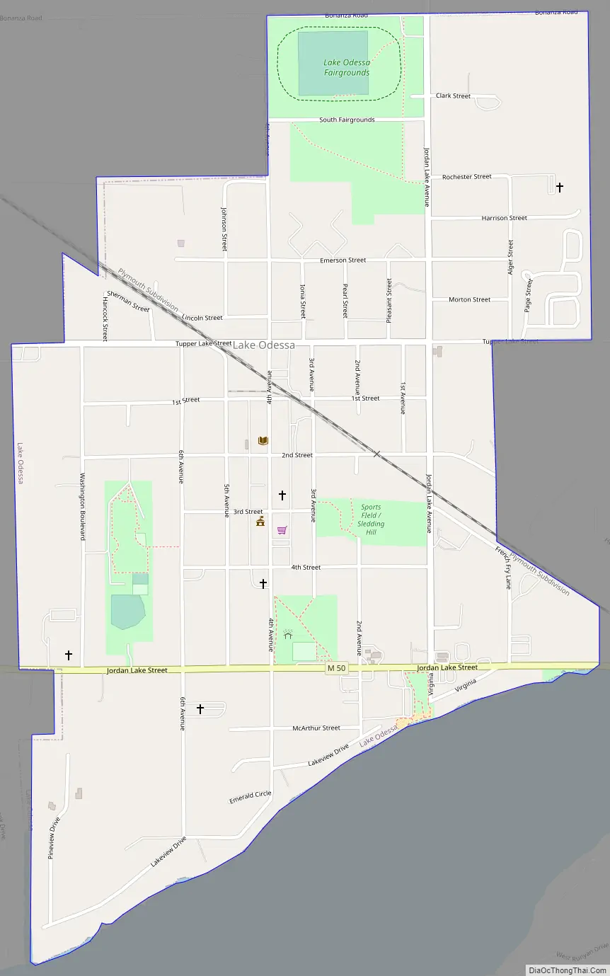
Lake Odessa Road Map
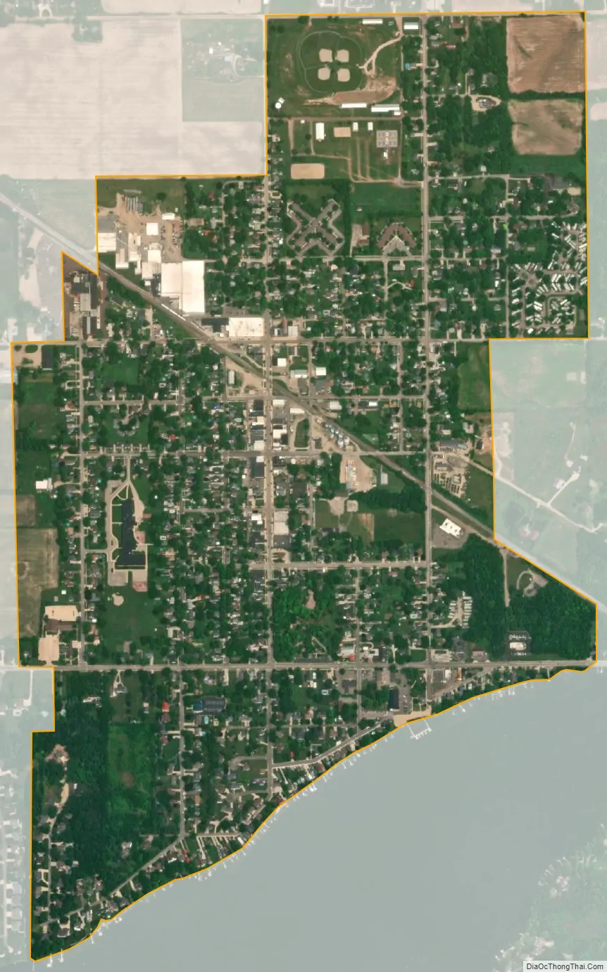
Lake Odessa city Satellite Map
Geography
According to the United States Census Bureau, the village has a total area of 0.89 square miles (2.31 km), all land. Lake Odessa, along with neighboring Woodland, Sunfield and Clarksville, make up the Lakewood Public School district.
See also
Map of Michigan State and its subdivision:- Alcona
- Alger
- Allegan
- Alpena
- Antrim
- Arenac
- Baraga
- Barry
- Bay
- Benzie
- Berrien
- Branch
- Calhoun
- Cass
- Charlevoix
- Cheboygan
- Chippewa
- Clare
- Clinton
- Crawford
- Delta
- Dickinson
- Eaton
- Emmet
- Genesee
- Gladwin
- Gogebic
- Grand Traverse
- Gratiot
- Hillsdale
- Houghton
- Huron
- Ingham
- Ionia
- Iosco
- Iron
- Isabella
- Jackson
- Kalamazoo
- Kalkaska
- Kent
- Keweenaw
- Lake
- Lake Hurron
- Lake Michigan
- Lake St. Clair
- Lake Superior
- Lapeer
- Leelanau
- Lenawee
- Livingston
- Luce
- Mackinac
- Macomb
- Manistee
- Marquette
- Mason
- Mecosta
- Menominee
- Midland
- Missaukee
- Monroe
- Montcalm
- Montmorency
- Muskegon
- Newaygo
- Oakland
- Oceana
- Ogemaw
- Ontonagon
- Osceola
- Oscoda
- Otsego
- Ottawa
- Presque Isle
- Roscommon
- Saginaw
- Saint Clair
- Saint Joseph
- Sanilac
- Schoolcraft
- Shiawassee
- Tuscola
- Van Buren
- Washtenaw
- Wayne
- Wexford
- Alabama
- Alaska
- Arizona
- Arkansas
- California
- Colorado
- Connecticut
- Delaware
- District of Columbia
- Florida
- Georgia
- Hawaii
- Idaho
- Illinois
- Indiana
- Iowa
- Kansas
- Kentucky
- Louisiana
- Maine
- Maryland
- Massachusetts
- Michigan
- Minnesota
- Mississippi
- Missouri
- Montana
- Nebraska
- Nevada
- New Hampshire
- New Jersey
- New Mexico
- New York
- North Carolina
- North Dakota
- Ohio
- Oklahoma
- Oregon
- Pennsylvania
- Rhode Island
- South Carolina
- South Dakota
- Tennessee
- Texas
- Utah
- Vermont
- Virginia
- Washington
- West Virginia
- Wisconsin
- Wyoming